
Beautiful Places in the USA

What I love most about New Mexico is how each city and region seems to have its own distinct personality, especially if you visit during different seasons.
Read More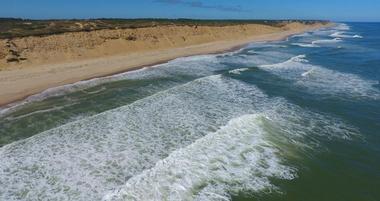
Best Places to Visit in Massachusetts
What makes Massachusetts truly unique to me is its variety: walking the historic Freedom Trail in Boston, relaxing on Cape Cod’s beaches, or wandering through the Berkshires for art and outdoor adventure.
Read More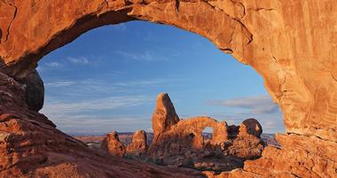
Places to Visit in Utah
For me, Utah isn’t just about sightseeing. It’s about the unique landscapes, the favorite experiences, and the best underrated gems that make the state unforgettable.
Read More
11 Places to Visit in New Hampshire
I love how New Hampshire offers the best mix of mountain adventures, charming small towns, and peaceful lakeside escapes. Nestled between Maine, Vermont, and Massachusetts, New Hampshire is one of the best and most unique destinations in New England.
Read More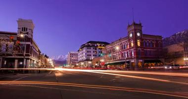
8 Things to Do in Provo
Provo is known for its abundance of natural beauty, a prestigious university and fast-growing economy.
Read More
Must-Visit Natural Hot Springs in the USA
I think that natural hot springs in the United States are some of the best and most unique experiences, underrated favorites that always leave me feeling recharged.
Read More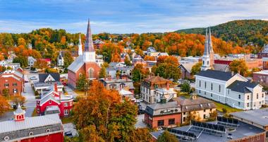
8 Unique Places to Visit in Vermont
Vermont is one of the best and most unique destinations in the U.S. whether you like hiking, swimming, fall foliage or skiing.
Read More
5 Orange County Day Trips
Orange County, or “The OC,” is one of the most iconic counties in the United States, in huge part thanks to its gorgeous beaches and family attractions.
Read More
Places to Visit in West Virginia (my favorite finds!)
I love how West Virginia offers the best mix of rugged natural beauty, cozy small towns, and thrilling outdoor activities.
Read More
Day Trips in Ohio
Ohio is one of the Midwest's most charming states, stretching between the Ohio River landscape in the south and picturesque Lake Erie along its northern border.
Read More
Places to Visit in Mississippi
For me, Mississippi is one of the best and most unique states to explore. Why? Honestly, it's an underrated favorite that we can drive to on a road trip from our home that always delivers memorable experiences.
Read More
7 Places to Go in August
I love how August trips offer the best mix of sunny weather, outdoor fun, and vibrant festivals. Even though it’s peak travel season, there are so many underrated spots where you can still find hidden gems and memorable experiences.
Read More
Places to Visit in Idaho
The best part about visiting Idaho is the variety: hot springs, mountain adventures, and charming downtowns.
Read More
Memorial Day Weekend Getaways
Memorial Day vacation ideas in the U.S. are some of the most unique ways to kick off summer. With warm weather, festive events, and long weekends made for travel, this holiday is one of the best opportunities to explore new destinations or revisit your old favorites.
Read More
10 Places to Travel in March
What makes March trips truly unique to me is their variety: chasing cherry blossoms, exploring national parks before the rush, or enjoying cultural festivals. Each experience feels exciting and different.
Read More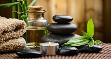
Mindfulness, Spa and Yoga Vacation Ideas
Mindfulness retreats in the United States are some of the most unique and transformative experiences you can have.
Read More
The Largest Cities in South Dakota
Located in the Midwest region of the United States, South Dakota is the 17th biggest state in terms of area but has the 46th largest population. For me, the largest cities in South Dakota are unique hubs of community and great destinations that make the state feel special.
Read More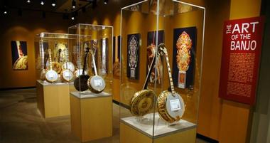
American Banjo Museum
The American Banjo Museum is home to 21,000 square feet of information that provides historical celebration of the Banjo.
Read More