Places to Visit in Mississippi

Ready to unplug from the daily routine and explore Mississippi? Well, you are in the right place! We've discovered the coolest spots in The Magnolia State since we moved to the South that I can't wait to share with you! These are my personal favorite places to visit in Mississippi, all based on my own travels.
Biloxi
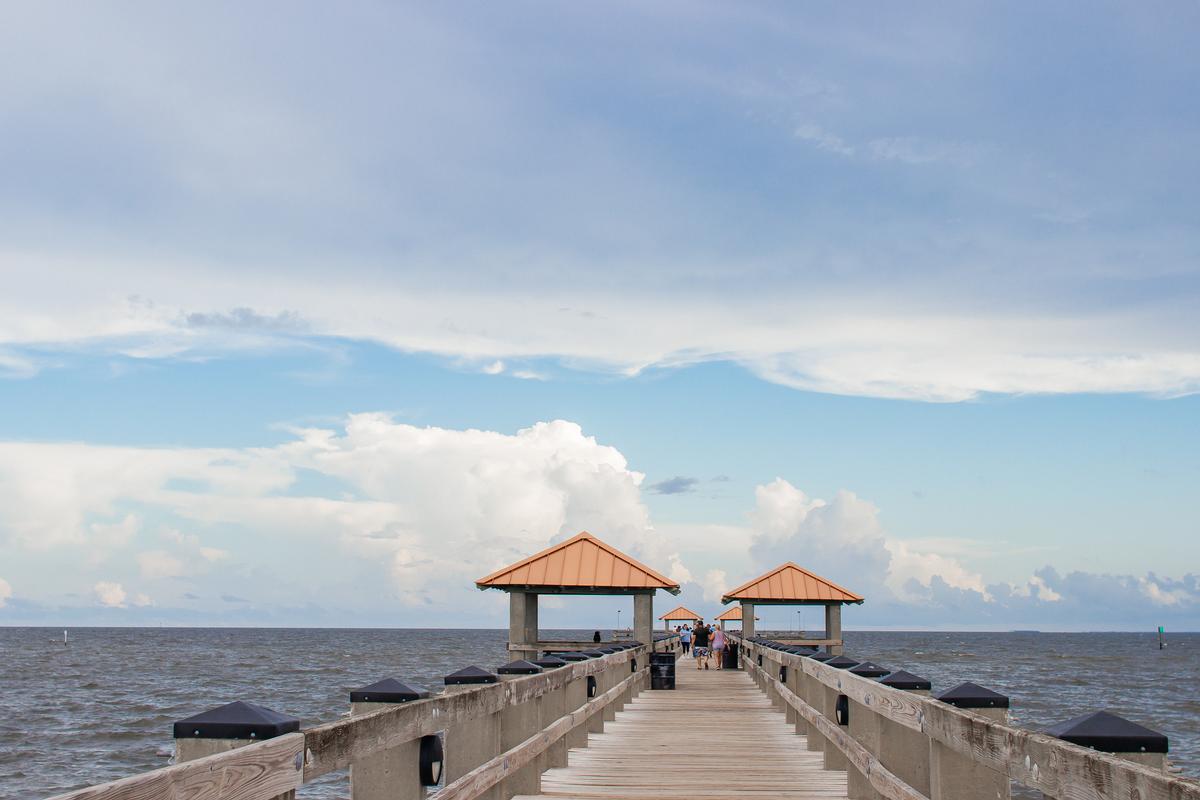
When I made my way to this town on the Mississippi Gulf Coast, I immediately felt the magic of the seaside vibe. "The Seafood Capital of the World" is right along the Gulf, and, for me, it’s one of the absolute best places for a beach-filled weekend getaway. There are heaps of unique things to do here!
We drove from Austin, TX to Biloxi with many stops on our long road trip (but it's 8 hours and 30 minutes if you drive non-stop!.
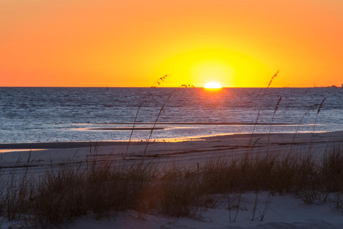
One of my favorite experiences was relaxing on Biloxi Beach itself. The soft white sand and gentle waves made it such an underrated gem for swimming, sunbathing, and just simply relaxing.
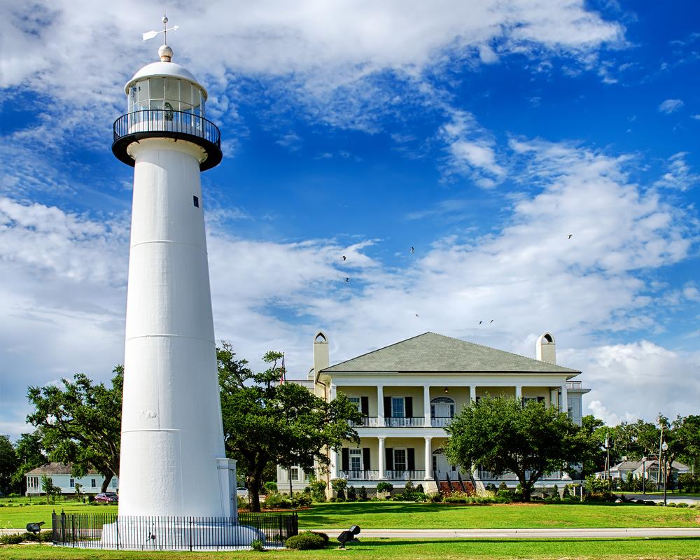
I also loved exploring the Biloxi Lighthouse, which sits right near Highway 90. Climbing to the top gave me a spectacular view of the coastline, and it felt like stepping into one of the most iconic landmarks in Mississippi.
For something cool and unusual, I spent two hours visiting the Ohr-O’Keefe Museum of Art ($12 Adult admission, $6 for kids, free under 6 years old). This unique Frank Gehry-designed space was filled with the coolest exhibits, and it quickly became one of my favorite cultural finds in the city.
The casinos were another exciting part of the trip. While I don’t always gamble, the atmosphere was electric. In addition, I loved that resorts offered so many dining options (both romantic or family-friendly!), spa experiences (I indulged in a 60-minute massage), and all sorts of entertainment, making it feel like a complete getaway.
What I loved best:
My personal highlight was enjoying a sunset on the beach with Chris and our son.
A downside?
Weekend crowds meant parking filled quickly.
We stayed at Beau Rivage Resort (from $129/night) for three relaxing days.
Gulfport
Now, first things first, if you are craving a weekend road trip on the coast, you need to go to Gulfport!
We loved that Gulfport was easy to get to, the beaches are wide, and it's peaceful compared to bigger resort towns. On the other hand, if the mood strikes and you want additional excitement, you'll be just 20 minutes from Biloxi along Highway 90.
First we headed to Mississippi Aquarium near the harbor downtown with our son. We were there around the holidays and caught "A Magical Mississippi Christmas" event at the aquarium in December which was especially fun for my son. I thought it was one of the best affordable things to do around the holidays on the Gulf Coast (Tickets are just $15 for adults and $5 for children)!
We also loved wandering around Jones Park right near the harbor. With its marina, green spaces, and scenic walking paths, it was a true local underrated gem!
If you fancy a day trip out on the water, hop on the ferry to Ship Island ($44 round trip for Adults, $38 for kids), which is just off the coast of Gulfport. You'll find clear waters, untouched beaches, and historic Fort Massachusetts there.
What I loved best:
Watching the sun set over the Gulf while eating shrimp and oysters was the absolute best way to end the day.

Bay St. Louis
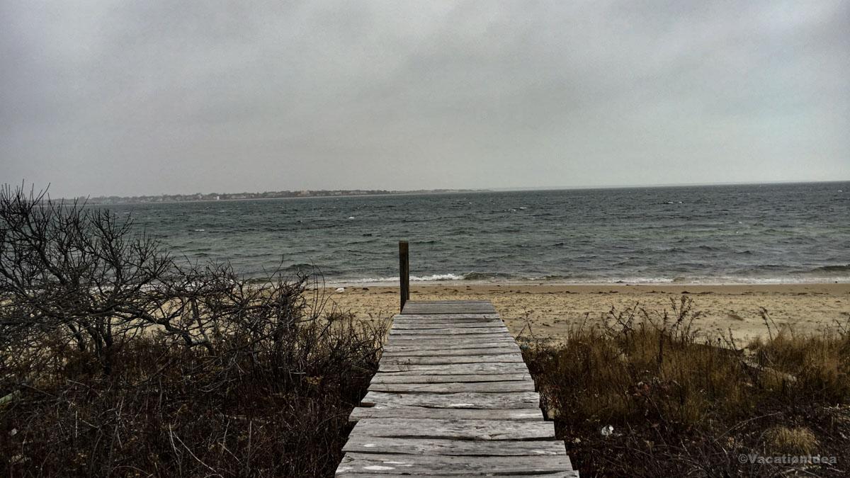
The first time we discovered Bay St. Louis on our romantic weekend getaway in Mississippi, I was instantly won over. Honestly, if you want the best combination of a cool downtown and and Gulf Coast seaside beauty, Bay St. Louis is your place!
We drove west along Highway 90 from Gulfport, barely thirty minutes before the coastline curved into Bay St. Louis where we checked into The Bay Town Inn for two relaxing days.
My favorite part was Old Town, which had so many unique shops, art galleries, and cafes.
We spent lots of time at the Bay St. Louis Beach, which felt like a hidden treasure with its soft sand.
In addition, I checked out the Alice Moseley Folk Art Museum near the historic train depot. The quirky pieces gave me a glimpse into the creative spirit of the town, and it quickly became one of my favorite finds.
Another spectacular highlight of this trip was walking across the Bay St. Louis Bridge. The pedestrian path offered amazing views of the bay, and I thought it was one of the coolest ways to experience the water up close.
What I loved best:
In the evening, we enjoyed fresh Gulf seafood at 200 North Beach Restaurant and Bar which I discovered on a recommendation from a local we met earlier in the day. My highlight was eating Risotto with delicious Barbecue Shrimp ($16) while watching the sunset.
A downside? The town was peaceful, but I have to warn you that options for evening entertainment were limited once the sun went down.
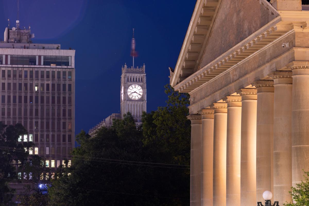
Jackson, MS
When friends ask me about the best places to visit in Mississippi beyond the beaches, this capital city instantly comes to mind because it offers such a diverse choice of parks, culture, and great restaurants.
We drove about 3 hours on our road trip from our previous stop in Bay St. Louis.
Walking downtown, I experienced a vibrant mix of history, music, and art that felt both exciting and deeply meaningful.
We explored the Mississippi Civil Rights Museum, which to me was one of the most powerful and unforgettable experiences in the state.
Jackson surprised us with its cool food scene, where soulful Southern flavors meet modern twists in unique and interesting ways.
The Mississippi Museum of Art was another absolute best stop, offering an inspiring experience I still dream about.
We spent time at LeFleur’s Bluff State Park, an amazing and underrated escape right near the city’s heart.
I loved how easy it was to balance nature and culture, which made Jackson feel like a brilliant idea for families or couples.
At sunset, we enjoyed live blues and jazz, and I swear the music added magic to the warm Southern air.
Jackson’s historic homes and tree-lined streets felt romantic, unique, and full of stories waiting to be discovered.
I think the best part is how welcoming the city feels, making every visit joyful and personal. I have to warn you, though, that parking can be a challenge!
What I loved best:
Locals recommended Louise's Piano Bar & Jazz Club which was a cool place to end the day (a standout!).
A downside? I have to say that some downtown streets felt quieter than I expected in the evenings, and we had to plan our stops carefully since not every spot stayed open late.
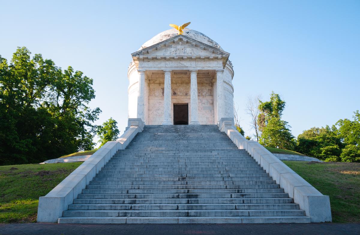
Vicksburg National Military Park
This historic site in western Mississippi is one of my favorite day trips from Jackson when I'm in the mood for quiet beauty. You'll find so much deep history here. I think it's one of the most unique places to visit inland in Mississippi.
An easy 45-minute drive from Jackson, Vicksburg National Military Park feels like stepping into the past through preserved battlefields. They tell such powerful stories of the past!
We explored the park by car first, stopping at several monuments and overlooks. I loved how immersive it felt with the way each marker, cannon, and memorial added another layer to the story of the Siege of Vicksburg.
What I loved best:
The Illinois Memorial was solemn and awe-inspiring. You can get stunning views from the top!
A downside?
The scale of the park is truly impressive. I have to warn you that but you have to plan your visit carefully if you don't have a lot of time.
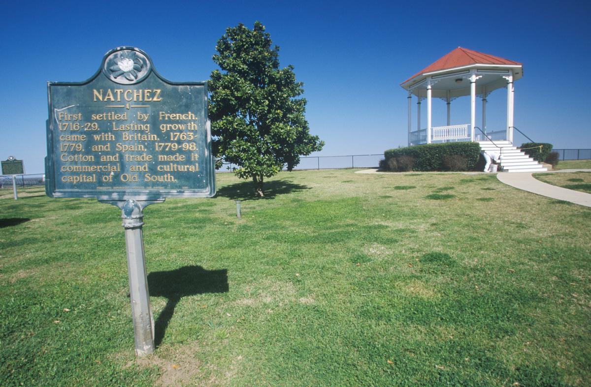
Natchez
This is one of my favorite places to visit in Mississippi because it feels like stepping into another era. In addition, Natchez is rich in history, and beautifully preserved. I thought it was perfect for slow days spent exploring grand homes and enjoying scenic river views.
We drove around two hours from our previous stop in Jackson and I kept thinking that Natchez makes the perfect day trip from the capital.
The first time we visited "New Orleans Lite", I was genuinely surprised by how much history and charm was packed into such a small city. Sitting high on bluffs overlooking the Mississippi River, Natchez feels like a place where time has slowed down—in the best possible way. Grand antebellum mansions line quiet streets, Spanish moss drapes over centuries-old oak trees, and the river sunsets are some of the most beautiful I’ve seen anywhere in the South.
Natchez is best known for its historic homes and deep Southern roots, and unlike many Southern cities, it escaped widespread destruction during the Civil War. Because of that, it has one of the highest concentrations of preserved antebellum homes in the country. Walking through town feels like stepping into a living museum, but it never feels stuffy or overdone—just authentic and proud of its past.
What I really loved about Natchez is how walkable and relaxed it is. The historic downtown area is compact, filled with locally owned shops, cozy cafés, and river-view restaurants. From almost anywhere in town, you’re only minutes away from the bluff, where you can look out over the Mississippi River and watch massive barges slowly drift by. It’s peaceful, scenic, and surprisingly romantic.
One of the best ways to experience the city is by touring its historic homes. We found a tour with a local guide truly bring these places to life, with knowledgeable guides sharing stories about the families who lived there, the architecture, and the city’s complex history. Homes like Longwood, Stanton Hall, and Rosalie Mansion are especially impressive, each offering a different perspective on Natchez’s past. Many tours are short and affordable, making it easy to visit more than one in a day.
If you enjoy nature as much as history, Natchez also delivers. The Natchez Trace Parkway begins just outside the city and offers beautiful drives, scenic overlooks, and peaceful hiking spots. It’s a great way to see another side of Mississippi and escape into nature without going far. Driving along the Trace early in the morning or near sunset is especially memorable.
Another highlight for us was the food scene. Natchez has some fantastic Southern cooking, from classic comfort food to more refined takes on regional dishes. Dining with a view of the Mississippi River while the sun sets is an experience I’d recommend to anyone—it perfectly captures the laid-back elegance of the city.
What I loved best:
We had a great time walking along the Natchez Bluff Trail, my personal highlight. With sweeping views of the Mississippi River, it was one of the most peaceful moments of my trip, especially at sunset—it truly felt magical.
Oxford
Looking for a destination with culture and character? I was struck by the vibrant mix of Southern charm, literary history, and cool small-town energy in Oxford, MS. Tucked in the northern part of the state, it’s one of the absolute best weekend getaways in Mississippi when I'm in the mood for culture and great food.
We drove about 4 hours and 15 minutes on our road trip from our previous stop in Natchez.
We started exploring in the historic Oxford Square, which is the beating heart of the town. Surrounded by colorful boutiques, cozy cafés, and unique local restaurants, it felt like an underrated gem. I absolutely loved stepping into Square Books, one of the coolest independent bookstores I’ve ever visited.
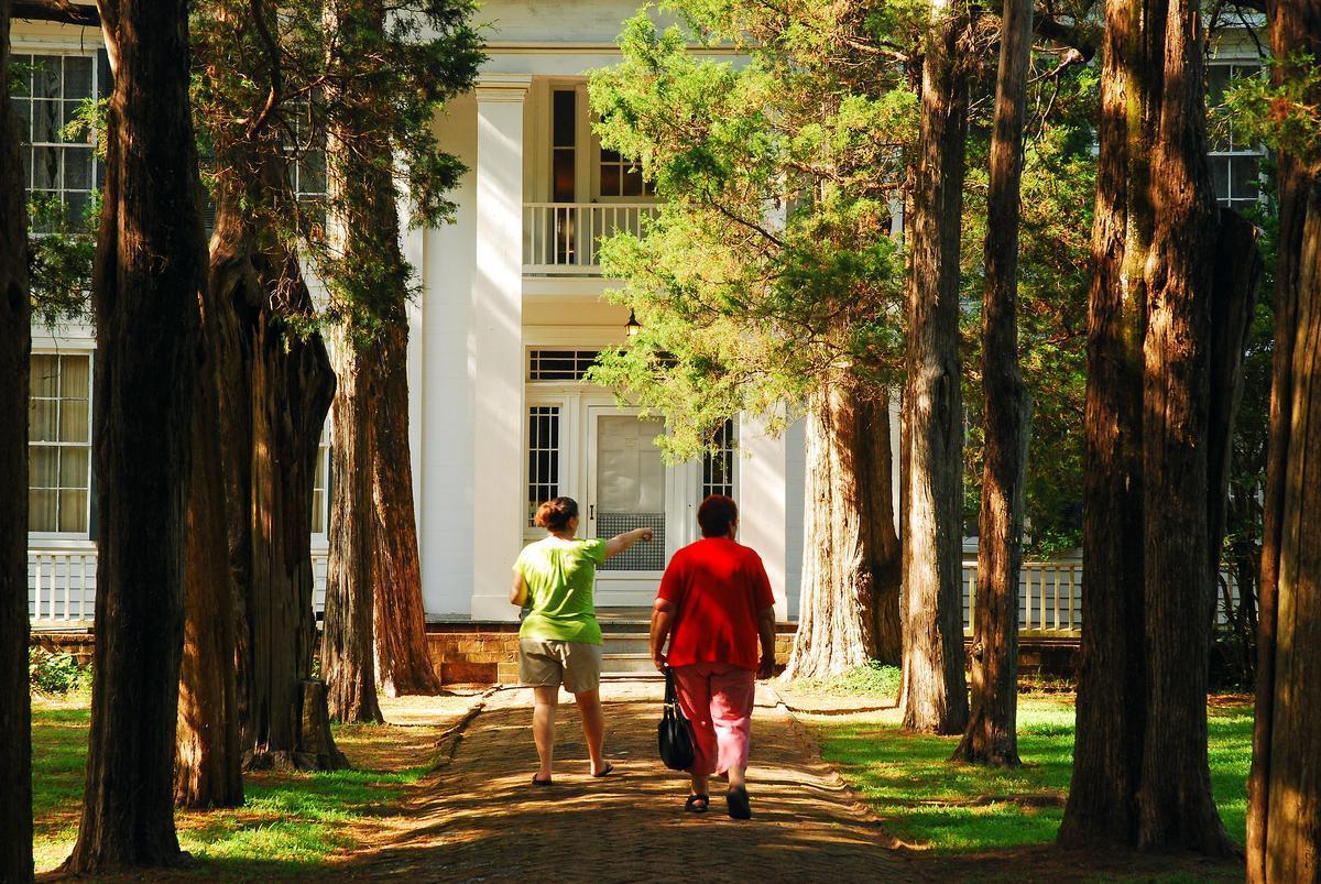
For a cultural experience, I visited Rowan Oak ($5 Adult admission, cash only), the former home of William Faulkner. Nestled in a quiet grove near the university, it felt both peaceful and inspiring—a spectacular piece of literary history right in Oxford.
The University of Mississippi campus, known as Ole Miss, was another highlight. Walking through its tree-lined paths and seeing the Grove, one of the most famous tailgating spots in the country, was such an exciting and unique experience, earning it titles like "The Holy Grail of Tailgating".
In addition, I loved tasting Southern comfort food at Ajax Diner, and Tallahatchie Gourmet (fried seafood and po-boys are a standout!).
What I loved best:
For me, Oxford was one of the best places to visit in Mississippi. One evening, I found myself enjoying live music at Proud Larry's, my favorite highlight.
A downside? Keep in mind that parking around the square is tricky.