10 Places to Visit in Wisconsin
Looking for where to go in Wisconsin? You've landed on the right page. Wisconsin is a state of natural beauty, and a fantastic place to explore on a weekend getaway from Chicago or a local Midwest trip. Having traveled through its lakeshores, forests, and cultural hubs, I’ve found that The Badger State offers plenty of Midwest hospitality. Here are the places I recommend, and I think you’ll enjoy them too.
Best Places to Visit in Wisconsin 1 to 2 Hours from Milwaukee
When I'm in the mood for a quick day trip, I look for unique destination that I can reach in an hour or two. Here are my favorites near Milwaukee.
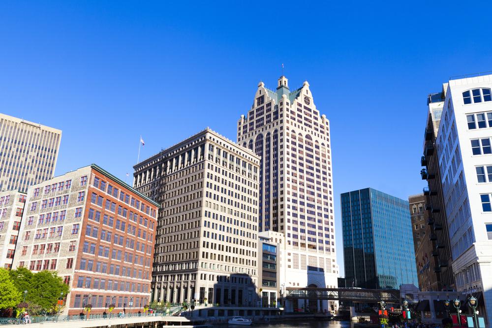
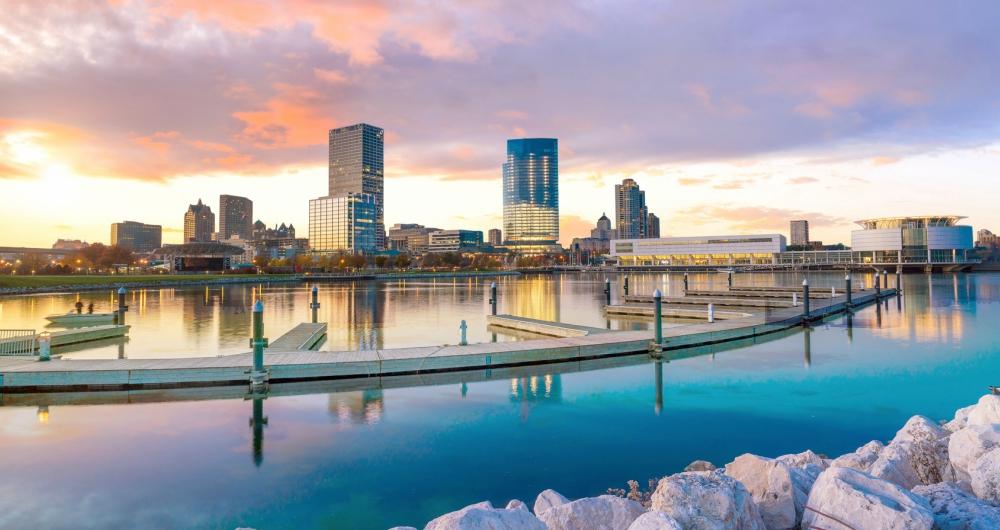
Milwaukee
I’ve mentioned this first because I personally thought it was the most unique city in the Midwest!
In face, if you could visit just one place Wisconsin, Milwaukee should be it. Since it's located on the late, it's not only full of museums and restaurants, but also natural beauty.
Since there are heaps of unique things to do here, we decided to join a guided tour with a local guide on our first visit which was a great idea.
You'll find Milwaukee quite historic and multicultural since it was shaped German, Polish, and Eastern European immigrants.
I recommend strolling along the scenic Milwaukee RiverWalk first. Next, head to Historic Third Ward, and visit the Milwaukee Art Museum.
When we got hungry, my favorite were artisanal cheeses and seafood at the affordable Milwaukee Public Market. Later, we sampled craft brews at local microbreweries (this is the Beer City, after all!), and watched the sunset over Lake Michigan at Veterans Park.
What I loved best:
Next day, one of the best discoveries was the Historic Pabst Brewery, which is a hidden gem filled with history. I enjoyed learning about modern craft beer culture here.
Of course, no trip felt complete without a stop at Honeypie, one of my favorite neighborhood gems. The pie's to die for and I honestly think their homemade flavors are among the best I’ve ever tried.
Another must-visit spot if you have kids or enjoy sweets is Purple Door Ice Cream.
We explored from our comfortable base at The Pfister Hotel in Milwaukee for two days (it's won the AAA Four Diamond award!).
Lake Geneva - less than 1 hour from Milwaukee
Of course, living in Milwaukee is amazing, but I loved having access to so many unique destinations nearby.
Nicknamed the “Newport of the Midwest” for its Gilded Age mansions, Lake Geneva quickly became my favorite day trip from Milwaukee! The lake is simply magical.
You can start with a slow stroll along the Shore Path, and explore the boutiques downtown. We couldn’t resist hopping aboard a classic Geneva Lake boat tour. I thought hearing some quirky stories about the families who built this city was especially fun.
Thinking of a summer vacation to Wisconsin? The beaches on Lake Geneva are awesome. You can swim, sunbathe, and stroll along the shoreline.
Just in it for the food? For a romantic dinner overlooking the lake, you'll want a table at Oakfire, my personal favorite.
If you are in the mood for for a family pizza night, head to Tuscan Tavern & Grill. I had great pizza which was definitely among my top 3 in the Midwest!
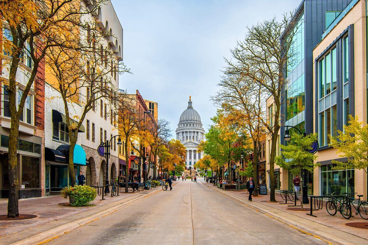
Madison - 1 hour 20 minutes inland from Milwaukee
We absolutely loved Madison (home to about 275,000 people), and have been many times. This is one of my favorite Midwest places to go to because of its culture, food, and nature.
One of the coolest discoveries for me was Gail Ambrosius Chocolatier. To me, their handcrafted chocolates that tasted like pure magic.
For food, Venezuelan dishes at La Taguara were an underrated treasure. You can stroll through the lively downtown near the Capitol Square. I have to warn you, though, that parking can be a challenge!
What I loved best:
Walking around the University of Wisconsin campus added to the magic.
Middleton - 1 hour 25 minutes inland from Milwaukee
I fell hard for this place. Do you have time for a quick side day trip from Madison? Middleton, just 7 miles west, is well worth your time. I was so glad we decided to spend a day here, visiting the National Mustard Museum which quickly became one of the coolest attractions I’ve ever visited. I instantly thought our journey was worth it!
Another absolute best stop in Middleton for me was Hubbard Avenue Diner. We and heard about its spectacular pies from locals but also found other amazing hearty comfort food.
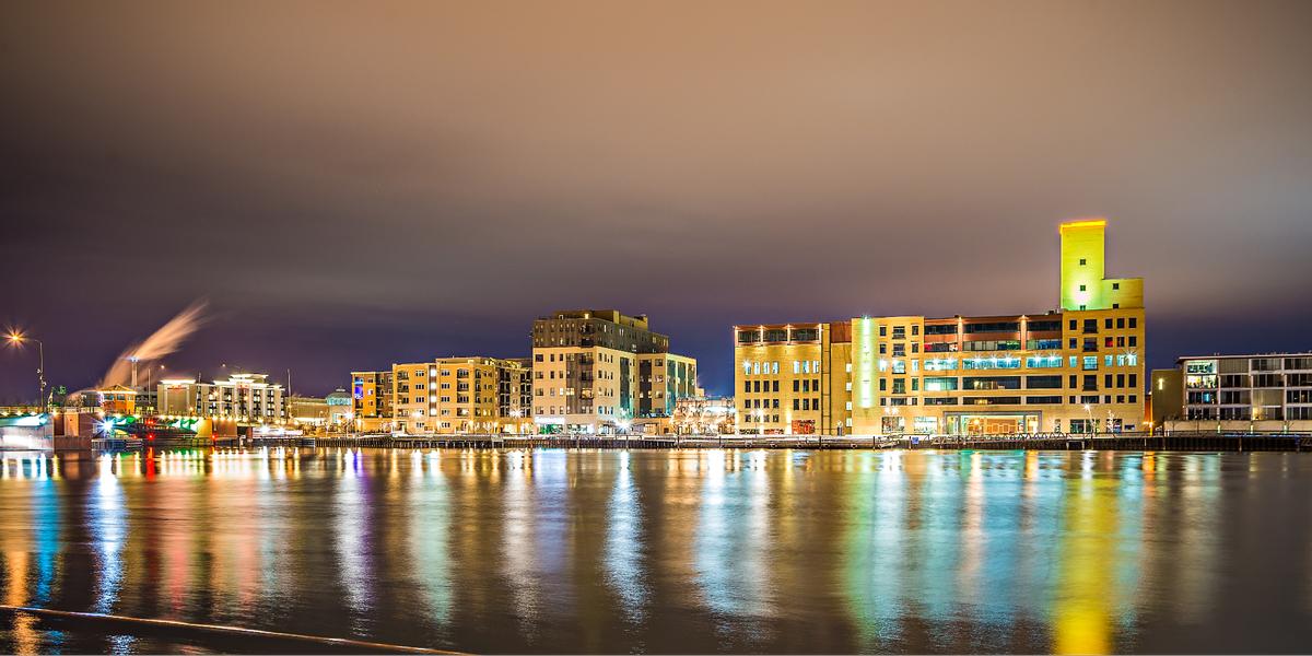
Green Bay - 1 hour and 45 minutes north from Milwaukee
This is easily one of the most exciting places we’ve visited in Wisconsin, full of sports history (it's the legendary home of the Packers!), waterfront views, and unique attractions.
From Lake Geneva, Chris and I made the scenic 2.5-hour drive northeast to "Titletown USA". And while, yes, the Green Bay Packers are impossible to ignore, there are heaps of other things to see here.
You can visit the Neville Public Museum to learn about local history, and enjoy nature along the Fox River Trail. Not only does the trail offer peaceful views, it also connects to several parks, including CityDeck.
What I loved best:
One of my favorite spots to unwind was the Green Bay Botanical Garden. It was so peaceful and had lots of interesting trails.
The Bay Beach Amusement Park was another hidden gem. It was affordable, fun, and perfect for our son, but unfortunately it only operates during the summer which is very short here (well...compared to where in live in Texas anyway!).

Spring Green - 2 hours inland from Milwaukee
I couldn’t help but be swept up in the magic of this place. Looking for a family-friendly weekend idea? Head to Spring Green, one of the best places in Wisconsin to visit.
We enjoy visiting Taliesin, Frank Lloyd Wright’s home and studio right after we arrived. It was a living piece of art and history that our whole family enjoyed.
Another unforgettable stop was the House on the Rock. Walking through the displays was magical and absolutely exciting.
What I loved best:
For a more relaxed vibe, I found the Spring Green General Store Café to be one of the best places to enjoy a joyful family meal with my husband and our son.
Best Places to Visit in Wisconsin Over 3 Hours from Milwaukee
When I'm in the mood for a weekend getaway or even a road trip, I enjoy doing a bit more driving. Here's the trips I personally enjoyed and hope that you will too.
Eau Claire - 3 hours and 30 minutes inland from Milwaukee
I’m always charmed by this city of approximately 74,000 people. If you are in the mood for a slightly longer drive, you should check out "Sawdust City" and its lumber industry history. First thing, we visited the Chippewa Valley Museum, which was truly fascinating, highlighting the area’s history to life.
I enjoyed walking along the Chippewa River State Trail, strolling through the downtown area, and saw a concert at the Pablo Center at the Confluence at the end of the day.
For breakfast next day, we enjoyed Fella's Loaded Goat Restaurant & Bar. If you have kids in tow, The Reboot Social offers games while you wait for your food so of course my son loved it.
We checked into the budget-friendly 3-star Oxbow Hotel (around $91/night) for four artsy days.

Bayfield - Old Rittenhouse Inn - 6 hours from Milwaukee
I thought this was one of the best romantic weekend getaways in Wisconsin. Why? First off, the atmosphere is super romantic so just relaxing at the inn itself for 48 hours was amazing! Secondly, Bayfield is steeped in history, which Chris and I found perfect for exploring beyond the inn!
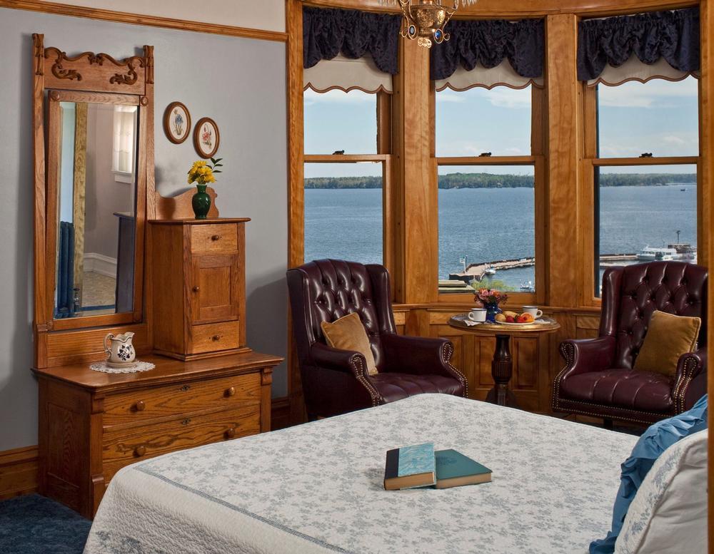
Old Rittenhouse Inn is actually a historic Victorian mansion turned boutique B&B so you get that old-world Midwest atmosphere here! In addition, we loved the views of Lake Superior right from our bed (in the picture) since the inn is located on a hill. Our romantic room for two days had a four-poster bed, a private fireplace, and large windows with views of the lake.
What I loved best:
My favorite highlight was dinner at Landmark Restaurant right on property.
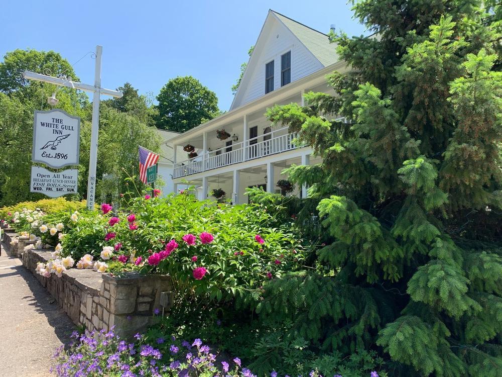
Fish Creek - White Gull Inn - 3 hours north from Milwaukee
I fell hard for this inn in Fish Creek because it's one of those places that instantly felt like a retreat into simpler times. It quickly became one of my favorite affordable weekend getaways in Wisconsin! You'll find it in the heart of Door County.
We drove from our apartment in Chicago for 4 hours and 15 minutes and stayed in a cozy room with a King bed for two care-free days.
What I loved best:
My favorite highlight was their traditional Door County fish boil. It's an outdoor experience that combines storytelling, and the freshest whitefish ($27.95 per person). It’s communal and uniquely local.
In addition, I loved their famous cherry-stuffed French toast I for breakfast.
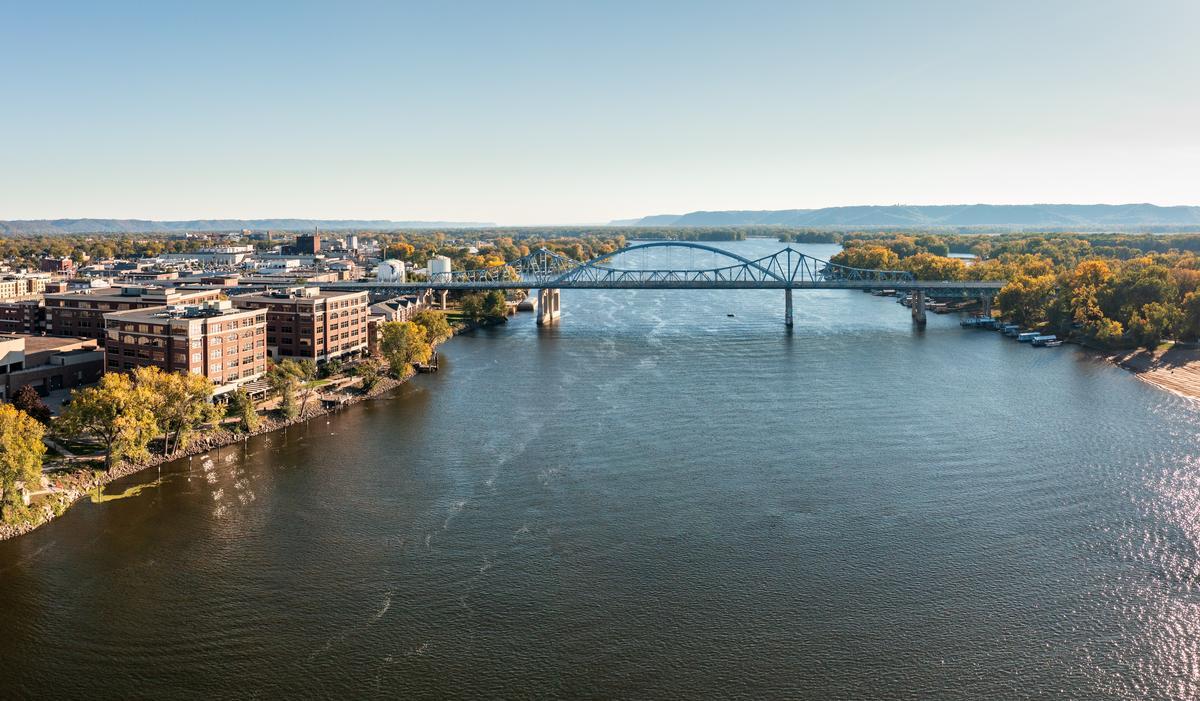
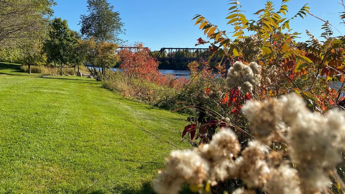
La Crosse - 3 hours inland from Milwaukee
For me, this riverfront gem was one of the most photogenic towns I came across. It was most definitely well worth the longer drive. You'll find La Crosse along the Mississippi River. You can enjoy strolling downtown, and take in the views from riverfront paths.
The Dahl Auto Museum is an exciting stop, showcasing classic cars and automotive history.
We checked into the budget-friendly GrandStay Hotel & Suites La Crosse for two days, just a short walk from the river.
What I loved best:
I think that La Crosse is one of the best places to visit in Wisconsin because it offers a chance to unplug which still having the option to stay active.
One of my favorite highlights were the International Friendship Gardens.
Local tip: One time, I caught an Amtrak Empire Builder train from Milwaukee to La Crosse (about 3.5 hours, $30–$50 one way). The station was just a mile from downtown, making it easy to walk or take a taxi into the city without worrying about driving.