
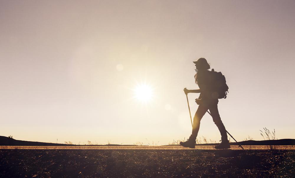
Want to swap city streets for forest paths and mountain views? These hiking trails near Seattle offer fresh air, lush greenery, and just the right amount of adventure—no long drive required.
Highlights:
Unique Hiking Trails Near Seattle:
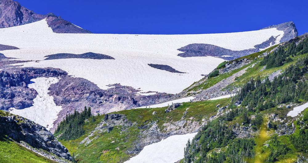
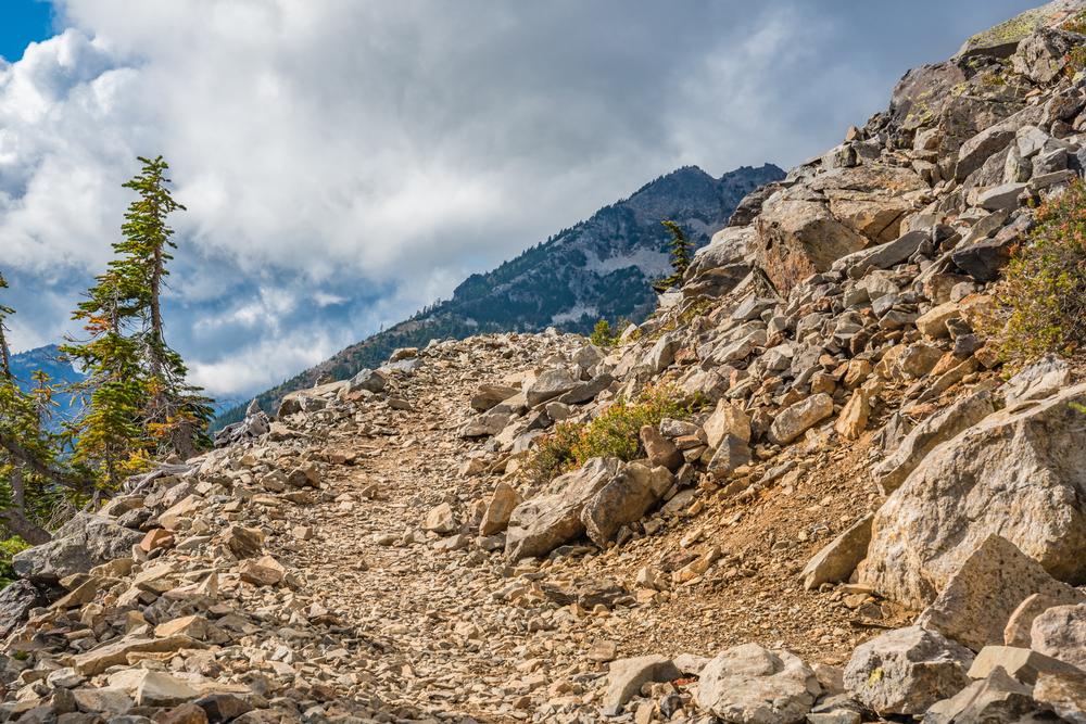
1. Camp Muir Trail
Rating: ★★★★★
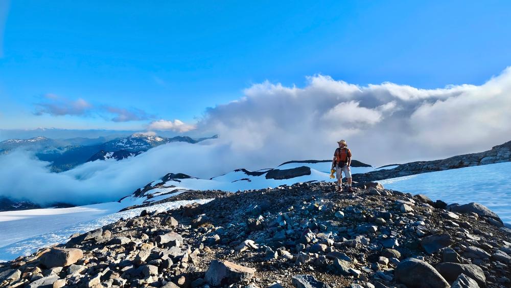
The views near the summit of the Camp Muir Trail are breathtaking.
2. Chain Lakes Loop
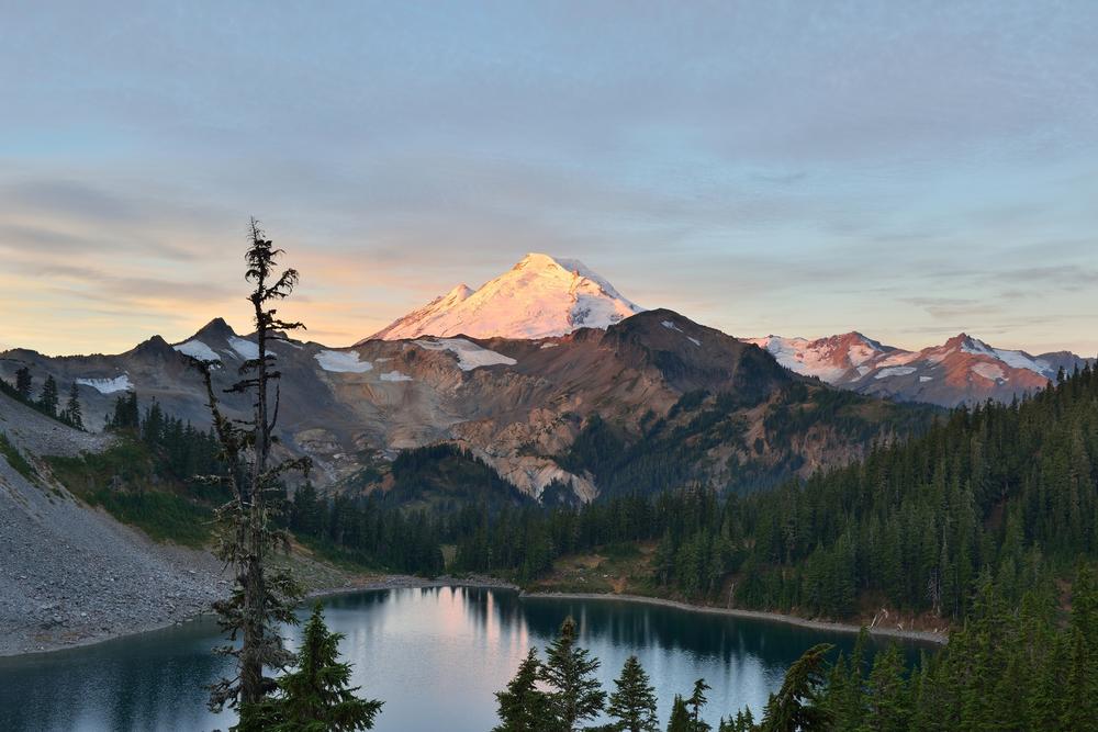
Chain Lakes Loop offers stunning views of the North Cascades Range, including Mounts Shuksan and Baker, at a maximum elevation of 5,400 feet. The eight-mile round-trip hiking loop is accessible from three parking lots within North Cascades National Park, including the Artist Point and Austin Pass/Heather Meadows access points. It offers views of sights such as Table Mountain, Mount Herman, and Herman Saddle along its route, which meanders a well-maintained trail through a variety of wildflower-populated meadows. During the summer months, trailside blueberry picking is permitted. Several alpine lakes are also accessible for swimming include the Bagley and Chain Lakes.
Chain Lakes Loop, 810 State Route 20, Sedro-Woolley, WA 98284
3. Dungeness Spit
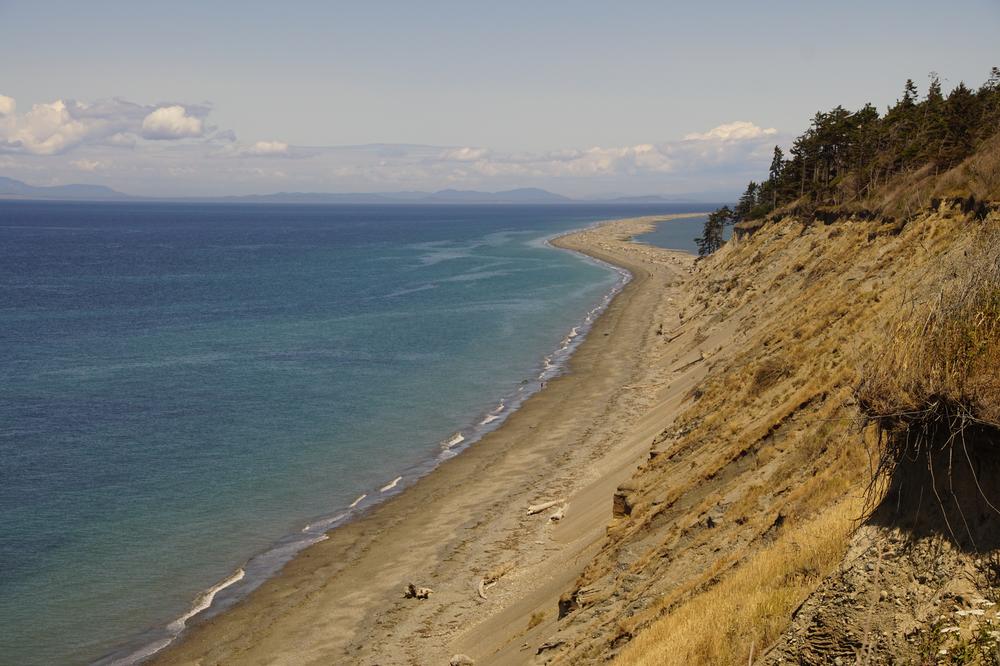
Dungeness Spit offers an 11-mile round-trip hike along the Olympic Peninsula’s northern coast, located along the Strait of Juan de Fuca near Port Angeles. The 6.8-mile sand spit is the United States’ longest naturally-occurring spit, enclosing the Dungeness Bay, and is contained within Dungeness National Wildlife Refuge. Hikers can explore sites at the spit’s public beach end such as the historic New Dungeness Lighthouse, which was once staffed by the United States Coast Guard and now offers a small museum exhibit and picnic area. Along the way, the spit showcases lush canopy forests and serves as a popular spot for shorebird watching.
Dungeness Spit, PO Box 1283, Sequim, WA 98382
4. Ebey’s Landing
Ebey’s Landing is a 19,000-acre National Historical Reserve located on Whidbey Island overlooking the Puget Sound.
The reserve protects a 19th-century rural farming district located near the seaport community of Coupeville, one of the state’s oldest extant communities, and also includes the nearby Fort Casey and Fort Ebey State Parks.
Its 5.6-mile round-trip Bluff Trail embarks from both a seaside parking lot and the Prairie Overlook trailhead, offering spectacular views of nearby Mount Baker and access to shoreline bluffs and lagoons. Bird watching is popular along the trail, which traverses lush wildflower and tree-lined regions. A visitor center is offered at the Ebey’s Landing entrance, and quaint historic attractions and small-town sites are easily accessible in nearby Coupeville.
Ebey’s Landing, 162 Cemetery Rd, Coupeville, WA 98239
5. Kendall Katwalk
Kendall Katwalk is a moderately difficult 12-mile round-trip hike located along the Pacific Crest Trail within the Mount Baker-Snoqualmie National Forest. The hike embarks from a trailhead near Snoqualmie Pass and spans a narrow path of steep rock slopes reaching a maximum elevation gain of 2,700 feet.
The trail passes expansive areas of old-growth forest and offers beautiful views of the Alpine Lakes Wilderness near Kendall Peak. Waterfalls, blueberry patches, and wildflower fields abound, including the flower-filled Kendall Gardens slope meadow. For an additional trek, visitors can continue along another mile and a half to Ridge and Gravel Lakes.
Kendall Katwalk , Pacific Crest Trail, North Bend, WA 98045
Hiking Trails Near Seattle for Couples:
6. Little Si
Little Si is a 1,576-foot elevation mountain within the Cascade Range located near the Washington city of North Bend, named along with neighboring larger Mount Si for regional homestead pioneer Josiah Merritt.
It is accessible via a moderately easy 4.7-mile graded trail and serves as a popular year-round hiking site, colloquially referred to with its sister peak trail as “Resolution Peaks” due to the high volume of beginner hikers following January 1st each year. The north-to-south trail begins with a sharp increase in elevation but levels out after the first quarter mile, making it a prime spot for hikers looking to get in shape for more advanced area trails. Two opportunities to cut away to the nearby Boulder Garden Loop also offer rewards for veteran hikers before reaching the mountain’s summit at an elevation gain of 1,300 feet.
Little Si, SE Mt Si Rd, North Bend, WA 98045
7. Maple Pass Loop
Maple Pass Loop is a moderate 7.2-mile loop trail accessible from the North Cascades Highway near the city of Mazama. The trail is a casual hiker’s dream in all seasons, showcasing beautiful ridges full of wildflowers during the spring and summer months and dramatic colorful autumn leaves overlooking lakes accessible until its winter closing. The loop trail begins at either the Lake Ann or Rainy Lake Trailhead and ascends more than 2,000 feet of elevation until it reaches its highest peak at the 6,995-foot Maple Pass. At Heather Pass, the trail diverges into other North Cascades National Park (video) passes offering access to sites such as Black Peak and Lewis and Wing Lakes.
Maple Pass Loop, 810 State Route 20, Sedro-Woolley, WA 98284
8. Moraine Trail
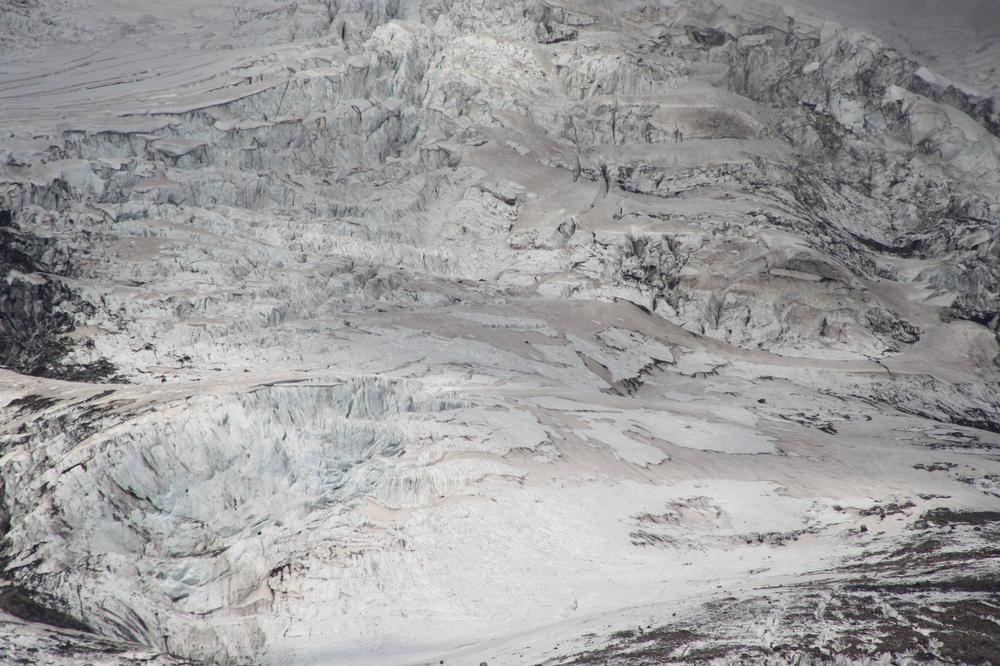
Moraine Trail offers a respite from the tourist crowds at Mount Rainer National Park, located within its southwestern region.
The 2.2-mile round-trip hike is accessible via the Skyline and Deadhorse Creek Trails, which embark from the Paradise trailhead, and offers an excursion down into the Nisqually River Valley. The trail experiences approximately 400 feet in up and down elevation change throughout its mostly pleasant route, which takes hikers to the edge of the moraine for spectacular views of the Nisqually Glacier several hundred feet beneath the summit. Route maps are available at both the Longmire Wilderness Information Center and the Paradise Visitor Center.
Moraine Trail, 55210 238th Avenue East, Ashford, WA 98304
9. Mt. Pilchuck
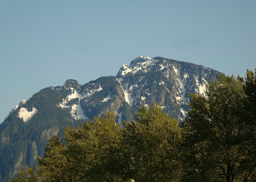
Mt. Pilchuck is located within North Cascades National Park and ascends a height of 5,327 feet, offering 360-degree views of nearby Mounts Baker and Rainier and the Olympic Mountain Range.
The moderately easy hike spans 5.4 miles round-trip through a high-elevation trailhead that is heavily trafficked during the peak summer season. It is accessible from the Mountain Loop Highway and offers a historic 1921 fire lookout shelter at its peak that is a very popular picnic spot in fair weather. Visitors should note that despite the trail’s popularity, elements of the path may become perilous in winter or in poor weather conditions. For an alternative, nearby Heather Lake Trail provides similar views from a lower elevation.
Mt. Pilchuck, 810 State Route 20, Sedro-Woolley, WA 98284
10. Rattlesnake Ledge
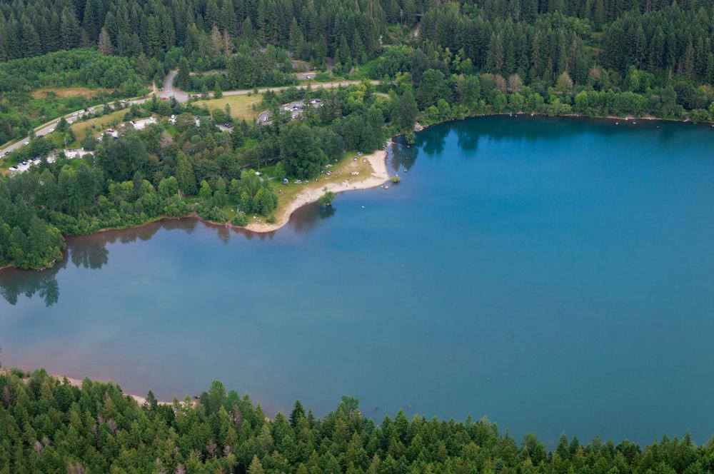
Rattlesnake Ledge is located near Snoqualmie and offers spectacular views of nearby Rattlesnake Lake and regional landmarks such as Mounts Si and Washington.
The 4.0-mile round-trip trail is maintained as part of the Rattlesnake Lake Recreation Area and embarks from a parking lot trailhead with restroom facilities and an information kiosk offering trail maps. The ledge is located 1.9 miles into the hike and features sheer cliffs overlooking the Cedar River watershed at an elevation of more than 2,000 feet. For hikers looking to extend the route, trail branches are available toward East Peak, Snoqualmie Park, and Middle and Upper Ledges. Hikers with dogs on leash should exercise caution, as cliff edges may be sudden and steep.
Rattlesnake Ledge, 17905 Cedar Falls Road SE, North Bend, WA 98045
Plan Your Trip