
8 Things to Do in Provo

Searching for what to do on your trip to Provo, Utah? Well, you are in the right place! Nicknamed "Garden City", Provo is surrounded by mountains and lakes, which I think make it one of the most appealing destinations in the state. You can look forward to outdoor adventure, family-friendly activities, and a lively downtown. Provo offers something for every type of traveler. There are heaps of unique things to do here!
As far as places to stay go, there are several great options. 3-star Provo Marriott Hotel & Conference Center is very comfortable for families. If you are looking for something romantic, 3-star Hines Mansion Bed & Breakfast, set in a restored 19th-century Victorian home, is for you.
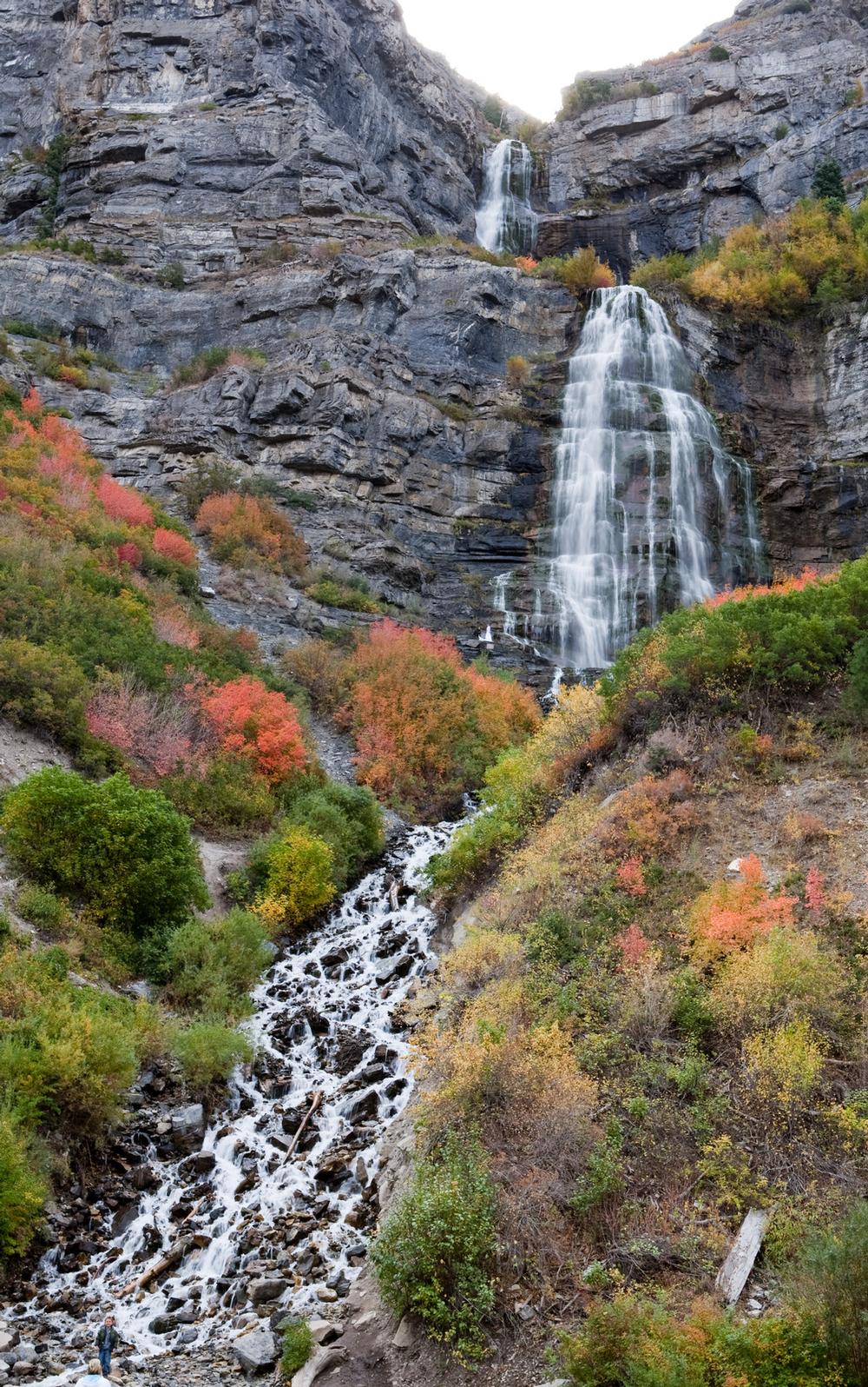
Bridal Veil Falls
I thought Bridal Veil Falls were one of the most striking parts of Provo.
I recommend visiting here first. In fact, just a short drive up Provo Canyon, I thought this was the absolute best thing to do in Provo when we visited. This amazing waterfall is tucked into the Wasatch Mountains.
There is parking near the trailhead. You can follow the sound of rushing water to the 607-foot (185-meter) double falls.
The area is family-friendly. There is a paved walking and biking path, so even kids and strollers can get close to the magic.
We brought a picnic for a lovely mid-morning out with our son.
What I loved best:
Best of all, you don’t have to hike for hours or spend much money, yet you walk away with spectacular memories.
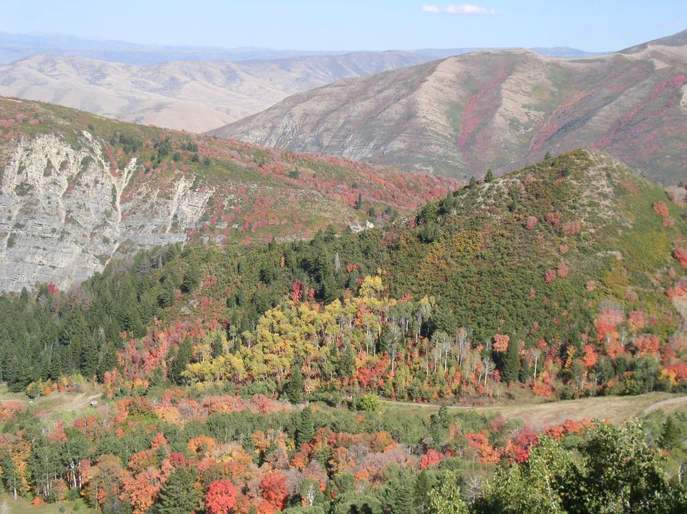
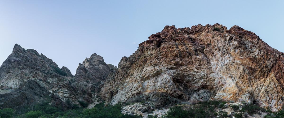
Provo Canyon
I was wowed by Provo Canyon. This is an amazing place to explore after you are done visiting Bridal Veil Falls.
Pack your hiking shoes, a light jacket, and your camera, because this canyon is packed with great scenery.
You'll find Provo Canyon just 10 minutes from downtown Provo (and about an hour south of Salt Lake City if you are thinking of a day trip!).
Provo Canyon offers trails for a range of abilities. The Provo River Trail is mostly flat and great for walking or biking, while routes near Sundance Mountain Resort provide steeper hikes. If you prefer less effort, Sundance’s scenic chairlift rides offer panoramic views without the climb.
Local tip:
Try to avoid weekends and peak summer afternoons if possible, as the canyon is popular with both locals and visitors. Parking is free, though some recreation sites may charge small seasonal fees.
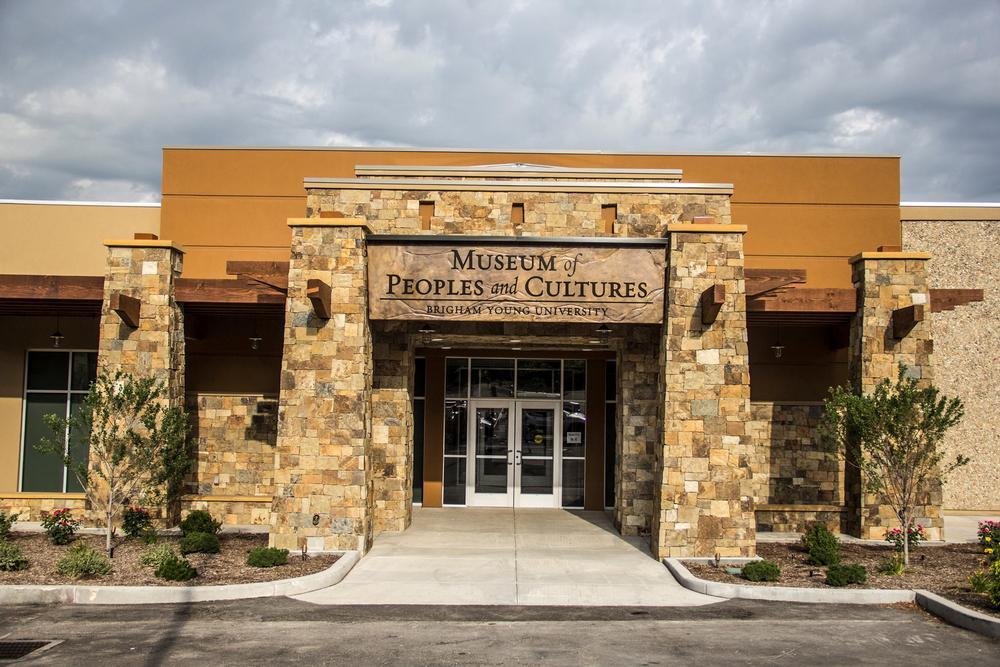
Museum of Peoples and Cultures
I adored this museum and I think it's one of the top underrated cultural things to do in Provo.
Run by BYU’s anthropology department, the museum is packed with over a million artifacts from regions like the American Southwest, Central and South America, the Great Basin, Polynesia, and more.
Admission to Museum of Peoples and Cultures is free.
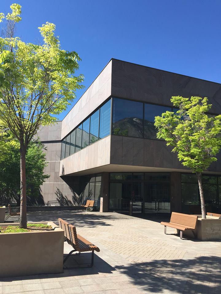
Brigham Young University Museum of Art
My second favorite gem on the BYU campus was Brigham Young University Museum of Art. You can visit light-filled galleries full of great art. We saw European paintings, American art as well as modern installations.
I loved that the BYU Museum of Art constantly rotates its exhibitions, so every visit has something new to see.
Just like Museum of Peoples and Cultures, admission to the museum is free, making it one of the most affordable ways to spend time in Provo.
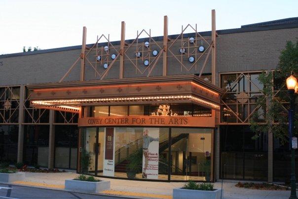
The Covey Center for The Arts
I loved our evening here! If you have energy left over after a day of exploring, head to The Covey Center for The Arts to see a unique performance. The main theater is quite large because it seats over 600 people. If you prefer, you can go for a more intimate performance in one of the studio theaters.
I was impressed by the art galleries inside The Covey Center too.
Monte L. Bean Life Science Museum
We had so much fun at this cool place. Our son loves science so we always visit science museums. Monte L. Bean Life Science Museum (Google Maps pin) in Provo is super interactive. You can see a live animal show and enjoy different exhibits. Monte L. Bean Life Science Museum is free to visit.
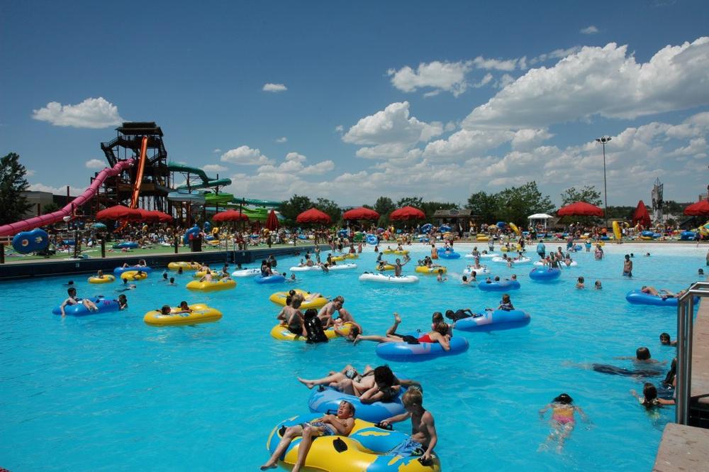
Splash Summit Waterpark
We had the best time here! If summer Utah heat it getting to you, take the kids to Splash Summit Waterpark (Google Maps pin) just minutes from downtown Provo.
Traveling with littles? Splash Summit delivers joy there too. The shallow kids' zones, splash pads, and toddler-friendly areas are playful.
We’ve also discovered that getting to the park early is one of the best ideas. It’s less crowded for sure than later in the day.
Pro tip: the walkways get hot so water shoes are a must.
Provo River Parkway Trail
I fell hard for this peaceful place! Stretching more than 15 miles from Utah Lake all the way up through Provo Canyon to Vivian Park, it’s an amazing trail that is a must visit in the fall.
One of the most exciting highlights for me was reaching Bridal Veil Falls (#1 on this list) right off the trail. The fact that you can start downtown and end up in the heart of Provo Canyon is such a brilliant idea for hikers with heaps of energy to spend.
What I loved best:
I think that Provo River Parkway Trail is one of the best things to do in Provo.
Whether you’re looking for exercise, a relaxing stroll, or a unique family outing, this trail is one of Provo’s coolest gems.
Conclusion
Where to Eat in Provo, UT
- Recommended for Families: Black Sheep Café – Creative fusion with fry bread, and tacos.
- For Casual Dining: Station 22 Café – Southern-inspired comfort food in downtown Provo.
- For Date Night: Communal – Upscale farm-to-table restaurant featuring locally sourced dishes.
Exploring Provo has been such a joyful adventure. What I love most is how much variety the city offers, whether you decide to visit for a day or a week!
