Best Places to Visit in Oregon

Searching for the best places to visit in Oregon? Well, you are in the right place! With great cities, beaches, and endless outdoor adventures, The Beaver State is one of the most diverse and rewarding destinations I loved exploring on our road trip in the Pacific Northwest. This is exactly why I decided to share my favourite experiences in Oregon so that you can use my guide as an inspiration to plan your own road trip.
Whether you’re planning a road trip, a family vacation, or a peaceful romantic weekend getaway into nature, these are the places (and things to do along the way) that I recommend from my own travels - I hope you’ll enjoy them too.
- Best Places to Visit on the Coast of Oregon
- - Cannon Beach - Astoria - Lincoln City - South Coast Tours
- Best Inland Day Trips in Oregon - Willamette Valley
- - Eugene - Corvallis - Salem
- Best Places to Visit in Oregon - Columbia River Gorge / Mt. Hood Area
- - Hood River - Kiyokawa Family Orchards
- Best Places to Visit in Oregon - Portland Metro
- - Beaverton - Newberg - Portland
Best Places to Visit on the Coast
Stretching more than 360 miles along the Pacific Ocean, the Oregon Coast is an incredible place to visit. Here are my favorite stops along the north, central and south cost of Oregon.
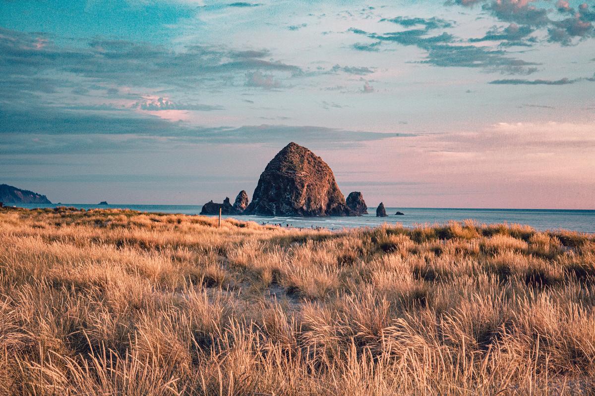
Cannon Beach - 1 hour and 30 minutes from Portland
This has to be one of the absolute best coastal towns I’ve ever visited in Oregon (and one of my favorite beaches on the West Coast!). I love that and it’s only about 90 minutes west of Portland where we landed.
The moment I arrived, the sight of the towering Haystack Rock rising out of the surf felt like pure magic and instantly made me fall in love with this place.
First thing, we toured the Cannon Beach History Center & Museum (free admission, exhibits on early settlers and shipwrecks). Later, we spent a lot of time admiring Haystack Rock (235 feet tall, formed by ancient lava flows), where adorable puffins also nest in spring and summer.
I recommend parking your car and just relaxing here for a few hours even if you are not stopping for the night. Just walking along the wide, sandy beach, to me, this was one of the coolest and most romantic stretches of coast we found in all of the Pacific Northwest! Later, watching the tide pools come alive with starfish and anemones at the base of Haystack Rock was one of my favorite things to do on the coast of Oregon.
My favorite part of Cannon Beach was how vibrant and charming the town itself felt. From hidden art galleries and boutique shops to cozy cafés, it had that perfect small-town vibe mixed with exciting discoveries at every corner.
The food scene here was another gem. I loved sampling fresh seafood at Driftwood Restaurant & Lounge where we stopped for lunch.
We checked into a comfortable vacation rental for seven days.
What I loved best:
Exploring Ecola State Park, just minutes away, was a standout.
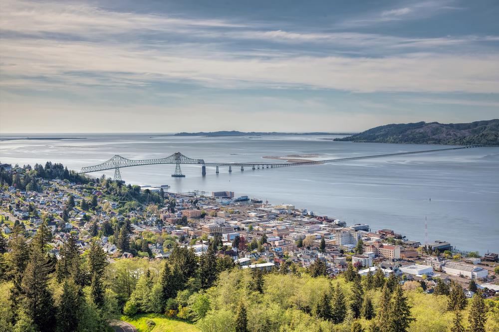
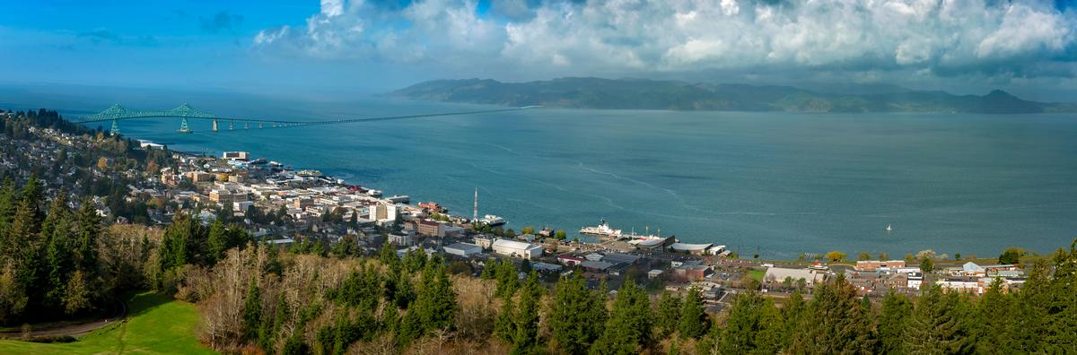
Astoria - 2 hours by car from Portland
Chris and I both absolutely love Astoria (nicknamed "Little San Francisco"), and have been many times. Perched at the mouth of the Columbia River just 40 minutes from our last stop, this is one of the most atmospheric coastal towns I’ve ever visited on our road trip, and I think it's absolutely one of the best romantic weekend destinations on the West Coast.
We started our visit at the Astoria Column, where the climb up its spiral staircase rewarded us with some of the most spectacular panoramic views. After, what I loved best was simply walking along the waterfront.
When we got hungry, Astoria’s food and drink scene surprised me too. I loved the unique breweries tucked into old canneries and the seafood restaurants with fresh local catches.
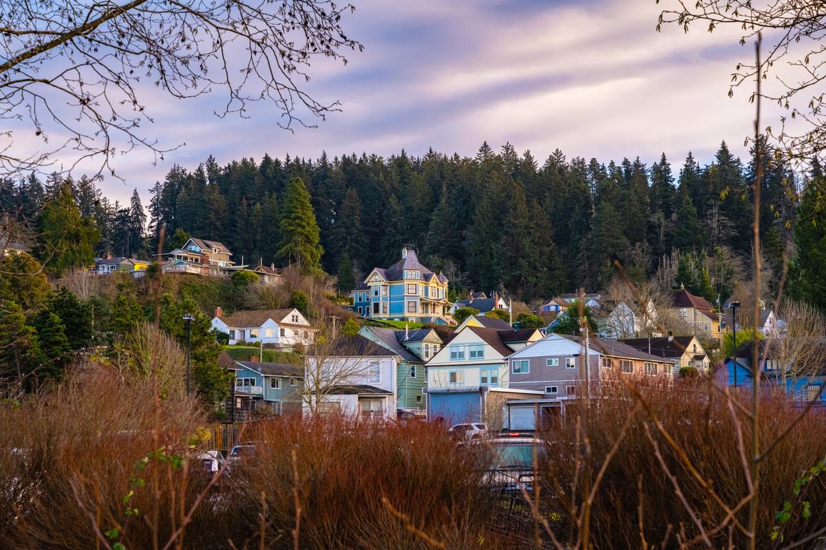
In the afternoon, we admired the town’s history which is everywhere, from the Maritime Museum to the Victorian homes that line the hills.
We stayed at Cannery Pier Hotel & Spa for two days, a restored salmon cannery built over the river with balconies above the water which was super cool!
Local Tip:
The Riverwalk made it easy to enjoy it all and was my favorite highlight. In addition, hopping on the old trolley was a fun, affordable way to see the city.
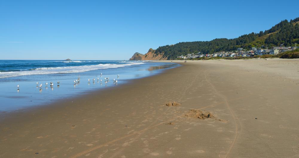
Lincoln City
This is easily one of my favorite coastal getaways in Oregon with a beautiful sandy beach. It sits right along Highway 101 about two and a half hours south down the scenic coast from Astoria. This part of the drive was easily one of my favorite stretches on our road trip (see the map below):
When we reached Lincoln City, first, we headed to the beach which stretches for 7 miles along the Pacific. The beach gave Chris, our son and I endless opportunities to find the best ocean views to relax.
Our next highlight was exploring Siletz Bay, where the calm waters, seals, and birds made for a peaceful experience.
Next, Downtown Lincoln City surprised me with cool antique shops, art galleries, and some of the most affordable seafood restaurants along the coast. We sampled clam chowder, fresh Dungeness crab, and even wood-fired pizza at Gallucci's Pizzeria, an unexpected find that was an absolute best foodie moment.
What I loved best:
Next day, one of the most amazing parts of this part of our road trip was Devil’s Lake which felt like a hidden treasure tucked just behind the dunes.
South Coast Tours
Just a heads up that Oregon's coast is long! Very long! It stretches for 360 miles so to a first time visitor it's overwhelming. On our first few trips, we found that guided tours with a knowledgeable local guide helped us save time and let us discover hidden gems that we would otherwise have missed on our road trip.
One of my favorites, South Coast Tours operates along the southern Oregon coast, roughly from Coos Bay down to the Oregon-California border (Crescent City, CA).
So, if you are an outdoor lover like me, this is for you! Enjoy guided kayaking, stand-up paddle boarding (SUP), fishing, surfing lessons, river boat tours, mountain biking shuttles, whales & wildlife boat tours with a guide, snorkeling, scuba, scenic flatwater paddles, and more.
Best Inland Day Trips in Oregon - Willamette Valley
The Willamette Valley is the cultural and agricultural heart of Oregon.
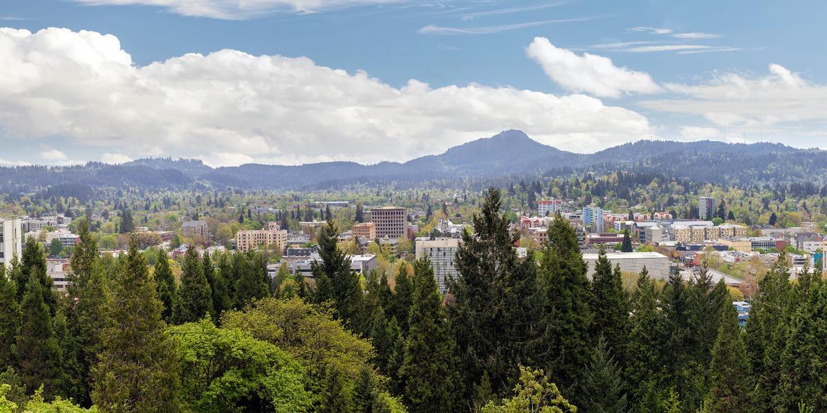
Eugene - 2 hours and 15 from Portland
This part of our road trip meant leaving the beautiful coastal area behind and driving inland. The scenery here was totally different which was part of the excitement.
Eugene is one of the most soulful day-trip (or weekend!) places in Oregon to visit because it's laid-back, creative, and quietly romantic.
After parking in Eugene, we started with a slow morning walk along the riverfront path, very calm and unhurried.
Next, my favorite part was visiting Hendricks Park. I especially recommend it to you during rhododendron season (late March through May!) when everything is in bloom and absolutely stunning!
After, we headed to Downtown Eugene for coffee and pastries at Perugino. We also found artsy bookshops that invited us to browse, one of my favorite things to do.
After, I loved browsing the Saturday Market, with its handmade jewelry, local art, and street musicians.
A quiet highlight was heading up Skinner Butte just before sunset, where we looked out over the town and surrounding hills.
What I loved best:
Alton Baker Park along the Willamette River, where families, cyclists, and kayakers all shared the joyful outdoor vibe was a standout for me.
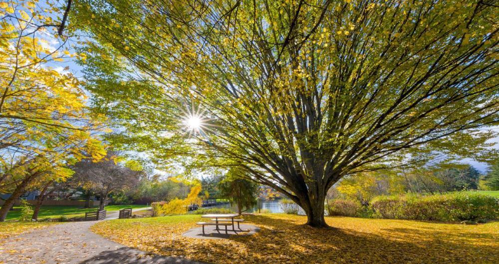
Corvallis
Ready for a history-rich Oregon day trip just 40 minutes north of Eugene? Check out Corvallis, one of my favorite vacation ideas, home to Oregon State University and one of my favorite stops on our journey through the state!
You can walk around downtown first thing to orient yourself. Next, walking along the Willamette River was my favorite way to slow down, the views were peaceful and honestly kind of magic.
After a quick coffee break, we checked out Oregon State University. Lunch came next at a small café we found by accident, called Odd Bird Cafe, one of those underrated spots that end up being great.
After eating, we explored nearby Bald Hill Natural Area, just minutes from town, and it felt like a dream escape into nature. The hike wasn’t hard at all, which made it perfect for bringing our son, and the scenery was spectacular.
As evening rolled in, we grabbed dinner downtown again at The Brass Monkey (the burger and fries were delicious!).
What I loved best:
Next morning, Bald Hill Natural Area was my personal highlight - Just a few minutes from downtown, I found myself on a peaceful trail surrounded by wildflowers and views of rolling hills—it felt like a hidden sanctuary right near the city.
We stayed at Hotel Corvallis for the night, a boutique inn in a restored 1920s brick building right downtown.
Salem - 1 hour from Portland
Continuing our road trip about 35 minutes north from Corvallis, Salem is one of my favorite places to visit in Oregon, I love its riverfront parks, a lively arts scene, and beautiful gardens.
First thing, strolling through downtown, we admired the blend of historic buildings, independent boutiques and bookstores.
My favorite stop was Archive Coffee & Bar near the riverfront, where we shared flaky pastries and expertly brewed coffee.
Next, we wandered through small galleries and specialty shops, smiling as we discovered handmade goods and quirky finds. My personal highlight was an amazing Cheesy BLT ($19) at Word of Mouth Bistro where are refueled for lunch.
A short drive brought us to nearby parks and gardens, where quiet trails and open green spaces gave us a peaceful chance to walk side by side and enjoy the fresh valley air.
In the afternoon, we stopped by the local farmers’ market, with great produce, fresh bread, and handcrafted treats.
What I loved best:
Next day, the Willamette Heritage Center was a standout, where I found unusual exhibits and historic mill buildings that gave me a glimpse into the region’s past. It was an affordable and fascinating stop that I hadn’t expected to enjoy as much as I did.
Best Places to Visit in Oregon - Columbia River Gorge / Mt. Hood Area
For me, this is one of Oregon’s most iconic regions.
We stayed at The Grand Hotel in Salem, with direct access to the convention center.
Hood River - 1 hour and 15 minutes from Portland
This is one of the most breathtaking small towns I’ve ever explored in Oregon and I think it’s one of the absolute best day trips near Portland (about an hour east!). Why? With a population under 10,000 people, Hood River is peaceful and offers panoramic gorge views, vineyard-dotted hillsides, and a relaxed, outdoorsy vibe far removed from the city.
We drove just over an hour east from Portland on our road trip to Hood River, perched on the Columbia River.
First thing we did was park near downtown and just walk, which honestly is the best way to experience this small but exciting town. The streets felt lively yet relaxed, with coffee shops, bakeries, and outdoor gear stores.
We grabbed lunch at River Daze Café close to Columbia River and it was one of the most joyful starts to a day, affordable and delicious with river views.
Later we explored Hood River Fruit Loop, which was my favorite part, full of hidden farms, orchards, and cool roadside stands. Stopping at a small farm for fresh cherries was a brilliant idea and one of the best spontaneous experiences.
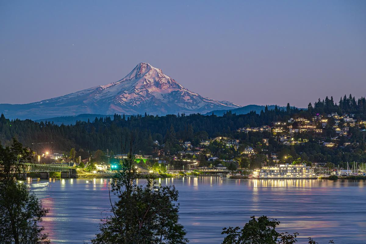
In the afternoon we headed back to town and did some wine tasting, which was a romantic and relaxed experience for us. The views of Mount Hood in the distance were spectacular.
We ended the day walking along the waterfront trail, which was peaceful, interesting, and perfect for a family or couple.
What I loved best:
Wahclella Falls and Punchbowl Falls gave me spectacular views and that cool, refreshing spray of Oregon’s famous waterfalls, my personal highlight.
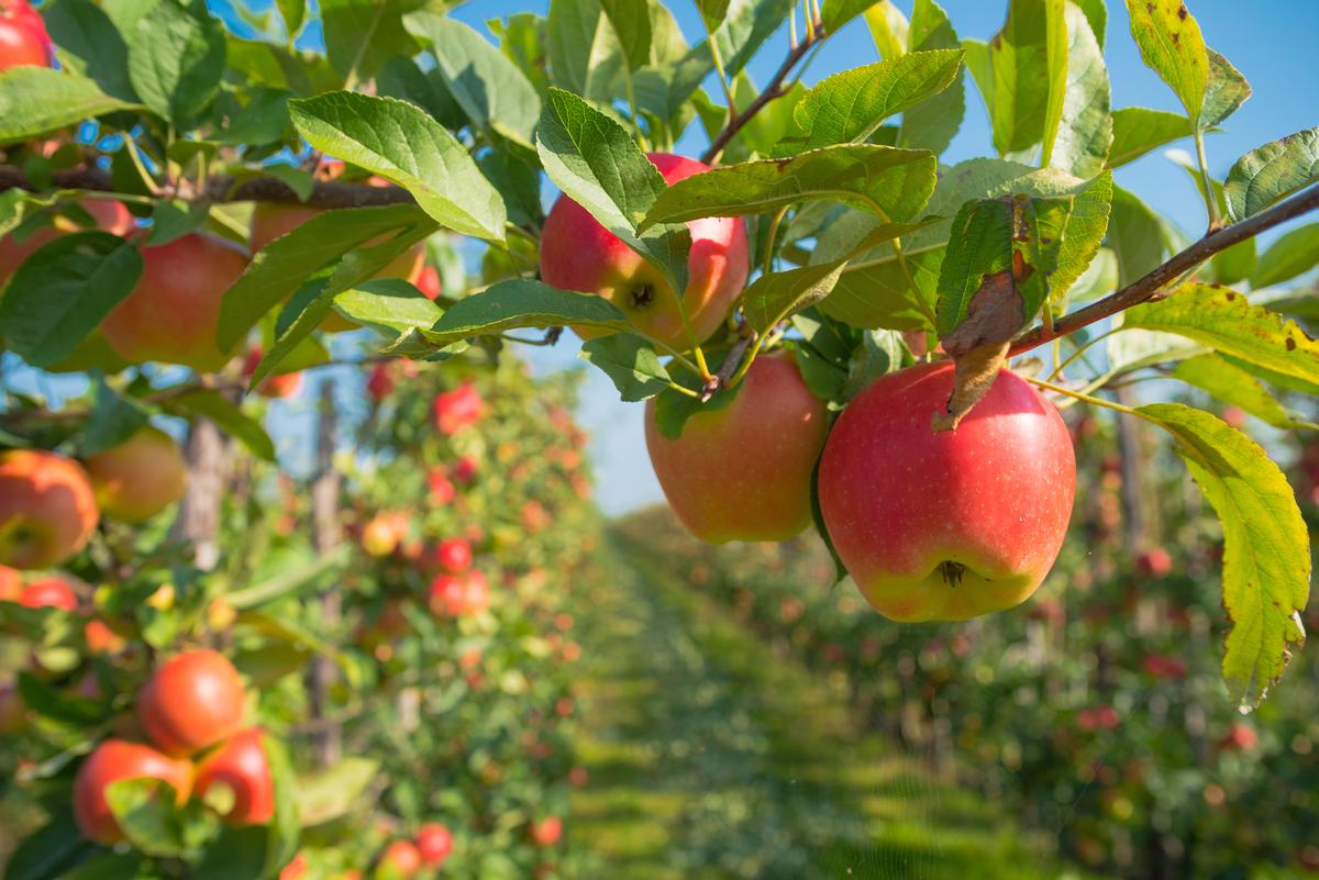
Kiyokawa Family Orchards
If you are planning a fall vacation to this area, you'll not want to miss Kiyokawa Family Orchards just 20 minutes from Hood River. We drove up toward Mount Hood as rows of fruit trees stretched beneath glacier-fed slopes. When I arrived at Kiyokawa Family Orchards in Parkdale, the sun was low, the air cool and sweet with fruit blossoms.
I thought Kiyokawa Family Orchards was deeply charming, with bees, birds, orchards in bloom, and the busy hum of harvest. It was such an unexpectedly delicious stop on our road trip where we could pick our own fresh-from-the-tree apples.
What I loved best:
There is a certain “stepping out of daily life” feel when you arrive at the orchard, my personal highlight.
Best Places to Visit in Oregon - Columbia River Gorge / Mt. Hood Area
With easy connections to the coast, the Columbia River Gorge, and the Willamette Valley, the Portland Metro is both a destination and a gateway to the rest of Oregon.
Beaverton
This turned out to be one of the most interesting and underrated spots I’ve explored in Oregon, located just west of Portland (20 minutes by car!) in the Tualatin Valley.
We started at Tualatin Hills Nature Park, and it was an absolute best way to slow down, surrounded by trees, boardwalks, and quiet moments.
Later we headed toward Nike World Headquarters nearby, which was a cool and interesting stop and honestly felt like a dream for design lovers.
Lunch was one of the most amazing parts, because Beaverton has some of the best food scenes near Portland and it felt like a total gem. In the afternoon we wandered through shops and markets.
What I loved best:
I thought the Beaverton Farmers Market was a vibrant and exciting experience next day, honestly my personal highlight in the fall. Fresh produce, handmade goods, and live music made it feel like the heart of the community. Strolling through with a basket of local berries was both simple and magical.
For the night, we stayed at the Hilton Garden Inn Beaverton, a comfortable base close to trails and transit.
Newberg
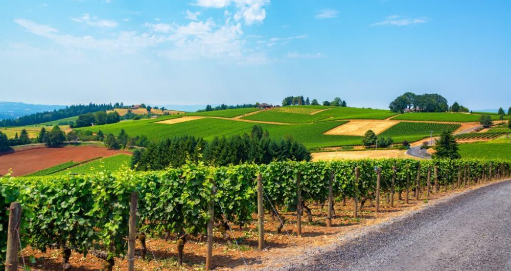
Ready for a history-rich wine country escape? Check out Newberg, a real standout! This felt like one of Oregon’s most underrated gems, located in the heart of the Willamette Valley.
We drove just 15 minutes west from Beaverton to Newberg, known as a gateway to the Willamette Valley wine region.
First, we loved wandering through the charming downtown, where I found cool boutiques, cozy coffee shops, and some of the best small-town eateries around.
My favorite part of Newberg was exploring the surrounding wineries. This area is Pinot Noir country, and tasting local wines while overlooking rolling vineyards was absolutely spectacular.
We also drove the nearby backroads, where farm stands and orchards offered affordable and delicious treats, from fresh berries to homemade jams. Those simple, joyful moments made me appreciate Newberg even more.
What I loved best:
One hidden gem I discovered was the Chehalem Cultural Center, where art, history, and community came together in such an exciting way. It was the coolest surprise to stumble on a place that celebrated both local creativity and culture.
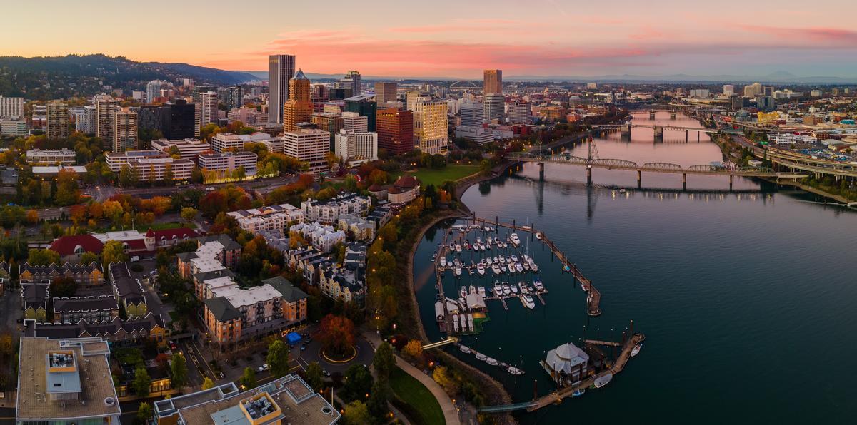
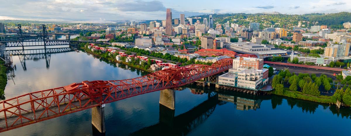
Portland
This has always been one of my favorite cities in Oregon, and every time I visit I discover something new that makes me love it even more. Portland is Oregon's largest city (estimated population exceeding 650,000) and there are heaps of things to do here! Best of all, starting (and ending) our road trip here is easy with lots of flights available daily and an efficient car rental area.
Before catching our flight back to Austin, we stayed a week in a vacation rental. My mornings always started right, with a perfectly pulled espresso from Nossa Familia Coffee, with rich, sustainable brews.
Next, we loved exploring downtown and the Pearl District. Powell’s City of Books it the absolute best bookstore I’ve ever stepped into, with miles of shelves to get lost in. I have to warn you, though, that parking can be a challenge!
When hunger strikes, my favorite part of Portland is the food scene. Don't miss stopping at The Country Cat serving comfort food with Southern roots and local Northwest seafood and made-from-scratch!
After lunch, we wandered through the Japanese Garden and the International Rose Test Garden, both of which felt magical. The peaceful landscapes and vibrant flowers made me realize why Portland is nicknamed the “City of Roses.”
For a truly unique getaway, you can also check out the 4-star Heathman Hotel (from $119/night) in downtown Portland that has retained AAA Four Diamond status for over 30 years so you can trust in a quality stay.
What I loved best:
For me, Portland is one of the best places to visit in Oregon because it's scenic, family-friendly and unique!
Dinner at Mother’s Bistro & Bar was my personal highlight - I had their pot roast, slow-cooked to perfection.