Places to Visit in South Carolina

Trying to figure out where to go in South Carolina? Well, you are in the right place! The Palmetto State has no shortage of incredible destinations I discovered during my recent four week road trip. This is exactly why I decided to share my favourite things in South Carolina so that you can use my guide as an inspiration to plan your own road trip. Here are the places I recommend, and I hope you will enjoy too.
- Best Places to Visit in South Carolina - Lowcountry / Coastal
- - Hilton Head - Charleston - Kiawah Island - Beaufort
- Best Day Trips in South Carolina - Midlands
- - Aiken - Columbia - Congaree National Park
- Best Places to Visit in South Carolina - Grand Strand (Northeast Coast)
- - Myrtle Beach - Pawleys Island - Huntington Beach State Park
- Best Places to Visit in Upstate South Carolina
- - Greenville - Spartanburg
Best Places to Visit in South Carolina - Lowcountry / Coastal
This offers a captivating blend of history, natural beauty, and laid-back coastal charm.
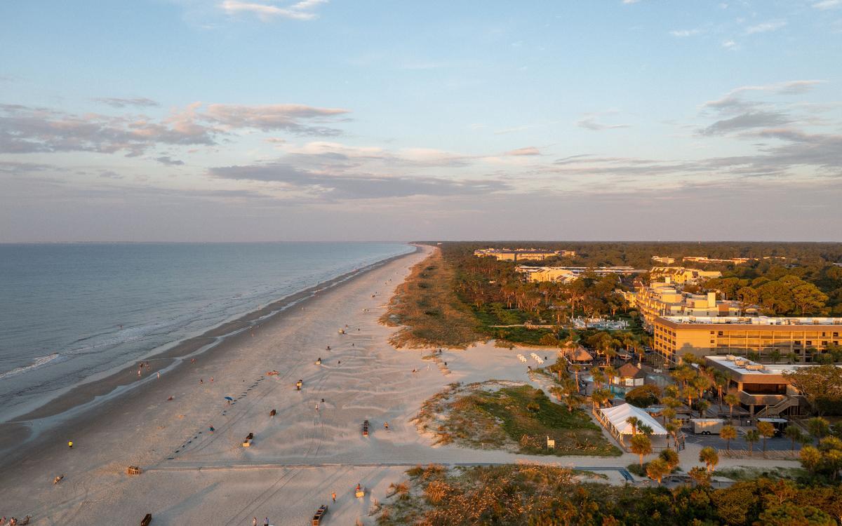
Hilton Head
This is one of the most inviting coastal landscapes I’ve explored in the Southeast, and I think it’s one of the absolute best island getaways in the USA.
We drove about 1 hour northeast from Savannah to Hilton Head Island (population 40,000). As soon as we arrived, I adored Hilton Head's miles of wide, sandy beaches, shaded pathways, and tidal creeks alive with egrets and dolphins. Afterwards, I enjoyed exploring the charming Harbour Town.
What I loved best:
My personal highlight were evenings at Shelter Cove Marina where live music drifted across the water.
We spent the night at the Inn & Club at Harbour Town ($353), a boutique hotel inside Sea Pines Resort.
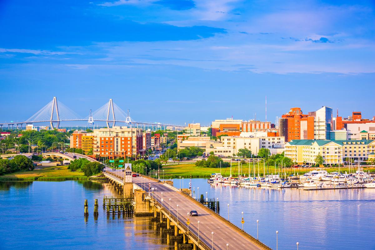
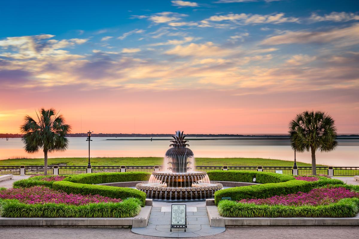
Charleston, SC
We absolutely love Charleston (founded in 1670 !), and have been many times. This quickly became one of my favorite places to visit in South Carolina when I moved to the South.
This beautiful city offers a bit of everything - incredible food, great views, and a diverse selection of accommodations. In addition, it’s remarkably easy to explore on foot which makes it extra relaxing on a weekend getaway because we didn't have to worry about parking.
Next, Chris, our son and I visited Fort Sumter National Monument, where the Civil War began in 1861.
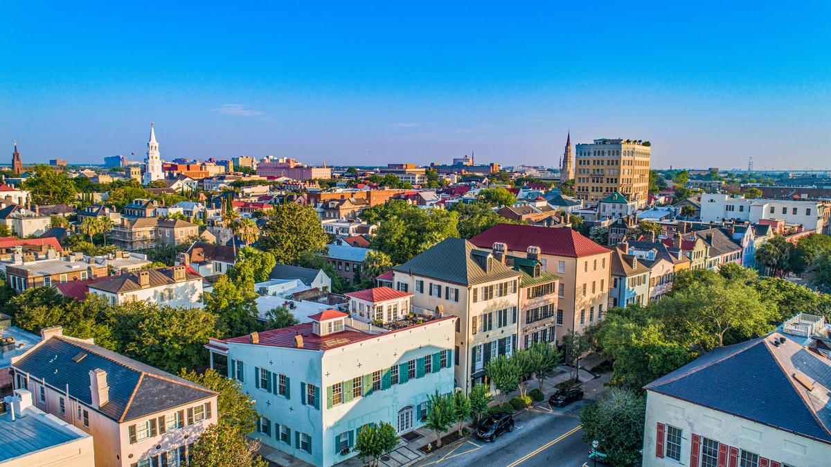
Next day, we enjoyed that most of the main sights are within walking distance of each other, especially in the Historic District south of Calhoun Street.
One of the coolest things we did next was join a Charleston Culinary Tour - it turned out to be the best idea ever as I got to sample local flavors, meet local chefs, and hear the city’s fascinating food history.
In the afternoon, the views of Fort Sumter and Charleston Harbor are beautiful, and the historic mansions lining the waterfront are iconic.
For a joyful and more casual stop, I grabbed coffee at Bitty & Beau’s where the atmosphere was warm, and the drinks were great.
From there, head toward Rainbow Row, explore the Charleston City Market, and make time to stroll King Street, where you’ll find great shopping, coffee spots, and local boutiques.
Dinner at Circa 1886 was another highlight, an elegant restaurant tucked inside the historic Wentworth Mansion and one of the best romantic restaurants in the USA.
What I loved best:
Sesame Burgers & Beer gave us the coolest affordable meal of the trip, and The Darling Oyster Bar on King Street completely won me over with fresh seafood and an atmosphere that was both romantic and lively.
One thing to keep in mind is that Charleston’s charm can slow you down—in the best way. It’s easy to wander aimlessly, pop into shops, and lose track of time without covering much ground. On our first visit, we found that taking a guided tour with a local guide helped us understand the city better and make the most of our limited time.
We checked into the Francis Marion Hotel ($259/night) for four relaxing days, a 1924 landmark overlooking Marion Square.

Kiawah Island
For me, Kiawah Island is one of the most effortlessly romantic vacation ideas on the South Carolina coast.
We drove about 45 minutes southwest from Charleston to Kiawah Island (population 2,000). I instantly thought our journey was worth it!
We started our days biking along the shaded paths that wind through maritime forests and open onto quiet stretches of beach. Later, walking the beach together quickly became our favorite ritual.
We spent afternoons lingering by the ocean, reading, talking, and doing absolutely nothing, which somehow felt like the most luxurious part of the trip. One evening, we shared a sunset dinner overlooking the marsh.
What I loved best:
For me, Kiawah Island is one of the best vacation spots in South Carolina. It's romantic, peaceful, and a favorite escape I can’t wait to return to!
I loved all the dining options on the island, including upscale options like Jasmine Porch and The Ocean Room, casual spots such as Cantina 76 and Cherrywood BBQ & Ale House, and diverse choices like Fuji Sushi Bar & Grill and Tomasso at Turtle Point.
We checked into The Sanctuary at Kiawah Island Golf Resort ($178/night) for blissful five days, a grand oceanfront hotel designed in Lowcountry mansion style.

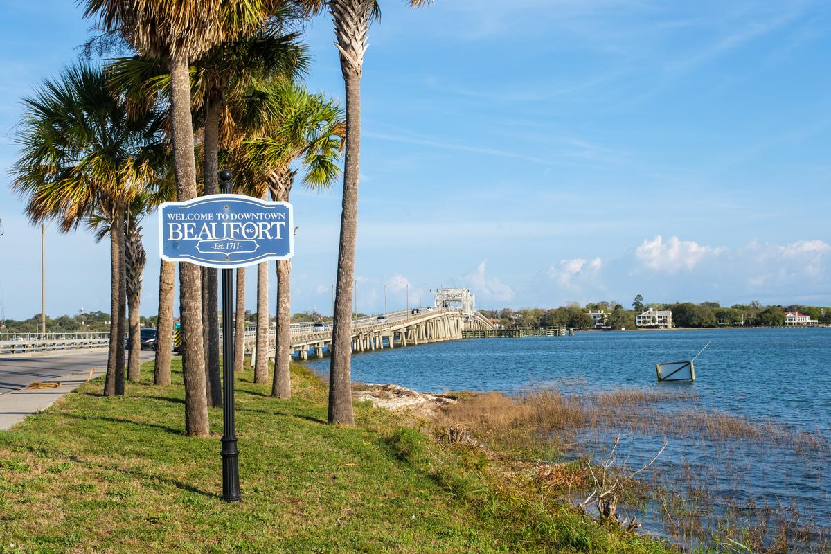
Beaufort
If you have time for just one Lowcountry destination, I say go for this town! Why? It has ante-bellum (pre-Civil-War) mansions shaded by moss-draped oaks, a breezy waterfront, tidal rivers, and a historic district that felt like stepping straight into a Southern novel!
We drove about 1.5 hours southwest from Charleston to Beaufort (population ~13,500), founded in 1711 and one of the South’s best-preserved historic towns.
Getting around Beaufort is easy, especially if you’re staying near downtown. The historic district is very walkable, and many of the main sights are clustered close together. If you’re coming from nearby areas like Hilton Head or Savannah, driving is the most convenient option, and parking downtown is generally straightforward. Once you’re there, walking or biking is the best way to take in Beaufort’s beautiful oak-lined streets and river views.
I think you should start by exploring the Historic Downtown and strolling along the Henry C. Chambers Waterfront Park. The park offers peaceful views of the Beaufort River, shaded benches, and a great spot to watch boats come and go. From there, wander through the surrounding neighborhood to admire the antebellum homes and Spanish moss-draped oak trees that give Beaufort its postcard-worthy look.
Beaufort also has a strong food scene for a town its size. You’ll find plenty of local restaurants serving Lowcountry classics like shrimp and grits, fried green tomatoes, and fresh seafood. There are also cozy cafés and bakeries that are perfect for a midday break.
What I loved best:
If you enjoy history like me, stopping by the Beaufort History Museum or touring one of the historic homes adds depth to your visit and helps you better understand the area’s past.
Best Day Trips in South Carolina - Midlands
This area offers some of the state’s most rewarding and easygoing day trips!
We spent two nights at the romantic Anchorage 1770 Inn ($366/night), a waterfront tabby concrete mansion turned boutique inn.

Aiken
Set among rolling sandhills and shaded by massive live oaks, this is one of the most elegant and peaceful Southern towns I’ve visited on a road trip, and I think it’s one of the absolute best low-key romantic weekend getaways in South Carolina. Why? Aiken offers scenic horse country, quiet gardens, historic estates, and a laid-back vibe perfect for a day trip or a longer vacation.
I planned my visit around the Aiken Fall Steeplechase Championship, when locals don their finest hats for a weekend of thrilling races which were lots of fun to watch.
First when we arrived, I enjoyed a coffee on the patio at New Moon Cafe in downtown Aiken, and purchased one of their specialty sandwiches to go.
Then, we strolled through Hitchcock Woods, admired the horse-drawn carriages, and wandered through downtown’s Laurens Street.
Just a 25-minute drive from Augusta, I checked into the historic 3-star Hilton Garden Inn Aiken for three amazing days and I loved the way life here moved at an unhurried pace.
What I loved best:
Exploring beautiful Hopelands Gardens was my favorite highlight.

Columbia
For me, the capital of South Carolina is one of those underrated gems that always surprises me with its mix of history, culture, and energy. There are heaps of amazing things to do here!
First off, one of my favorite experiences was joining Columbia Food Tours, which turned out to be the absolute best way to discover the city’s culinary side. We got to experience a joyful mix of flavors and history, and I thought it was such a brilliant idea for first-time visitors.
In addition, Columbia, SC is an incredible destination for foodies where restaurants include a diverse range of options, from Southern staples like Tupelo Honey and Mr. Friendly's to iconic spots like Maurice's Piggie Park, as well as international cuisine like MOA Korean BBQ, Motor Supply Co. Bistro for its farm-to-table approach and Blue Marlin for its seafood. I have to warn you, though, that parking can be a challenge!
Just a 20-minute drive from the airport, I checked into the boutique 3-star Hotel Trundle, a stylish art-deco gem in the heart of Main Street for four care-free days with my husband.
What I loved best:
I had a great time exploring The Vista, wandered on the riverfront trails at the Three Rivers Greenway (my favorite highlight!), and visiting the South Carolina State House and its beautiful grounds right in the heart of downtown.

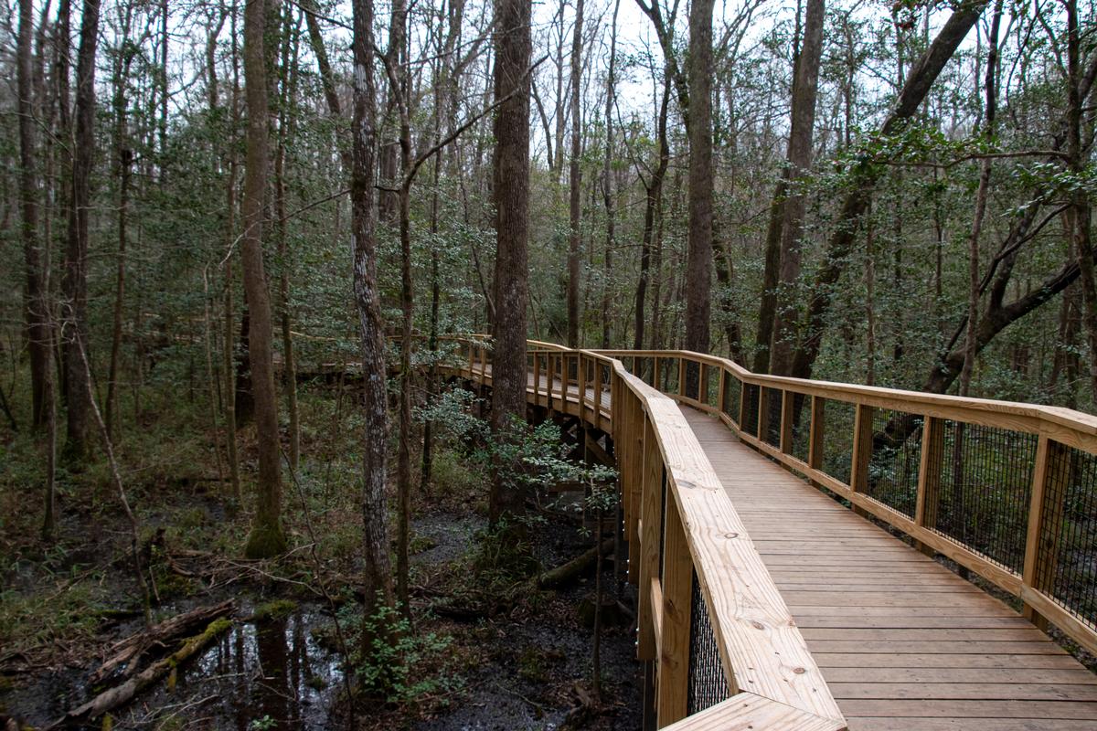
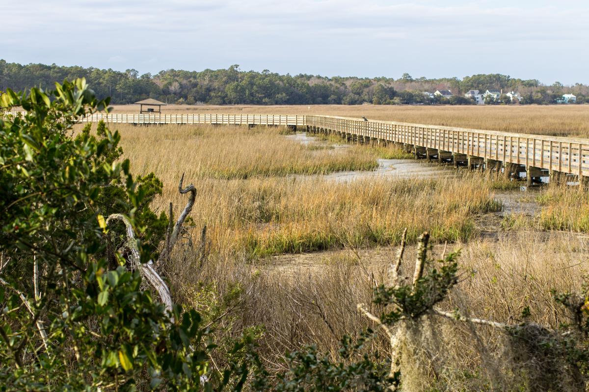
Congaree National Park
I thought this hidden South Carolina gem was a spellbinding, dreamlike world with a vast cathedral of towering trees mirrored in the water.
From our home base in Columbia, we drove just about 30 minutes southeast. First thing, I wandered down the famous Boardwalk Loop Trail at dawn, where I spotted great blue herons, a perfect way to reset surrounded by nature.
What I loved best:
Spotting a few elusive river otters with my son was my personal highlight.
Best Places to Visit in South Carolina - Grand Strand (Northeast Coast)
This 60-mile coastal region offers a mix of family-friendly fun, natural beauty, and laid-back beach towns.
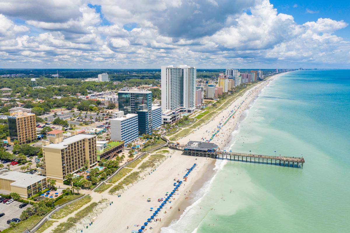
Myrtle Beach
This is one of the most iconic beach destinations on the East Coast, and I think it’s one of the absolute best seaside escapes in South Carolina.
The first thing we did was walk along the boardwalk.
After that we grabbed breakfast nearby, an affordable spot locals loved, which felt like a hidden gem.
Later we spent hours on the sand, and it was my favorite experience just watching waves. The ocean breeze felt cool and joyful, making this underrated beach town feel like a dream.
By midday we explored Broadway at the Beach, which is one of the most fun areas. There were shops, music, and unusual attractions, making it a brilliant idea for families.
Next we headed to SkyWheel, and wow that view was the absolute best experience. Seeing Myrtle Beach from above felt spectacular.
In the afternoon we drove a bit south near Murrells Inlet for seafood. That stop felt like an underrated food spot and easily one of my favorite meals.
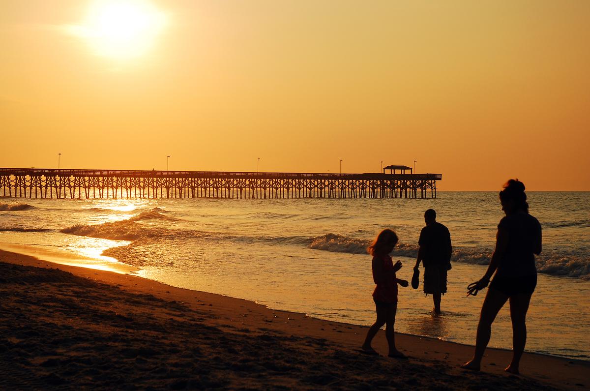
As evening came, we went back near the shore to watch sunset together. The colors over the water were amazing and honestly felt like pure magic.
After just a quick 15-minute drive from the airport, we checked into the stylish Marina Inn at Grande Dunes ($119/night) for two days, a AAA Four Diamond award winner and one of my favorite romantic weekend getaways in South Carolina.
What I loved best:
At night we walked the beach again, which felt peaceful and unique.
I thought that dining at the renowned Sea Captain’s House at the resort was a standout!
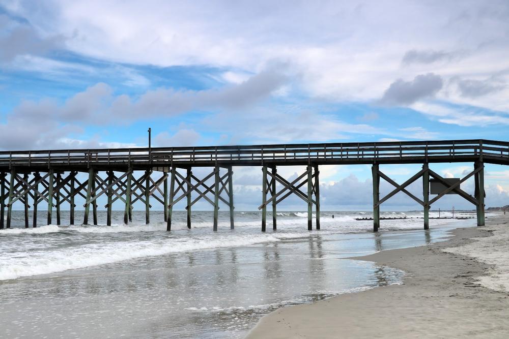
Pawleys Island
Stretching between the Atlantic Ocean and a calm tidal creek, this is one of the most unspoiled barrier islands I’ve seen on the East Coast.
I also learned that Pawleys Island (population ~100 year-round) is one of the oldest resort areas on the East Coast!
We started the day with a slow walk along the beach, with soft sand, rolling waves, and salty breeze. My favorite part was wandering near the dunes and marshes, hand in hand.
The island itself had a laid-back charm, with weathered cottages, shady oak trees, and hammock-lined paths.
We stopped for lunch at a local spot and shared fresh seafood that tasted like summer—simple, flavorful, and made even better by the unhurried pace.
Later, we wandered out onto the pier, watching fishermen cast their lines while pelicans skimmed the water.
As the day wound down, we found a quiet place by the marsh, where the sky turned soft shades of pink and gold and the air grew still.
We drove about 1.5 hours north from Charleston to Pawleys Island and checked into Sea View Inn for a fantastic four-night stay that gave me such a cool sense of stepping back in time.
What I loved best:
One thing we enjoyed most was the variety of food here, from burgers at Rustic Table to great seafood at Chive Blossom Cafe.
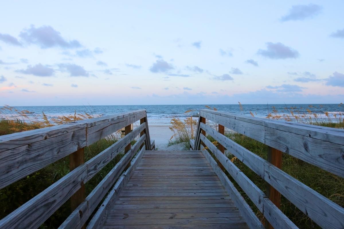
Huntington Beach State Park
Ready for a coastal nature getaway? Check out Huntington Beach State Park, a real standout!
I loved visiting and I instantly thought that the mix of untamed nature and quiet beauty gave this place a serene feel.
First, I strolled along the boardwalk trails, watched pelicans, and then explored the hauntingly beautiful Atalaya Castle.
What I loved best:
I loved that from Myrtle Beach it's just 30 minutes south to reach the park’s wide, empty beaches so it made a great day trip.
Best Places to Visit in Upstate South Carolina
Inland South Carolina offers waterfalls, hiking trails, lakes, and vibrant downtowns with a strong local food and arts scene.

Greenville
This is one of my favorite cities in South Carolina for a weekend getaway because of its lively, walkable downtown.
First stop on our itinerary, I loved our visit to the the Museum & Gallery (M&G), a collection of great significance in the realm of “Old Master” European art on the campus of Bob Jones University (BJU).
Next stop, I always feel a special sense of peace when I walk through Furman University’s campus in Greenville because the manicured lawns, Georgian-style buildings, and the lovely lake.
We had dinner at Jianna, a modern Italian gem perched above Falls Park where we savored the handmade pastas, the fresh oysters, and the romantic views from the rooftop patio.
Next day, other highlights for me personally are Paris Mountain State Park, Greenville Zoo (we first visited when our son was little and he loved it!), Greenville County Museum of Art, Runway Park at GMU, Pitt County Arboretum and Greenville Greenway.
We spent two romantic days at the Westin Poinsett ($239/night), a 1925 Beaux-Arts landmark hotel in the heart of downtown.
What I loved best:
We had another amazing meal at Grill Marks, right near Main Street later, and it was one of the absolute best burger experiences I’ve had in the South.
Keep in mind that there are plenty of cool spots to visit on a day trip from Greenville as well.


Spartanburg
Ready for a foothills-and-culture getaway? Check out Spartanburg, a real standout and an Upstate Carolina gem!
First, I explored the charming "Hub City" downtown filled with indie coffee shops and galleries. Then, we walked along the leafy Mary Black Rail Trail, followed by a coffee break.
Later, we admired the outdoor sculptures at Chapman Cultural Center.
Next morning after breakfast at the hotel, we drove out into the countryside where we saw peach orchards.
What I loved best:
For me, Spartanburg is one of the best places to visit in South Carolina.
Dinner at The Kennedy was my personal highlight, where my husband, our son and I loved its modern, creative spin on Southern flavors. I really appreciated the artful presentation of small plates like crispy pork belly with sorghum glaze, and the cozy, stylish vibe.
Just a short 30-minute drive from Greenville, I settled in for two days at the sleek AC Hotel by Marriott overlooking Morgan Square.