Places to Visit in Colorado

Looking for an amazing fresh destination to explore in Colorado? You've come to the right place! Colorado is a state of breathtaking landscapes, exciting cities, and relaxing natural hot springs, which, for me, makes it one of the most rewarding places to explore in the U.S. What I love most is that Colorado offers something unforgettable in every season which makes it easy to plan vacation.
This is exactly why I decided to share my favorite things in Colorado so that you can use my guide as an inspiration to plan your own vacation. Here are the places I recommend from my years of exploring (and our recent four week road trip), and I hope you’ll enjoy them too.
- Boulder
- Things to Do in Denver
- Morrison - Just 25 minutes west of Denver
- Glenwood Springs
- Telluride
- Fort Collins - an hour north from Denver
- Things to Do in Steamboat Springs
- Allenspark - 1 hour northwest from Denver - Ouray - Silverton - Pagosa Springs
- Things to Do in Aspen
- Colorado Springs - Vail - Palisade - Loveland - Littleton - Delta - Canon City - Mesa Verde
- Conclusion & Things to Know

Boulder
We absolutely love Boulder, and have been many times. This is one of the most naturally beautiful cities I’ve ever explored, and honestly, it feels like one of the most underrated escapes in the U.S. Since there is so much to take in, we decided to join a guided tour with a local guide on our first visit which was a great idea.
I love the way the mountains meet city life at the base of the Flatirons, just about 30 minutes northwest of Denver. Not only is it easy for me to get to, but it feels like I’m stepping into both a lively college town and a mountain escape at the same time.
Instead of driving, we hopped on the RTD bus from Denver to Boulder ($10.50, about 1 hour), a cheap and easy ride straight into town. From there, it was all walkable, especially down Pearl Street, and around the University of Colorado campus.
Chautauqua Park is my favorite place to start the morning because the trails are right there at the edge of town. For something a little more unusual, I like heading to the Boulder Dushanbe Teahouse which was handcrafted and gifted from Boulder’s sister city in Tajikistan.
Later, Local Table Tours instantly pulled me into the city’s thriving food culture. In addition, I learned a lot about Boulder’s culinary personality in just a few delicious hours.
Art and culture thrive here, too. I like visiting the Boulder Museum of Contemporary Art for local and national exhibits, or catching a show at the Boulder Theater, an Art Deco landmark that hosts live music and film events. For science lovers like my son, the Fiske Planetarium and National Center for Atmospheric Research (NCAR) offer fascinating educational experiences with stunning views.
If you love the outdoors, Boulder is paradise. Go rock climbing at Eldorado Canyon State Park, paddleboard at Boulder Reservoir, or drive the Peak to Peak Scenic Byway for breathtaking mountain vistas.
What about food? One place I wholeheartedly recommend is Flagstaff House Restaurant, perched on the mountainside. Its sweeping views and inventive New American tasting menus (think elk tenderloin and lavender-honey panna cotta) made our sunset dinner unforgettable.
In fact, foodies will find endless choices — from farm-to-table restaurants like Black Cat Bistro and Bramble & Hare, to innovative eateries like Frasca Food and Wine, a James Beard Award winner. For casual dining, try Snooze, an A.M. Eatery for breakfast or West End Tavern for BBQ and mountain views. Craft beer lovers can tour Avery Brewing Co., one of Boulder’s most iconic breweries.
What I loved best:
Our plush room with a King bed at 4-star St Julien Hotel & Spa for five amazing days was my favorite highlight because it offered luxury and relaxation with mountain views right downtown. For a cozier vibe (and more affordable pricing!), we've also stayed Basecamp Boulder, a boutique hotel designed for adventurers.
Things to Do in Denver
Ready for a city-meets-mountains retreat? Check out Denver, a real standout, where we spent ten easy-going days in a vacation rental this summer! I think that the "Mile High City" provided us with the perfect mix of culture, history, and fresh air. There are heaps of unique things to do here! We flew into Denver International Airport (DEN).
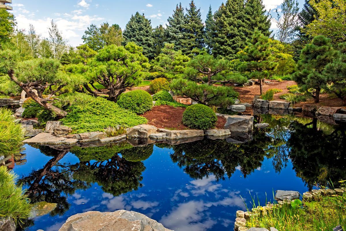
Chris, our son and I started the day with a Steel Cut Oatmeal breakfast ($11) at The Corner Office. From there, I walked off breakfast through the Denver Botanic Gardens which I thought was such an amazing spot in the summer!
Afterwards, we enjoyed late lunch at Panzano, where I had the house-made tagliatelle with wild mushrooms and truffle oil, while we sat near the window.
Later, we wandered through the Kirkland Museum, and admired rooms of mid-century color and unique, elegant furniture.
Then came the Forney Museum of Transportation, full chrome and a sense of movement locked in time, where we saw some of the coolest historical and technological items related to the history of transportation.
Midafternoon brought a second pause, this time at Syrup, for a quick sweet bite - I ordered their famous banana pudding pancakes which I highly recommend!
Evening came as I reached Larimer Square, then we I stopped at Tacos Tequila Whiskey where I had dinner and some of the best carne asada tacos I've ever tasted (crisp-edged, with just the right touch of lime!).
I ended the night at Black Shirt Brewing Co., tucked into a quiet courtyard, a real standout for a relaxing night out. If you enjoy casual dining, Comrade Brewing Company is another one of my favorite friendly local spots where we've especially enjoyed its outdoor patio.
What I loved best:
Dinner with my husband and son at ChoLon Modern Asian Bistro was my personal highlight, where the French onion soup dumplings came out steaming.
A downside? The altitude took some adjusting for a few days after we landed. Even walking a few blocks uphill left me catching my breath, and drinking extra water became a necessity.
Morrison - Just 25 minutes west of Denver
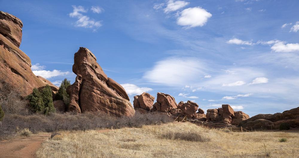
This is one of the most naturally dramatic places I’ve explored in Colorado, and I think for me it's one of the absolute best spots when I'm in the mood for unique landscapes. I loved that it was so close to Denver, yet feels like a hidden canyon retreat!
I discovered that early summer was the perfect time to visit Morrison because the weather was warm and the timing put me ahead of the heavy concert-season crowds.
I stayed at a cozy cabin rental for seven days, and woke up to see hummingbirds darting between wildflowers. After a hearty breakfast at Morrison Joe, I hiked the trails at Red Rocks Park, admired the Red Rocks Amphitheatre mid-morning, and cooled off at Bear Creek Lake Park.
What I loved best:
Dinner at The Fort was a highlight with the building itself a full-scale replica inspired by Bent’s Old Fort (the 1830s fur-trading post on the Santa Fe Trail). We thought the menu at The Fort was super unique, since it draws on frontier-era, mountain-west, Native American, Spanish and Mexican trading-post influences!
Glenwood Springs
This is one of the most naturally beautiful towns I’ve explored in Colorado, and I think it’s one of the absolute best spots for a relaxing weekend getaway in the "Centennial State".
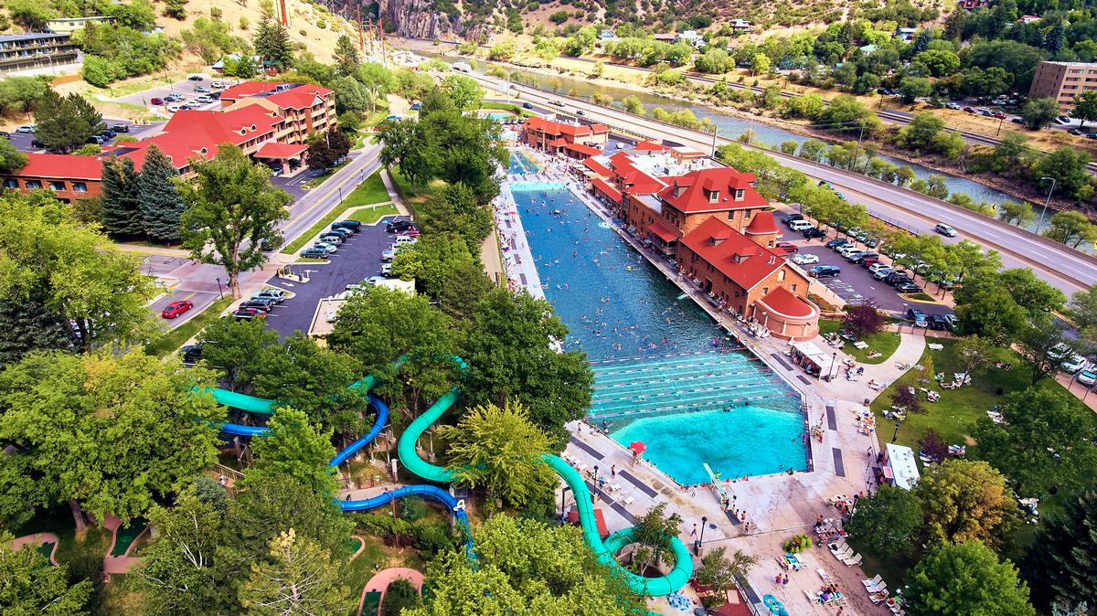
Located along I-70 between Aspen and Vail, this town is famous for its natural hot springs, and soaking here always feels like the perfect way to unwind on vacation.
I hopped on Amtrak’s California Zephyr from Denver (about 6 hours, $50–$80 one way) to enjoy the view instead of driving. I wasn't disapointed - The train hugs the Colorado River, slipping through 40 tunnels before reaching Glenwood Springs. I instantly thought our journey was worth it!
My favorite spot (and where I spent most of my time) is Glenwood Hot Springs Pool, which is massive and filled with mineral-rich water that makes me feel instantly refreshed.
For something a little more unusual, I love taking the hike up to Hanging Lake. The trail is steep, but when I reach the top and see the turquoise waters and cascading falls, it feels like discovering a hidden paradise tucked into the cliffs.
Downtown Glenwood Springs is small but lively, with shops, art galleries, and plenty of great places to eat.
What I loved best:
For me, dining was a highlight in Glenwood Springs, probably because I was so hungry after soaking in the springs! We enjoyed wood-fired pizza and craft beer at Slope & Hatch on our first night. On our second day, we went for upscale mountain dining at The Pullman (I love that they serve early dinner, starting at 4:30 pm).
There are three hotels I recommend in town, each with its own vibe. First, there is the 3-star Hotel Colorado (from $268/night), a historic landmark with Victorian elegance and rumored ghost stories (I thought it was perfect when we wanted a historic twist to our stay). Glenwood Hot Springs Resort (from $107/night) is my favorite because it puts you steps from the pools. (In addition, I enjoyed how family-friendly it was when traveling with my son). For an affordable stay, try Best Western Antlers (from $98/night).

Telluride
If you are like me, this historic wild west town will make you feel like you’ve discovered one of Colorado’s most spectacular treasures.
I love strolling down Main Street, where Victorian buildings and boutique shops sit against towering cliffs of the San Juan Mountains.
One of my favorite experiences is taking the gondola ride up to Mountain Village. I was surprised to discover that it's completely FREE to ride because it's part of a public transportation system connecting the towns of Telluride and Mountain Village. The ride took just 12 minutes and gave us the most incredible 360-degree views of the San Juan Mountains!
In the summer, I’m drawn to the music festivals and outdoor events that fill Telluride with energy. I think the Telluride Bluegrass Festival is a standout that combines world-class talent with an unforgettable mountain setting. I have to warn you, though, that parking can be a challenge!
What I loved best:
Mountain cuisine at 221 South Oak was my favorite highlight. For breakfast, we loved The Butcher & The Baker, where we had great pastries and bought some sandwiches to go, and enjoyed them later on the trails.
A downside?
If you’re staying overnight, you’ll find options that range from luxurious to rustic-chic, though when we visited in the summer prices were sky-high.
Fort Collins - an hour north from Denver
Ready for a vibrant small-city escape? Check out Fort Collins, a real standout!
From Denver, it was just over an hour north to Fort Collins. I filled my visit with biking along the Poudre River Trail, exploring Old Town’s charming shops, and watching a sunset over Horsetooth Reservoir.
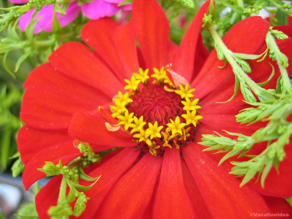
As a garden lover, my absolute favorite stop were the Colorado State University Flower Gardens, where colors and sweet floral scents made for a peaceful afternoon stroll.
Later, locals shared tips about the Taste of Fort Collins music and food festival happening that weekend.
What I loved best:
Dinner both nights at the farm-to-table Farmhouse at Jessup Farm was my personal highlight, with lights over the patio and delicious seasonal salads and chicken dishes.

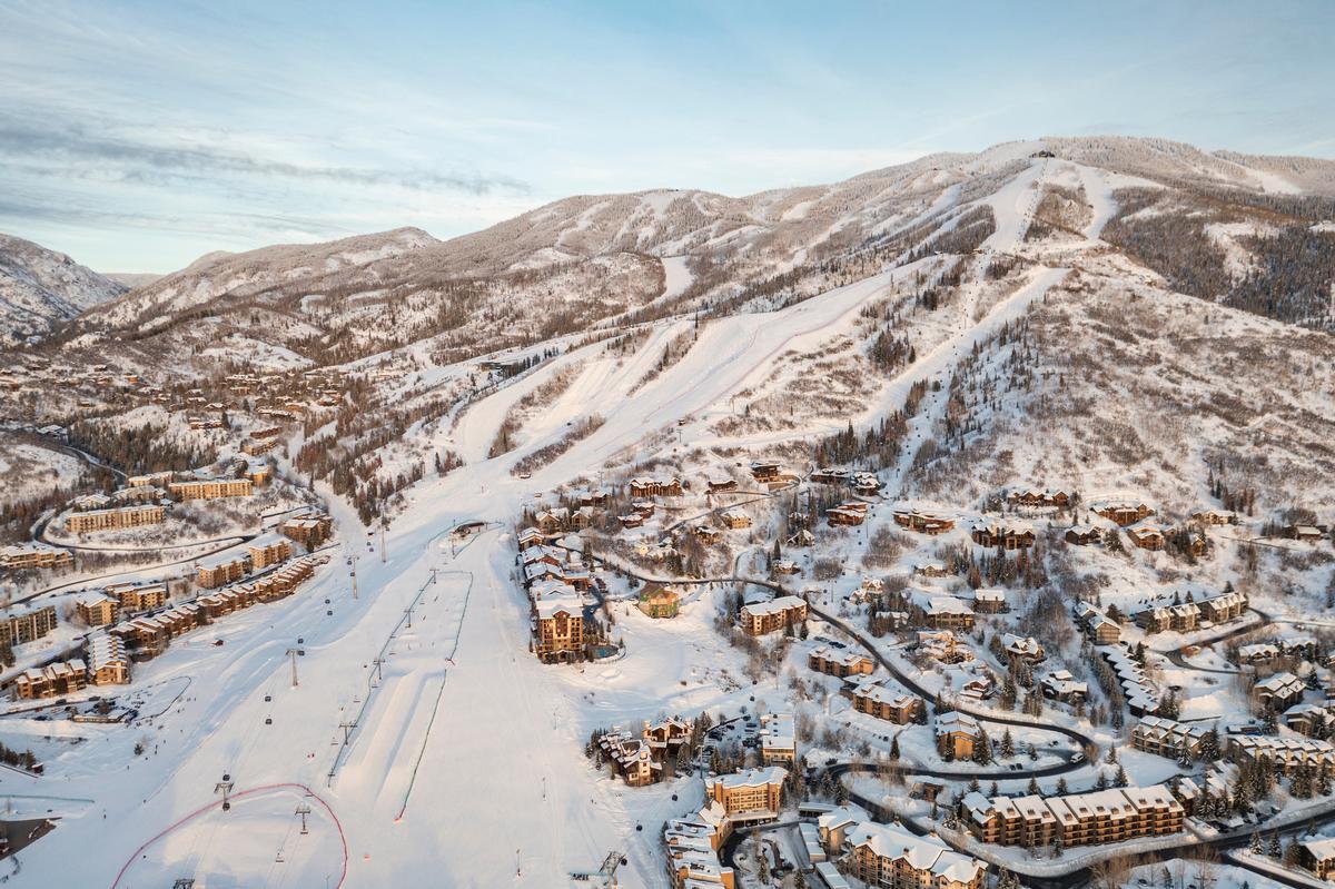
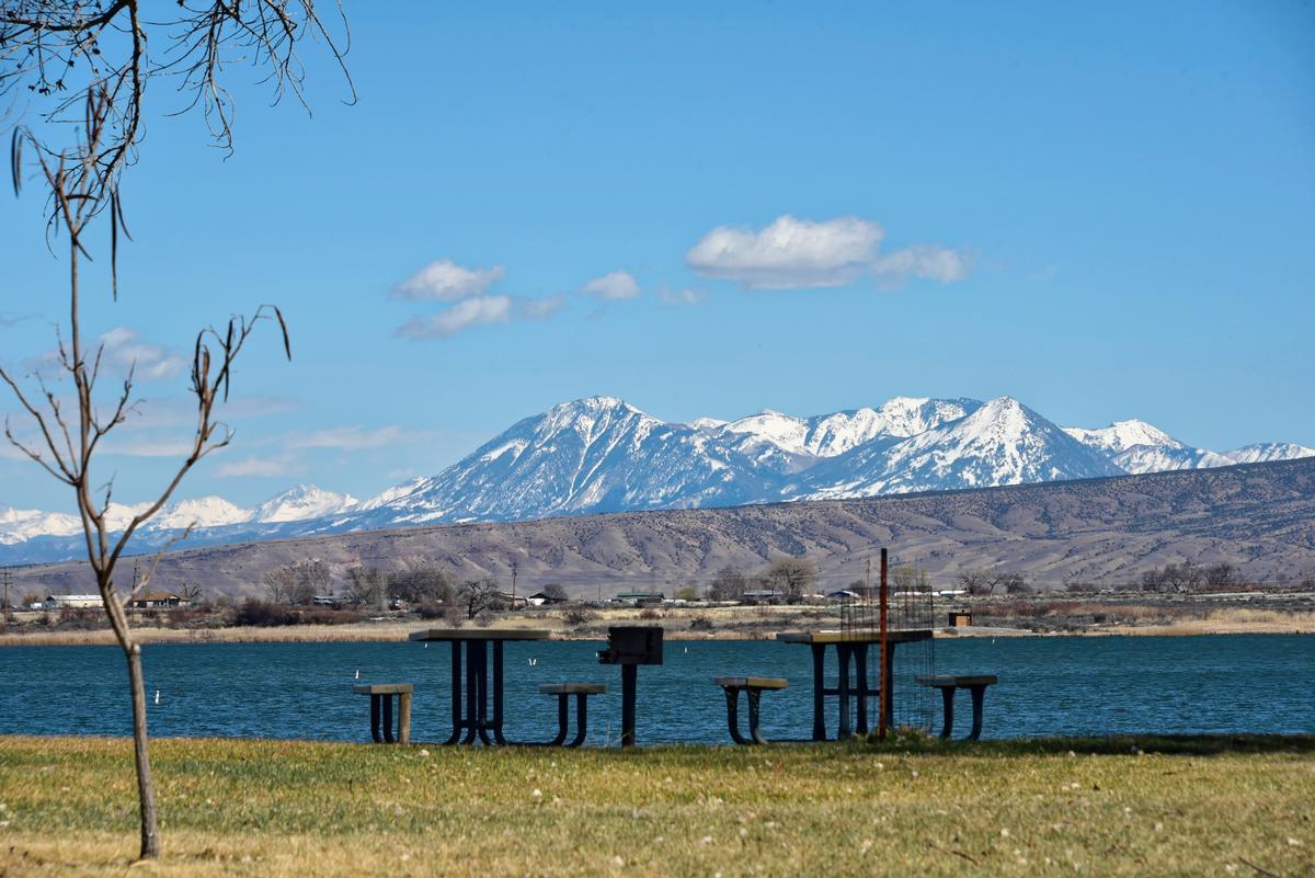
Things to Do in Steamboat Springs
This is one of the most beautiful and welcoming ski towns (with a strong ranching and history!) I’ve explored in Colorado. We drove 2 hours and 45 minutes northwest from Denver.
One of my favorite things to do was visiting the Tread of Pioneers Museum ($7.14 adult admission, $3.06 child), gazing at exhibits and photographs featuring Native American heritage, early settlers and Olympians who trained here.
Later, dinner at Aurum Food & Wine was super memorable because the restaurant overlooked the Yampa River. I ordered delicious pan-seared scallops with a parsnip puree and roasted vegetables (everything was delicious!).
Later that evening I headed to Mountain Tap Brewery where I ordered a wood-fired pizza with roasted mushrooms.
A downside? The drive into town, while beautiful, was long and winding. I didn't mind and I thought it was a perfect weekend getaway from Denver, but I thought you should know!
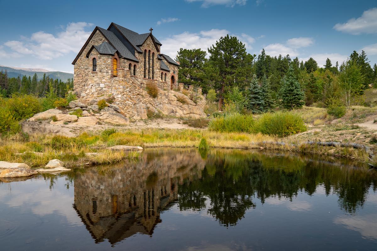
Allenspark - 1 hour northwest from Denver
Ready for a quiet mountain escape? Check out Allenspark, which was real standout for me! Tucked along the Peak to Peak Scenic Byway, about an hour and a half northwest of Denver and just south of Estes Park, this tiny town feels hidden away from the crowds while still being close to Rocky Mountain National Park.
Surrounded by towering pines and meadows filled with wildflowers, it’s the kind of place where I can breathe deeply and slow down.
- Location: Northern Colorado in the Rocky Mountains near the eastern edge of Rocky Mountain National Park, south of Estes Park and northwest of Lyons
- Map & Directions
What I loved best:
Walking around town, stopping at the small cafés and local shops was my personal highlight. In addition, we enjoyed seeing historic Chapel on the Rock and joined a 0.5 mile guided hike on Friday morning.
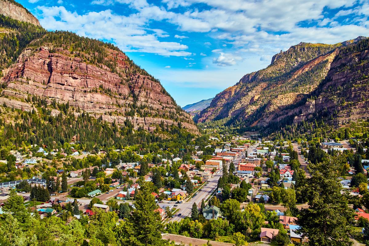
Ouray
I think this town is one of the absolute best spots for mountain lovers, and I understand why this place is called the “Switzerland of America.” We discovered it by accident, while looking for affordable home base near Telluride.
I love exploring the town itself, with its Victorian buildings, charming shops, and joyful small-town vibe. Walking down Main Street feels like stepping back in time, yet everything is welcoming and full of life.
For adventure, the hiking trails are unforgettable. Box Canyon Falls is a must-see, with a roaring waterfall tucked into a narrow gorge that feels hidden away from the world. In the winter, I’m always amazed by the Ice Park, where climbers scale frozen waterfalls—it’s one of the coolest and most unusual sights I’ve ever witnessed.
What I loved best:
My favorite experience here is soaking in the Ouray Hot Springs Pool. Sitting in those steaming waters while gazing at snowy peaks around me is pure magic, and it’s the perfect way to relax after a day of adventure.
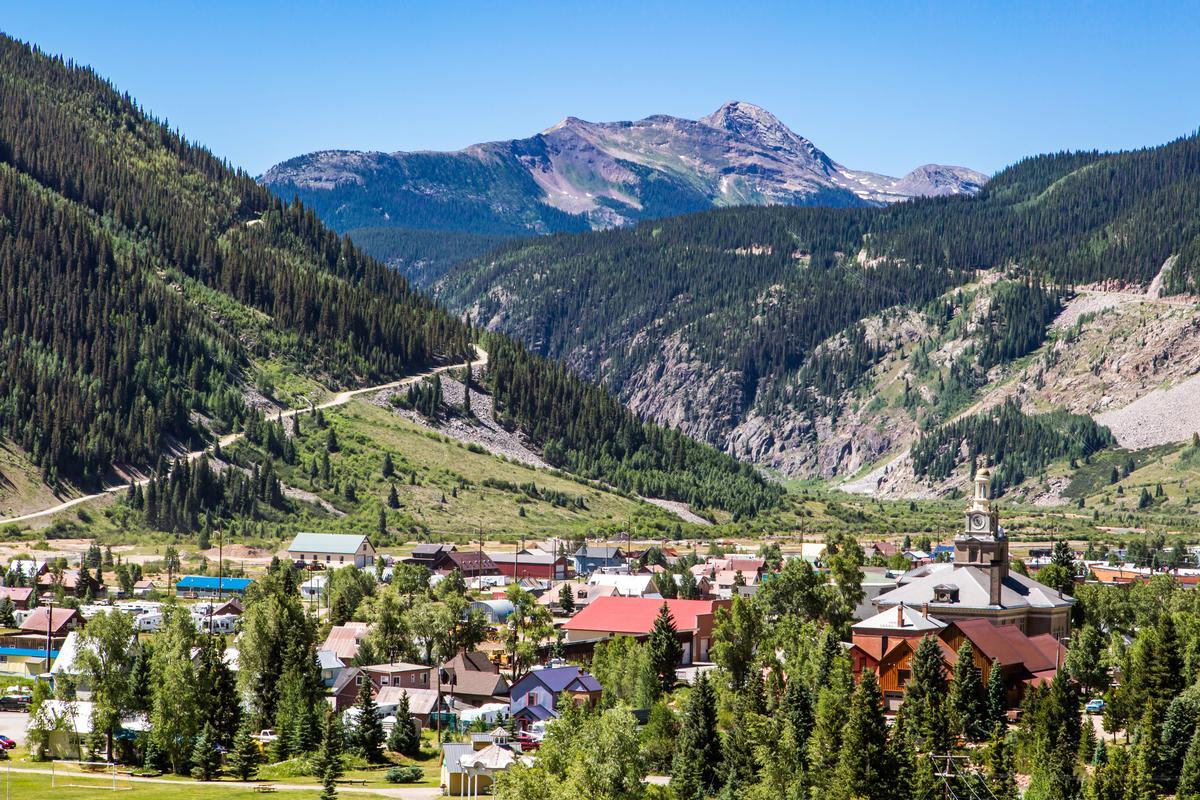
Silverton
Another favorite of mine, and just a 45 minute day-trip south from our previous stop in Ouray, Silverton is one of the most atmospheric towns I’ve explored in Colorado! Why? You get towering peaks, mining history, and a rugged, old-West vibe untouched by big development (for now!).
I loved walking down Greene Street lined with historic buildings, saloons, and shops that remind me of its mining boom days.
One of my favorite adventures here is riding the Durango & Silverton Narrow Gauge Railroad. Rolling through mountain canyons on that historic steam train feels like stepping into another era, a real standout!
What I loved best:
When it’s time to refuel, The Bent Elbow is my go-to spot for rustic meals and Western atmosphere.
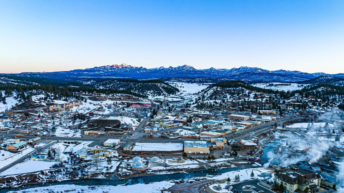
Pagosa Springs
This is one of the most naturally beautiful wellness-focused towns I’ve visited in Colorado, and I think it’s one of the absolute best spots if you are in the mood for deep relaxation in a mountain setting!
We started our visit at the Hot Springs — the heart and soul of Pagosa. For a quieter soak or a last minute romantic idea (no reservations required!), head to Overlook Hot Springs Spa.
Beyond the springs, The San Juan National Forest offers miles of hiking, mountain biking, and horseback riding trails. In addition, the Piedra River Trail and Opal Lake Trail are perfect for scenic day hikes with waterfalls and wildflowers. In the winter, nearby Wolf Creek Ski Area is known for some of the best powder skiing in Colorado (and fewer crowds than major resorts!).
Downtown Pagosa has a friendly, walkable charm with shops, art galleries, and cozy restaurants. We enjoyed breakfast at Two Chicks & A Hippie, and a riverside lunch at Riff Raff Brewing Company. For coffee and local pastries, Root House Coffee is a must-stop.
What I loved best:
Dinner at Alley House Grille for our anniversary dinner was my favorite highlight!
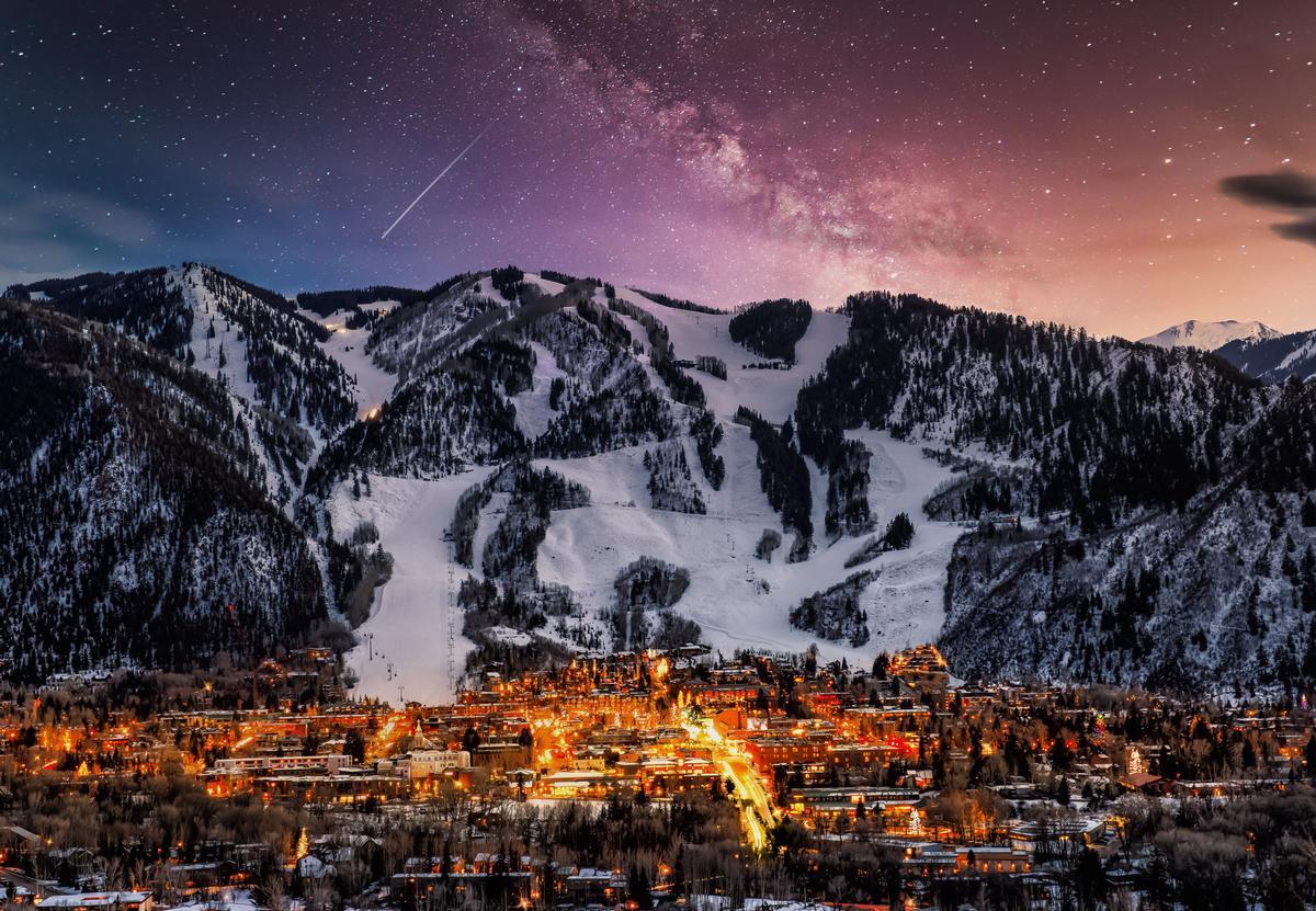
Things to Do in Aspen
Ready for a nature-rich getaway with a touch of elegance? For me, this place is the definition of mountain magic. Nestled high in the Rocky Mountains, Aspen is famous for its skiing on four ski mountains (Aspen Mountain, Aspen Highlands, Snowmass, and Buttermilk!), but we've had some of our best adventures here in the summer months too.
After landing at Aspen/Pitkin County Airport, we drove downtown where we enjoyed art galleries, The Aspen Art Museum, and a play at the Wheeler Opera House (dating back to 1889!) in the evening.
One of Aspen’s most iconic sights is the Maroon Bells, a pair of 14,000-foot peaks mirrored in a pristine alpine lake. I loved that getting there is easy with public transportation from downtown.
What I loved best:
Family dinner at White House Tavern was my favorite highlight. We had great burgers and salads in a 19th-century miner's cottage-setting.
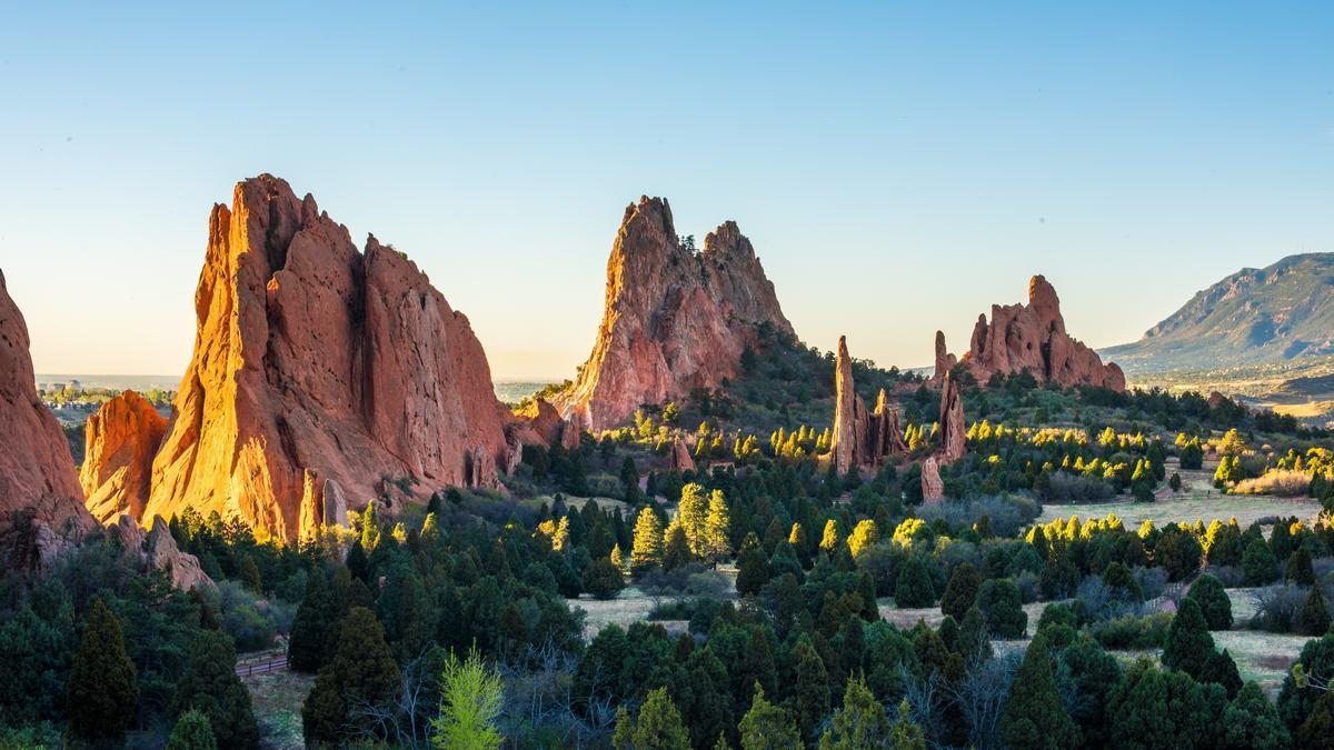
Colorado Springs Weekend Ideas
I thought that it was one of the best places to visit in Colorado because of how much natural beauty surrounds the city. In addition, it was an easy trip just an hour south of Denver.
We enjoyed hiking the trails around Red Rock Canyon Open Space, riding the Cog Railway up to the 14,115-foot summit of Pikes Peak, and stepping into the Fine Arts Center at Colorado College.
What I loved best:
Standing among the sandstone towers at Garden of the Gods (free) was a standout.
A downside? The popularity of Garden of the Gods meant parking lots filled quickly, even in the morning.
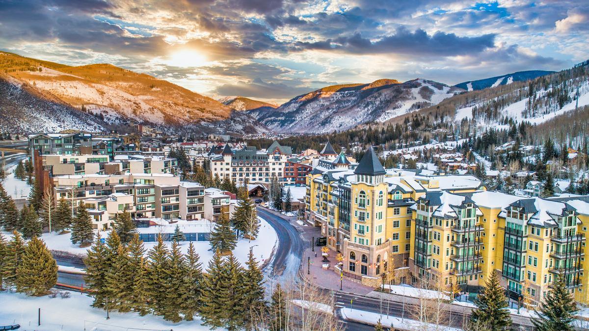
Vail
This alpine village, tucked between dramatic Rocky Mountain peaks, is one of my go-to places when I want a mix of outdoor adventure, great food, and that classic mountain-town atmosphere.
On my second trip, I discovered that December was the most magical time to visit — the mountains blanketed in fresh powder, the air crisp, and the village glowing under holiday lights. In addition, I caught the Vail Film Festival and watched several unique documentaries and shorts.
Mornings were spent skiing, and in the afternoons, I loved unwinding at the Sonnenalp Spa, a beautiful facility made for relaxing!
We went out to dine at Montauk Seafood Grill, one of Vail's top fine dining destinations for more than three decades, and housed within the city's beautiful Lionshead Village area.
What I loved best:
Taking the gondola ride up the mountain ($64 adult and one free child) was unforgettable.
A downside? Prices were high across the board, including meals, lodging, even parking.
Chris and I stayed at the elegant 4-star Sonnenalp for two romantic days. I loved the fireplace, soft blankets, and steaming mugs of hot chocolate.
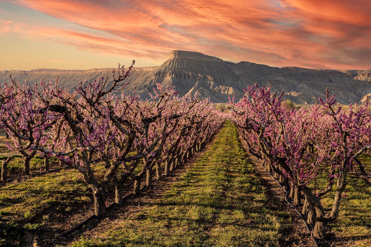
Palisade Things to See and Do
This small town, tucked beneath dramatic cliffs and surrounded by orchards, is one of my favorite places to visit when I want a mix of great food, outdoor exploration, and wine country views.
I discovered that late summer was the perfect time to visit with warm golden days, and vineyard-covered hills. Locals were out cycling along the scenic Fruit & Wine Byway, and every roadside stand seemed to tempt with baskets of sun-warmed fruit and fresh lavender bunches.
I thought that Wine Country Inn ($200) was the best place to stay. Days began with coffee on the wraparound porch, followed by leisurely wine tastings at Carlson Vineyards.
What I loved best:
One day we discovered the Palisade Sunday Farmers Market, bought great snacks, and sampled amazing local peach jam, my favorite highlight.
Loveland
This foothills town, tucked between lakes and mountain views, is one of my go-to spots when I want a blend of art, nature, and easygoing Colorado. I discovered that springtime was the perfect time to visit — the foothills were turning green, wildflowers along the hiking trails, and the town was alive with art and music events.
Known as the “Sweetheart City,” Loveland had a welcoming, creative spirit that made me feel instantly at home. Locals told me about the town’s famous Valentine Re-Mailing Program, where thousands of love letters are postmarked with special messages each year. During the day, I wandered through the beautiful Benson Sculpture Garden (with over 150 bronze and stone sculptures!) and Chapungu Sculpture Park with Zimbabwean stone sculptures, benches & a stream.
What I loved best:
Dinner at Door 222 was my personal highlight where we had great contemporary comfort food!
Littleton
Set along the South Platte River and framed by foothill views, I think this is one of the most inviting and underrated towns on the Front Range. Why? Picture a town that feels both close to Denver and yet wonderfully its own. Just 20 minutes south of downtown Denver, it offers me a quieter, small-town atmosphere while still keeping all the cool city conveniences nearby.
I grabbed the RTD light rail from downtown Denver to Littleton ($3, about 35 minutes), a smooth, cheap, car-free trip!
I love strolling through Historic Downtown Littleton, but one of my favorite places to explore is Hudson Gardens, where the walking trails, flowers, and peaceful ponds make it feel like a hidden retreat.
When I want to spend time outdoors, Chatfield State Park is my go-to.
Littleton’s food scene has plenty to offer, too. Try Smokin Fins for seafood and sushi, or The Melting Pot for a fun fondue experience. My favorite was Farm House at Breckenridge Brewery, which combines Colorado craft beer with rustic comfort food on an open-air patio overlooking the river.
What I loved best:
Stopping by Inside Scoop Creamery for homemade ice cream was my personal highlight!
Things to Do in Delta, CO
This is one of the most quietly stunning stretches of Colorado I’ve explored. We drove from our previous stop in Aspen for 2.5 hours to reach Delta in western Colorado.
My days were spent exploring the region’s wild beauty — hiking the surreal formations at Escalante Canyon, wandering the sandstone trails of Dominguez–Escalante National Conservation Area, and taking a side trip to the Black Canyon of the Gunnison, where sheer cliffs drop dramatically.
What I loved best:
Watching a sunset from the Sweitzer Lake State Park overlook is my personal highlight.
In addition, dinner at Daveto’s Italian Restaurant was a standout — serving hearty, homemade pasta in the heart of the Rockies (quite a surprise!).
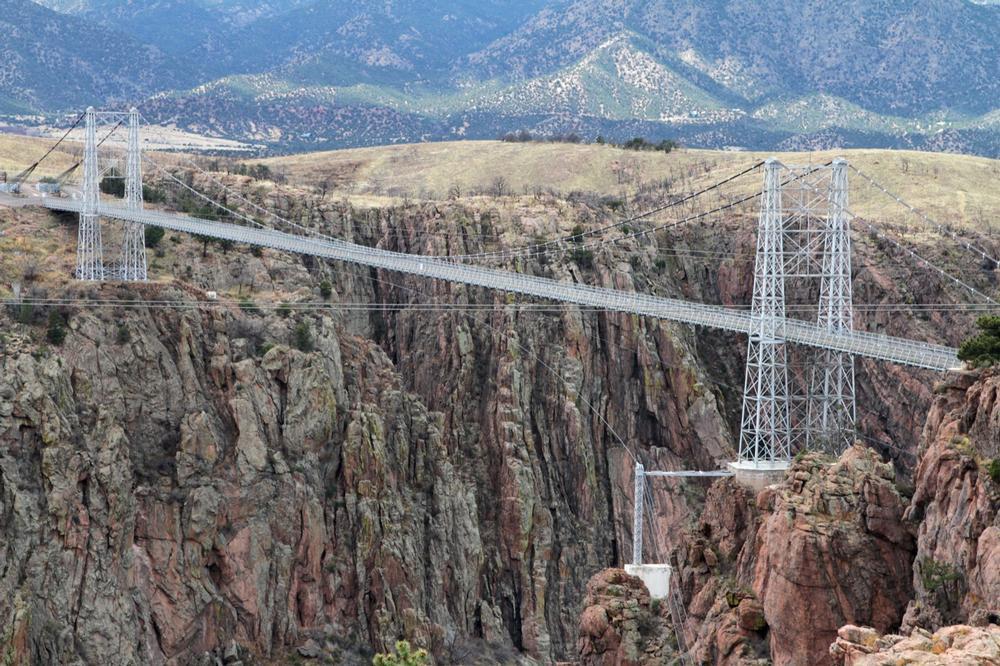
What to Do in Canon City
Looking for a nature-filled day trip stop with a dash of history? I think that Cañon City is a perfect pick! I stood on the Royal Gorge Bridge, looking down at the Arkansas River cutting deep through the canyon, and thought, “This is what awe feels like without needing words.” The bridge creaked softly beneath my feet, and all I could hear was wind and the call of a raven far below.
What I Loved Most: The space. The quiet that came from standing above something so impossibly wide and deep.
My highlights? A slow afternoon at The Winery At Holy Cross Abbey was a standout, where I sat beneath a pergola with a view of the former monastery building.
One downside? I wished I had more time to ride the Royal Gorge Route Railroad. It's definitely something I plan to do next time when I visit in the summer!
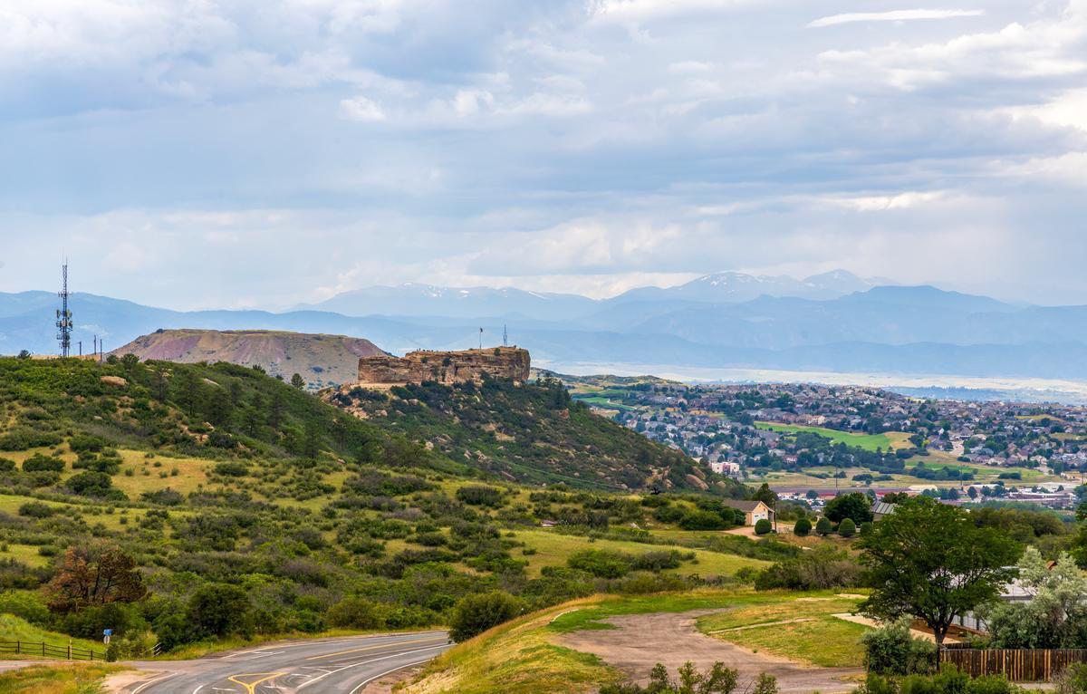
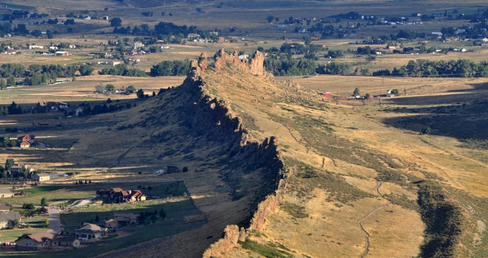
Castle Rock
This is one of my favorite places for an anniversary because of the scenery, especially the dramatic buttes and rocky outcrops rising above the rolling Colorado plains. In addition, we loved the vibrant downtown that balances small-town charm with outdoor adventure.
After a 40-minute drive south from Denver, I found a community that felt both rugged and welcoming, part natural playground, part family-friendly hub. Over three days I hiked up to Castle Rock’s namesake volcanic butte in Rock Park for sweeping views of the Rockies, scrambled through the red sandstone canyons of Castlewood Canyon State Park, and checked out the scenic East Plum Creek Trail.
In town, I browsed boutiques and cafés in historic downtown, cooled off at the Miller Activity Complex with its indoor water slides, and attended a evening concerts under the stars at Philip S. Miller Park.
What I loved best:
My food highlight was brunch at Crave Real Burgers. I had a bison burger with roasted poblanos, smoked gouda, and chipotle aioli on a housemade bun. It smelled like char and spice, the meat tender and rich. We split a side of truffle fries and it was a perfect way to end the day on our anniversary vacation!
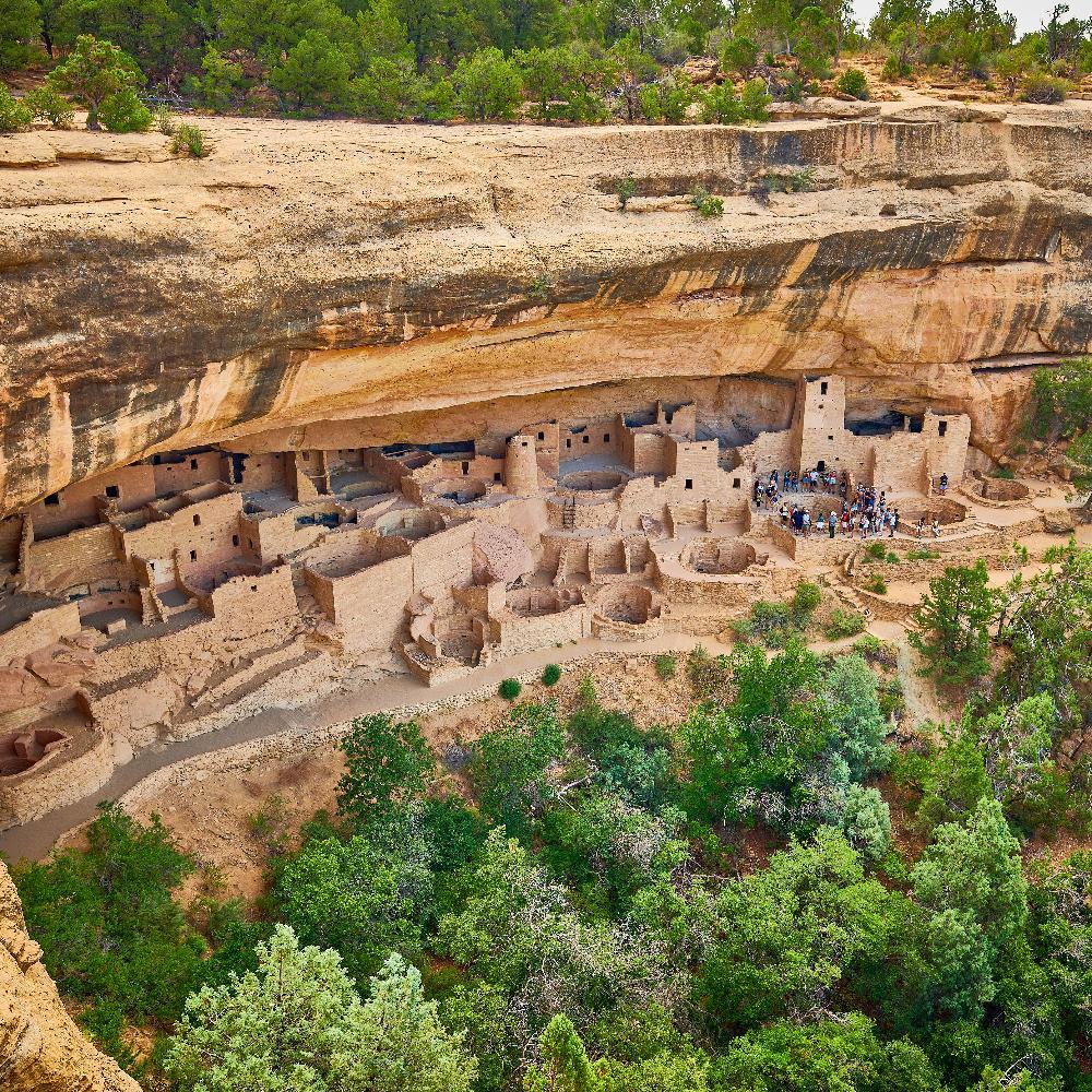
Mesa Verde
This high mesa, carved by canyons and dotted with ancient dwellings, is one of my go-to places when I want a mix of adventure, discovery, and big Western views.
A 1-hour drive from Cortez brought me into Mesa Verde, where the mesa rises dramatically above the Montezuma Valley. On my trip, I learned that this UNESCO World Heritage Site protects both archaeological treasures and wild landscapes.
My favorite experience was touring Cliff Palace, the largest cliff dwelling in North America! Walking through its stone walls and seeing how entire communities once lived here is truly unforgettable.
What I loved best:
For me, Mesa Verde is one of the best places to visit in Colorado because it's peaceful, affordable, and hope you will love it too!
The combination of culture and nature makes every visit feel magical in its own way. I also loved the location near the Four Corners Monument (less than an hour by car) where Colorado, Utah, Arizona, and New Mexico meet!
Conclusion & Things to Know
Best Time to Visit Colorado
If you ask me, the best time really depends on what kind of getaway you’re after. For hiking, road trips, and mountain views, go between June and September...you’ll get warm days, wildflowers, and endless sunshine. I’ve gone in early fall too, and the golden aspens in September are stunning but if you’re into skiing or cozy cabin vibes, December through March is unbeatable, so basically I’ve done both seasons and they each have their own kind of magic.
How to Get to Colorado
- By Air: Most people fly into Denver International Airport (DEN) (myself included) and I found it's easy access to the mountains or cities like Boulder and Colorado Springs.
- By Car: Road-tripping is honestly the best way to explore and I love driving through the Rockies and Highway 285 or I-70 both have jaw-dropping scenery and charming small towns along the way.
- By Train: I took Amtrak’s California Zephyr which passes through Denver, Glenwood Springs, and Grand Junction once, and the mountain views from the observation car were unreal so I can't wait to do it again!
How to Get Around Colorado
Once you’re here, having a car is the easiest way to get around, especially if you’re planning to explore mountain towns or scenic byways but be sure rent an SUV or something with good clearance since some mountain roads can get steep or icy, depending on the season.
If you’re staying in Denver, Boulder, or Colorado Springs, you can rely on public transit, rideshares, and bikes. Light rail in Denver is especially convenient for hopping between downtown, the airport, and nearby neighborhoods. In ski towns like Aspen or Breckenridge, there are free shuttles and local buses that make it easy (and cheap!) to get around without driving.