
- Please support our journalism through affiliate links. Affiliate Disclosure
- Written by our human editors, structured with the help of AI.
Review & FAQ:
-
What is the Wraith Falls Trail?
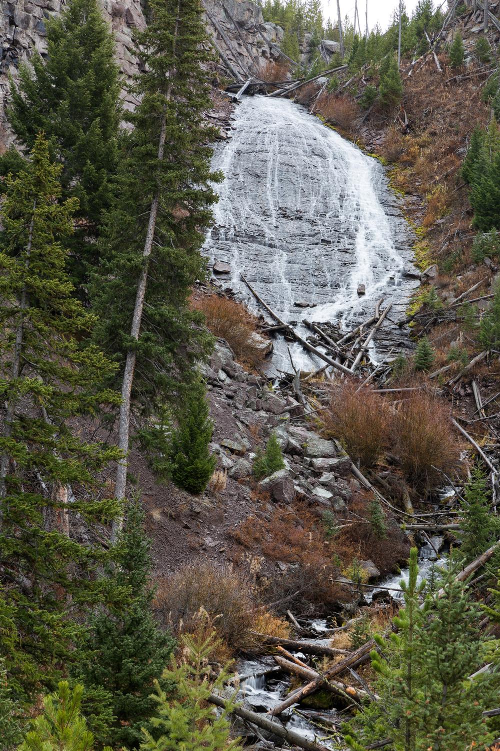
- The Wraith Falls Trail is a short and easy 0.3-mile hike that leads to a scenic cascade in the northwest part of Yellowstone National Park.
-
What type of terrain does the trail cover?
- The trail passes through a beautiful sagebrush meadow, runs alongside a small stream, and goes through a small stand of Douglas fir.
-
Where does the trail lead?
- The trail crosses Lupine Creek before reaching a viewing platform about 200 feet from the base of Wraith Falls.
-
What is Wraith Falls?
- Wraith Falls is a 100-foot cascade that flows rapidly over the edge of Blacktail Deer Plateau.
-
Where is the best view of Wraith Falls?
- The best view of the waterfall flowing down the steep, smooth rock face is from the end of the trail at the viewing platform.
-
Where is the trailhead located?
- The trailhead is located about 5 miles from Mammoth Hot Springs on the Grand Loop Road.
© rjamphoto/stock.adobe.com
Rating: ⭐⭐⭐⭐⭐
Lava Creek Trail
Mount Washburn Trail
Fairy Falls Trail
Bunsen Peak Trail
Mystic Falls
Elephant Back Loop
Observation Point
Bechler Falls Trail
Divide Lookout Trail
Lone Star Geyser Basin
Mallard Lake Trail
Sentinel Meadows
Grand Prismatic Spring Overlook
Shoshone Lake Trail
Yellowstone Lake Overlook
Riddle Lake
Pelican Creek Nature Trail
Storm Point Trail
Clear Lake/Ribbon Lake Loop
Trout Lake
Beaver Ponds Loop
Wraith Falls Trail
Slough Creek
Plan Your Trip
Get Ready to Go!
- Search flights and stays nearby.
- Book your tour or local activity.
- Book your car rental.
Need some more help?
Go to travel reservations.