10 Places to Visit in Wyoming

Searching for a cool place (or several) to visit in Wyoming? Well, you are in the right place! My first road trip to Wyoming was decades ago, and it was all for the chance to see Old Faithful! What actually happened was that I fell in love with this place and it became one of my favorite places to visit in the world! I landed at Jackson Hole Airport with my husband, where we rented a car and spent our first night at The Wort Hotel in Jackson. The next day, we drove through Grand Teton National Park before continuing on to Yellowstone.
That evening, watching Old Faithful erupt under the stars and then falling asleep at the historic Old Faithful Inn became one of the most unforgettable moments of my life. That’s what The Equality State is like, it surprises you with new adventures at every turn! It’s why I’ll keep going back whenever I can. I hope you, too, find the perfect places for your own getaway.
- Best Places to Visit in Wyoming - Yellowstone Area
- - #1. Yellowstone National Park - #2. Old Faithful Inn
- Jackson Hole Valley
- - #3. Jackson Hole Valley - #4. Spring Creek Ranch - #5. The Wort Hotel in Jackson - #6. Rustic Inn Creekside Resort & Spa
- Best Day Trips in Wyoming
- - #7. Cody - #8. Cheyenne - #9. Casper - #10. Thermopolis
Best Places to Visit in Wyoming - Yellowstone Area
This is Wyoming’s most iconic and awe-inspiring region, home to geysers, wilderness, and Western history.
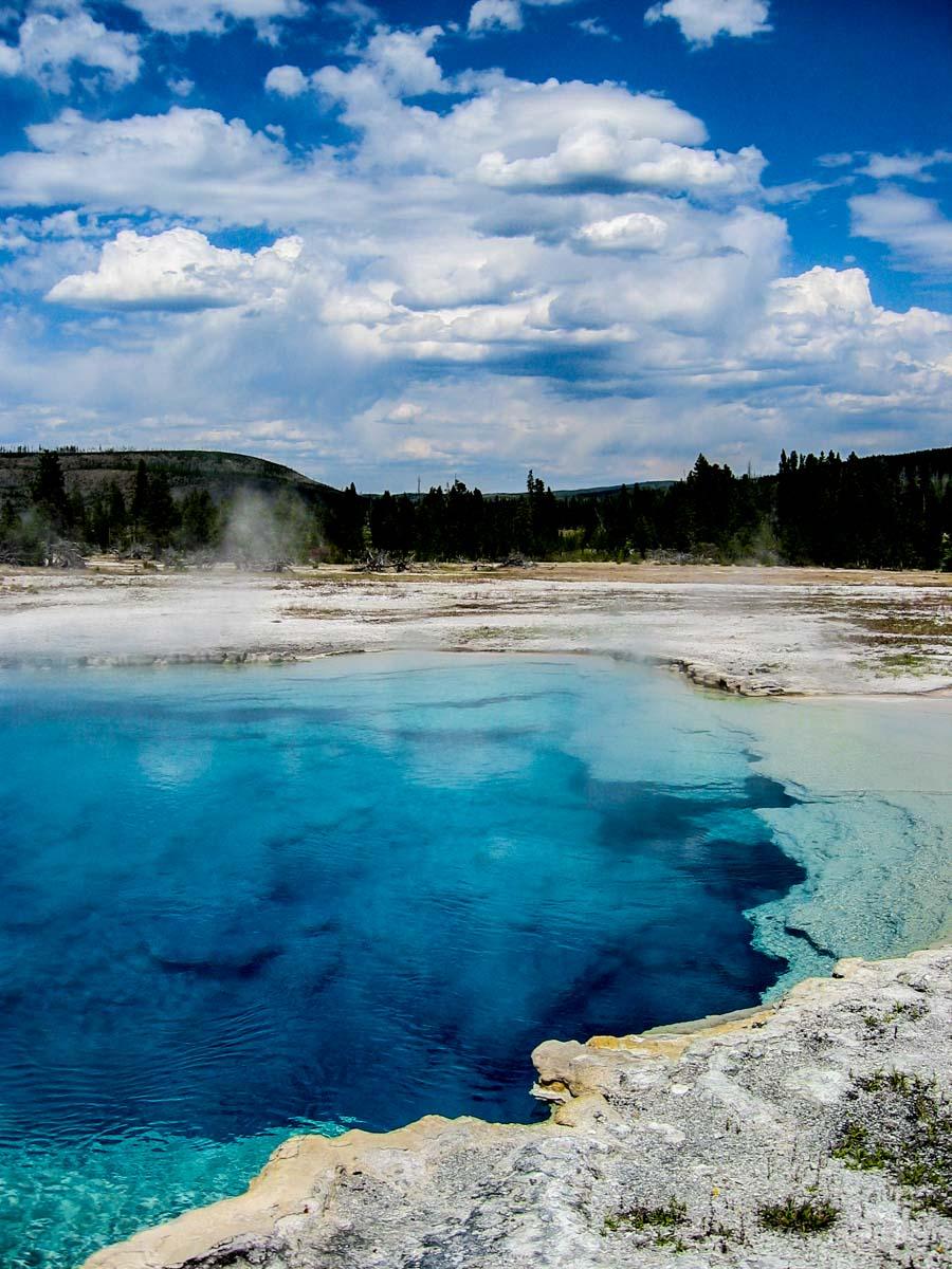
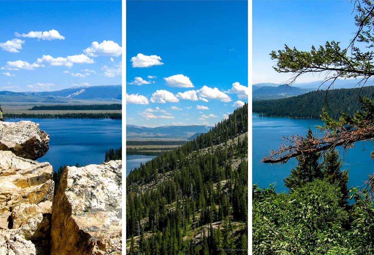
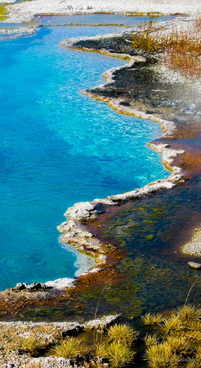
Yellowstone National Park
I was absolutely stunned by this place! In fact, this is one of my favorite national parks to visit in the USA because it truly has a bit of everything.
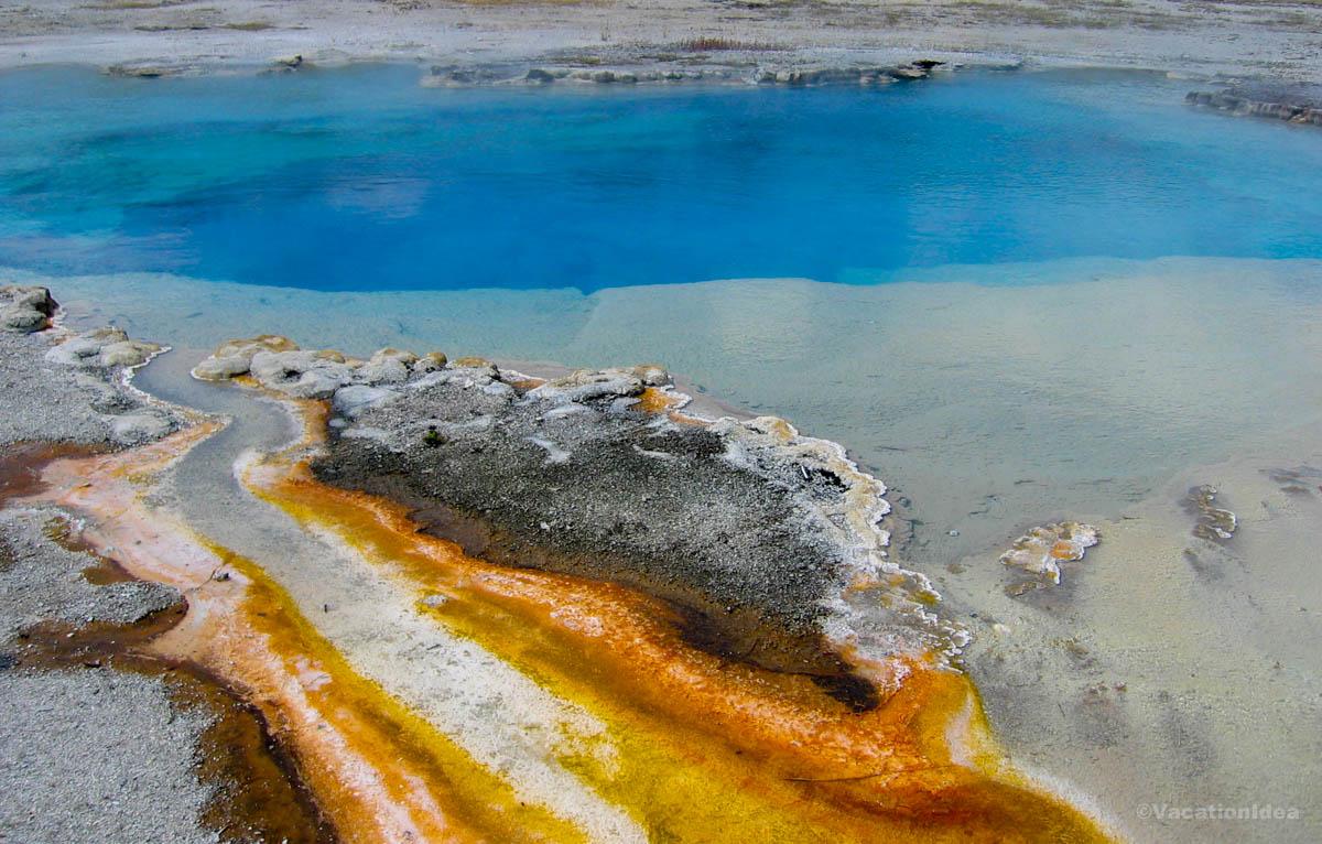
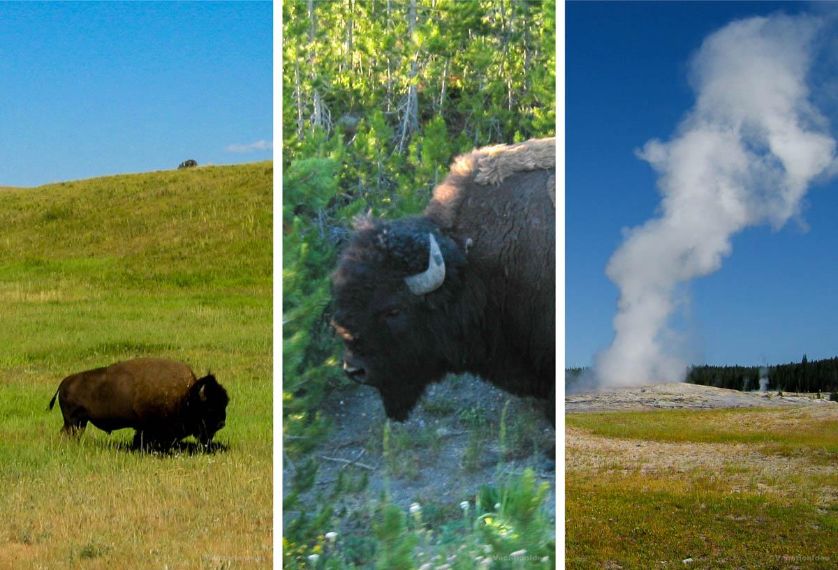
You'll find incredible geysers of all colors, a giant late, waterfalls rivers, and wildlife around every corner. There are actually bison strolling right along the roadside as you drive (be careful around them and follow ranger alerts to stay safe!).
If you don't want to drive, you can sign up for a tour with a local guide instead, departing from many locations in Wyoming, Montana and Idaho.
For me, Yellowstone, also nicknamed "Wonderland", was more fascinating and beautiful than any other place on the planet. It truly felt like the Earth was showing off. When we stopped at Yellowstone Lake, there were geysers in the lake itself! Walking along the various boardwalks all around Yellowstone, I was constantly in awe of the surreal colors, one place more unbelievable than the next!
My highlight was a hearty lunch at Old Faithful Inn Dining Room. It was full of visitors who came for an Old Faithful eruption. I found the excitement catching! In addition, the food was surprisingly delicious for such a touristy spot. I still remember the bison meatloaf with mashed potatoes and huckleberry sauce.
What I loved best:
Sitting beside Yellowstone Lake at dusk watching the sunset was my personal highlight.
Local tip:
You can enter Yellowstone from Wyoming like we did on this trip, Montana or Idaho. Although there are many places to stay just outside the park (they are usually more affordable), I also love spending two nights at Old Faithful Inn right in the heart of the park!
A downside? The park is vast so you need to plan your visit carefully otherwise you may miss something.
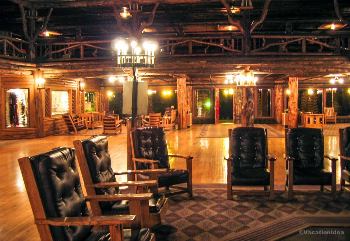
Relaxing at Old Faithful Inn
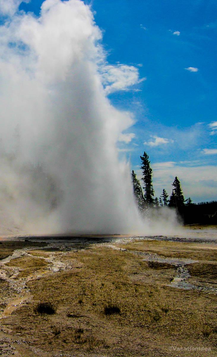
This historic inn (Google Maps Pin) offered one of the most unique stays I’ve ever experienced in a national park. You'll find Old Faithful Inn just steps from one of the world’s most famous geysers, Old Faithful. It has a grand wild West vibe with a giant fireplace and huge leather chairs in the lobby.
We watched the Old Faithful geyser (just outside the inn) late into the night and spent the night at Old Faithful Inn. I instantly thought our journey was worth it!
Local tip: Be sure to book early because rooms completely sell out, especially in June, July and August, even on weekdays!
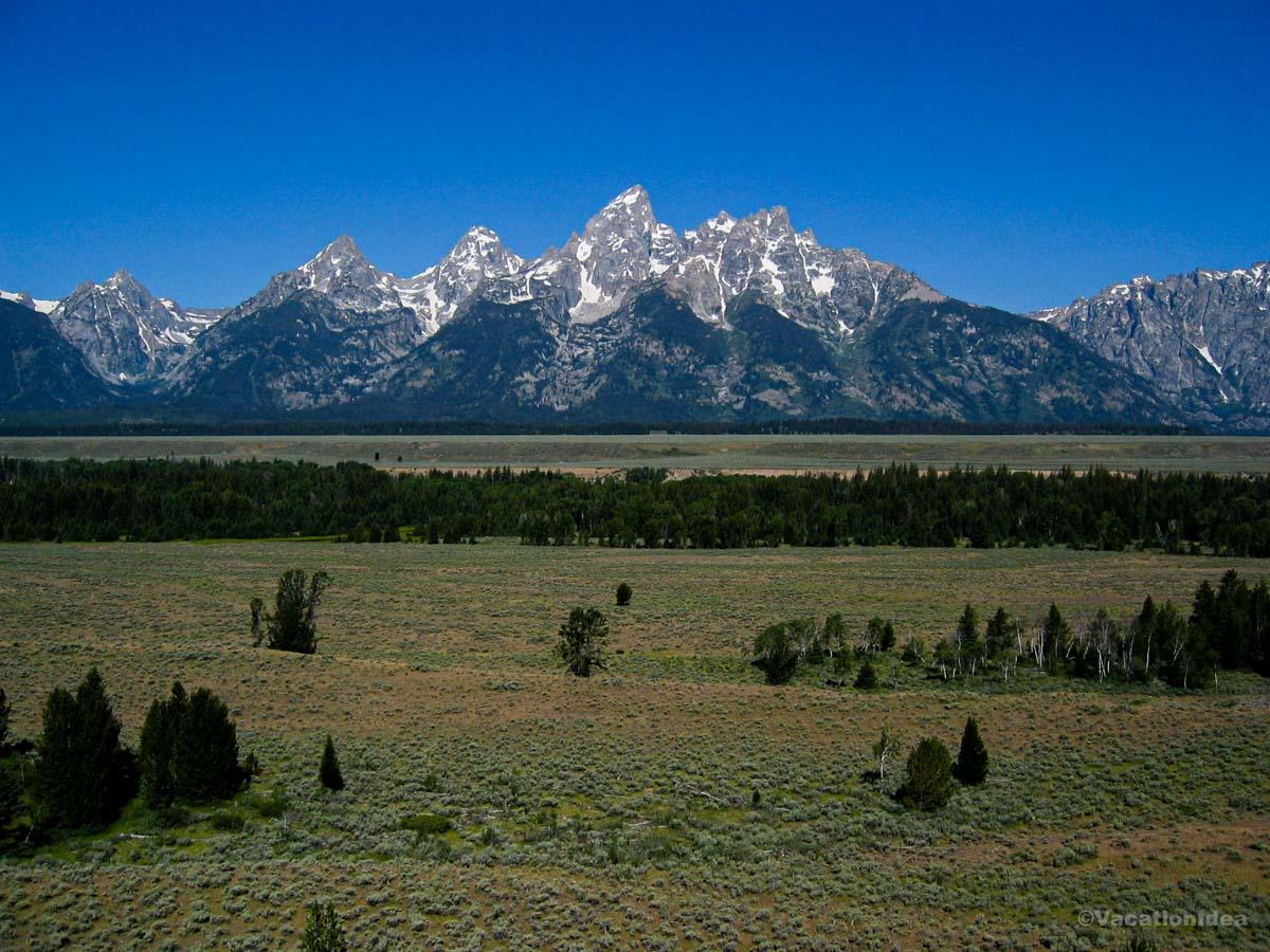
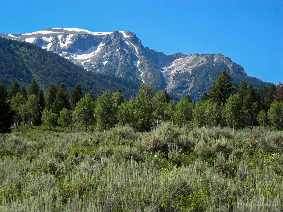
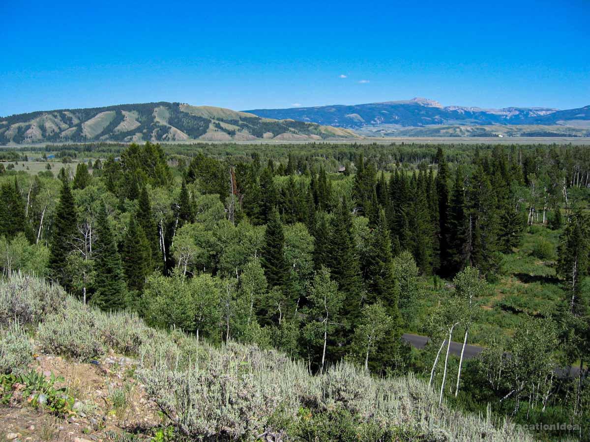
Best Places to Visit in Wyoming - Jackson Hole Valley
Framed by the Teton Range, the valley offers a unique blend of rugged wilderness and refined amenities.
Jackson Hole Valley
No place was quite like Jackson Hole! This is one of my favorite places in Wyoming because it truly felt like the gateway to the Wild West.
Landing at Jackson Hole Airport was a smooth experience in August, but locals told me that in winter there can be flight delays. From the airport, it will take you about 30 minutes to reach town of Jackson.
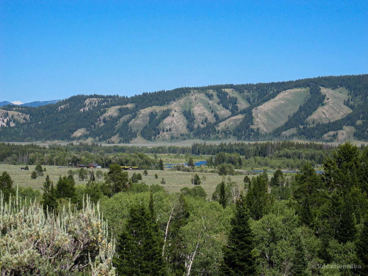
In the afternoon, we rode the aerial tram in Teton Village up the mountain for an incredible view (tickets from $50 for Adults round-trip). Just a heads up that there is a serious altitude adjustment. Teton Village is at the elevation of 6,329 feet, but the tram ascends another 4,139 vertical feet in 15 minutes. This means that the summit elevation is 10,450 feet (3,185 meters) on Rendezvous Mountain. If your home is in a low altitude city, you should wait a few days to acclimate and ride the tram up later. Also, be sure to pack a jacket because it's so much colder at the summit.
Next morning we went on an adventure all around the valley (Google Maps Pin), driving to Grand Teton National Park, and taking the boat shuttle across Jenny Lake ($20 for adults round-trip). If you cross Lenny Lake via the boat shuttle, I recommend hiking past waterfalls along Hidden Falls trail towards Inspiration Point. The lower part of the trail is kid-friendly, but it gets more challenging closer to the top.
What I loved best:
Elk medallions at Snake River Grill for dinner.
The Cons: I have to warn you that parking can be a challenge during the afternoon Jackson Hole Town Square Shootout (May 31st through Labor Day). We went early and walked around town for about an hour which I highly recommend.

Spring Creek Ranch - 25 minutes from Jackson Hole Airport
This was the most relaxing stop on my trip through Wyoming! Located at an elevation of 7,000 feet, the ranch is a wilderness experience with luxury amenities. You'll find it about half an hour from Jackson Hole Airport.
You get to wake up to sunrise over the Tetons, and watch moose graze in the valley below. You can book a horseback ride along the ranch’s trails. Families can take the shuttle into Jackson for shopping and art galleries, then return for the night. Stargazing is a magical experience. For larger families, the Spring Creek Ranch offers townhomes and mountain villas in addition to regular hotel-style rooms.
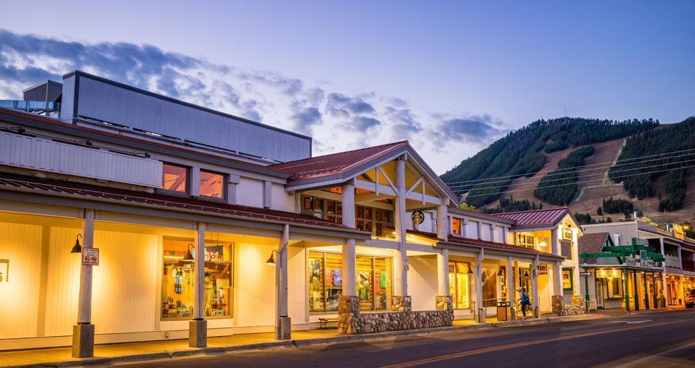
The Wort Hotel in Jackson
This place exceeded all my expectations! The Wort Hotel is a convenient place to stay in Downtown Jackson if you need time to acclimate to the altitude wen you lend. The lobby greets you with Western-style decor and luxury service.
The best part of staying here is that you have Downtown Jackson at your fingertips. Just outside the front door, you can stroll to restaurants, art galleries, western shops.
The onsite Silver Dollar Bar & Grill is great for dinner. Try the ribeye with potatoes.
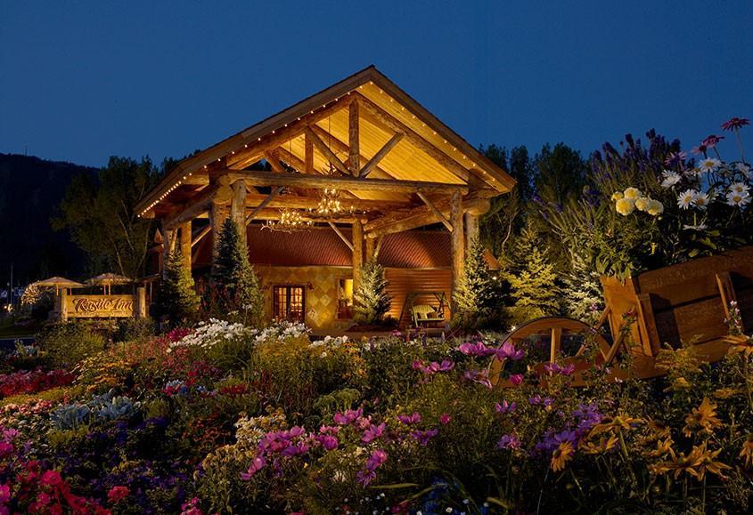
Rustic Inn Creekside Resort & Spa
This is an incredible hidden gem in Jackson, WY. It's more secluded than The Wort Hotel because it's set along its own private stretch of Flat Creek.
You can book your own cabin right on the creek. It's kid-friendly and more private than staying at a hotel.
You can explore Downtown Jackson which is about a half mile away. Don't miss dinner at onsite Rustic Inn Bistro.
Best Day Trips in Wyoming - Other Areas
Beyond Wyoming’s most famous destinations, the state’s other regions are fun to explore.
Cody
This is one of the most underrated places we visited in WY! If you are planning to visit Yellowstone, you will find Cody about 50 miles east of the park's East Entrance (Google Maps Pin).
I recommend spending the night so that you can explore this cool spirit town. If you decided to drive from Jackson Hole without stopping, it would take about 4.5 hours. The drive itself is scenic, through mountain passes and open plains. But you will most likely make many stops along the way to enjoy the views.
In Cody, don't miss the Buffalo Bill Center of the West ($23 adult admission, kids $16). It's dedicated to the culture, people, and landscapes that shaped the West. For example, you can see the Plains Indian history and western art. My son loved the interactive exhibits.
We also enjoyed an evening at the Cody Nite Rodeo (only available from June to August).
What I loved best:
Wood-fried pizza lunch at Trailhead Bar and Grill.
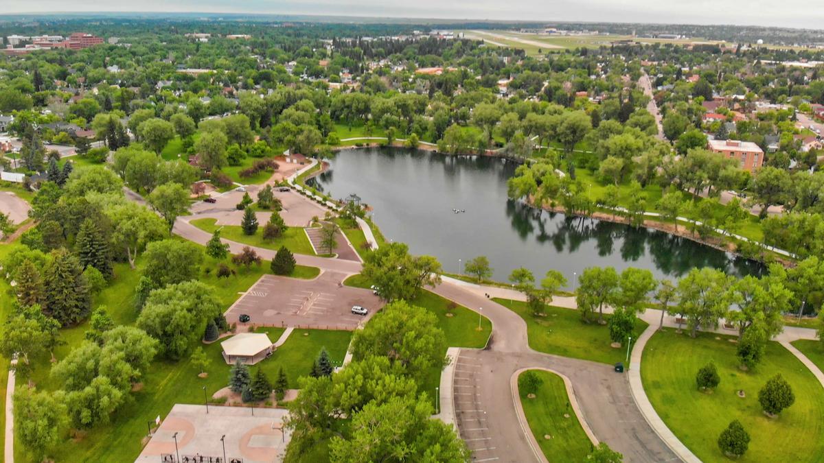
Cheyenne
This place surprised me with its beauty! If you don't plan on visiting Yellowstone and would prefer a trip east towards the border of Nebraska and Colorado, you should check out Cheyenne (Google Maps Pin). You'll find it just under 7 hours from Jackson Hole.
Here you can learn all about how railroads shaped this place. In fact, a great first stop is the Cheyenne Depot Museum. The museum is the steward of the Historic UPRR Depot and now a National Historic Landmark.
You can also go on a guided tour of the Wyoming State Capitol (free admission). Afterwards, stroll along Sheridan Street lined with western shops and bronze statues.
If you are interested in rodeo, the Cheyenne Frontier Days Old West Museum ($15 admission, kids $10) is must-see.
Local tip: Cheyenne is very lively during Frontier Days in late July. If you come in off-season, expect fewer events.
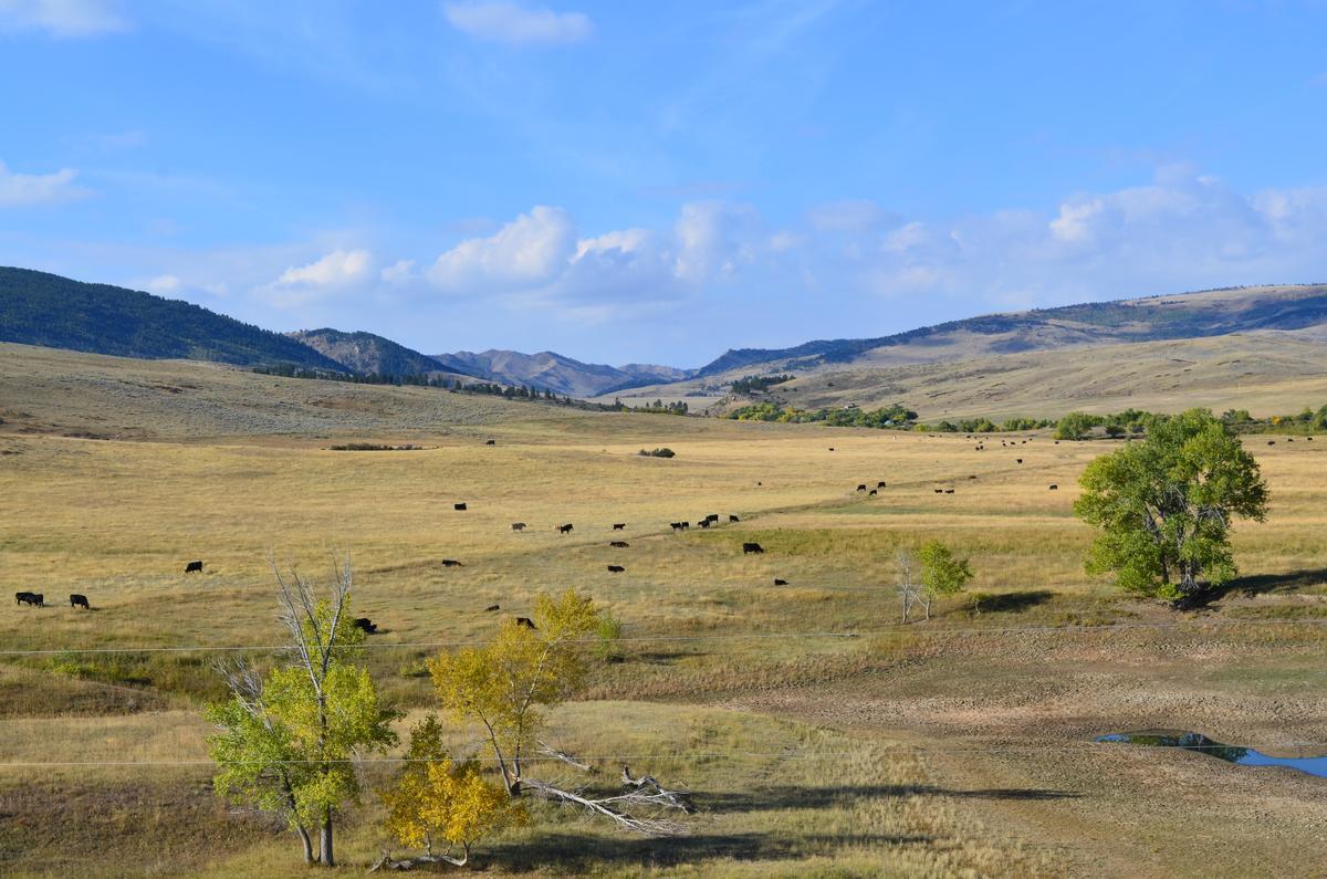
Casper
I was wowed by the scenery on our drive! Another cool road trip stop about 3 hours from Cheyenne is Casper. It's still off-the-beaten path and that's exactly why I thought it was one of the best places in Wyoming to visit.
You'll find Casper along the North Platte River, surrounded by totally open landscapes. If you are like me and love Old West history, you won't be disappointed. This is true cowboy country. Plus, you’re never more than a few minutes from hiking trails, river views, or open plains.
You can enjoy fly fishing, kayaking and strolling along the riverwalk of the North Platte River.
For history buffs, The National Historic Trails Interpretive Center is a must-visit. You can hear the stories of the pioneers who traveled in this area. Nearby, Fort Caspar Museum offers reconstructed buildings and exhibits that bring the frontier era to life.
Downtown Casper is very walkable, with local shops, breweries, casual places to grab coffee, and restaurants serving filling meals.
What I loved best:
Wood-fired ribeye at FireRock Steakhouse (from $35.95) with a smoky crust and tender center.
The Cons: This town is quieter than Jackson or Cheyenne. Nightlife is limited, and attractions close early.

Thermopolis
I loved visiting this quieter natural gem! Thermopolis is another cool Wyoming road trip stop just two hours from Casper. With a population of just about 3,000 residents, Thermopolis (Google Maps Pin) is small but it's the perfect base for exploring Hot Springs State Park.
You can view colorful terraces of mineral deposits that remind you of Yellowstone but have their own atmosphere. There's no overnight camping in Hot Springs State Park, but you can use picnic shelters, and the free bath house year-round. Summer flowers are very beautiful so don't rush the visit.
You can eat at One Eyed Buffalo Brewing Company. Try the bison burger.
What I loved best:
For me, Thermopolis was one of the best places to visit in Wyoming because of the hot springs! When I soaked at Hot Springs State Park (free, 20-minute limit per visit, 104 degrees), I felt the tension from the road slip away, my favorite highlight.
The Cons: The town was small, so options for lodging and dining were limited. I recommend booking ahead of time. Also, just a heads up that the Bath House is closed on Thanksgiving & Christmas Day.