Places to Visit in Utah

Looking for a cool place to visit in Utah? What fun! Once I started exploring all of Utah (beyond Salt Lake City!), I discovered its jaw-dropping deserts, mountains, and multiple cities. "The Beehive State" truly has something for every kind of traveler. Here are the places I recommend, and I hope you’ll enjoy them too.
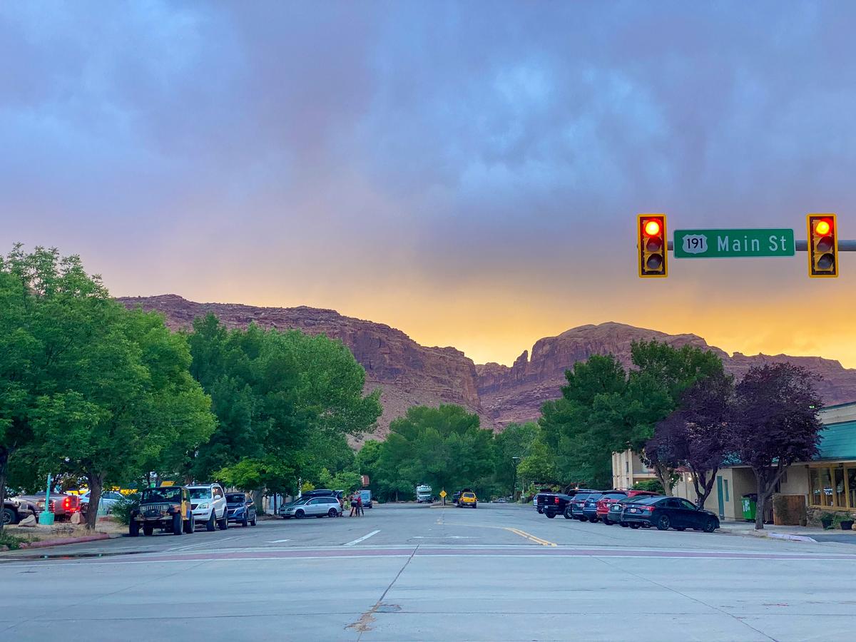
Moab, Arches and Canyonlands National Parks
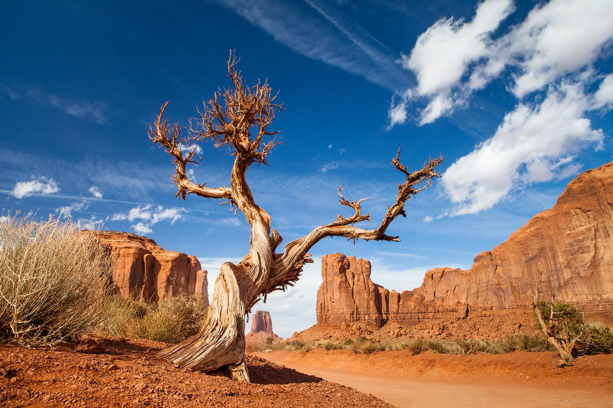
I was blown away by this famous place! Visiting the dramatic sandstone arches that surround Moab was absolutely surreal. I loved discovering winding canyons and miles of otherworldly desert trails.
I walked on the epic Slickrock Trail and explored the surreal landscapes of Arches National Park (just 10 minutes from Moab). I think that Delicate Arch is totally worth your time, but the park actually has over 2,000 natural stone arches.
Just remember to leave no trace (including not marking on rocks). Also I have to warn you that you'll be at an elevation of 4,026 feet (1,227 meters) with very strong sun, so be sure to wear UV clothing and bring lots of water (yes even in winter!).
Also nearby, we hiked in Canyonlands’ Island in the Sky (about 30 minutes from Moab) for sweeping views.
The town of Moab itself had an outdoorsy vibe with plenty of great coffee spots, breweries, and food trucks to refuel between adventures.
Don't miss a visit to Hauer Ranch which felt like traveling back in time. We were surrounded by red cliffs and amazing canyons of the Southwest! I thought it was a must-stop for anyone who loves horses and truly one of the best things to do in Utah!
What I loved best:
My personal highlight was stargazing in some of the clearest night skies I’ve ever seen.
A downside? The campground in Arches National Park filled up so far in advance that it was extremely difficult to get a spot.
Local tip: I think that Island in the Sky (Willow Flat) Campground was just as lovely as Arches and in our experience it was easier to get a spot. Just be sure to get there early because it had just 12 sites, first-come, first-served ($15 per site). The park entrance fee is $30 USD per vehicle (or free with an America the Beautiful pass).
If you want to really understand the geology and hidden viewpoints without worrying about navigation, I recommend a guided 4x4 or a full-day tour. These tours take you down rugged backcountry roads you couldn’t safely access on your own and often include stops at remote overlooks, short hikes, and detailed explanations of the landscape. Prices typically range from $150–$200 USD. I think the experience was well worth it, especially for first-time visitors.
On our return trip, we enjoyed staying at HTR Moab Lodge & Cottages. They gave us easy access to all the attractions I mentioned and were more comfortable than camping.
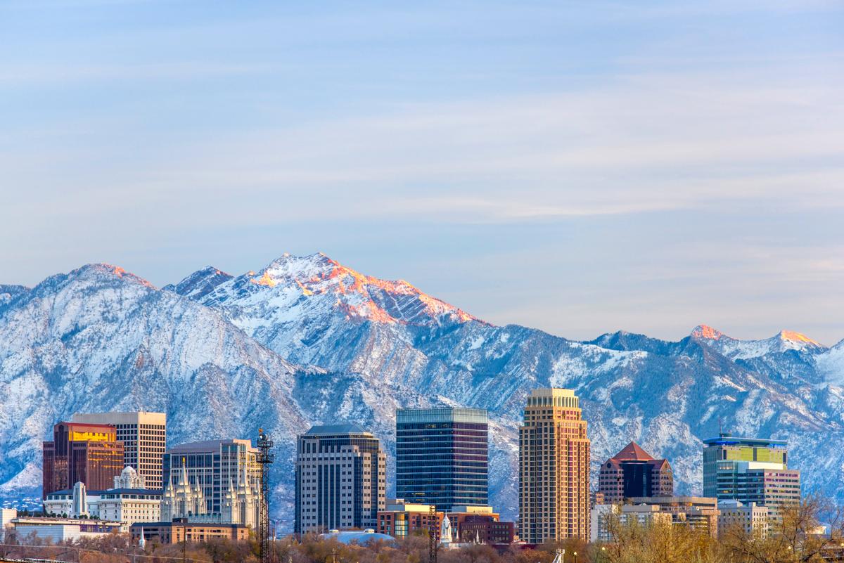
Salt Lake City
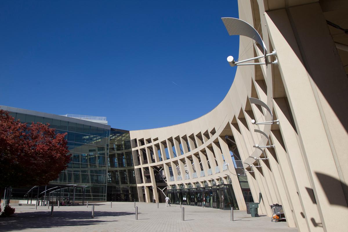
We absolutely loved Salt Lake City (population around 205,000 people) which didn’t fail to wow me. I thought it was an amazing place to live and use as a starting point for exploring Utah.
If you are flying in, hop on the TRAX light rail from the airport straight into downtown (about 20 minutes, $2.50).
Nicknamed "The Crossroads of the West", the city had the coolest urban energy with the added benefit of quick access to nature. Since there were heaps of unique things to do here, joining a guided tour with a local guide on your first visit can save you time.
Now, first things first, head downtown to explore Temple Square with its manicured gardens, then browse vintage shops and cafés in the Sugar House neighborhood. I have to warn you, though, that parking can be a challenge which is why I recommended TRAX light rail! Trust me, take public transportation and ride shares to save yourself the hassle.
When you get hungry, Penny Ann Cafe was a great family-friendly breakfast and brunch spot to start the day, serving amazing pancakes, burgers, wraps and salads. It does get busy on weekends so get there early if you can get the kids up!
I also loved Caputo’s Market & Deli with its awesome selection of cheeses, chocolate, and charcuterie.
After lunch, tour the Natural History Museum of Utah (my son said it was teenager-approved), and enjoy panoramic views from the Utah State Capitol.
For an outdoor adventure, you can hike along the trails at Big Cottonwood Canyon, and bike along the Jordan River Parkway.
Need a place to stay? We've enjoyed The 5-star Grand America Hotel on multiple stays over the last 30 years.
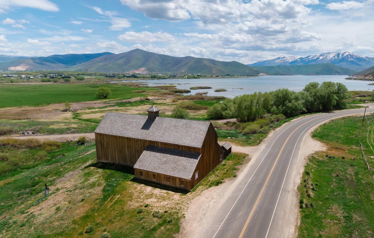
Midway, UT
This place completely wowed me and for a second I thought I was in the wrong place! Midway in the Heber Valley was such an easy day trip from Salt Lake City that made me feel like I traveled all the way to Switzerland. We reached in just 50 minutes from Salt Lake City.
You'll find Swiss chalet-style architecture surrounded by mountain peaks. This is one of my absolute favorite places to visit in Utah. Why? Now, first things first, it gives you this dramatic shift in atmosphere without having to drive far. In addition, we also discovered the Homestead Crater here, a stunning natural wonder.
I loved booking a 40 minute soak in the 10,000-year-old Homestead Crater hot spring (90–96°F year-round). True, it's a bit pricey at $28 for just 40 minutes but it was truly one-of-a-kind experience in a hidden cavern that I recommend you don't miss! They welcomed all ages, and the price of admission included a life jacket rental.
If you decide to turn your day trip into a longer vacation, Zermatt Utah Resort & Spa was the most iconic place to stay here. If you don't want to spend the night, you can relax for a while at the resort's European-style day spa.
In summer, You can bike on the scenic Provo River Parkway, fly fish and hike. Wasatch Mountain State Park is another great spot for camping (heads up, there is no water to the campsites from November 1st until May 1st). I also loved that in the winter, Midway transformed into a snowy playground with cross-country skiing and tubing.
I though the 4-star Zermatt Utah Resort & Spa was a great idea for our romantic 48-hour weekend getaway.
Loved this easy day trip from Salt Lake City without much driving? Another favorite of ours is just 45 minutes south and I've already written about all the cool things you can do in Provo.
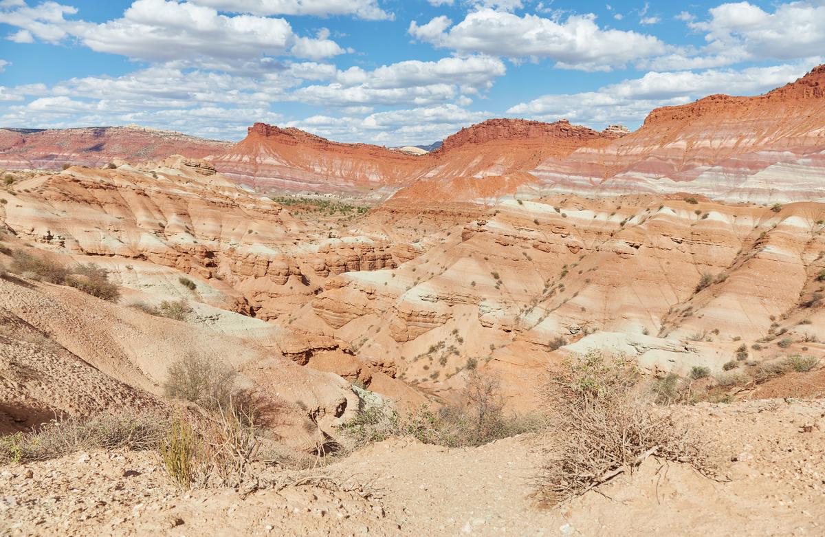
Grand Staircase-Escalante - 4 hours from Salt Lake City
I thought this was one of the most untamed landscapes I've ever visited and it quickly became one of my favorite places to visit in Utah. We enjoyed gorgeous plateaus, canyons, and hidden waterfalls.
While driving along Scenic Byway 12 (one of the most beautiful highways in America), we stopped at overlooks to admire the colorful cliffs far into the horizon. I instantly thought our journey was worth it!
You can camp under star-filled skies, hike into the famous slot canyons of Peek-a-Boo and Spooky Gulch. I found it fascinating that some sandstone corridors were so narrow w aectually had to get through sideways.
Boulder’s Anasazi State Park Museum is a cool local stop that will give you a glimpse of ancient Puebloan life.
What I loved best:
I was blown away by Lower Calf Creek Falls, a stunning 126-foot waterfall cascading into a pool surrounded by ferns, my personal highlight.
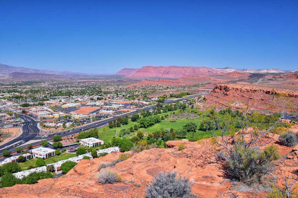
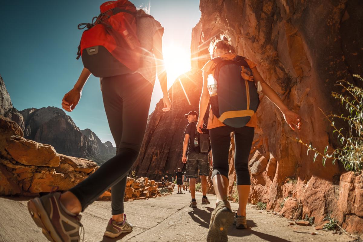
St. George and Zion National Park
This place made me want to slow down and just soak in its history! When visiting Zion National Park, we loved basing ourselves in St. George because of its amazing scenery and modern conveniences available in town.
Downtown St. George had cozy cafés, local restaurants, and a historic vibe. We even treated ourselves to a couples’ spa experience at a nearby resort, which felt especially indulgent after long days of hiking. The contrast between rugged outdoor adventure and quiet relaxation made the trip feel perfectly balanced.
You can look forward to evenings that are especially magical with soft breezes, picture-perfect sunsets, and starry skies
What I loved best:
My favorite hidden gem was hiking through Snow Canyon State Park, where lava tubes, red petrified dunes surrounded us along the way.
Local tip:
If you are planning a day trip from Las Vegas, you can catch shuttle from Las Vegas to St. George (about 2.5 hours, $45) instead of driving.
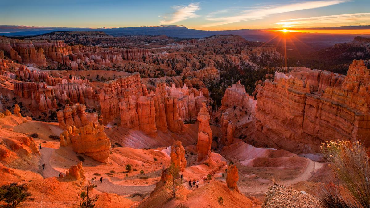
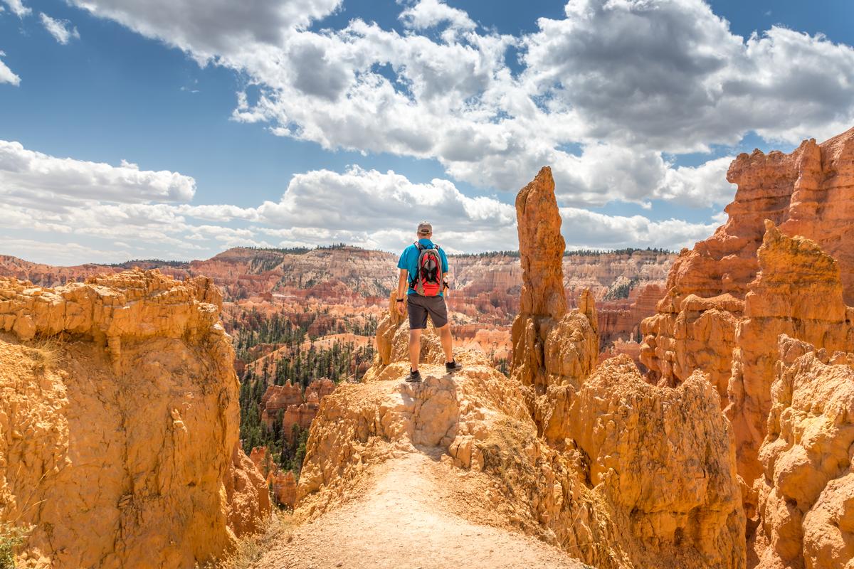
Bryce Canyon
This was another super unique stop on our road trip through the American Southwest. It was a last minute decision to drive out here and we didn't regret it. You will reach it in about two hours from Zion National Park, and it feels super remote and peaceful.
We were completely blown away by the "hoodoos", the rock spires that you see in the photo.
You can catch a sunrise at perfectly-named Sunrise Point, hike along Queen’s Garden Trail, and visit Bryce Point to take lots of photos. Bryce Canyon is known as an International Dark Sky Park and it's one of my favorite places to visit in Utah for stargazing.
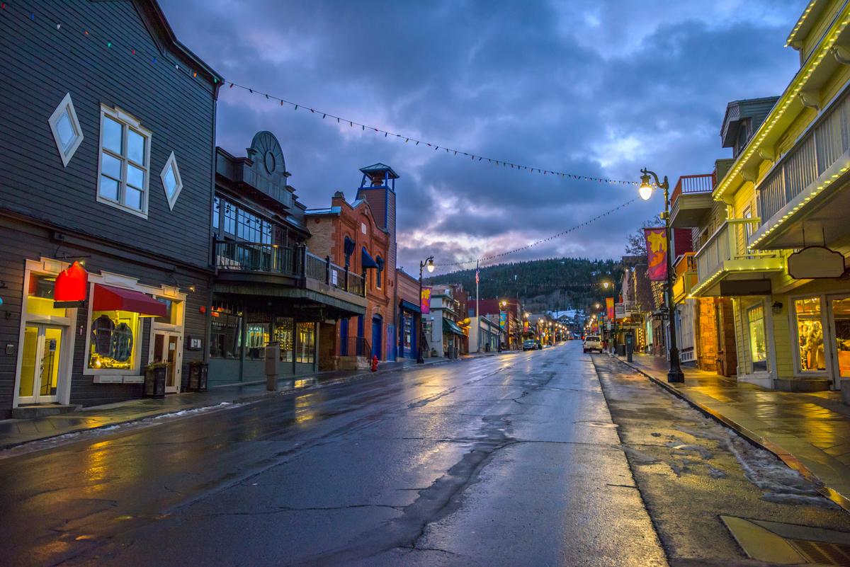
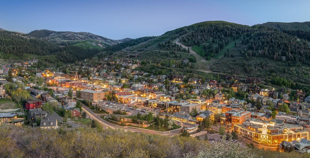
Park City
If you are already visiting Salt Lake City, a side trip to Park City (Just 35 minutes) is a must. I thought it was one of those almost-too-pretty-to-be-real towns (population around 10,000 people) and one of the best places in Utah for mountain lovers year-round.
In the summer, you can hike, and watch as the town transforms for the Park Silly Sunday Market on Sundays. It's an incredible open-air street festival that runs June through September.
Main Street was down to cars and filled with local artists, food vendors and musicians. I sampled fresh lemonade, watched a bluegrass band play, and browsed handmade jewelry and other vintage finds.
We spent seven active days in an affordable vacation rental. Wildflower hikes and relaxing on Jordanelle Reservoir were my highlights.
What I loved best:
Farm-to-table dinner at Riverhorse on Main was my favorite highlight.
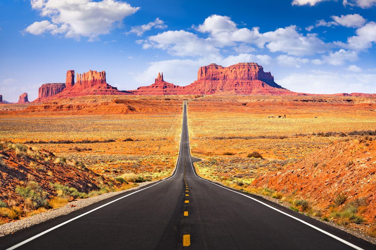
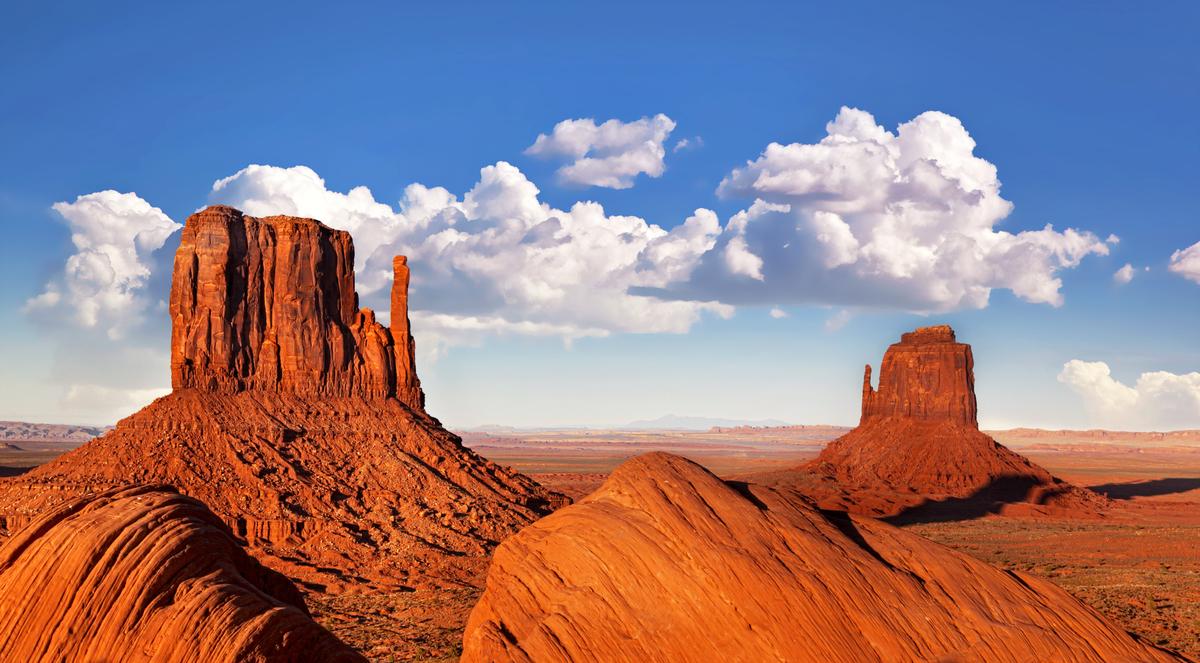
Monument Valley
I personally think this is one of the most magical places on the planet! Since Monument Valley is quite a remote place, we planned a separate road trip to reach it.
We adored the towering sandstone buttes and endless desert horizons. You should know that The Navajo Nation manages this 92,000-acre park, and it's home to many sacred sites.
On your drive there, stop at overlooks. The views were quite familiar from classic Western films, and that's why this area is nicknamed "John Wayne Country".
You can join a Navajo-led tour into the backcountry, explore hidden arches, petroglyphs, and sacred sites not accessible on your own.
Need a place to stay? We stayed at the 3-star View Hotel for two days, right on the rim.
What I loved best:
Incredible stargazing here was my personal highlight.
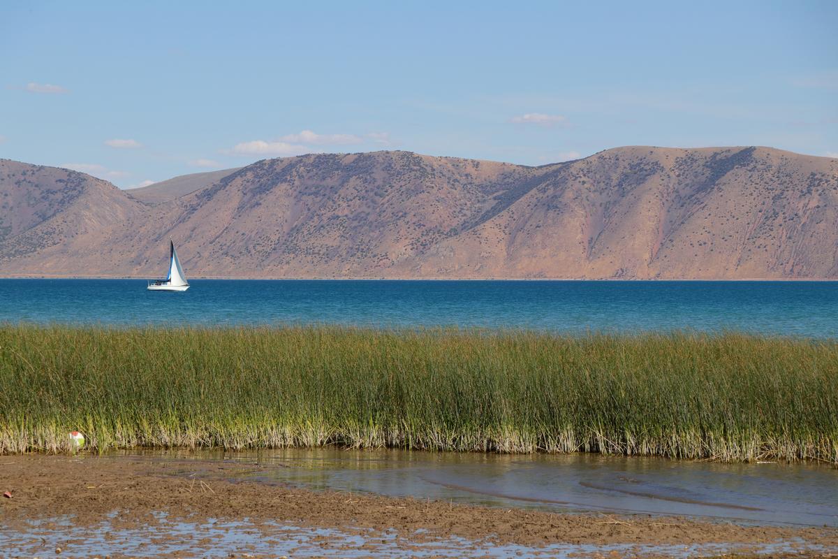
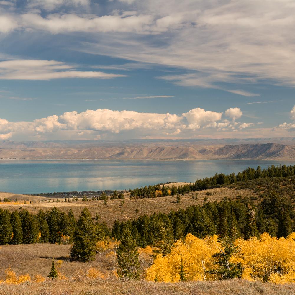
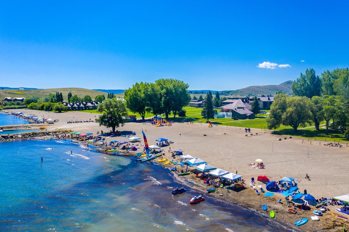
Bear Lake
Wow this lake was stunning! Need another weekend idea from Salt Lake City? Less than 2 and a half hours away, Bear Lake is one of my favorite places to visit in Utah. The lake is actually nicknamed the “Caribbean of the Rockies” for its turquoise color.
You can relax on sandy beaches, and if you have more energy, bike the 50-mile loop road around the lake.
In summer, Bear Lake was all about water sports and hiking. We picked up snacks at a fresh fruit stand which was a great idea. I haven't been in winter, but locals told me you can go snowmobiling, ice fishing, and cross-country skiing.
What I loved best:
For me, Bear Lake is one of the best places to visit in Utah because it's magical! Best of all, after being so active, I sampled the famous local raspberry shakes guilt-free.