Best Places to Visit in Texas

Searching for the best places to visit in Texas? You are in the right place! I live in Texas and I especially adore the beautiful coastal areas on the Gulf and the Texas Hill Country because it's where I live and travel to the most with my husband and son. If you are looking for hotel and resort weekend getaways in Texas, I recommend this article too.
The Lone Star State is vast and I'm still getting to know all its hidden corners but here are the places I personally vetted and wholeheartedly recommend - I hope you’ll enjoy them too.
- Best Time to Visit Texas
- How to Get to Texas
- How to Get Around
- Best Places to Visit On the Coast in Texas
- - Galveston - South Padre Island - Port Aransas
- Best Places to Visit in the Texas Hill Country
- - Fredericksburg - Johnson City - Austin - New Braunfels - Drive-In Theaters - Boerne - San Antonio- Killeen, TX
- Best Day Trips from Dallas
- - Plano - Frisco - Irving - Fort Worth - Arlington - Dallas
- More Unique Places to Visit Around Texas
- - Houston - Amarillo - Beaumont - Waco - McAllen - Alpine
Best Time to Visit Texas
I found that the best time really depends on what part of Texas you’re exploring...it’s a big state with all kinds of weather. For comfortable temperatures and outdoor fun, go between March and May or October and November.
How to Get to Texas
- By Air: Unless you are on a longer road trip in the South USA, you will probably fly into major airports like Dallas/Fort Worth International (DFW), Houston’s George Bush Intercontinental (IAH), or Austin-Bergstrom International (AUS). I recommend flying into Austin (where I live) because it’s small, easy to navigate, and you will land right in the middle of the Hill Country, hands down my favorite spot in Texas.
- By Car: Texas is made for road trips, and when I’ve driven from Austin to Big Bend and from Dallas to the Gulf Coast and each route felt like its own mini adventure. Highways like I-35, I-10, and US-90 connect most major Texas places, cities and scenic areas.
- By Train: Amtrak’s Texas Eagle runs between Chicago and San Antonio, with stops in Dallas Austin, and smaller Texas places. I usually drive because it gives us more flexibility to discover new hidden gems along the way, but the views from the train of small towns and open countryside are classic Texas, so I like that too.
How to Get Around Texas
Having a car is by far the easiest way to get around Texas because distances are long and public transit between cities is limited.
In cities like Austin, Dallas, and Houston, you can get around with rideshares, scooters, or light rail (Dallas and Houston both have them). In smaller Texas towns or national parks, though, driving is essential.
Best Places to Visit On the Coast in Texas
Craving ocean air and water views on your Texas vacation? Head to the coast where Texas offers a super diverse selection of destinations (from very busy to totally empty). Here's what I recommend from my recent four week Texas road trip.
Why Should You Trust These Vacation Ideas?
The United States is our home and we started this website over 30 years ago. After decades of travel writing and five years of non-stop travel, our content is based on real-world experience.

1. Things to Do in Galveston
This coastal Texas gem is one of my absolute favorite places to visit in Texas. Why? First off, it's full of great attractions and unique hotels that keep me coming back again and again. In addition, Galveston's one of the easiest beach trips from Houston as well as from my own home near Austin (that's why we've already spent 2 weeks in Galveston!). I'm convinced that there’s something for everyone in Galveston, from its historic Strand District to family favorites like Moody Gardens and the Pleasure Pier.
I've especially enjoyed visiting during the Galveston Island Revue Weekend which celebrates the area's vintage past (usually in June!) with vintage swimsuits, live jazz, and classic cars parked along the seawall. My favorite places to stay are 4-star Hotel Galvez and Spa (around $207) or The 4-star Tremont House (around $242) where Chris and I recently stayed in a room with a King Bed, floor-to-ceiling windows and classical decor for two relaxing days.
I love that Galveston is such a great place for foodies, where I start my morning with fresh baked Cinnamon Roll at The Sunflower Bakery & Cafe, have seafood lunch at Miller's Seawall Grill (their $20.99 lump crab and avocado salad is among the best I've ever had!), and end my day with dinner with ocean view at The Spot.
Our Ocean View room with Double Beds at Hotel Galvez and Spa where we stayed on our anniversary was such a joy to return to after a long day exploring. In addition, my 50-minute massage at the Hotel Galvez Spa was my personal highlight.
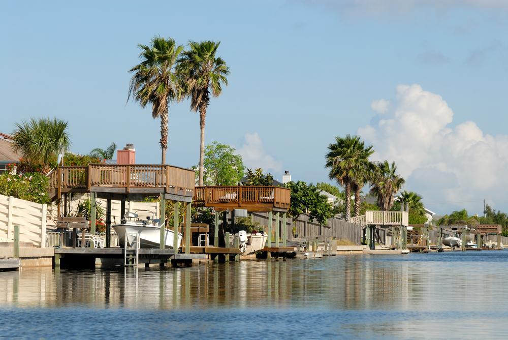
2. South Padre Island
We absolutely love South Padre Island, and have been many times. I think that this magical island is one of the best beach destinations in Texasbecause it’s Texas at its most tropical!
First, just take the Queen Isabella Causeway across from Port Isabel, and you’ll find yourself on this amazing Texan barrier island that, which, to me (and lots of my fellow Texans I talk to!), totally feels like a slice of paradise on mainland USA.
Once there, we checked into a comfortable Premium Sand Room with sea view and a comfy King bed at Margaritaville Beach Resort South Padre Island for stress-free two days.
Once fully settled at the hotel, I recommend that you start exploring with a visit to Isla Blanca Park, where I loved the scenic beaches (of course!). Pack a picnic lunch and enjoy on the beach! After, head to the South Padre Island Birding and Nature Center ($12 admission), where we strolled along the boardwalk and spotted herons and pelicans (locals reminded me to look out for sea turtles too).
In the evening, I loved our dinner at Sea Ranch Restaurant & Bar, a local favorite, or savor a romantic dinner at Liam’s Steakhouse & Oyster Bar where we loved its elegant atmosphere and refined coastal cuisine.
Back at the hotel, the spa menu is quite impressive, and I can vouch for the 50-minute Deep Tissue massage (around $140) at Margaritaville South Padre which relaxed my muscles, joints, and got rid of all the tension I was holding onto.
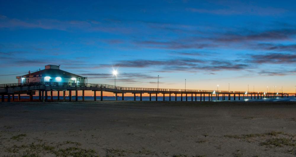
3. Port Aransas - 3 hours 50 minutes from Austin
I fell hard for Port Aransas with its beaches, salty Gulf breezes, and colorful coastal cottages! But I think the real magic was its easy rhythm, a mix of beach-town joy and island calm that made it the perfect family Texas beach vacation.
Just a short ferry ride from the mainland, the drive over the causeway lead us to the little barrier-island town where I spent three days at the affordable Seashell Village Resort (around $65/night). I loved that our Cottage Suite included two bedrooms so there was plenty of space for my husband, son and myself.
I was up first thing and it was very early so I wandered along the shoreline at sunrise, and watched the dolphins just offshore. We had breakfast at the resort and afterwards we explored local shops on Alister Street. After a quick coffee break, we walked through Mustang Island State Park, wind in my hair, enjoying the views - it was an amazing beach vacation day.
In the evening, we were all in the mood for a seafood feast (shrimp fresh off the boat!) and live music drifting from beach bars under the stars.
Next day, for something off the beaten path in Texas, the birding at the Leonabelle Turnbull Birding Center is spectacular, an underrated gem where I’ve spotted herons, egrets, and even alligators, which always adds a little thrill to the trip.
For lunch, we headed to the Venetian Hot Plate, my personal highlight. Their rich Gulf snapper piccata and house-made key-lime pie were absolute perfection after a day in the sun!
Best Places to Visit in the Texas Hill Country
The Texas Hill Country is my absolute favorite place on the planet and it's also where I live year-round. I love our super long summers that start in March and end in October, friendly people, amazing nature, cool cities like Austin and San Antonio, and great food! Here are the places I think you should visit that will give you a taste of this wonderful place.

4. Fredericksburg - 1 hour from Austin
Looking for a place to go near Austin, TX with tons of history? Check out Fredericksburg, TX, a short 60-minute drive from Austin where I live. Over the years of going there by myself, with my son and brining friends from out-of-town, I found out that makes for the perfect weekend destination for couples, families, history buffs, and even wine lovers! Locals told me that it was founded in 1846 by German immigrants, and you can definitely see the remnants of its Old World culture around town (especially amazing tradition German food, beer and music!).
One of the top historical attractions my son appreciated is the National Museum of the Pacific War, a must-see attraction dedicated to Admiral Chester W. Nimitz, a Fredericksburg native.
For a taste of the town’s German heritage, stroll down Main Street as soon as you arrive, where you’ll find shops, bakeries, and biergartens like Altdorf Biergarten which was my personal highlight!
After, stop by Pioneer Museum, which showcases early settler life through preserved cabins and artifacts, and later head to Enchanted Rock State Natural Area, a massive pink granite dome offering stunning panoramic views.
When it’s time to relax, unwind with live music and craft beer at Altstadt Brewery, a striking German-style Texas castle and brewery, and for dinner, indulge in hearty German-Texan fare at Otto’s German Bistro or enjoy upscale Southern comfort food at Vaudeville.
We stayed two days at the charming Hoffman Haus ($226/night), a cozy bed and breakfast where we loved its spa-style suites and breakfast baskets delivered to our door. There is a good selection of Airbnbs too.
Visiting Wildseed Farms with my son was incredible next morning. It's the largest working wildflower farm in the U.S., where children can roam colorful fields and adults can shop for seeds and Texas wines.
A downside? Weekends (especially during wildflower season, Oktoberfest, and holidays) mean heavy tourist traffic.

5. Things to Do in Johnson City, TX
One of my favorite places to visit in the Texas Hill Country is this charming hometown of President Lyndon B. Johnson. It's easy for me to get to since it's just an hour west of Austin. In addition, it's a gateway to our region’s growing wine country so it's perfect for a quick couples' weekend getaway.
If you are looking for a taste of Texas wine country, One of my favorites vineyards is Sandy Road Vineyards where you can taste their small-batch wines in the shade of oak trees.
Later, we had a lovely stroll through Johnson City’s quiet downtown, where historic limestone buildings hold art galleries, antique stores, and coffee shops. I can personally vouch for Johnson City Coffee Co., the best spot in town for coffee outdoors on their shaded patio.
When we take a day trip to Johnson City with my son, Science Mill is our must-visit, a hands-on science museum, located in a historic 1880s mill building and repurposed into an interactive STEM environment.
In addition, the city is home to the coolest Texas castle (290 Wine Castle), a perfect vacation idea if you are looking for something romantic!

6. Austin
This easily my favorite city to visit in Texas, not just because I live here! I think that Austin has the absolute best mix of live music, museums, and nature.
Unlike many big cities in the USA, I think that Austin still manages to feel down-to-earth where you can spend the morning admiring the views over Lady Bird Lake, the afternoon exploring boutique shops on South Congress Avenue, and evenings sampling unique foods and visiting music venues.
I recommend starting your visit in Downtown Austin, visit the Texas State Capitol, Zilker Park, and the Barton Springs Pool, a natural spring-fed oasis perfect for cooling off on a warm Texas afternoon.
When the sun goes down, head to The Continental Club or Antone’s to experience Austin’s legendary live music scene (blues, rock, or country. Foodies will want to dine at Uchi, a contemporary Japanese restaurant loved for its innovative sushi and chic ambiance, and indulge in Texas barbecue perfection at Franklin Barbecue.
Just a heads up: Austin is actually pretty spread out with many unique neighborhoods. That's why when I have friends visiting from out-of-town, I highly recommend a local tour to orient yourself. There some really cool tours to choose from, including walking tours, cruises, food tours and even a double decker bus tour!
What about accommodations? There are lots of choices for every budget, from hotels to vacation rentals. Our room at 5-star Hotel Saint Cecilia had one of the most comfortable beds I've ever slept in, with lush private gardens that were such a hidden gem and my personal highlight.
A downside? From June through September, temperatures often sit at 100°F+ so you need to be near a pool, swimming hole (or somewhere air conditioned). The most popular is Barton Springs Pool, a three-acre swimming pool fed by underground springs in Zilker Metropolitan Park. There are two parking lots and admission is $9 for non-residents (but often free during the colder months!). See if you can spot our adorable (and unfortunately endangered) Barton Springs Salamander!

7. New Braunfels - 50 minutes by car from Austin
I thought this place, nestled between San Antonio and Austin, has to be one of the absolute best day trips in Texas.
First thing we did was grab coffee downtown at New Braunfels Coffee and wander around. The historic buildings mixed with cool shops felt like an underrated but amazing experience. We ended the morning with another coffee and a snack at Pink Coffee & Co. New Braunfels.
After that we headed straight to the Comal River, which is literally right there, and floating in it was the absolute best way to slow down and feel that Texas summer magic.
We laughed a lot, soaked up the sun, and this part was easily my favorite because it felt joyful, affordable, and kind of like a dream afternoon.
Later we checked out Gruene, just outside of town, and it felt like a hidden time capsule with live music, antique stores, and the coolest dance hall ever. We didn’t even plan much, but stumbling into Gruene Hall for music was such a brilliant idea and one of the most authentic experiences of the trip. Locals told me that it's the oldest dance hall in Texas.
That evening we ate ay Alpine Haus Restaurant, my personal highlight, especially their Black Forest Cake for dessert!
The next morning after breakfast we explored Landa Park, which I think is one of the most underrated parks in Texas, especially for a family or chill weekend.
We walked along the trails, and loved how green and peaceful everything felt.

8. Drive-In Theaters: Texas Hill Country and Beyond
If you are thinking of catching a movie at a drive-in theater in Texas, I think it's a great vacation idea! Why? To me, it feels nostalgic, exciting, and totally unique compared to a regular cinema.
One of my absolute favorite spots is the Stars & Stripes Drive-In in New Braunfels where I feel like I’ve stepped back into a simpler time, especially with the Hill Country sky glowing overhead during the movie.
Another gem I really enjoy is the Blue Starlite Mini Urban Drive-In near my home near Austin, which offers such a cool way for our family to enjoy a movie together in a unique setting (it used to be my grandma's favorite!).
Of course, Texas has other drive-in gems too, like the Coyote Drive-In in Fort Worth and the Big Sky Drive-In in Midland comes to mind.

9. Boerne
We absolutely love this small town with great German heritage food and underground caverns! Boerne is our go-to longer day trip from Austin, about 1.5 hours southwest down scenic Texas Hill Country roads. I think that driving from Austin to Boerne, you get to see a slice of Old Texas, especially in the spring with bluebonnets sprinkled by every roadside!
It's also just 35 minutes northwest of San Antonio if you are looking for an easy day trip north - some of our friends live here and commute from San Antonio. One of the absolute best things to do in Boerne is stroll down the Hill Country Mile as soon as you arrive, past the boutique shops, art galleries, and cafés.
In addition, I think that Boerne is the best place to go in Texas for natural beauty - I was totally in awe of Cascade Caverns and the Cave Without a Name when we first moved to Texas. Visit one or the other in the afternoon!
When it’s time to for lunch or dinner, treat yourself to an elegant meal at The Creek Restaurant, a romantic riverside spot offering fine American cuisine with Hill Country flair. For a more laid-back evening, stop by Dodging Duck Brewhaus where we've had many joyful family meals and enjoyed their hearty pub fare while listening to live music.
Ending the day at Kendall, a boutique inn housed in an 1859 stagecoach stop was a highlight. I also like The Bevy Hotel Boerne, and the intimate Tapatio Springs Hill Country Resort, co-owned by country legend George Strait.

10. San Antonio
If you are looking for the best places to visit in Texas on a family vacation, I think that San Antonio in South-Central is the ideal choice. Why? First off, your kids will have heard of The Alamo in their history class, which you can visit in San Antonio (my son really appreciated this historical perspective!).
In addition, the iconic San Antonio River Walk is very family friendly where you can easily stop for refreshments, enjoy a peaceful riverboat cruise, and then easily pop back to your hotel for an afternoon nap.
In addition, LEGOLAND Discovery Center San Antonio is within easy walk from hotels like the 4-star Hilton Palacio del Rio and 4-star Hotel Contessa, making it easy to visit even with smaller kids.
For art and culture, visit La Villita Historic Arts Village and the San Antonio Museum of Art, while nature enthusiasts can spend a morning at the Japanese Tea Garden and the San Antonio Botanical Garden, both ideal for a serene escape within the city.
When it’s time to dine, we've enjoyed elevated Tex-Mex at Mi Tierra Café y Panadería, and refined dining at Biga on the Banks, a River Walk gem where we love their New American cuisine and romantic riverside ambiance.
Finally, there are many events you can catch in San Antonio throughout the seasons but my favorite is Muertos Fest at Hemisfair in October!
As the night winds down, I loved our stay at 5-star Hotel Emma (a AAA Five Diamond hotel so you can expect amazing service), or check out the more affordable 3-star Hotel Gibbs Downtown San Antonio Riverwalk.
If you have time for a day trip from San Antonio, Natural Bridge Caverns is a must-see stop! This underground natural wonder in Texas has to be one of the coolest and most exciting cave experiences I’ve ever had in the U.S.! I loved that there are several unique tours to to choose from, and afterwards above ground the park offered even more fun—like zip-lining, obstacle courses, and gem mining. Expect to pay around $25-$40+ for standard cavern tours, plus a separate $10 parking fee per vehicle.

11. Killeen, TX
About an hour north of Austin, Killeen makes for a cool and easy day trip that’s full of surprises like Fort Cavazos (formerly Fort Hood) at the heart of the city, where I found the museums and exhibits absolutely fascinating.
When I want to be outdoors, Stillhouse Hollow Lake and Belton Lake are my go-to spots for a picnic, fishing, or simply relaxing by the shore at sunset.
One of my favorite food stops is Taqueria Mexico Lindo, a hidden gem that serves some of the most flavorful tacos, affordable and authentic Mexican dishes I’ve had in Central Texas.
Best Day Trips from Dallas
The Dallas area offers so many unique corners to explore, whether you like nature, museums or dining. Here's where to go.

12. Plano - 30 minutes from Dallas
This suburban town charmed me with its restored red-brick heritage buildings, tucked-away eateries, sprawling nature preserves, and an energetic modern shopping-and-dining scene.
A quick 25–30 minute drive north from Dallas brought me into Downtown Plano Arts District, where the atmosphere felt cozy yet contemporary.
There’s plenty to do here: stroll through the brick-lined streets of Historic Downtown Plano, explore the tranquil trails at Arbor Hills Nature Preserve, or experience the artistry and live entertainment at the Courtyard Theater. We had tons of fun bowling and riding bumper cars at Pinstack.
Dinner at Urban Crust, a stylish wood-fired pizzeria set in a historic building, was a highlight, especially if you snag a rooftop spot at sunset.
Or make a reservation at Seasons 52, an upscale spot known for its seasonally inspired menu and impressive wine list. Alternatively, for something extra special, enjoy a fine dining experience at Fogo de Chao, where Brazilian steakhouse flair meets Texas hospitality.
Unwinding for the night at the luxurious 4-star Renaissance Dallas at Plano Legacy West Hotel was ideal, with its sleek modern design, rooftop pool, and sweeping views of the city.

13. Frisco - 30 minutes from Dallas
Just north of Dallas (about 30 minutes by car!), Frisco is one of the most underrated towns I’ve explored in North Texas, and I think it’s one of the absolute best low-key getaways near the metroplex.
First, strolling through the Rail District, we admired the blend of historic charm and modern touches, discovering unique boutiques and local spots that encouraged us to slow down and enjoy the moment together.
My favorite next stop was a cozy café tucked along Main Street, where we shared flaky pastries and perfectly made lattes—it felt like the absolute best way to start the day.
After coffee and snacks, we wandered into small specialty shops and antique-style stores filled with quirky finds, laughing as certain items sparked memories of childhood and family stories.
A short drive took us to nearby parks like Frisco Commons, where winding trails, open green spaces, and quiet ponds gave us a refreshing chance to walk side by side this month and soak up the Texas sunshine.
In the afternoon, a favorite highlight of mine was strolling through the Frisco Heritage Center with historic buildings - it gave me a look into small-town Texas life from over a century ago.
I loved that Frisco had such an underrated vibe—polished yet relaxed, welcoming without feeling rushed—which made it feel like our own little escape despite being close to the city.
We also stopped by the local farmers market, where fresh produce, baked goods, and handmade items gave us a real sense of community and plenty of snacks to bring along for later.
Our last stop was Stonebriar Centre, with its fun dining, entertainment, as well as KidZania for kids, perfect for a family day trip from Dallas, Texas.
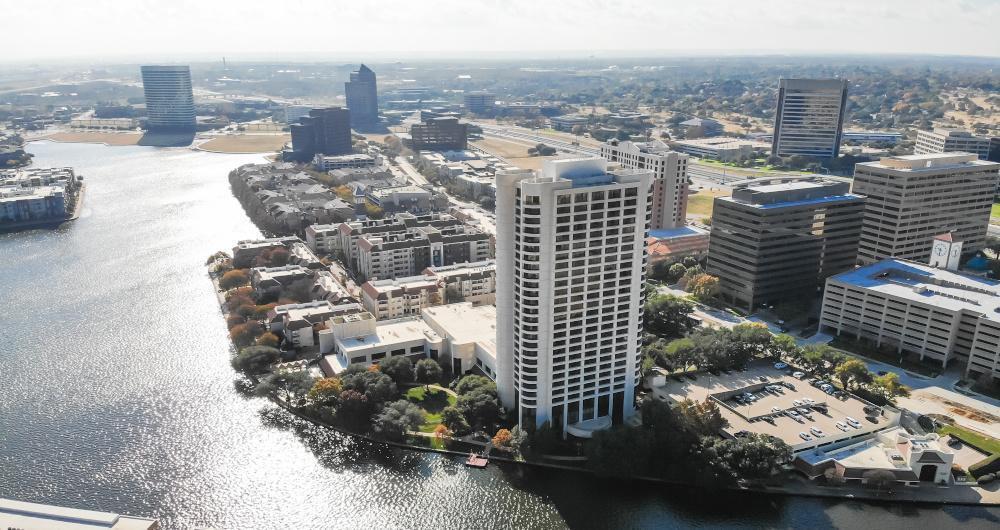
14. Irving - 20 minutes from Dallas
Just a short drive from Dallas, this city has become one of my favorite underrated gems in North Texas. Why? Every time I visit, I find a mix of vibrant city energy and hidden spots that make it a cool weekend escape or even just a quick day trip.
Irving's Las Colinas area is absolutely the coolest part of town for me because I admire its sleek modern skyline, and waterfront vibe. At the center of it all, is Gondola Adventures, where the spirit of Venice lives right here in Texas. I wasn’t expecting to find gondolas here, (real ones!) wondered in a second if I was teleported to Italy...but as soon as you step aboard, the city melts away.
When I get hungry, I can never resist stopping at affordable Bread Zeppelin serving fresh salads stuffed into warm, artisan baguettes and every time I eat there, I feel like I’ve stumbled onto one of the coolest foodie secrets in the state.

15. Fort Worth - 30 minutes from Dallas
Just a short drive west from Dallas, this city feels like a world of its own and I think it's one of the most captivating weekend getaways in the Lone Star State. Once I arrived, I quickly understood why Fort Worth is often called the place “where the West begins”, because of its cool cowboy culture.
Start your visit in the Historic Fort Worth Stockyards, where you can witness a real-life cattle drive, browse Western boutiques, and grab a drink at Billy Bob’s Texas, the world’s largest honky-tonk. Then, make your way downtown to Sundance Square, a lively district filled with upscale shops, live music, and art-filled courtyards.
Afterwards, art lovers will find plenty to explore in the Cultural District, like the Kimbell Art Museum, the Modern Art Museum of Fort Worth, and the Amon Carter Museum of American Art. Although these are walking distance of each other, I recommend leaving plenty of time to enjoy them. You can also join one of the many organized tours on offer to cover more ground in a shorter time.
In the evening, treat yourself to an elegant dinner at Grace, a chic downtown steakhouse with a reputation for exceptional service and a superb wine list. Or, for a more relaxed meal, try the legendary Heim Barbecue (yes, you have to wait a bit, but it was so worth it!).
After dinner, relax in your luxurious room at 4-star Hotel Drover, a gem located in the Stockyards, or choose a room at the more affordable 3-star Stockyards Hotel (around $159/night).
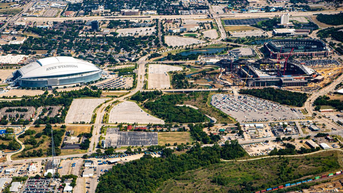
16. Arlington - 30 minutes from Dallas
This was one of my favorite places for a Texas day trip because it blends excitement, family fun, and hidden gems all in one, tucked right between Dallas and Fort Worth.
One of the absolute best highlights for in Arlington is catching a game or event at AT&T Stadium or Globe Life Field because even if you’re not a huge sports fan, the energy is electric, and the atmosphere is just spectacular.
For thrills, Six Flags Over Texas is always a cool option for riding roller coasters with my son and having a worry-free day outside.
One of my favorite hidden treasures in Arlington is dining at Mariano’s Hacienda, an iconic spot where the frozen margarita machine was actually invented! We ordered spicy pulled chicken enchiladas ($16) and other tasty eats and stayed for a while.
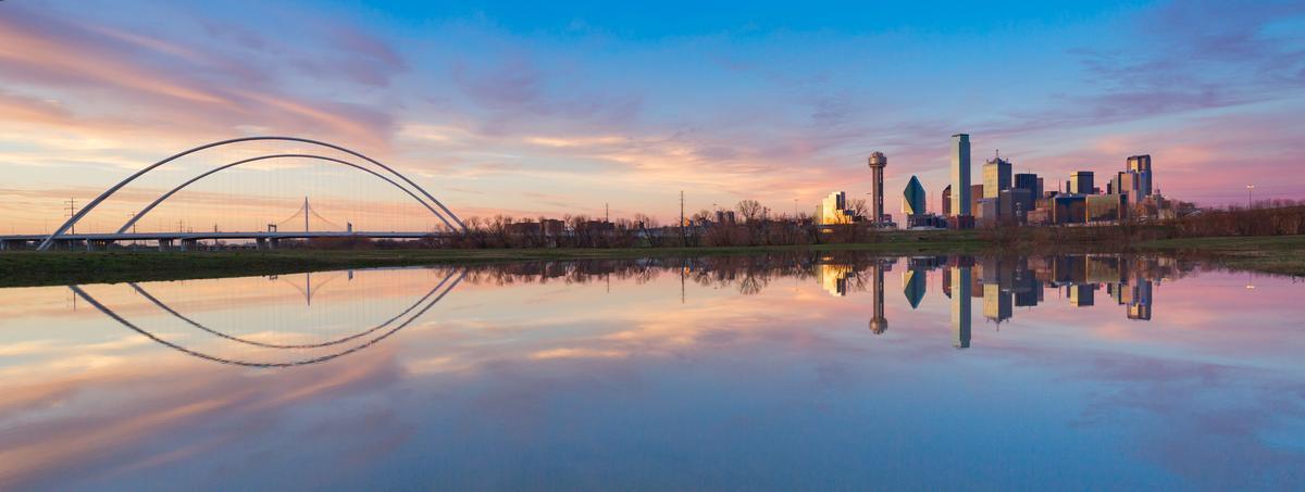
17. Things to Do in Dallas
One of the coolest things about planning a trip to Dallas is its art scene! I I especially love exploring the Dallas Arts District, which I read is the largest urban arts district in the nation!
Afterwards, we relaxed at Peticolas Brewing Company tucked just west of downtown in the Design District and I thought this spot is a true hidden gem for craft beer lovers.
For a step back in time, Dealey Plaza and the Sixth Floor Museum are unusual and powerful places to visit.
One of my favorite places to stay is The Joule, a AAA Four Diamond award winner, where we checked into a Premier Room with a King Bed with hypo-allergenic bedding and modern decor.
One of my favorite museums is Meadows Museum, part of Southern Methodist University, houses one of the largest and most comprehensive collections of Spanish art outside of Spain.
Whenever I want a peaceful escape, the Dallas Arboretum is my go-to because the gardens are absolutely beautiful, and a stroll by White Rock Lake is one of the most underrated and romantic things to do in the city.
More Unique Places to Visit Around Texas
From the incredible energy of Houston to the rugged West Texas character Alpine, you can choose from some super unique destinations in other parts of Texas. Here's where I think you should start.

18. Things to Do in Houston
I love visiting this mega city with my family (and on last minute solo day trips too!) A scenic 25-minute drive from almost anywhere in Houston (thanks to its impressive loop system I can totally vouch for) can take you from the sleek Museum District to the laid-back vibes of the Heights or the buzz of Midtown. A fair warning, though, Houston is very spread out so you can easily end up wandering aimlessly without a plan. It's a good idea to chart your itinerary ahead of time or sign up for one of the cool local guided tours.
We started downtown near Discovery Green which is right in the heart of the city, and it felt vibrant, exciting, and full of magic right away. Walking around first thing was a brilliant idea because we got to see hidden gems, cool murals, and unique architecture before it got busy.
After that we headed toward Midtown which is near downtown Houston, and this area was one of my favorite spots for food and people watching. Trying local tacos there was an absolute best experience, affordable and family-friendly.
After lunch, we explored the Museum District near Hermann Park, and this was such a spectacular and interesting area that felt almost like a dream. The museums are close together which made it easy, and honestly this part of Houston felt like a cultural gem and very family friendly.
I loved our afternoon wandering through the Museum of Fine Arts, followed by dinner at Christie's Seafood (a local gem in business for over 100 years!) before we settled into Hotel ZaZa's Junior Suite with a separate sitting area for two days.
Next day after breakfast we relaxed at Buffalo Bayou Park which sits just west of downtown, and it was one of the most peaceful and romantic moments. Watching the skyline from there felt special and unusual, especially since Houston is so spread out but still looks incredible.
When hunger hits, Houston truly shines and lunch at Coreanos is a fun spot blending Korean and Mexican street food. I found the Korean BBQ tacos to be addictively good and perfect after a day of exploring. !
In the evening we went to Montrose which is near the city center. This neighborhood was vibrant, artsy, and totally my favorite. The Burger Joint captures the city’s casual, come-as-you-are charm perfectly, and set along Montrose Boulevard, it’s the kind of spot where the sizzle from the grill mingled with the hum of conversation spilling out onto the patio.
We ended the trip near the Galleria area uptown Houston, and it felt like the perfect mix of luxury, fun, and the absolute best way to finish.
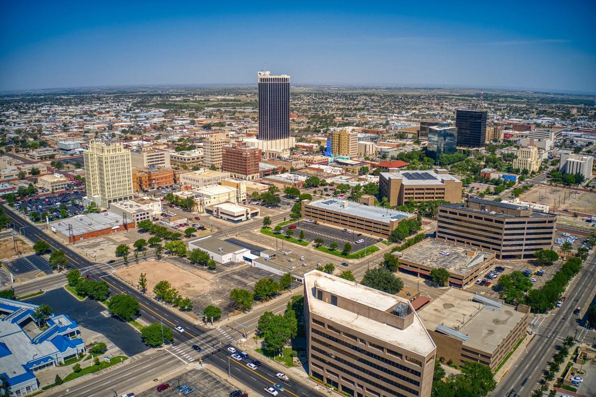
19. Amarillo
I think that this is one of the best places to visit in Texas if you’re looking for a mix of cowboy spirit, Route 66 nostalgia, and wide-open Texas Panhandle skies.
To get here, the first option is to fly to Rick Husband Amarillo International Airport, or as a second option drive 1 hour 45 minutes from Lubbock as part of a larger road trip like we did.
Start your journey at Amarillo's iconic Cadillac Ranch, where ten half-buried vintage Cadillacs stand nose-down in the dirt (a totally unique public art installation that was oh-so-Texan!), then, explore the American Quarter Horse Hall of Fame & Museum, celebrating one of Texas’s most beloved traditions.
A notable outdoor park here is Palo Duro Canyon State Park, often called the “Grand Canyon of Texas,” where you can hike along the colorful red-rock trails (my favorite!), catch a horseback ride through the canyon floor, or take in the famous TEXAS Outdoor Musical, a summer tradition set under the stars.
When hunger strikes, head to The Big Texan Steak Ranch because it's an Amarillo institution famous for its 72-ounce steak challenge, or for something more refined, head to OHMS Café & Bar, where I loved their locally inspired dishes!
End your evening at the 4-star Courtyard by Marriott Amarillo Downtown or the boutique 4-star Barfield, Autograph Collection (we stayed in a Corner King Room for two days which was very comfortable!).
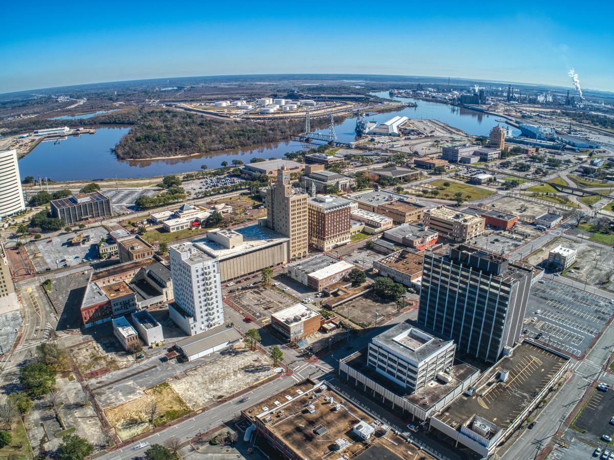
20. Beaumont
Once here, you’ll quickly see why this city captivates visitors with its unique blend of Cajun culture, Texas heritage, and outdoor adventure. We drove about 3.5 hours east from our home in Austin to Beaumont, a city of about 110,000 near the Louisiana border on the Neches River.
I recommend starting your trip by exploring Downtown Beaumont, home to colorful murals, and restored Art Deco buildings. If you are a history buff like me, you'll love visiting the Spindletop Boomtown Museum, where the Texas oil boom began in 1901, or the McFaddin-Ward House Museum, a grand Beaux-Arts mansion that showcases early 20th-century elegance.
Nature lovers can’t miss the chance to wander through the Cattail Marsh Wetlands, a serene 900-acre habitat we spotted herons, roseate spoonbills, and alligators along the boardwalk, and for a wild Texas experience, stop by the Gator Country Adventure Park that's home to hundreds of rescued reptiles, including “Big Al,” a 1,000-pound alligator.
When hunger hits, indulge in Beaumont’s flavorful Cajun-Texan cuisine at Floyd’s Cajun Seafood where I ordered spicy crawfish, or head to Katharine & Company for fresh, locally inspired dishes in a charming setting.
Stay at MCM Elegante Hotel Beaumont (around $103/night) for two days where we splashed around in the resort-style pool, and visited the spa (I indulged in a 60 minute classical massage and I highly recommend it).
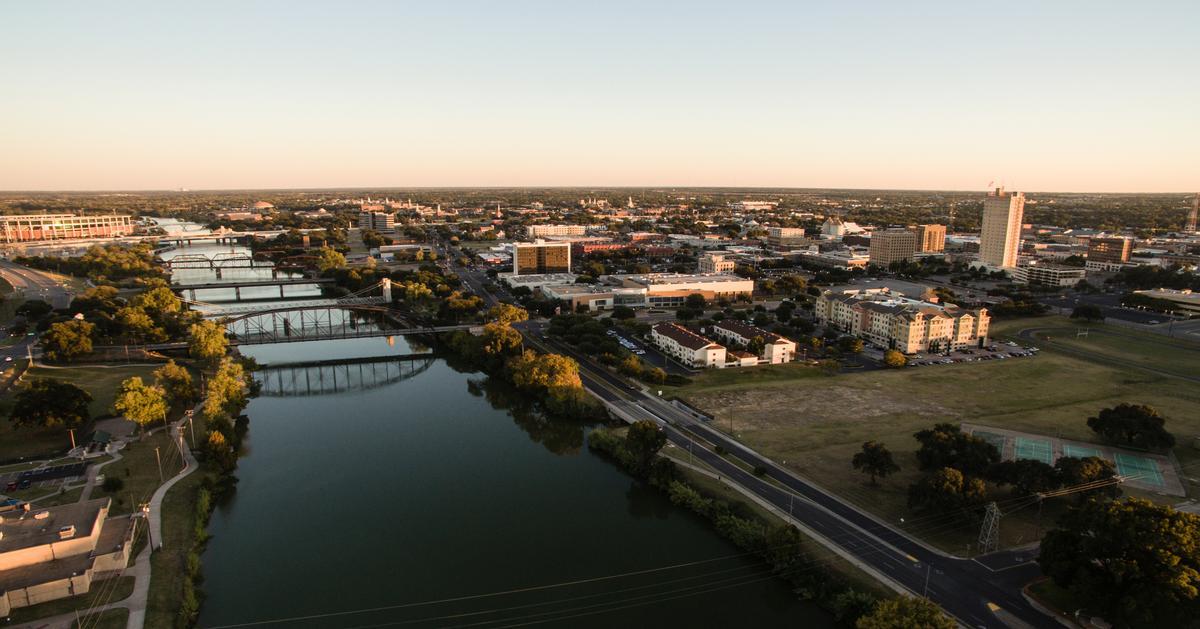
21. Waco TX in 48 Hours
I adored this Texas destination where small-town charm meets big personality with brick warehouses turned chic boutiques, riverside trails, and a thriving creative scene.
We drove about 1.5 hours north from our home in Austin to Waco (population ~140,000), and once a cattle-trading town on the Brazos River, Waco still carries its frontier spirit.
I started with a stroll through the Magnolia Market at the Silos, wandered through the Dr Pepper Museum, admired the modern art at the Martin Museum of Art, and I walked along the Brazos Riverwalk at sunset.
We spent the night in a Traditiona King room at the Hotel 1928, a beautifully restored historic getaway.
My personal highlight was visiting the Texas Ranger Hall of Fame & Museum, strolling along the historic Suspension Bridge (1870), and exploring Cameron Park, a 416-acre green space with bluffs overlooking the river.
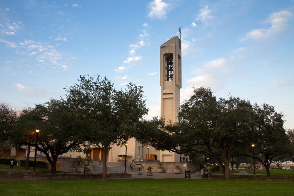
22. McAllen - 1 hour by car from Brownsville
This unique city, located in the Rio Grande Valley near the U.S.–Mexico border, is one of my favorite underrated destination on our Texas road trips.
We started our experience downtown, which was the best first stop because everything felt walkable, colorful, and full of energy, with murals, cafés, and music setting the magic mood.
After that, breakfast turned into one of my favorite moments at a local café, where the food was affordable but absolutely amazing, and the coffee fueled the rest of our dream day.
Then we headed to Quinta Mazatlán, a hidden nature gem near central McAllen, and it was such a cool and unusual experience seeing peacocks, tropical plants, and historic architecture all in one place.
Later in the afternoon we explored shopping at La Plaza Mall, which is honestly one of the best shopping experiences in Texas, and see in my photos how vibrant and lively it felt.
As the sun started to set, we drove just a short distance to the McAllen Nature Center, which felt peaceful and romantic, a total underrated spot for walking and slowing down.
Dinner was next and we chose a local Mexican restaurant that turned into an exceptional food experience, easily the absolute best flavors we had all weekend.
If I’m in the mood for something lively, I love catching a performance at the McAllen Performing Arts Center where the shows are top-notch - I think it’s one of the coolest venues in South Texas.
That night was spent walking around downtown again, enjoying live music and people watching, which made McAllen feel joyful and full of life.The next morning we took it slow, which was the best idea, grabbing breakfast tacos before heading out to explore nearby Mission and the surrounding Valley towns.
What makes McAllen so special is how unique and interesting it is, combining culture, food, nature, and city vibes into one brilliant idea of a family or romantic getaway.
>
23. Alpine
Tucked away in the heart of the Big Bend region, I thought that this was one of the most scenic and soulful weekend getaways when I moved to the Lone Star State.
Just hop on I-10 West and US-67 South from Midland or El Paso, and after a few hours of open-road beauty, you’ll arrive in this charming high-desert town surrounded by rolling hills and endless blue skies. Once here, you’ll understand why Alpine is often called the “Heart of the Big Bend” because it’s so peaceful, artsy, and full of rugged West Texas character.
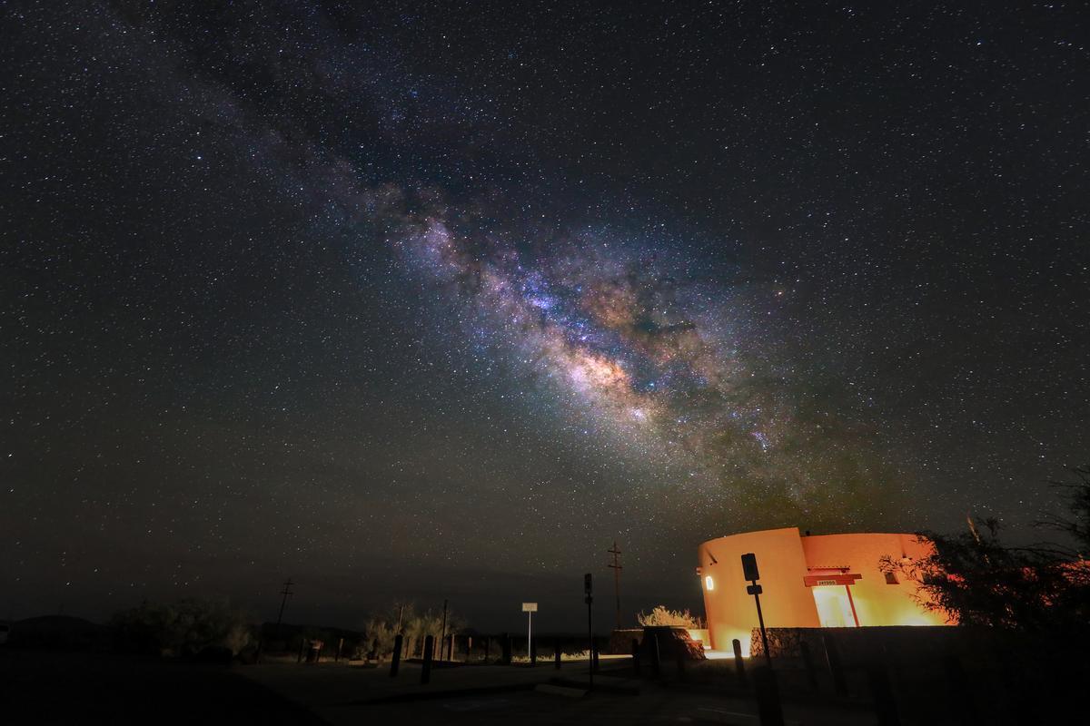
I love how totally authentic Alpine is, a place where locals don't have tourism fatigue, and star-filled nights are brighter than you imagined.
Start your adventure in Downtown Alpine, see the murals, browse local art galleries, and stop for a latte at Cedar Coffee Supply, and if you enjoy history the Museum of the Big Bend is for you... located on the Sul Ross State University campus, a fascinating stop that highlights the area’s rich Native American, ranching, and frontier heritage.
For a day outdoors, there's Big Bend National Park or Davis Mountains State Park both offering some of the best hiking, stargazing, and desert scenery in Texas, and if you’re in town at the right time, catch a local festival like Trappings of Texas in September, celebrating Western art and cowboy culture.
When it’s time to eat, head to Reata Restaurant, a West Texas legend where we adored its perfectly cooked steaks, spicy jalapeño crab bisque, and cozy rustic ambiance.
After dinner, we retreated to the 3-star Holland Hotel (around $127/night), a beautifully restored Spanish Colonial landmark, and our elegant room with a King bed for two days was comfortable, we enjoyed their on-site restaurant, and proximity to downtown...I really thought it’s the most incredible base for our romantic getaway in Texas.
Conclusion
The more we explore across Texas, the more we realize that each city and town has its own unique magic that makes it special. I hope that you see from my list of best places to visit in Texas how vast and diverse the Lone Star State really is. If you only have a weekend, fly to Austin, Dallas or Houston and base yourself there for bit of exploring. Most of all, I hope you enjoy exploring Texas as much as we do.
Booking Checklist
1. Book Your Flight - I use Expedia because I like their mobile app with my itinerary. They've helped me re-book flights on many occasions. Once you reach their Gold tier, support is especially good.
2. Book Your Hotel - I use Booking.com or Expedia, depending on my destination.
3. Book Your Rental Car - I use Expedia.
4. Book your tours on Viator or Get Your Guide.
5. If you are planning to visit more than three national parks in the next 12 months, we've found that buying the America the Beautiful Pass is cost effective.
