
10 Places to Go in Texas

Searching for your ideal Texas destination and things to do here? You are in the right place! I live in Texas and I especially adore the beautiful coastal areas on the Gulf and the Texas Hill Country because it's where I live and travel to the most with my husband and son.
The Lone Star State is vast and I'm still getting to know its hidden corners. Here are the places I personally vetted on my weekend getaways that I hope you’ll enjoy them too.
Best Places to Visit in the Texas Hill Country
The Texas Hill Country is one of my favorite places on the planet and it's also where I live year-round with Chris and our son. I love our super long summers that start in March and end in October, friendly people, amazing nature, and great food (of course!). The biggest Texas Hill Country cities (Austin and San Antonio) are perfectly situated to enjoy exciting day trips nearby. Here are the places I think you should visit in the Texas Hill Country.
Fredericksburg - 1 hour from Austin
I was wowed by this town of approximately 11,000 people! Looking for a place to go near Austin, TX with tons of history? Check out Fredericksburg, TX (Google Maps Pin), just a short 60-minute drive from Austin where I live.
Locals told me that it was founded in 1846 by German immigrants, and you can definitely see the remnants of its Old World culture all around town. We especially enjoyed amazing traditional German food, beer and music!
For a taste of the town’s German heritage, stroll down Main Street as soon as you arrive. You’ll find shops, bakeries, and biergartens like Altdorf Biergarten which was so much fun to stop at.
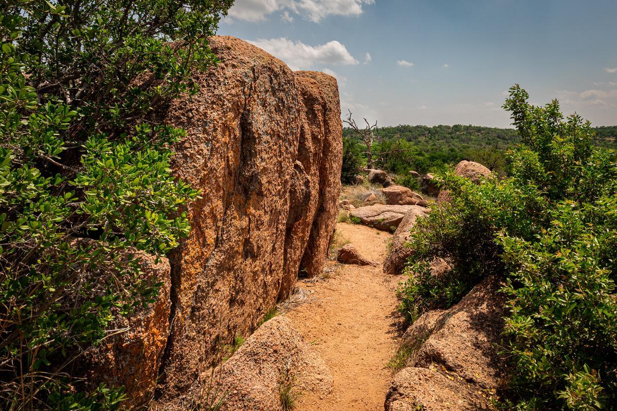
After, stop by Pioneer Museum, which has preserved cabins and artifacts from early settler lives. Later, head to Enchanted Rock State Natural Area for the views.
One of the top historical attractions my son appreciated is the National Museum of the Pacific War, dedicated to Admiral Chester W. Nimitz, a Fredericksburg native.
When it’s time to relax, unwind with live music and craft beer at Altstadt Brewery, a striking German-style Texas castle and brewery. Later, for dinner, indulge in hearty German-Texan fare at Otto’s German Bistro or enjoy upscale Southern comfort food at Vaudeville.
Visiting Wildseed Farms with my son was incredible next morning. It's the largest working wildflower farm in the U.S. Kids can roam through colorful fields and adults can shop for seeds and Texas wines.
A downside? I have to warn you that weekends (especially during wildflower season, Oktoberfest, and holidays) mean heavy tourist traffic.
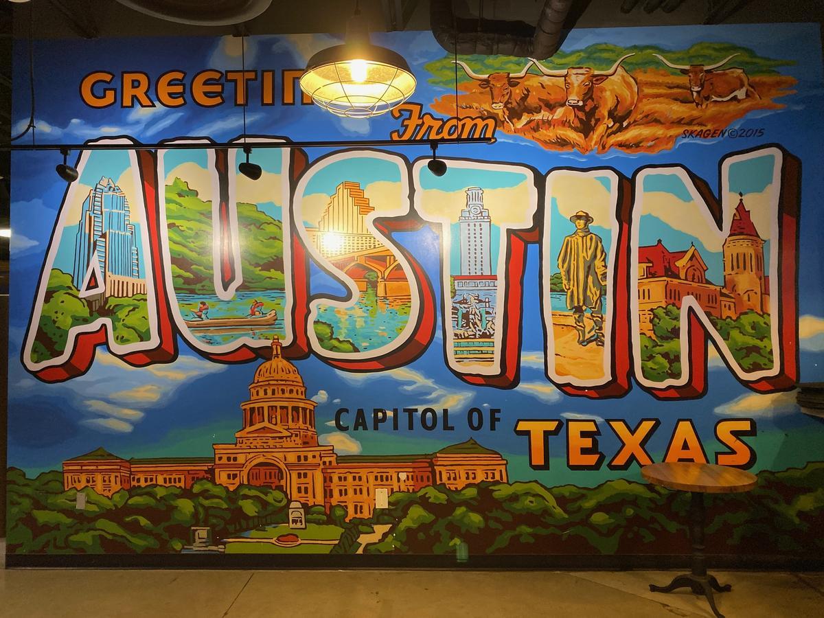
Austin
This easily my favorite city to visit in Texas, not just because I live here! I think that Austin is the best place if you are like me and love sunshine and nature. In fact, Barton Creek Greenbelt (in my photo) stretches all around the city and into the suburbs.
In addition, there is great live music downtown every evening, plus great food. Best of all, for me, Austin still manages to feel down-to-earth and also affordable.
I recommend starting your visit in Downtown Austin, where you can visit the Texas State Capitol for history, and Zilker Park for lovely views.
When the sun goes down, head to The Continental Club or Antone’s to experience Austin’s legendary live music scene (blues, rock, or country). Foodies can find great Japanese food at Uchi and Texas barbecue perfection at Franklin Barbecue.
Just a heads up: Austin is actually pretty spread out with many unique neighborhoods. That's why I highly recommend a local tour with a guide to orient yourself on your first visit out here. Luckily, there some really cool tours to choose from in my hometown, including walking tours, cruises, food tours and even a double decker bus tour!
A downside? From June through September, temperatures often sit at 100°F+ so you need to be near a pool, swimming hole (or somewhere indoors with air conditioning).
What I loved best:
My favorite swimming place is Barton Springs Pool. This is a three-acre swimming pool fed by underground springs in Zilker Metropolitan Park. There are two parking lots and admission is $9 for non-residents (but often free during the colder months!). See if you can spot our adorable (and unfortunately endangered) Barton Springs Salamander!
What about accommodations? There are lots of choices for every budget, from hotels to more affordable vacation rentals. Our room at 5-star Hotel Saint Cecilia had one of the most comfortable beds I've ever slept in, plus lush private gardens that are such a hidden gem in Texas.
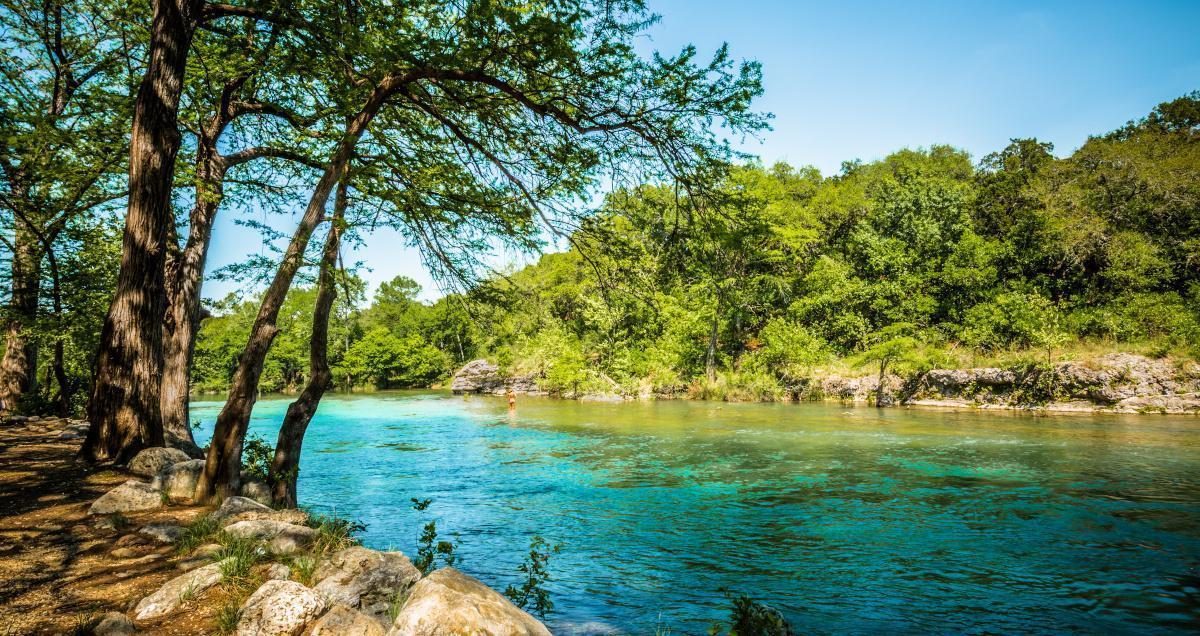
New Braunfels - 50 minutes by car from Austin
I was stunned by the beauty of this area and this is one of my favorite day trips in Texas. First thing we did was grab coffee downtown at New Braunfels Coffee and wander around Downtown New Braunfels. There are many historic buildings to admire, along with cool shops. We ended the morning with another coffee and a snack at Pink Coffee & Co. New Braunfels.
After that we headed straight to the Comal River. Floating down this river is best way to feel that Texas summer magic.
Later we checked out Gruene, just outside of town. Stumbling into Gruene Hall for music was the best. Locals told me that it's the oldest dance hall in Texas.
That evening we ate at Alpine Haus Restaurant. Try their Black Forest Cake for dessert!
The next morning after breakfast we explored Landa Park, which I think is one of the most underrated parks in Texas.
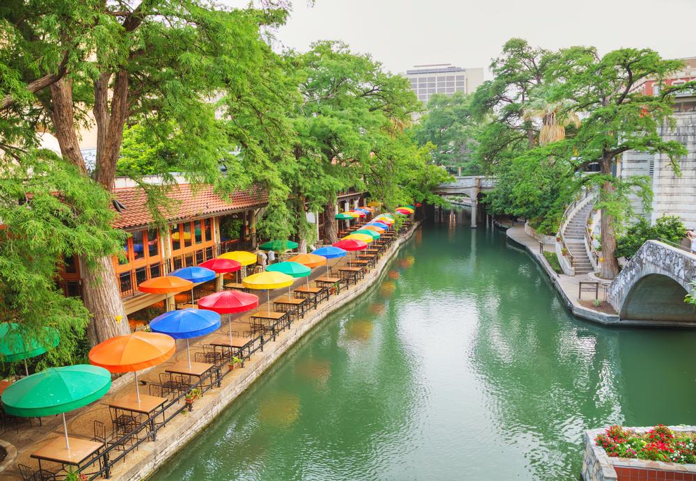
San Antonio
I was completely awed by this Texas city! In fact, if you are looking for the best places to visit in Texas on a family vacation, I think that San Antonio in South-Central Texas is the ideal choice. Why? First off, your kids will have heard of The Alamo in their history class (my son really appreciated this historical perspective!).
In addition, the iconic San Antonio River Walk is very family friendly. There are many cafes, restaurants, and hotels. You can enjoy a peaceful riverboat cruise, and then easily pop back to your hotel for an afternoon nap.
Next day, for art and culture, visit La Villita Historic Arts Village and the San Antonio Museum of Art. Nature enthusiasts can spend a morning at the Japanese Tea Garden and the San Antonio Botanical Garden. Both are amazing.
When it’s time to dine, we've enjoyed elevated Tex-Mex at Mi Tierra Café y Panadería, and refined dining at Biga on the Banks.
Finally, there are many events you can catch in San Antonio throughout the seasons. My favorite is Muertos Fest at Hemisfair in October! Though I have to warn you that traffic gets impossible so you are better off arriving the night before than trying to drive in the morning of the festival.
Killeen, TX
I thought this place felt like stepping straight into a storybook. About an hour north of Austin, Killeen makes for a cool road trip stop. You'll find unique attractions here like Fort Cavazos (formerly Fort Hood). The museums and exhibits are absolutely fascinating. In springtime, wildflowers are abundant as you can see in my wildflowers and butterflies video on our Youtube channel @vacationidea.
When I want to be outdoors, Stillhouse Hollow Lake and Belton Lake are my go-to spots for a picnic, fishing, and watching the sunset.
One of my favorite food stops were flavorful tacos at Taqueria Mexico Lindo, a hidden gem.
Best Day Trips from Dallas
The Dallas area offers so many unique corners to explore.
Dallas
One of the coolest things is stopping in Dallas! I especially love exploring the Dallas Arts District, which I read is the largest urban arts district in all of the USA!
Afterwards, we relaxed at Peticolas Brewing Company tucked just west of downtown in the Design District.
For history buffs like myself, Dealey Plaza and the Sixth Floor Museum are powerful places to visit.
One of my favorite museums is Meadows Museum, part of Southern Methodist University. I found it fascinating that it houses one of the largest and most comprehensive collections of Spanish art outside of Spain.
Whenever I want a peaceful escape, the Dallas Arboretum is my go-to because the gardens are absolutely beautiful. Strolling by White Rock Lake that borders the arboretum is one of the most underrated things to do in the city.
One of my favorite places to stay is The Joule, a AAA Four Diamond award winner. We checked into a Premier Room with a King Bed for two days. I appreciated its hypo-allergenic bedding and modern decor.
There are many cool day trips and weekend getaways you can take from Dallas as well.
More Unique Places to Visit Around Texas
You can choose from some super unique destinations in other parts of Texas. Here's where I think you should start.
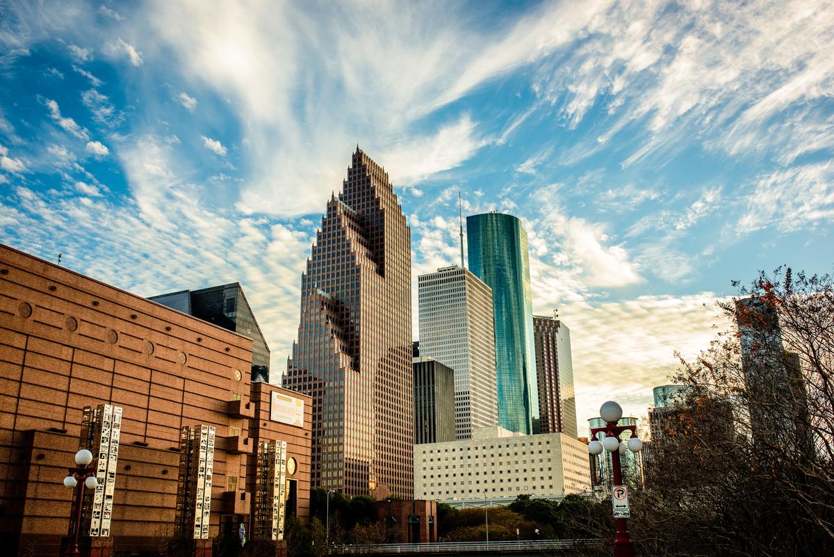
Houston
This was one of the most awesome cities we visited in Texas. In fact, if you don't live in Texas and you want to see a great city and a few beaches along the Gulf on the same weekend, Houston is a fantastic vacation idea.
I love visiting this mega city with my family (and on last minute solo trips too since Houston is just 2.5 hours from my house near Austin!)
I've always found it impressive that a scenic 25-minute drive from almost anywhere in Houston can lead you to a total change of scenery. Just hop on its impressive loop system I can totally vouch for. You can hop from the sleek Museum District to the laid-back Heights or the busy Midtown. I have to warn you that Houston is very spread out. So it's a good idea to chart your itinerary ahead of time if you want to maximize your time here.
I recommend visiting the Museum of Fine Arts. Then you can relax at Buffalo Bayou Park just west of downtown. Watching the skyline from there was great. Dinner at Christie's Seafood is special because this local gem has been in business for over 100 years!
Another great option is exploring Montrose (which is near the city center) and when you get hungry, pop into The Burger Joint. It serves delicious burgers and you can dine on the patio if you like.
As far as day trips from Houston go, you have heaps of options. One of the best is Galveston less than an hour away where you'll find great Texas beaches to relax on.
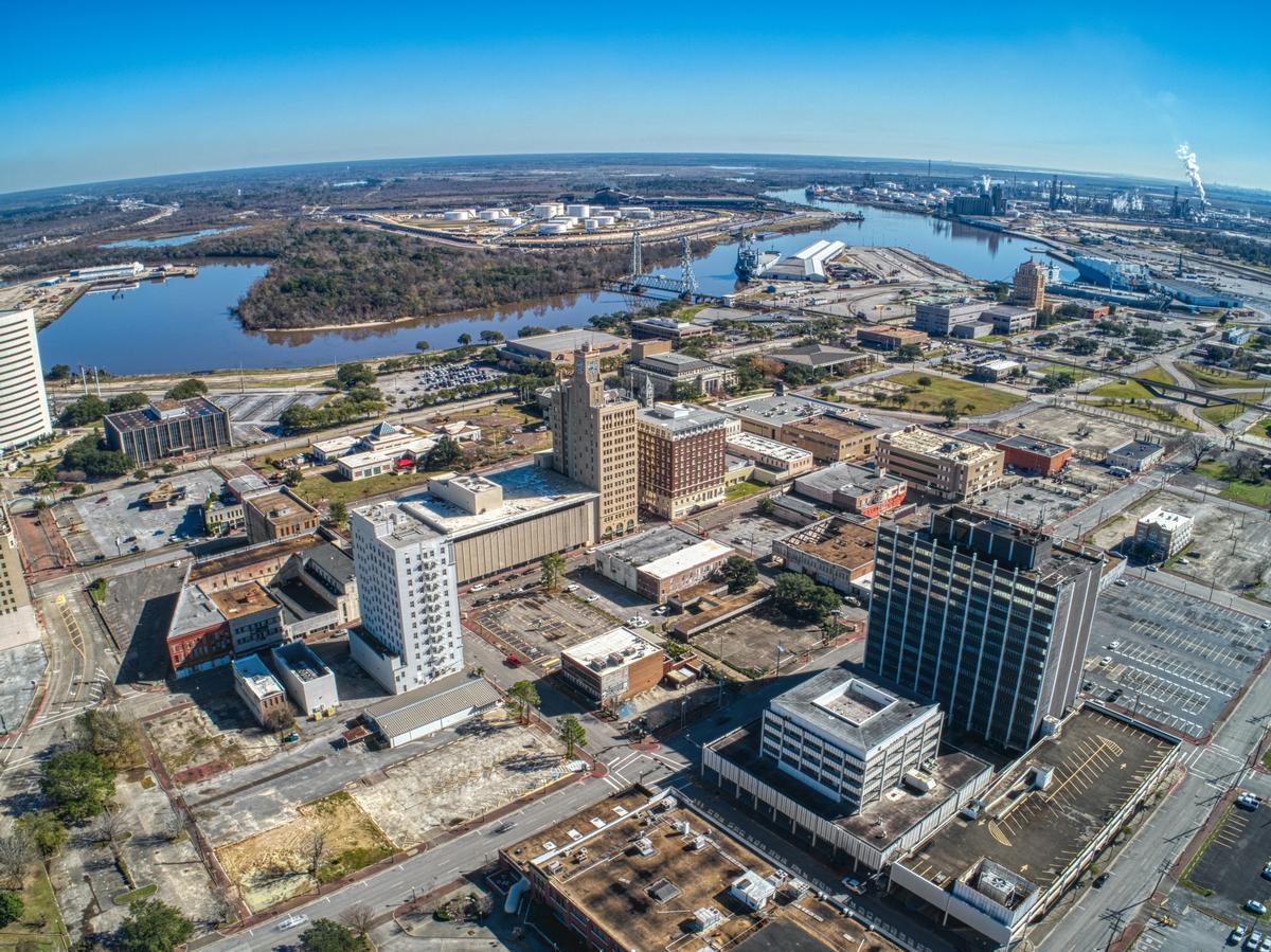
Beaumont
Once here, you’ll quickly see why this city is one of my favorites to visit. I love its unique blend of Cajun culture, Texas heritage, and outdoor adventure opportunities. We drove about 3.5 hours east from our home in Austin to Beaumont, a city of about 110,000 near the Louisiana border on the Neches River.
I recommend starting your trip by exploring Downtown Beaumont, home to colorful murals, and restored Art Deco buildings. If you are a history buff like me, you'll love visiting the Spindletop Boomtown Museum, where the Texas oil boom began in 1901, or the McFaddin-Ward House Museum, a grand Beaux-Arts mansion that showcases early 20th-century elegance.
Nature lovers can’t miss the chance to wander through the Cattail Marsh Wetlands, a serene 900-acre habitat we spotted herons, roseate spoonbills, and alligators along the boardwalk, and for a wild Texas experience, stop by the Gator Country Adventure Park that's home to hundreds of rescued reptiles, including “Big Al,” a 1,000-pound alligator.
When hunger hits, indulge in Beaumont’s flavorful Cajun-Texan cuisine at Floyd’s Cajun Seafood where I ordered spicy crawfish, or head to Katharine & Company for fresh, locally inspired dishes in a charming setting.
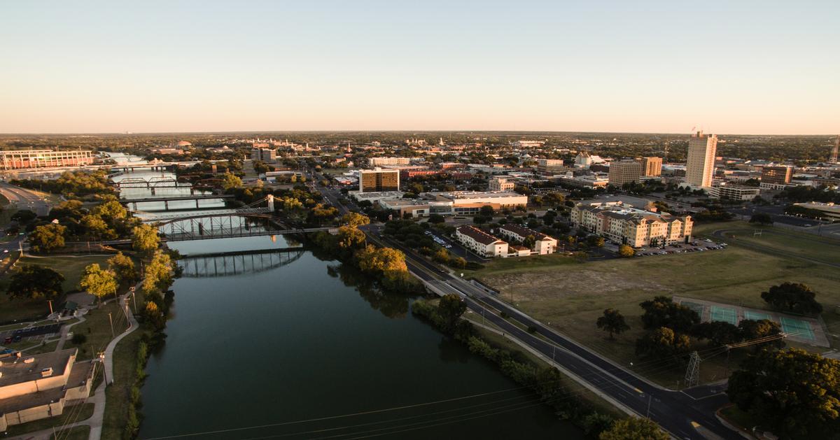
Waco TX in 48 Hours
I adored this Texas destination where small-town charm meets big personality with brick warehouses turned into chic boutiques, riverside trails, and a thriving creative scene. For me, it's one of the best Texas day trips from Austin.
We drove about 1.5 hours north from our home in Austin to Waco (population ~140,000), and once a cattle-trading town on the Brazos River, Waco still carries its frontier spirit.
I started with a stroll through the Magnolia Market at the Silos, wandered through the Dr Pepper Museum, admired the modern art at the Martin Museum of Art, and I walked along the Brazos Riverwalk at sunset.
My personal highlight was visiting the Texas Ranger Hall of Fame & Museum, strolling along the historic Suspension Bridge (1870), and exploring Cameron Park, a 416-acre green space with bluffs overlooking the river.
McAllen - 1 hour by car from Brownsville
Wandering around McAllen was pure nostalgia. This unique city, located in the Rio Grande Valley near the U.S.–Mexico border, is one of my favorite underrated destination on our Texas road trips.
We started our experience downtown McAllen, which was the best first stop because everything felt walkable, colorful, and full of energy, with murals, cafés, and music setting the magic mood.
After that, breakfast turned into one of my favorite moments at a local café, where the food was affordable but absolutely amazing, and the coffee fueled the rest of our dream day.
Then we headed to Quinta Mazatlán, a hidden nature gem near central McAllen, and it was such a cool and unusual experience seeing peacocks, tropical plants, and historic architecture all in one place.
Later in the afternoon we explored shopping at La Plaza Mall, which is honestly one of the best shopping experiences in Texas, and see in my photos how vibrant and lively it felt.
As the sun started to set, we drove just a short distance to the McAllen Nature Center, which felt peaceful and romantic, a total underrated spot for walking and slowing down.
Dinner was next and we chose a local Mexican restaurant that turned into an exceptional food experience, easily the absolute best flavors we had all weekend.
If I’m in the mood for something lively, I love catching a performance at the McAllen Performing Arts Center where the shows are top-notch - I think it’s one of the coolest venues in South Texas.
That night was spent walking around downtown again, enjoying live music and people watching, which made McAllen feel joyful and full of life.I thought that McAllen was one of the best places to visit in Texas because of its unique culture, food and nature.
The next morning we took it slow, which was the best idea, grabbing breakfast tacos before heading out to explore nearby Mission and the surrounding Valley towns.
