
Best Places to Visit in Oregon

Searching for the best places to visit in Oregon? Well, you are in the right place! With vibrant cities, charming small towns, and endless outdoor adventures, The Beaver State is one of the most diverse and rewarding destinations to I love exploring in the Pacific Northwest. Whether you’re planning a road trip, a family vacation, or a peaceful retreat into nature, Oregon offers countless places worth visiting. Here are the ones I recommend from my own travels, and I hope you’ll enjoy them too.
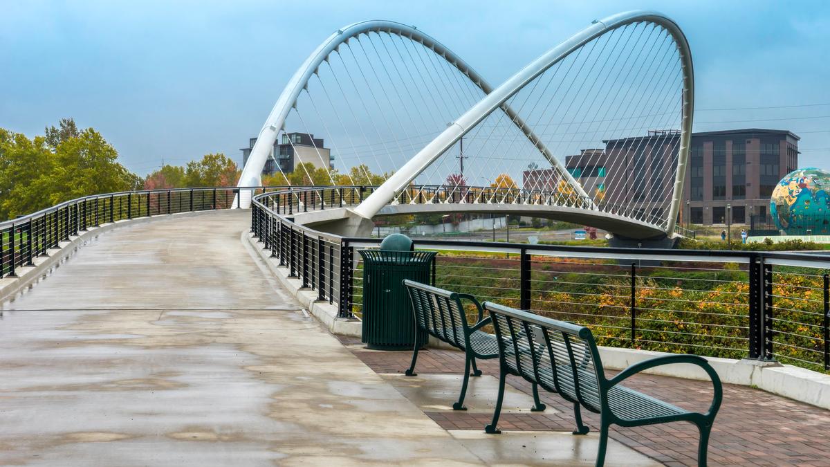
1. Corvallis
Ready for a history-rich Oregon getaway? Check out Corvallis, a real standout! When I first visited, I realized this was one of Oregon’s most underrated gems, tucked into the Willamette Valley about 90 minutes south of Portland. I thought the town offered that perfect blend of small-town charm and university energy, and it quickly became one of my favorite places to visit in Oregon.
We drove about 1 hr 30 min southwest from Portland to Corvallis, home to Oregon State University. We stayed at Hotel Corvallis, a boutique inn in a restored 1920s brick building right downtown.
We loved strolling through the historic downtown, filled with cool coffee shops, local boutiques, and some of the best affordable restaurants I’ve found in Oregon. It felt like a brilliant idea to wander with no plan, just discovering hidden corners and joyful surprises.
My favorite part was exploring the riverfront along the Willamette River. The paved trails were perfect for a romantic walk at sunset or even a family bike ride during the day—it was one of those places that really captures the magic of Oregon’s natural beauty.
We also checked out Oregon State University’s campus, which was surprisingly beautiful, with tree-lined pathways and interesting architecture. It gave Corvallis an exciting, youthful vibe that made the whole town feel alive.
What made Corvallis exceptional was how easy it was to mix outdoor adventures with cozy indoor moments. From weekend farmer’s markets to nearby wineries, every experience felt unique, affordable, and joyful.
- Location: Western Oregon in the Willamette Valley, along the Willamette River, south of Salem and north of Eugene
- Map & Directions
What I loved best:
Bald Hill Natural Area was my personal highlight - Just a few minutes from downtown, I found myself on a peaceful trail surrounded by wildflowers and views of rolling hills—it felt like a hidden sanctuary right near the city.
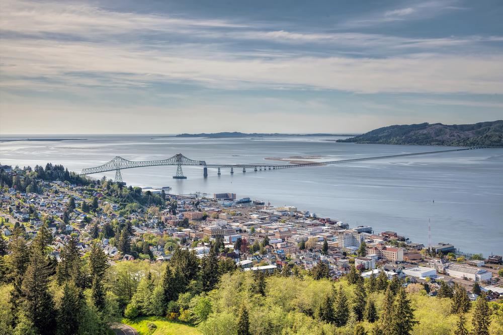
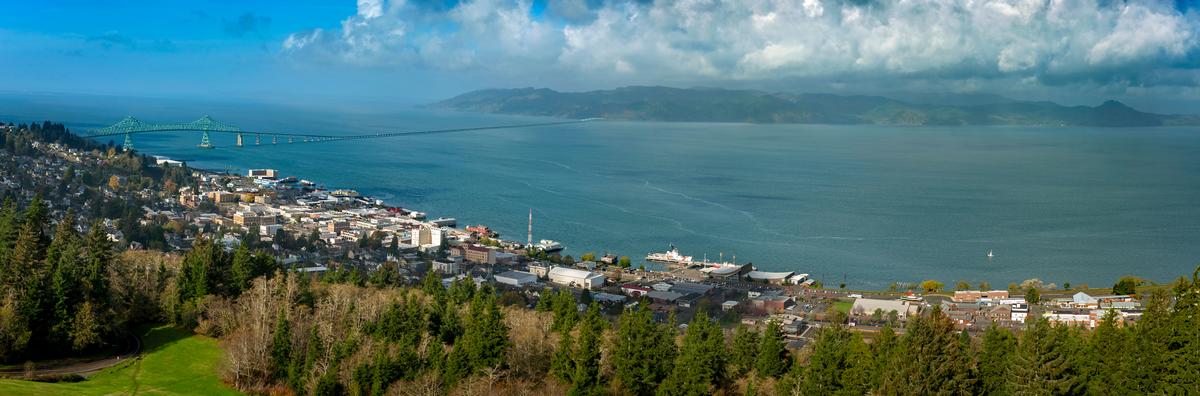
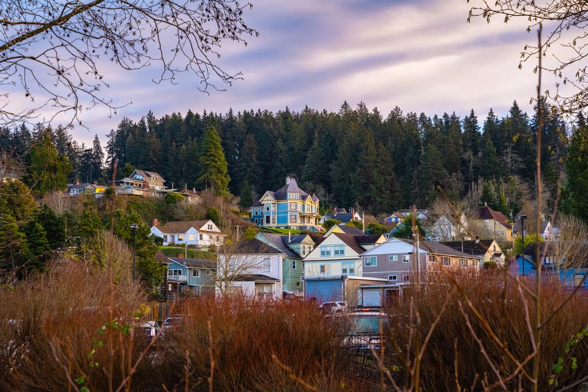
2. Astoria - 2 hours by car from Portland
Perched at the mouth of the Columbia River, this is one of the most atmospheric coastal towns I’ve ever visited. I think it’s one of the absolute best destinations near Portland. Why? Astoria offers sweeping river vistas. In addition, I loved learning about its maritime history, and seeing lovely Victorian architecture.
We started at the Astoria Column, and the climb up its spiral staircase rewarded us with some of the most spectacular panoramic views I’ve ever seen—the river, the ocean, and the green hills all blending together in one breathtaking scene. It was hands down one of my favorite experiences in town.
Another gem for me was simply walking along the waterfront. Watching ships come and go while sea lions barked from the docks was both joyful and unforgettable.
Nicknamed "Little San Francisco", Astoria’s food and drink scene surprised me too. I loved the unique breweries tucked into old canneries and the seafood restaurants with fresh, local catches. It felt like every meal had a story, which made the experience even more special.
The town’s history is everywhere, from the Maritime Museum to the Victorian homes that line the hills. I thought it was the absolute best place to mix culture with adventure.
We stayed at Cannery Pier Hotel & Spa, a restored salmon cannery built over the river with balconies above the water.
- Location: Northwestern Oregon at the mouth of the Columbia River, near the Pacific coast, southwest of Washington’s Long Beach Peninsula and northwest of Portland
- Map & Directions
What I loved best:
The Riverwalk made it easy to enjoy it all, and hopping on the old trolley felt like a fun, affordable way to see the city.

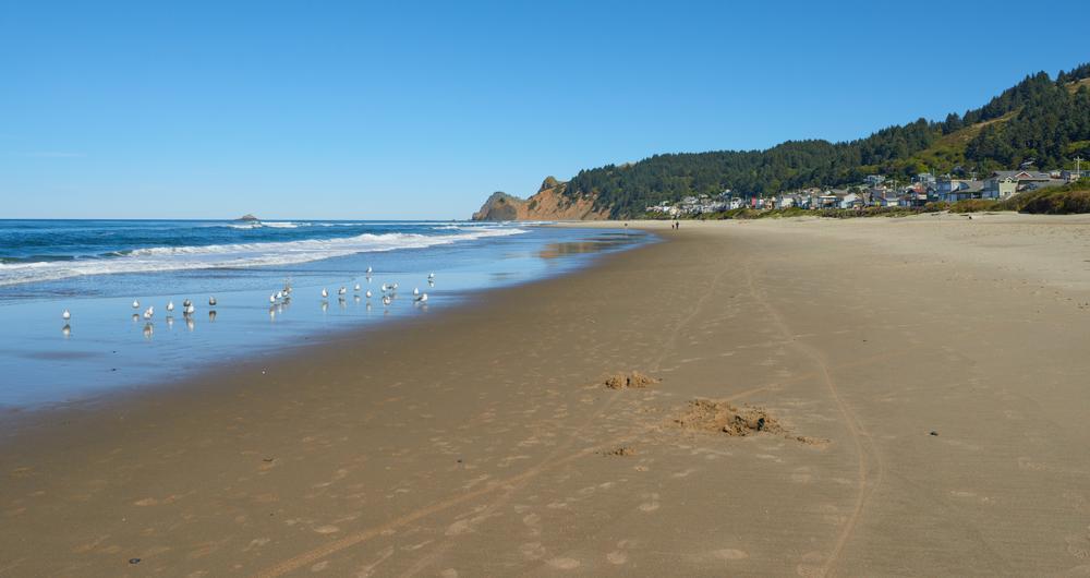
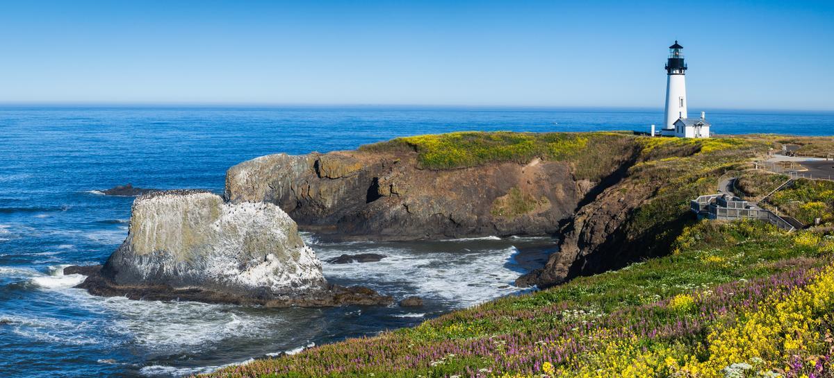
3. Cannon Beach - 1 hour and 30 minutes from Portland
This has to be one of the absolute best coastal towns I’ve ever visited in Oregon, and it’s only about 90 minutes west of Portland. The moment I arrived, the sight of the towering Haystack Rock rising out of the surf felt like pure magic and instantly made me fall in love with this place.
We drove just over an hour west from Hillsboro to Cannon Beach (population 1,500) and checked into a vacation rental for seven days.
I toured the Cannon Beach History Center & Museum (free admission, exhibits on early settlers and shipwrecks). Of course, we spent time at Haystack Rock (235 feet tall, formed by ancient lava flows), where puffins nest in spring and summer.
We spent hours just walking along the wide, sandy beach, which to me is one of the coolest and most romantic stretches of coast in the Pacific Northwest. Watching the tide pools come alive with starfish and anemones at the base of Haystack Rock was such a joyful and unforgettable experience.
My favorite part of Cannon Beach was how vibrant and charming the town itself felt. From hidden art galleries and boutique shops to cozy cafés, it had that perfect small-town vibe mixed with exciting discoveries at every corner.
The food scene here was another gem. I loved sampling fresh seafood at local restaurants, and ending the evening with craft cocktails while listening to the waves crash in the distance was a brilliant idea. It made the whole weekend getaway feel extra special.
- Location: Northwestern Oregon on the Pacific coast, south of Seaside and north of Manzanita along Highway 101
- Map & Directions
What I loved best:
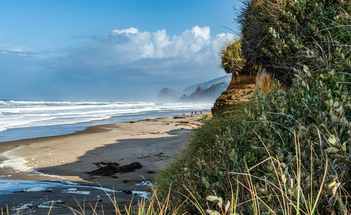
Exploring Ecola State Park, just minutes away, was my favorite highlight.
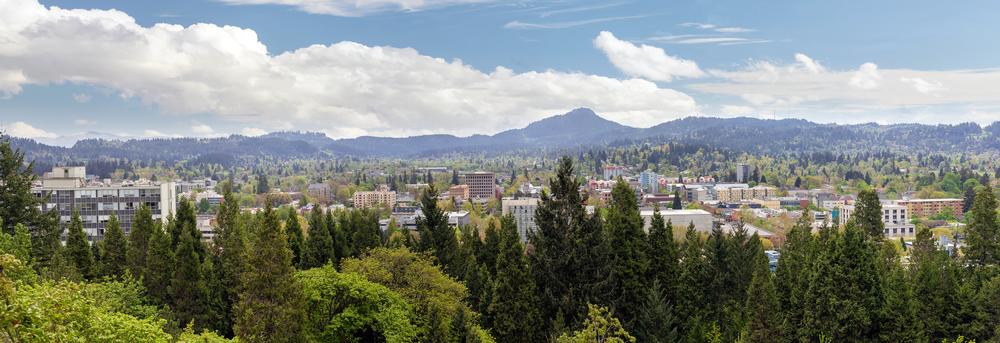
4. Eugene - 2 hours and 15 from Portland
I loved visiting this friendly college city in late autumn and I thought it was one of the best places to visit in the Pacific Northwest when we first moved. I loved seeing fall colors, visiting weekend markets, and sampling steaming cups of coffee from local roasters.
We drove about an hour south from Corvallis to Eugene, a city anchored by the University of Oregon.
We stayed at the Graduate Eugene for two days, a playful, collegiate-themed hotel with vintage décor that completely won me over.
We loved exploring downtown Eugene, which was filled with unique shops, colorful murals, and some of the best local breweries I’ve ever tried. It felt joyful just wandering the streets, stumbling upon hidden cafés, and soaking in the lively atmosphere.
My favorite part of Eugene was the Saturday Market, an absolute gem that bursts with art, food, and live music. I found it to be one of the most fun and affordable ways to connect with the community while tasting everything from fresh produce to unusual handmade crafts.
Another highlight for me was hiking up Spencer Butte. The trail was short but spectacular, and the panoramic views of the valley made the climb totally worth it. It felt like one of those cool, hidden escapes right near the city.
- Location: Western Oregon in the southern Willamette Valley, along the Willamette River, south of Corvallis and north of Springfield
- Map & Directions
What I loved best:
Alton Baker Park along the Willamette River, where families, cyclists, and kayakers all shared the joyful outdoor vibe was a standout for me.
5. Newberg
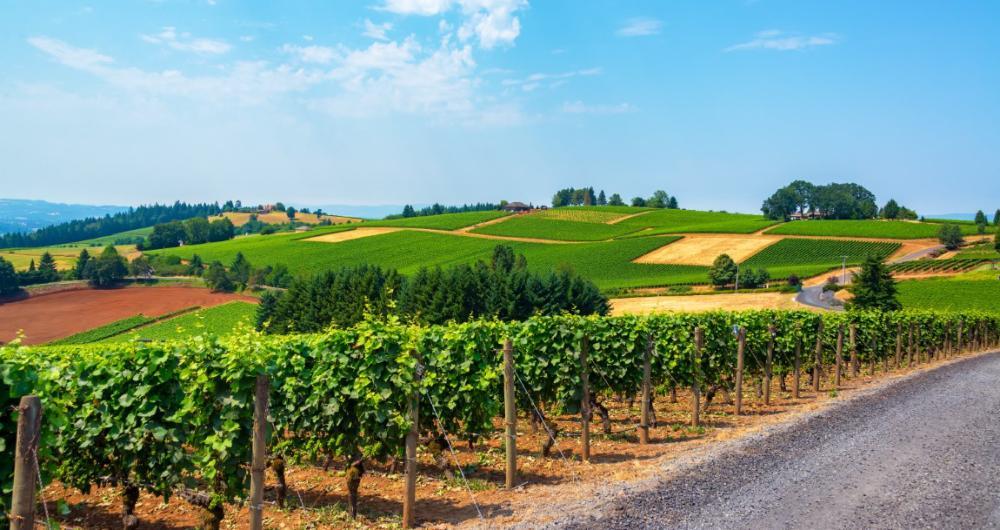
Ready for a history-rich wine country escape? Check out Newberg, a real standout! This felt like one of Oregon’s most underrated gems, tucked into the heart of the Willamette Valley just about 25 miles southwest of Portland. The town had this warm, welcoming vibe, and it immediately struck me as a perfect spot for both a romantic weekend or a family getaway.
We drove about 45 minutes southwest from Portland to Newberg, a gateway to the Willamette Valley wine region.
We loved wandering through the charming downtown, where I found cool boutiques, cozy coffee shops, and some of the best small-town eateries around. It was joyful to see how vibrant and artistic the community felt, with murals and galleries giving the place a unique energy.
My favorite part of Newberg was exploring the surrounding wineries—this area is Pinot Noir country, and tasting local wines while overlooking rolling vineyards was absolutely spectacular. It honestly felt like stepping into a dream landscape that you’d expect to see in my photos.
We also drove the nearby backroads, where farm stands and orchards offered affordable and delicious treats, from fresh berries to homemade jams. Those simple, joyful moments made me appreciate Newberg even more.
- Location: Northwestern Oregon in the Willamette Valley, along the Willamette River, southwest of Portland and northeast of McMinnville
- Map & Directions
What I loved best:
One hidden gem I discovered was the Chehalem Cultural Center, where art, history, and community came together in such an exciting way. It was the coolest surprise to stumble on a place that celebrated both local creativity and culture.

6. Beaverton
This turned out to be one of the most interesting and underrated spots I’ve explored in Oregon, located just west of Portland in the Tualatin Valley. It’s a place that blends suburban comfort with vibrant culture, and I thought it made for an awesome weekend escape with both family-friendly and romantic possibilities.
We drove about 20 minutes west from Portland to Beaverton, a city that grew from a Tualatin Valley farming hub into a high-tech suburb.
For the night, we stayed at the Hilton Garden Inn Beaverton, a comfortable base close to trails and transit.
We loved checking out the diverse food scene—Beaverton is known for having some of the best global eats in the state. From hidden gem food carts to cozy cafés and unusual international restaurants, every meal felt like a joyful surprise. It was honestly one of my favorite parts of the trip.
My visit to Tualatin Hills Nature Park was another highlight. Just minutes from downtown, the trails took me through wetlands and forests, and it felt like such a cool hidden sanctuary right in the middle of the city. I thought it was one of the absolute best places for a peaceful walk.
Another unique discovery for me was how close Beaverton is to Oregon’s wine country. Within minutes, we were sipping Pinot Noir in vineyards that looked like something out of a dream, which made the whole getaway feel even more special.
- Location: Northwestern Oregon in the Tualatin Valley, west of Portland and north of Tigard
- Map & Directions
What I loved best:
I thought the farmer market was a vibrant and exciting experience, my personal highlight. Fresh produce, handmade goods, and live music made it feel like the heart of the community. Strolling through with a basket of local berries was both simple and magical.

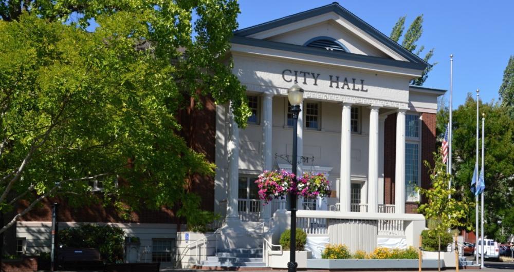
7. Salem - 1 hour from Portland
This is one of my favorite places to visit in Oregon because it offers a bit of everything—historic streets, riverfront parks, a lively arts scene, and beautiful gardens. I
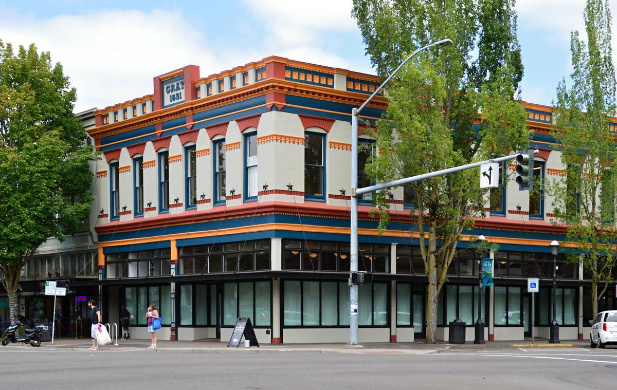
This place surprised me as one of the most underrated destinations in Oregon, located right in the heart of the Willamette Valley about an hour south of Portland. It’s the state capital, but to me it felt more like a hidden gem with a mix of history, culture, and natural beauty.
We drove about 35 minutes north from Albany to Salem, Oregon’s capital.
We stayed at The Grand Hotel in Salem, with direct access to the convention center.
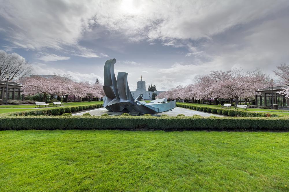
We loved exploring the Oregon State Capitol building and its beautiful grounds. Standing beneath the golden pioneer statue and wandering through the surrounding gardens felt both interesting and inspiring—it was such a cool way to connect with Oregon’s story.
One of my favorite spots was Riverfront Park, where we walked along the Willamette River and enjoyed the giant carousel, which was joyful and perfect for both families and couples. It felt like an exceptional space that really brought the community together.
We also discovered Salem’s wine scene—just minutes outside the city, vineyards offered spectacular views and some of the best Pinot Noir tastings I’ve ever had. Sipping wine with rolling hills in the background was pure magic.
- Location: Western Oregon in the Willamette Valley, along the Willamette River, south of Portland and north of Albany
- Map & Directions
What I loved best:
The Willamette Heritage Center was a standout, where I found unusual exhibits and historic mill buildings that gave me a glimpse into the region’s past. It was an affordable and fascinating stop that I hadn’t expected to enjoy as much as I did.
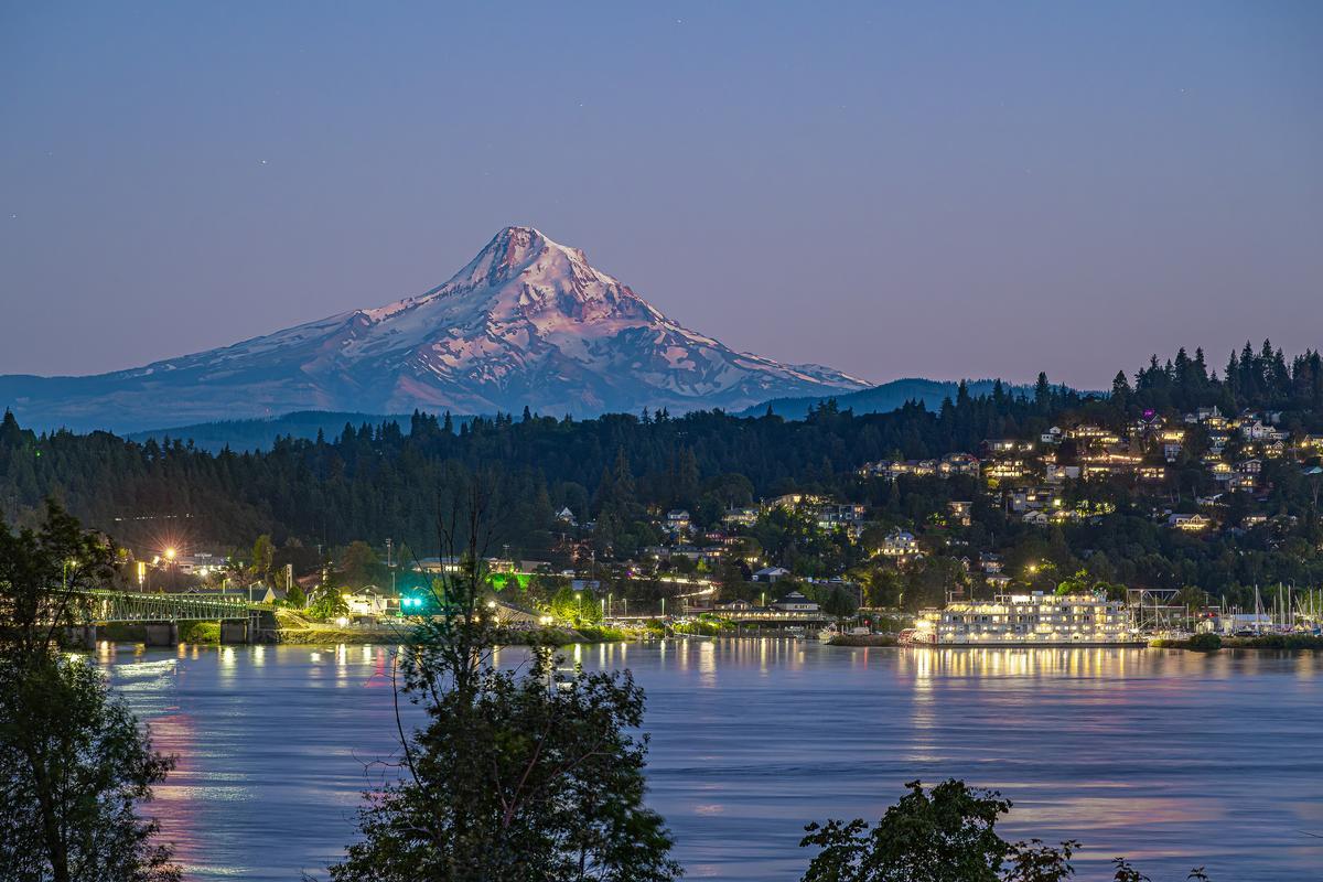
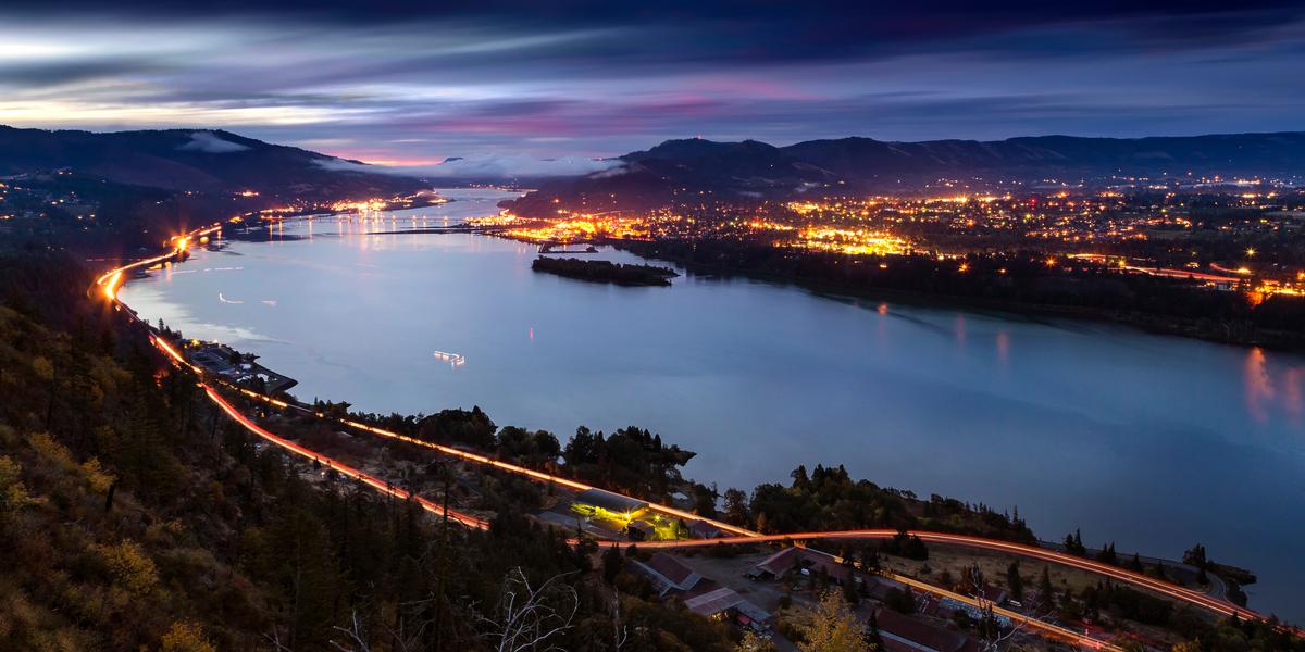
8. Hood River - 1 hour and 15 minutes from Portland
Perched along the Columbia River like a breezy outpost between mountains and water, this is one of the most breathtaking small towns I’ve ever explored in Oregon and I think it’s one of the absolute best destinations near Portland. Why? Hood River offers panoramic gorge views, vineyard-dotted hillsides, and a relaxed, outdoorsy vibe far removed from the city.
We drove just over an hour east from Portland to Hood River, perched on the Columbia River. We stayed at the Hood River Hotel, a 1912 boutique inn with mountain views and a vintage vibe.
We loved wandering through the lively main street, packed with cool boutiques, artisan shops, and some of the best coffee spots and breweries I’ve found in the Pacific Northwest. It felt like a dream to sip a craft beer while watching the sun set behind the Gorge.
One of the absolute best parts for me was watching the windsurfers and kiteboarders out on the Columbia River. Hood River is famous for it, and seeing the colorful sails dancing across the water was both exciting and magical.
I also explored the Fruit Loop, a scenic drive dotted with orchards, wineries, and farm stands. Tasting fresh apples, pears, and local wines with snow-capped Mount Hood towering in the distance felt like a joyful and underrated experience that you just can’t miss.
Hiking near Hood River was another highlight.
- Location: Northern Oregon in the Columbia River Gorge, along the Columbia River, east of Cascade Locks and west of The Dalles
- Map & Directions
What I loved best:
Wahclella Falls and Punchbowl Falls gave me spectacular views and that cool, refreshing spray of Oregon’s famous waterfalls, my personal highlight.
9. Lincoln City
This is easily one of my favorite coastal getaways in Oregon, sitting right along Highway 101 about two hours from Portland. The town stretches for miles along the Pacific, giving me endless opportunities to find the best ocean views and sandy spots to relax.
We drove just over an hour west from Salem to Lincoln City (population ~10,500), stretched along 7 miles of sandy beach. We stayed at the Shearwater Inn, a boutique spot with fireplaces and ocean views.
We loved that Lincoln City had such a vibrant yet laid-back vibe. The beaches felt wide and open, perfect for flying kites, searching for agates, or just enjoying a romantic walk at sunset. On my last trip, I even found one of the hidden glass floats placed along the sand—it felt like uncovering a magical gem.
Another highlight was exploring Siletz Bay, where the calm waters, seals, and birdlife made for an exciting yet peaceful experience. It felt like an unusual and underrated spot compared to the more crowded beach areas, and it was one of my favorite discoveries.
Downtown Lincoln City surprised me with cool antique shops, art galleries, and some of the most affordable seafood restaurants along the coast. We sampled clam chowder, fresh Dungeness crab, and even wood-fired pizza with a view—it was an absolute best foodie moment.
- Location: Central Oregon coast along Highway 101, bordering the Pacific Ocean, north of Depoe Bay and south of Tillamook
- Map & Directions
What I loved best:
One of the most amazing parts of my visit was Devil’s Lake which felt like a hidden treasure tucked just behind the dunes. It’s the perfect spot for a family outing or a relaxing day in nature.
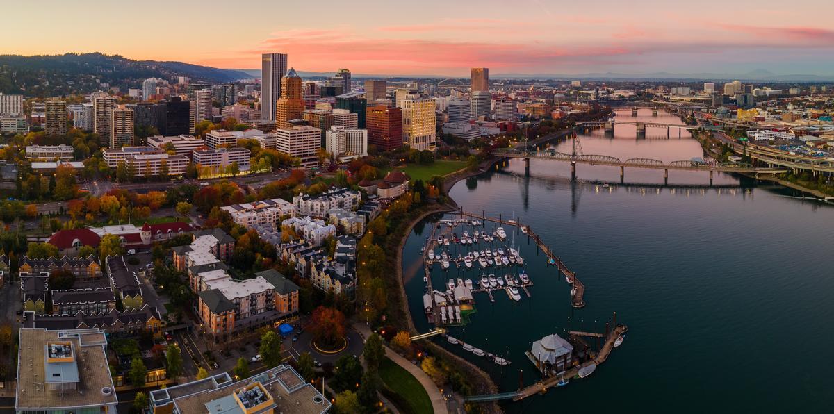
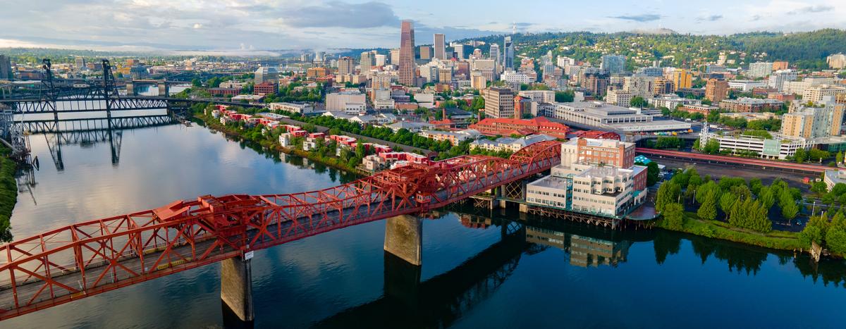
10. Portland
This has always been one of my favorite cities in Oregon, and every time I visit I discover something new that makes me love it even more. Nestled in the Willamette Valley, near the Columbia and Willamette Rivers, it feels both vibrant and laid-back, a perfect balance for an unforgettable getaway.
We flew just over 4 hours from Austin into Portland, Oregon’s largest city. This is where we usually start our road trip.
For a truly unique getaway, check out the 4-star Heathman Hotel in downtown Portland that has retained AAA Four Diamond status for over 30 years so you can trust in a quality stay.
My mornings always started right, with a perfectly pulled espresso from Nossa Familia Coffee, whose rich, sustainable brews captured Portland’s signature blend of craftsmanship and community.
We loved exploring downtown and the Pearl District, where cool boutiques, bookstores, and hidden cafés made every block feel like an adventure. Powell’s City of Books alone was a dream for me—it’s the absolute best bookstore I’ve ever stepped into, with miles of shelves to get lost in.
My favorite part of Portland is the food scene. Don't miss stopping at The Country Cat serving comfort food with Southern roots and local Northwest seafood and made-from-scratch!
We also wandered through the Japanese Garden and the International Rose Test Garden, both of which felt magical. The peaceful landscapes and vibrant flowers made me realize why Portland is nicknamed the “City of Roses.”
- Location: Northwestern Oregon at the confluence of the Willamette and Columbia Rivers, south of Vancouver, Washington, and north of Wilsonville
- Map & Directions
What I loved best:
Dinner at Mother’s Bistro & Bar was my personal highlight - I had their pot roast, slow-cooked to perfection.
11. South Coast Tours & the Wild Calm of the Oregon Shore
If you aren an outdoor lover like me, this is for you! Enjoy guided kayaking, stand-up paddle boarding (SUP), fishing, surfing lessons, river boat tours, mountain biking shuttles, whales & wildlife boat tours, snorkeling, scuba, scenic flatwater paddles, and more. South Coast Tours operates along the southern Oregon coast, roughly from Coos Bay down to the Oregon-California border (Crescent City, CA).
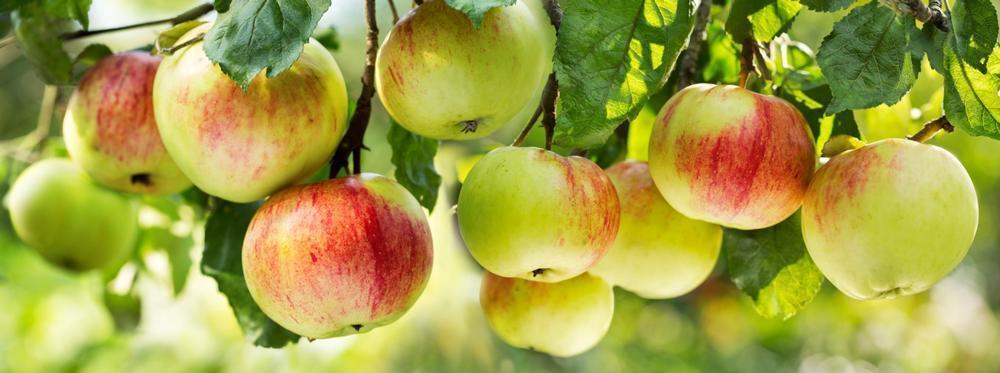
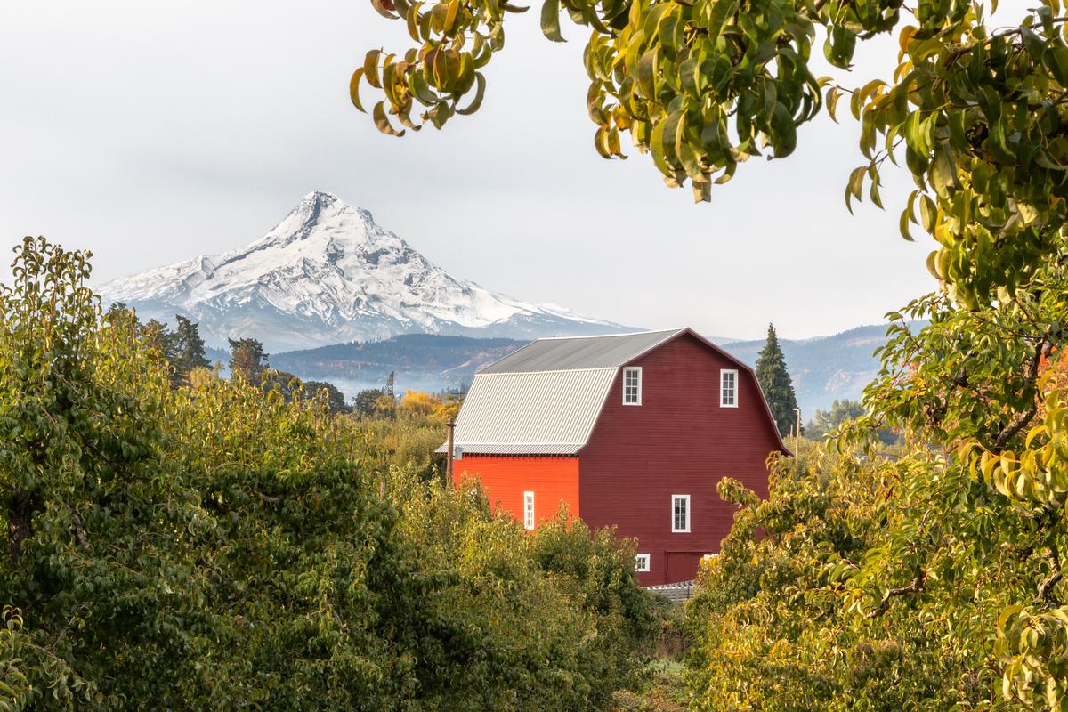
12. Kiyokawa Family Orchards
If you are planning a fall vacation, you'll not want to miss this one. I drove up toward Mount Hood as rows of fruit trees stretched beneath glacier-fed slopes. When I arrived at Kiyokawa Family Orchards in Parkdale, the sun was low, the air cool and sweet with fruit blossoms.
I thought Kiyokawa Family Orchards was deeply charming, a place where the land seems to quietly tell its history, where blossom scents mix with mountain air, and where fruit trees stand like old friends. Set at the base of Mt. Hood, the orchard has a hush about it, punctuated by bees, birds, orchards in bloom, and the busy hum of harvest.
- Location: Northern Oregon in the Hood River Valley near Parkdale, at the base of Mount Hood, south of Hood River and north of Mount Hood National Forest
- Map & Directions
What I loved best:
It’s not remote like an island, but there is a certain “stepping out of daily life” feel when you arrive, my personal highlight.
For me, Kiyokawa Family Orchards is one of the best places to visit in Oregon because it's scenic, family-friendly and unique!

Booking Checklist
1. Book Your Flight - I use Expedia because I like their mobile app with my itinerary. They've helped me re-book flights on many occasions. Once you reach their Gold tier, support is especially good.
2. Book Your Hotel - I use Booking.com or Expedia, depending on my destination.
3. Book Your Rental Car - I use Expedia.
4. Book your tours on Viator or Get Your Guide.
5. If you are planning to visit more than three national parks in the next 12 months, buy the America the Beautiful Pass.
