
Places to Visit in New York State
Searching for a cool place to go in New York State? Well, you are in the right place! Here are my absolute favorite places I discovered while living in New York City for 10 years and I explored on my recent four week road trip. These are all places we keep returning to and I hope you will love them as much as we do.
This is exactly why I decided to share my favourite things in New York so that you can use my guide as an inspiration to plan your own road trip. If you need quick day trips under an hour from NYC, I have you covered!
- Best Places to Visit in the NYC Area
- - Manhattan - Brooklyn
- Best Places to Visit in North Country / Far North
- - Narrowsburg - Watertown - Plattsburgh
- Best Places to Visit in Central & Western NY
- - Vestal - Rochester - Finger Lakes - Cooperstown and Fly Creek Cider Mill
- Best Upstate NY Day Trips
- - Saratoga Springs - Albany
- Best Places to Visit on Long Island
- - Cutchogue - Fire Island - Greenport
Best Places to Visit in the NYC Area
For me, this region delivers the best of both worlds—iconic cultural attractions, diverse food scenes, and neighborhoods full of character, paired with easy access to nature, history, and charming day trips along the Hudson and Long Island.

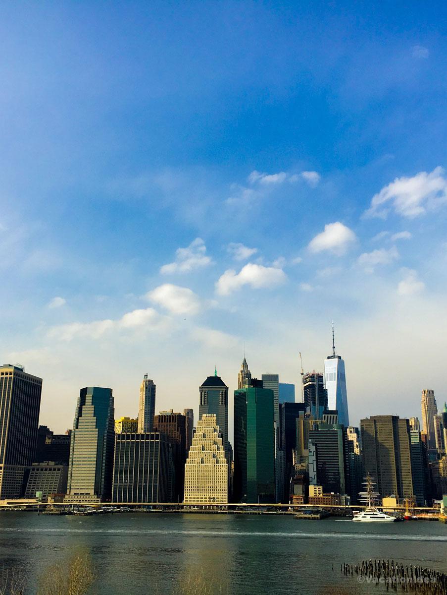
Things to do in Manhattan, NYC
This place needs no introduction because after all, it's an exceptional mix of culture, food, art, and energy, where every block feels alive. Chris and I lived in Manhattan for 10 years and on my visit last month we revisited our favorite spots with our teenage son. Since there is so much to take in, I recommend joining a guided tour with a local guide on your first visit.
Over five unforgettable days, we wandered the High Line’s urban gardens, browsed Chelsea Market’s gourmet stalls, and recharged with an espresso at Kobrick Coffee in the West Village, a century-old roaster that feels like stepping into old New York. For first-time visitors, I always recommend pairing the High Line + Chelsea Market as a three-hour morning combo, and even if you’re not much of a walker, you can just head straight for the food! I have to warn you, though, that parking can be a challenge!
Taking the ferry out to The Honorable William Wall, the floating clubhouse of the Manhattan Yacht Club near Ellis Island, felt like one of the coolest escapes I’ve ever had in the city—half the fun was just getting there. Another favorite water adventure is hopping on a New York Media Boat speedboat tour from Pier 25 in Tribeca, one of the most thrilling ways to see Manhattan’s skyline up close.
Even as a local, I love rediscovering the city’s classics and when I booked a Circle Line Cruise around Manhattan in June, it felt like seeing New York from an entirely new perspective. Of course, no visit to Manhattan is complete without Central Park, my go-to spot for outdoor fun, and after wandering its winding paths, Marea on Central Park South on Central Park South is a must for a refined seafood meal, or for something casual, grab lunch at Whole Foods in The Shops at Columbus Circle on the park’s southwest corner.
Evenings in Manhattan are pure magic, whether catching a Broadway show or soaking in the neon spectacle of Times Square, I always make time for Birdland Jazz Club on West 44th Street, one of the city’s most iconic jazz venues where dinner and live music meet perfectly. For something a bit more romantic, Elsie Rooftop above Midtown makes for an effortlessly fashionable date spot...just remember to reserve your table, especially on weekends (we made this mistake once)!
Afterwards, if you are in the mood for a bit of shopping and want something unique to take home with you, Creel and Gow on East 70th Street is the place to pick up one-of-a-kind treasures and gifts, and when I’m in the mood to “eat my way” through the city, Ahoy New York Food Tours captures everything I love about Manhattan—its flavor, its history, and its infectious energy.
Just north of Manhattan (separated from Manhattan by the Harlem River) Bronx Historical Tours offer a fascinating glimpse into local heritage.
What I loved best:
Celebrating OktoberFest NYC on the waterfront was super fun...okay, maybe it was a bit of a tourist trap (there were plenty of locals too!), but they’re nailing the vibe they are after. Hosted at places like Pier 15 in the Seaport District, OktoberFest NYC brings in the festive spirit of a traditional Bavarian beer garden right in the heart of the city.
Things to Do in Brooklyn
Ready for a history-rich city experience? Brooklyn is a real standout. For me, no visit to NYC is complete without a stop my sister-in-law lives. There are heaps of amazing things to do here! Brooklyn is the ultimate creative escape and one of the most unexpectedly soulful places you can explore just across the bridge from Manhattan.
For something totally unique and unexpected just across the bridge in Brooklyn, check out Farm.One in Prospect Heights, Brooklyn. You can book a tour at 625 Bergen Street in Brooklyn, New York where you get to taste what they grow, or check out one of their special events.
When I think of Brooklyn, one of my favorite places to spend a sunny day with kids is Luna Park at Coney Island, just a quick subway ride from Manhattan and the moment I step off with my son near Stillwell Avenue, we feel like we’ve walked into a joyful world filled with colorful rides, boardwalk snacks, and ocean breezes that completely win me over.
On weekends, I love heading to the Brooklyn Flea, which is usually set up near DUMBO and sometimes at Atlantic Terminal because the moment I arrive at Brooklyn Flea, I feel like I’ve stepped into a treasure hunt, with rows of vendors selling everything from vintage clothes to handmade crafts.
Over in Williamsburg, Café Mogador on Wythe Avenue became one of my go-to neighborhood spots, with its inviting décor, Moroccan-inspired menu, and easygoing atmosphere just steps from the waterfront.
And near Brooklyn Heights, stepping into the Brooklyn Historical Society (now part of the Center for Brooklyn History) felt like uncovering a hidden gem because its stately wood-paneled library and exhibits make it a place you’ll want to linger in for hours.
Creative energy thrives everywhere here with FAD Market in Brooklyn makes you feel like you’ve stepped into one of the coolest creative hubs in the city, usually popping up in places like Boerum Hill or Downtown Brooklyn - the market brings together an inspiring mix of fashion, art, and design from local makers.
Tucked in Carroll Gardens, Emma's Torch is another special find, a true hidden gem that doubles as a training ground for refugees building new lives through culinary careers and when we sat down in the warm, welcoming space, I loved knowing that every dish we enjoyed wasn’t only delicious but also part of a bigger mission that supports the community.
Afterwards, BRIC Arts Media in Downtown Brooklyn easily felt like one of the coolest creative spaces in the borough...located right by the Brooklyn Cultural District, it’s a hub where art, music, and storytelling all come together under one roof.
Moored under the Brooklyn Bridge at Fulton Ferry Landing, Bargemusic (a floating chamber music venue) offered not just world-class performances but also unforgettable views of the Manhattan skyline shimmering across the East River.
Pizza Loves Emily in Brooklyn is cozy, lively, and like a perfect slice of New York itself — casual but unforgettable and I stumbled upon some great dining deals here after the holidays, when the city feels a bit calmer but just as full of flavor.
Check out 1 Hotel Brooklyn Bridge where I stayed for two days on one of my trips back visiting family, which won the AAA Four Diamond award so you can trust that it's a quality place.
What I loved best:
Last but not least, attending the Brooklyn Film Festival in early summer was one of my most exciting cultural experiences in the borough.
Best Places to Visit in North Country / Far North
I head here when I'm in the mood for hiking, swimming, and farm-to-table flavors.
Narrowsburg - 2 hours 20 minutes from NYC
Perched above a dramatic bend in the Upper Delaware River, this tiny hamlet feels like one of the most unspoiled corners of New York I’ve visited. I think it’s one of the best small-town getaways within a few hours of the city (near the Pennsylvania border!), right at the foothills of the Catskill Mountains.
First thing we did was stop by Main Street, which is small but vibrant, full of interesting little shops, art galleries, and cafés that instantly made this place feel like an underrated but absolute best kind of town. We had coffee and snacks at 2 Queens Coffee.
Walking along the river was our next experience, and it honestly felt like magic seeing the water sparkle with the Catskill Mountains all around, one of the most peaceful and joyful moments of the whole weekend.
Later we explored the Narrowsburg Union, which is such a cool and unusual space with food, art, and community vibes that felt authentic and very local.
In the afternoon, we drove a short distance to check out nearby hiking trails in the Upper Delaware Scenic Byway area, which felt spectacular and wildly underrated.
Dinner came next and we found The Heron Restaurant with seasonal farm-to-table food and water views. To us, it felt romantic without trying too hard, perfect for couples.
As the sun went down, we walked back toward the river and the quiet was amazing, like the whole town slowed down just for us.
The next morning we explored more hidden corners and scenic overlooks, and every stop felt unique and special, like something you’d only see in my photos.
What I loved best:
I loved exploring the Delaware River (I even spotted a few bald eagles, my favorite highlight!)
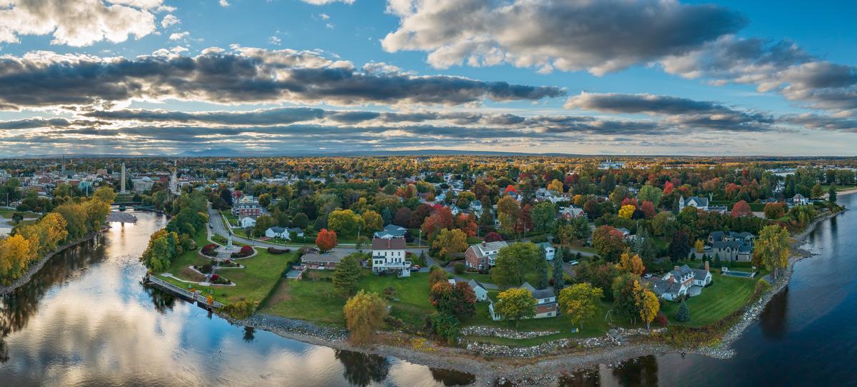
Watertown
This town feels like an amazing underrated gem tucked in the North Country near Lake Ontario and the Thousand Islands.
I loved how Watertown is located just 30 minutes from the Canadian border and only a short drive from the St. Lawrence River.
From the moment I arrived, I found the downtown area vibrant yet relaxed, with historic architecture, local shops, and interesting restaurants that gave us one of our most joyful small-town travel experiences.
I was surprised by the amount of nature surrounding the city, with spectacular waterfalls, scenic parks, and outdoor adventures that felt hidden yet incredibly accessible.
We spent time exploring nearby Thompson Park, which offered sweeping views of the city and Lake Ontario and felt like an absolute best spot for photos and sunsets.
I think Watertown’s proximity to the Thousand Islands region makes it even more exciting, since you can easily add boat tours and island hopping to your dream itinerary.
We also enjoyed how the city balances military history from nearby Fort Drum (you need a proper ID to visit) with a welcoming atmosphere that felt authentic.
What I loved best:
One of my favorite parts was how affordable everything felt, from dining to attractions, which made this destination feel like a brilliant idea for families or couples.
Plattsburgh, NY
We love the outdoors, and I think the farther north you go in New York State, the more spectacular the scenery becomes. One northern gem that often flies under the radar is Plattsburgh, NY. Sitting on the western shore of Lake Champlain and at the gateway to the Adirondack Mountains, Plattsburgh is perfect for travelers craving fresh air, water views, and easy access to nature. Grab your hiking shoes and comfortable clothing because this is an upstate adventure worth taking.
About five hours north of Manhattan, Plattsburgh to me feels worlds away from the city. I instantly thought our journey was worth it! We spent two fun days exploring the Plattsburgh City Beach (one of the largest freshwater beaches in the U.S.), checking out the War of 1812 Museum (free, and strolling through downtown shops.
We loved the lakefront with its beaches, marinas, and peaceful walking paths with views across the water to Vermont’s Green Mountains. In warmer months, kayaking, sailing, and swimming are popular, while in the fall we found absolutely stunning foliage and crisp air. Winter doesn’t slow things down either, with snowshoeing, cross-country skiing, and nearby downhill ski areas.
If you are nature lovers like us, you will find no shortage of places to explore. Just outside the city, Point Au Roche State Park features wooded trails, quiet picnic spots, and excellent lake views, while the dramatic Ausable Chasm (often called the “Grand Canyon of the Adirondacks”!) offers hiking, rafting, and jaw-dropping scenery carved by ancient waters. And since Plattsburgh sits right at the edge of the Adirondacks, countless hikes for all ability levels are within an easy drive.
If you’re looking for something less strenuous, downtown Plattsburgh is compact and walkable, with local cafés, breweries, and historic sites tied to the War of 1812. You can enjoy the outdoors without committing to long or difficult hikes, making it a great destination for families and casual explorers alike.
Plattsburgh is easily reached by car via I-87 (the Adirondack Northway), a scenic drive with no tolls north of Albany so it makes a scenic day trip from Albany. Just be sure to plan fuel and food stops ahead of time, as stretches of the drive are remote. Parking around the waterfront and parks is generally affordable or free, depending on the area and season—another win for budget-friendly travelers.
What I loved best:
My personal highlight were the peaceful lakeside trails at Point au Roche State Park (free).
Best Places to Visit in Central & Western NY
Known for rolling farmland, deep glacial lakes, and revitalized downtowns, we love the way this region blends outdoor adventure with history, arts, and a strong food and wine culture.
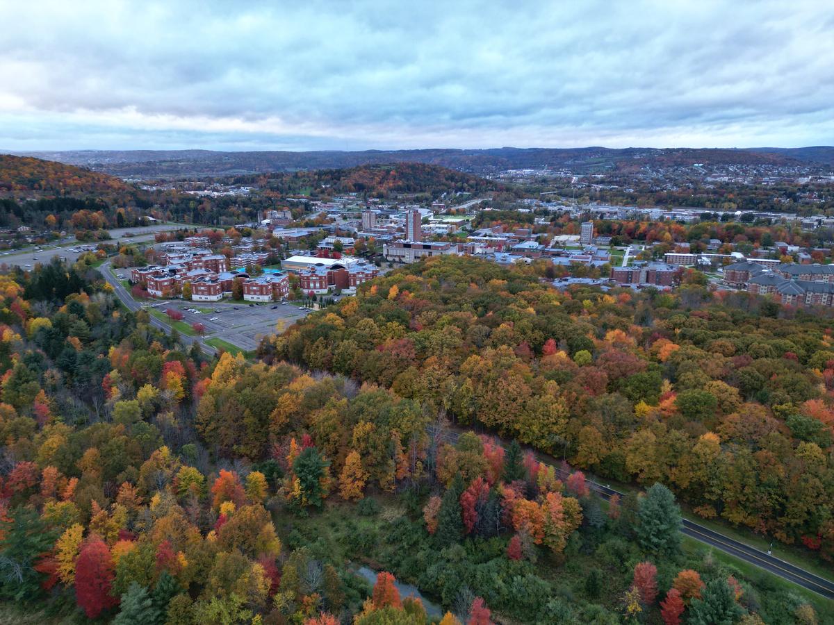
Vestal, NY
We really enjoyed our time here, and it pleasantly surprised me with how much it offers in a low-key, relaxed way.
Set along the Susquehanna River in the Southern Tier, Vestal feels like a town where nature, college-town energy, and everyday local life blend together effortlessly. It’s one of those places that doesn’t try to impress you—but ends up doing exactly that.
I drove about 4 hours northwest from New York City to reach Vestal. If you don’t want to drive, you can take a bus to nearby Binghamton and then a short rideshare into town, which makes the trip fairly straightforward.
We started the day with a walk along the Vestal Rail Trail, which follows the river and immediately sets a calm, scenic tone. The path is peaceful and well-maintained, and watching the water flow by with tree-lined views felt like an easy way to slow down and settle into the area.
Afterward, we stopped for breakfast at CAFFÈ del CORSO, a local favorite known for its creative comfort food and welcoming vibe. The portions were generous, the coffee was excellent, and the mix of students and locals gave me a strong sense of Vestal’s community feel.
Spending time near the Susquehanna River (between the Rail Trail and nearby parks!) was easily the highlight. The combination of water views, open green space, and gentle hills made it feel restorative without needing a full hike. It’s not dramatic in the way mountains are, but it has a quiet beauty that stays with you, especially if you’re craving a peaceful reset.
We spent two stress-free days at Residence Inn by Marriott (from $125/night).
What I loved best:
Enjoying a casual bite at The Vestal Bakery was my personal highlight where the selection of treats was irresistible!
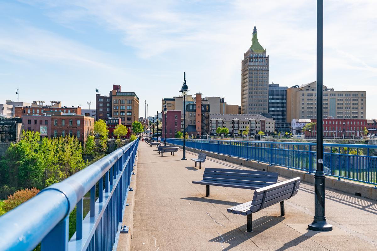
Things to Do in Rochester
For me, this city feels like one of the most underrated and unspoiled gems in New York State. Honestly I think it’s one of the best places to experience a mix of nature and culture.
My first visit was decades ago when I visited the University of Rochester while going to college nearby.
I learned that this city of roughly 210,000 is known as the birthplace of Eastman Kodak, Xerox, and Bausch & Lomb.
So what did we see on our 48 hour weekend getaway? Personally, I loved exploring the Strong National Museum of Play with my son, where hours passed in a blink and I was happy my kid learned a lot. If you’re into art, the Memorial Art Gallery is the coolest, with collections spanning centuries. For something outdoorsy, the Rochester's Highland Park and Durand Eastman Park have gardens and lake views (yes, they are lovely even in the winter but be sure to bundle up!).
We stayed at 3-star Hampton Inn & Suites Rochester (from $181/night) for two days.
What I loved best:
In summer, I think the Rochester Lilac Festival is one of the coolest events here!
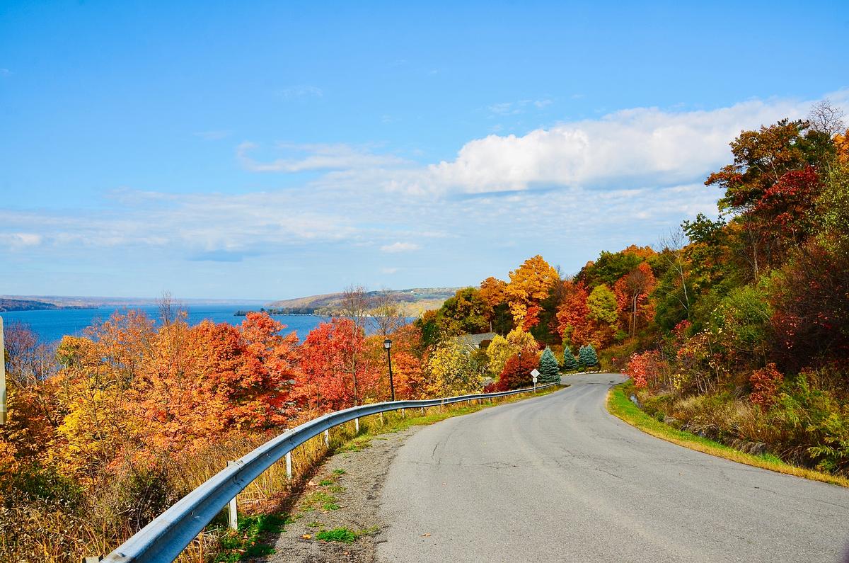
Finger Lakes
Tucked between rolling hills and a shimmering lake, this area is one of my favorites when I want a mix of wineries, farm-to-table food, and outdoor adventure on my road trip. In addition, I think these lakes are absolutely breathtaking with their deep, blue water, vineyards, and romantic sunsets over the water.
A friend told me about Sonnenberg Gardens & Mansion State Historic Park ($16 Adult admission, open from May 1st to October 31st) and it truly was the ultimate hidden gem in the Finger Lakes region when I visited this August.
To get here, I took a scenic 40-minute drive south from Rochester to Canandaigua, and I spent the afternoon browsing local boutiques on Main Street, walking along the pier on Canandaigua Lake, and then staying two wonderful nights at the 4-star Belhurst Castle (from $195/night), a lovely New York wine county hotel overlooking Seneca Lake.
What I loved best:
Dinner at Stonecat Café was my personal highlight: the pan-seared duck ($34) with local vegetables was unforgettable, paired with a crisp glass of Finger Lakes white.
A downside? Belhurst Castle is such a romantic, magical place, but I found that accommodations and winery tastings were a little pricier than in smaller upstate towns.

Cooperstown and Fly Creek Cider Mill
Just an hour and 30 minutes from Albany, I found one of the most perfect day trips from New York. This is a pretty hamlet that captures the essence of rural charm and autumn nostalgia.
A short scenic drive from Cooperstown brought me into the heart of Fly Creek, where the sound of rushing water from Fly Creek itself mingled with the scent of fresh apples and warm cider doughnuts. The undisputed highlight here is the Fly Creek Cider Mill & Orchard, a beloved family-run landmark that has been pressing cider for over 160 years, and I spent a delightful afternoon exploring the cider mill sampling sweet and hard ciders, and browsing the country store packed with local jams, cheeses, and baked goods.
Nearby Cooperstown, NY offers attractions like the National Baseball Hall of Fame and Museum, outdoor activities at Otsego Lake and Glimmerglass State Park, and cultural sites such as the Fenimore Art Museum and Hyde Hall.
What I loved best:
Watching the traditional cider-making process was my personal highlight!
Best Upstate NY Day Trips
Centered around the Hudson River and the state capital, this area is rich in architecture, culture, and easy access to nature.
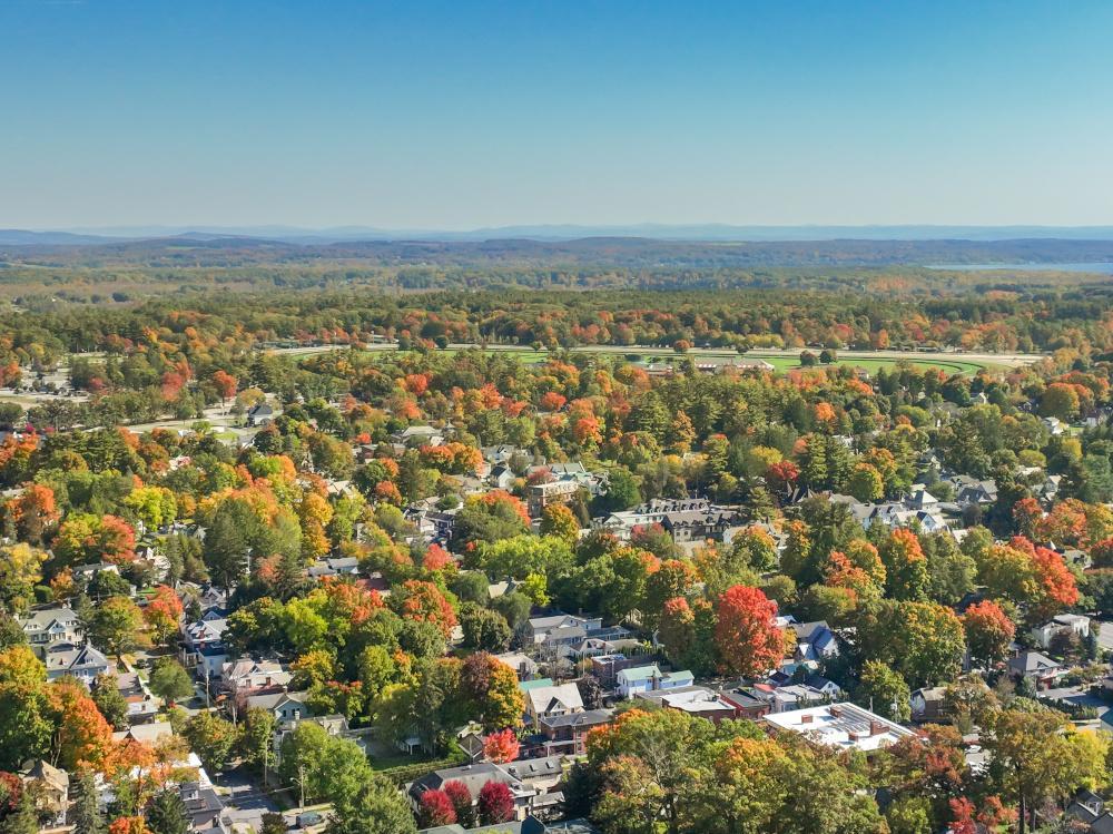
Saratoga Springs
This was my ultimate summer retreat and one of my favorite vacation ideas over a long summer weekend with my husband when I moved to New York City. Why? For me, the town has great energy, from the opening weeks of the world-famous Saratoga Race Course season to lively outdoor concerts in Saratoga Spa State Park ($10 per car).
Located in upstate New York, not far from Albany and surrounded by rolling countryside, this vibrant town has a magic that feels both historic and exciting at the same time.
We drove 3 hours 30 minutes from our apartment in NYC and spent three indulgent days soaking in mineral springs at the historic Roosevelt Baths & Spa ($65 for 40 minutes), strolling along Broadway’s boutique-lined streets, hiking on peaceful trails around Geyser Creek, and eating great hearty American fare at Olde Bryan Inn .
I thought that the Saratoga Farmers’ Market is not to be missed here because one of those places that instantly makes you feel connected to the community, in addition to offering amazing seasonal events and cheap eats!
In addition, my evenings in Saratoga were filled with culture, thanks to performances by the New York City Ballet and the Philadelphia Orchestra at the iconic Saratoga Performing Arts Center.
What I loved best:
For dinner, my highlight was
We checked into the elegant 4-star Adelphi Hotel (around $464/night, Michelin Key award winner).
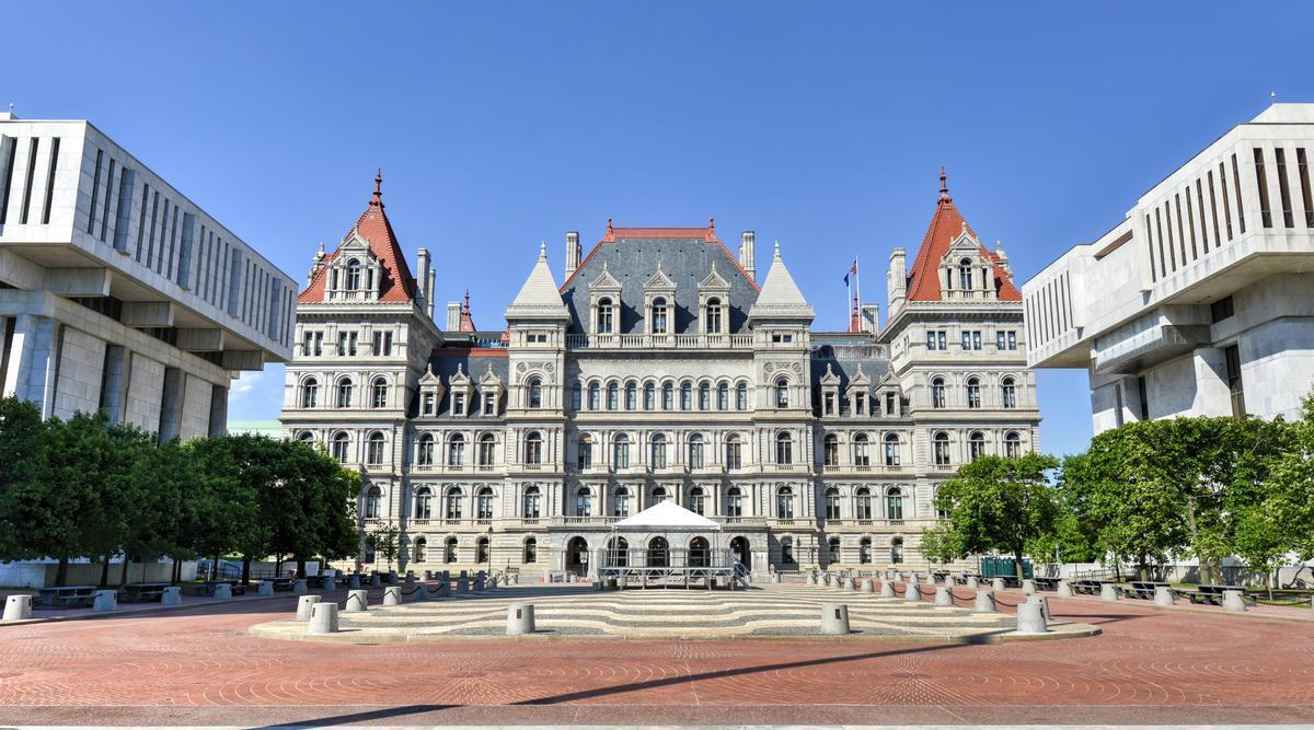
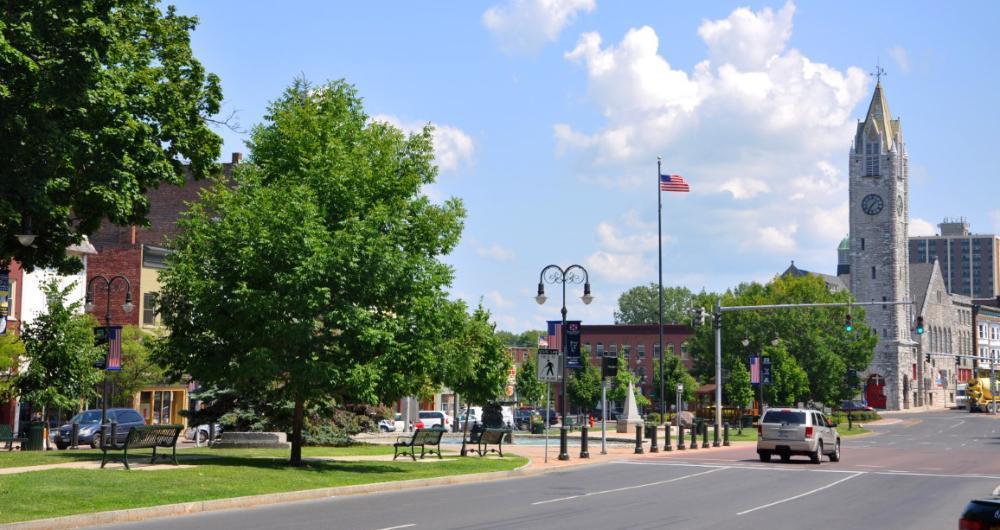
Things to Do in Albany
This is one of the most underrated cities I’ve explored in upstate New York, and I genuinely think it’s one of the best low-key getaways in the Capital Region, a perfect road trip stop.
We started by strolling through downtown and around the Empire State Plaza. There, we admired the mix of historic brownstones and bold modern architecture, enjoying how walkable and relaxed everything felt.
My favorite stop was a cozy café along Lark Street, where we shared flaky pastries and warm lattes—it felt like the perfect, unhurried way to start the day together.
We ducked into independent bookstores and vintage shops nearby, laughing as we discovered quirky finds and old records that sparked nostalgic conversations.
A short drive brought us to Washington Park, where tree-lined paths and open lawns gave us a peaceful place to wander side by side and soak in the fresh air.
Later in the afternoon, we ventured just outside the city to a small winery in the surrounding countryside, lingering over a tasting flight and a simple cheese board while dreaming up future trips.
I loved how Albany balanced culture and calm—it felt welcoming and quietly charming, never overcrowded, like a destination still flying under the radar.
We also made time for a local farmers’ market, where fresh bread, seasonal produce, and handmade treats gave us a real sense of the community and a few snacks to enjoy later.
If you are in the mood for hearty NY-style pizza or classic Italian comfort food lunch or dinner (who isn't?!), we love Paesan’s Pizza & Restaurant.
After a 2 hours and 30 minute drive from NYC, we stayed at the 3-star Hampton Inn & Suites Albany-Downtown for two nights, which turned out to be a perfect base for exploring the area.
Cutchogue on the North Fork of Long Island
Ready for a history-rich, wine-country getaway? I think Cutchogue on the North Fork of Long Island is one of the best hidden gems in New York State and I highly recommend it as a stop on your NY road trip. Every time we visit it feels like discovering a secret slice of coastal magic just east of Riverhead and west of Southold.
From our last stop in Greenport, NY, it was less than 20 minutes to reach Cutchogue, a hamlet of around 3,300 people.
We began the day wandering through the countryside, passing rows of grapevines and historic farmhouses that made the drive itself feel like part of the experience.
One of my favorite stops was a local winery, where we sat outside with a glass of North Fork wine, letting the breeze roll in from the Sound while we talked and lingered longer than planned.
I loved how unhurried everything felt—no crowds, no rush—just peaceful roads, open skies, and the sense that we had discovered a place meant to be enjoyed slowly.
Cutchogue’s agricultural roots added so much character, from farm stands filled with seasonal produce to the quiet history of the area that made the town feel grounded and authentic.
We stopped for a relaxed meal nearby, sharing fresh, local dishes that somehow tasted better knowing they came from just down the road.
As the afternoon softened into evening, the light over the vineyards turned golden, casting a calm, intimate glow over everything around us.
What I loved best:
We loved visiting Suhru & Lieb Vineyards - they have a lovely tasting room, surrounded by 54 acres of vines, including a furnished front patio.
For me, Cutchogue is one of the best places to visit in New York State because it's peaceful, scenic, and hope you will love it too!
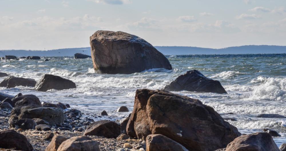
For me, the beaches nearby were a highlight as I walked along the calm shores of Peconic Bay and felt like I had the coast to myself, so peaceful, so romantic, and yet perfect for a family picnic too.

Fire Island, NY
This feels like one of the absolute best hidden gems in New York State.
We started in the morning, hopping on the ferry near Bay Shore on Long Island and already feeling that exciting magic like we were heading somewhere special.
Fire Island sits just off the southern shore of Long Island near New York City, but once we arrived it felt like a hidden gem far away from the chaos.
First thing we did was walk along the boardwalks, which was such a cool and unique experience since there are no cars and everything felt peaceful and joyful.
We grabbed breakfast at a small café and honestly it was one of the best simple meals ever, affordable and relaxed with ocean air all around us.
After that we headed straight to the beach, and wow, the wide sandy shoreline felt spectacular and kind of underrated compared to other NY beaches.
Spending hours swimming and laying in the sun was my favorite part, the vibe was romantic but also perfect for family trips too.
Later in the afternoon we explored the colorful beach houses and cute neighborhoods, which was an interesting and unusual sight you can see in my photos.
Fire Island felt vibrant without being overwhelming, and that balance made the whole experience feel like a dream.
As the sun started going down we found a spot near the dunes and watched the sky change colors, which was honestly the absolute best moment.
Dinner came next and we chose a casual waterfront restaurant, Matthew’s Seafood House, and it turned out to be a brilliant idea with amazing seafood.
Walking back at night under the stars felt safe and magical, and we kept saying how this place is one of the coolest NY destinations.
Fire Island is truly one of the best places to visit in New York State if you want an exciting yet chill escape.
We left the next morning already planning our return, because this hidden, special gem near NYC gave us one unforgettable experience.
What I loved best:
Dinner at Matthew’s Seafood House was a standout, with just-caught fish and a casual harbor view that felt quintessentially coastal. In addition, ending the day watching pastel sunsets over the Great South Bay was my personal highlight.
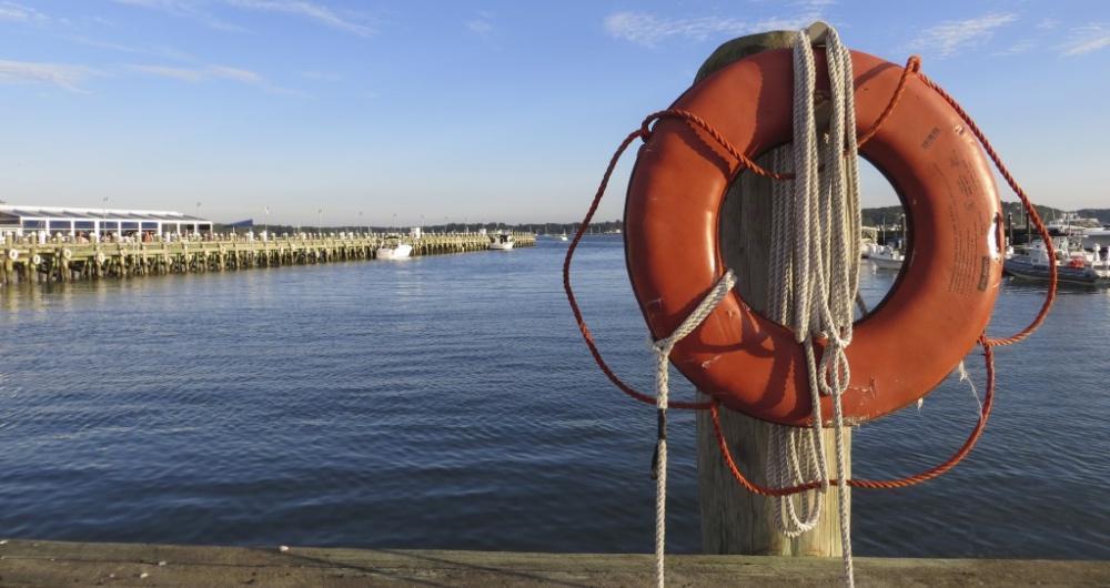
Greenport, NY
Ready for a history-rich harbor town? Greenport is a real standout. This is a coastal village on the North Fork of Long Island, about 2 hours from my apartment in NYC.
First thing we did was grab coffee at Aldo's Coffee Company, which felt vibrant, cozy, and like a hidden gem.
Walking down Main Street was the best experience, with colorful shops, docks, and locals waving hello.
We wandered the harbor next, watching boats glide by, and honestly it felt like a small seaside dream.
The waterfront is one of the most amazing underrated spots in New York State, especially for photos.
After that, we hopped on the Shelter Island ferry, which was a cool and unusual little adventure.
Being on the water made the whole trip feel exciting and joyful, like a classic summer escape.
Back in Greenport, lunch by the marina turned into my favorite meal of the weekend.
The seafood was fresh, simple, and absolutely the best kind of casual coastal food.
Later we explored nearby beaches, which are quiet and spectacular, perfect for a family trip.
As evening came, we strolled around the village again, popping into bars with live music and charm.
Dinner was waterfront again because honestly the views were too good to skip. In fact, sunset in Greenport is pure magic, with pink skies reflecting off the harbor.
We stayed three blissful nights in a Partial Harbor View Balcony King room at the waterfront Harbor Front Inn (around $206/night).
What I loved best:
For me, Greenport, NY is one of the best places to visit in New York.
Dinner at Claudio’s was unforgettable — the lobster roll ($38) was overflowing and perfectly seasoned, and eating it just steps from the dock made the experience quintessentially Greenport.
