
11 Places to Visit in New Hampshire
Ready to get away to New Hampshire and looking for where to visit? You've come to the right page. While living on the East Coast for 10 years, I thought that New Hampshire was the most underrated state we explored.
From my many trips exploring the Granite State and our most recent four week road trip I explored, I can’t wait to share my favorite finds, and I hope you will love them too.
- - #1. Manchester
- Best Places to Visit in New Hampshire's Lakes Region
- - #2. Squam Lake Inn - #3. Laconia
- Best Day Trips in the Monadnock Region / Southwest NH
- #4. Keene - #5. Chesterfield Inn
- Where to go on the coast of New Hampshire
- #6. Odiorne Point State Park - #7. Portsmouth
- Upper Valley / Dartmouth–Lake Sunapee
- - #8. Hanover - #9. Claremont
- Best Places to Visit in New Hampshire's White Mountains
- - #10. Lincoln - #11. North Conway
Best Places to Visit in New Hampshire - Merrimack Valley / South-Central NH
I think this is one of the state’s most convenient and well-rounded places to explore.
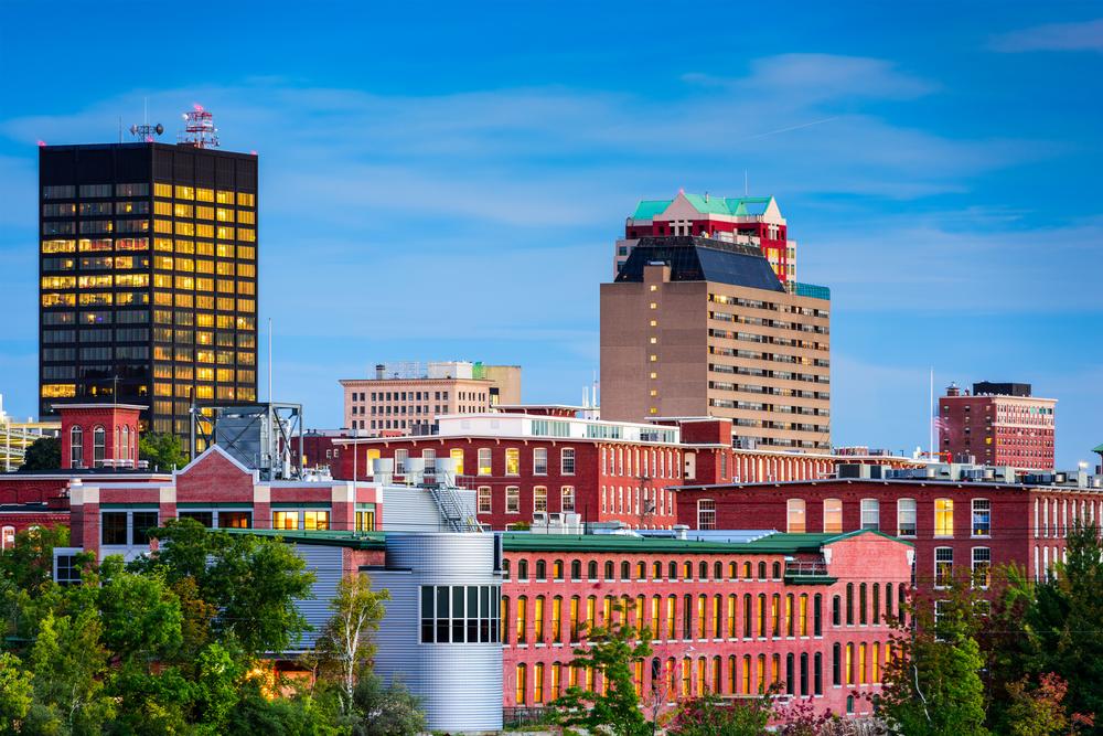
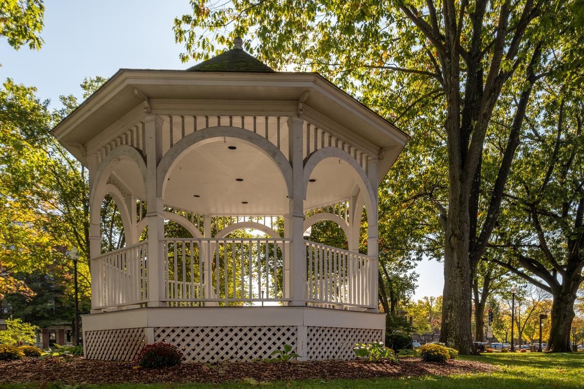
Manchester, NH
This place totally charmed me! Not only is this city of just under 120,000 people super easy to reach from Boston in less than an hour, it also makes a very relaxing weekend getaway.
Manchester used to be a factory town and you can still see its factory roots when you walk around town. After you park, just sit at one of the cafes and absorb the atmosphere. I was instantly pulled into a slower rythm that Manchester became one of my favorite New Hampshire places.
On my first trip, I came for the 550 Art Center which opened just over a decade ago while we were living in New York City. I recommend stopping here because inside the 550 Art Center, you can see art canvases the size of walls!
Over a decade later, Manchester has grown by about 10,000 people but the city is still laid-back compared to Boston. In addition to 550 Art Center, art lovers can visit Currier Museum of Art to see more European and American art.
In the afternoon, enjoy some down time next to Lake Massabesic. I have to warn you that swimming is not allowed because the lake provides drinking water for Manchester. Nevertheless, scenery is absolutely worth your time here, plus there are 10 miles of walking trails to explore!
Need a couple of ideas for kids? You can catch a New Hampshire Fisher Cats baseball game, or head to the SEE Science Center which our son loved.
Finally, Palace Theatre is a nice option for a romantic date night on vacation. In my experience, there's always something good on.
What I loved best:
There are heaps of good food options, but the roasted turkey cranberry sandwich for lunch at The Bridge Cafe on Elm was my favorite highlight.
Best Places to Visit in New Hampshire's Lakes Region
This is a classic New England region where you'll find some of the most lovable small-towns.
Squam Lake and Squam Lake Inn
This incredible place was such a treat! Squam Lake was one of my favorite New Hampshire getaways that Chris and I discovered that I'm happy to share with you.
For me, there's nothing better than a super comfortable place to return to at the end of the day while exploring, especially as the weather gets cooler. I felt like you are really inspired to savor the simple things in life at this romantic inn.
You'll find Squam Lake Inn in Holderness (about two hours from Boston). The village itself is small with around 2,000 people. The best part of the village is Squam Lake. It's so beautiful and in fact, you might have seen it in the 1981 movie On Golden Pond.
Dinner at the inn’s own Kitchen + Bar was a highlight of our stay. The farm-to-table menu changes creatively with the seasons so you'll be able to taste something new every time you stay.
I loved having things to do nearby. We visited the Squam Lakes Natural Science Center, strolled around the historic village green, and had a great burger at Walter's Basin. You'll also be surrounded by the White Mountains.
Laconia
I was wowed by this town of approximately 17,000 people. Did you enjoy the idea of a lakeside getaway in New Hampshire? In that case, I have to recommend Laconia, nicknamed "The City on the Lakes" for its location right between Lake Winnipesaukee and Lake Winnisquam in the heart of New Hampshire's Lakes Region.
One of my favorite parts of visiting Laconia has been spending time at Weirs Beach. If this is your first trip, I recommend visiting in July when you'll see the Weirs Beach boardwalk it its full glory with retro arcades and ice cream shops.
My second favorite time to visit is during the annual Motorcycle Week in June. Even if you are not a biker, it’s exciting to be part of such a legendary tradition.
There's no need to overthink food because there are many good options. I definitely recommend pancakes at Cafe Dejavu to start your day well. It has that New England retro diner vibe which we loved.
Best Day Trips in the Monadnock Region / Southwest NH
This is a quieter, more pastoral side of the state.
Keene - 1 hour and 45 minutes from Boston
This was a truly extraordinary region. With only around 23,000 residents, this town has a lively Main Street and makes a wonderful off-the-beaten-path weekend getaway from Boston.
One of the highlights of our trip was visiting Stonewall Farm. It's a real working farm and you can find all sorts of delicious eats at the farm store. If you are in the area for a while, their kids programs are a fun way for kids to learn about nature.
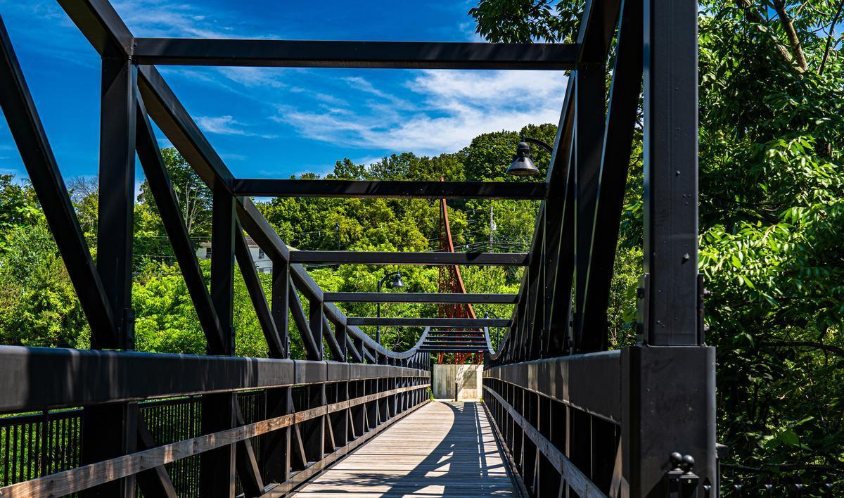
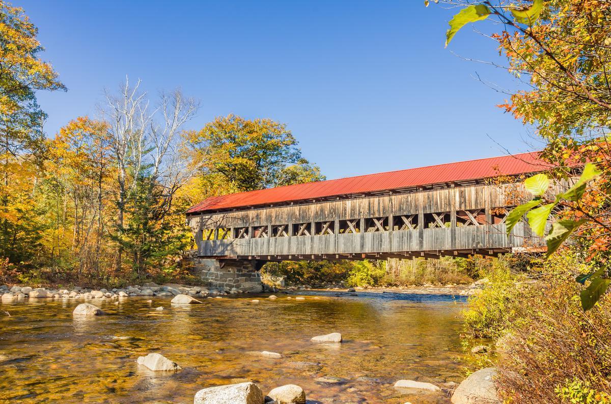
Another enjoyable activity is visiting covered bridges near Keene. You can reach Thompson Bridge in West Swanzey in less than 15 minutes. It was built in 1832 and is red in color which comes out great in photos.
You'll find my second favorite, the historic 1863 Stone Arch Bridge, located along the Cheshire Recreational Rail Trail.
What I loved best:
Stopping by the Wyman Tavern Museum and the Horatio Colony Museum. They are both great for learning about the town’s past.

Chesterfield Inn - 20 minutes from Keene
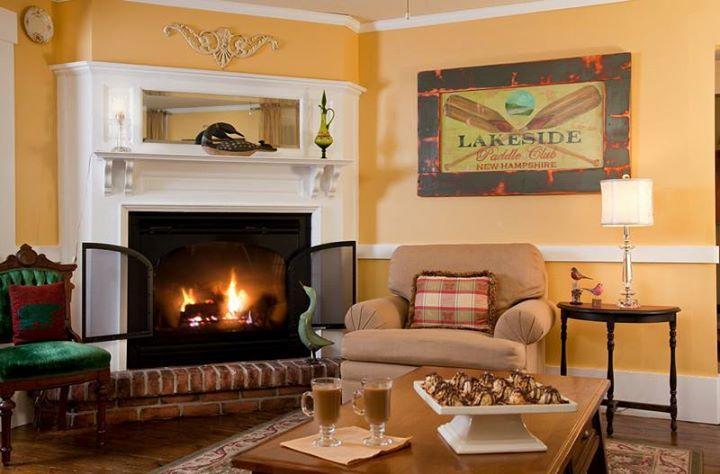
Looking for a unique place to stay near Keene? Check out Chesterfield Inn, one of my favorite romantic weekend getaways in New Hampshire. Just 20 minutes from Keene, our guest room for three days was lovely. I loved how uniquely it was styled. There was a four-poster bed, big windows, a fireplace, a whirlpool tub, and a private balcony.
In addition to getting to know Keene, during our three day stay, we explored the ruins at Madame Sherri’s Forest, and checked out the cliffs of Chesterfield Gorge Natural Area.
Where to go on the coast of New Hampshire
This area may be small in size, but it’s rich in coastal beauty and we had a great time exploring.
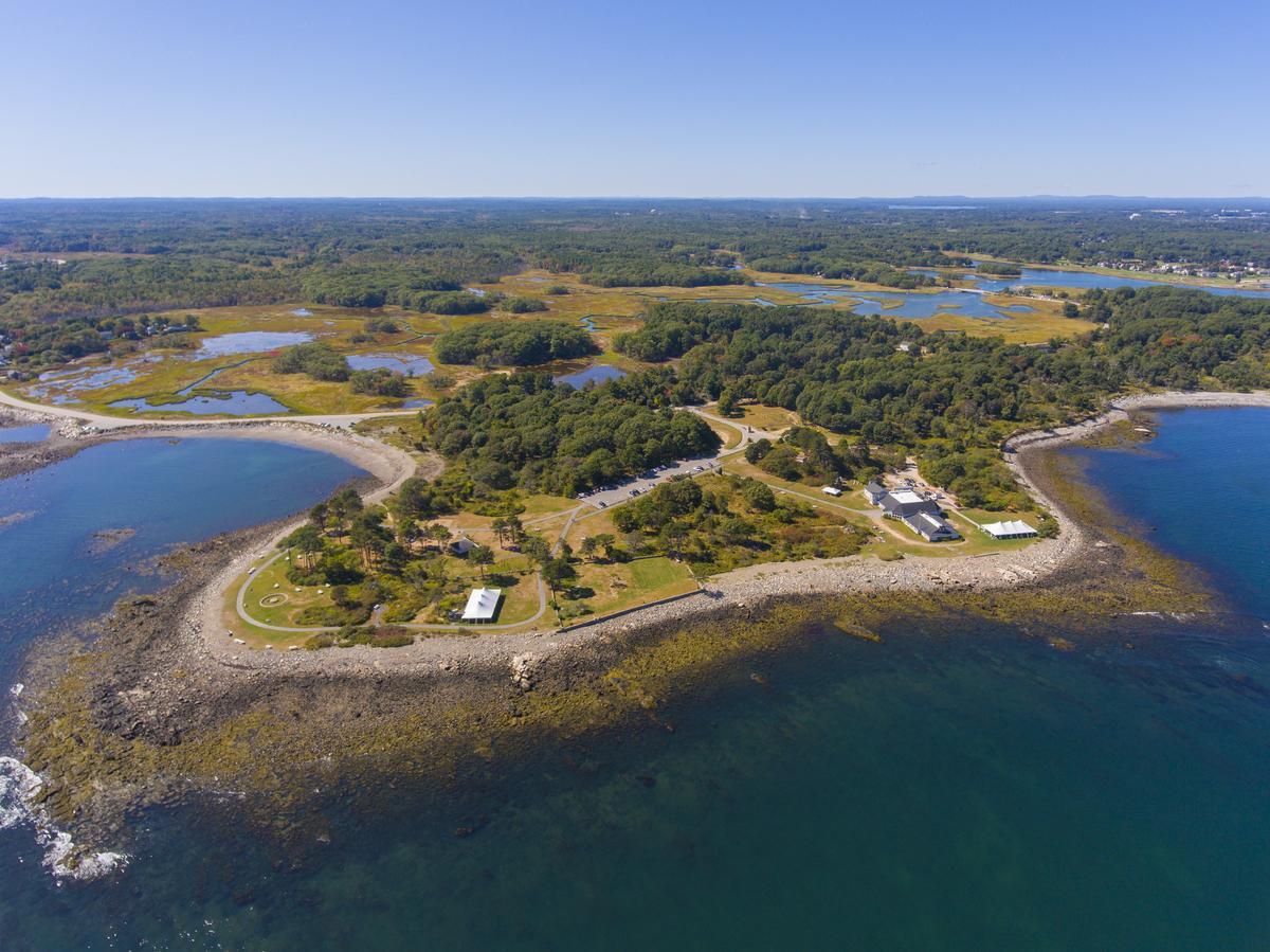
Odiorne Point State Park - 1 hour south of Portland, Maine
Ready for a nature-filled coastal getaway? I was completely wowed by Odiorne Point State Park, especially tidepools with sea stars, crabs, and barnacles.
Just a short 15-minute drive from Portsmouth, is this 330-acre park. It was very relaxing, and historic too. You will see WWII-era bunkers scattered about. The views are simply the best for any ocean lover.
Looking to stay overnight? Camping at Odiorne Point State Park starts at just $29.
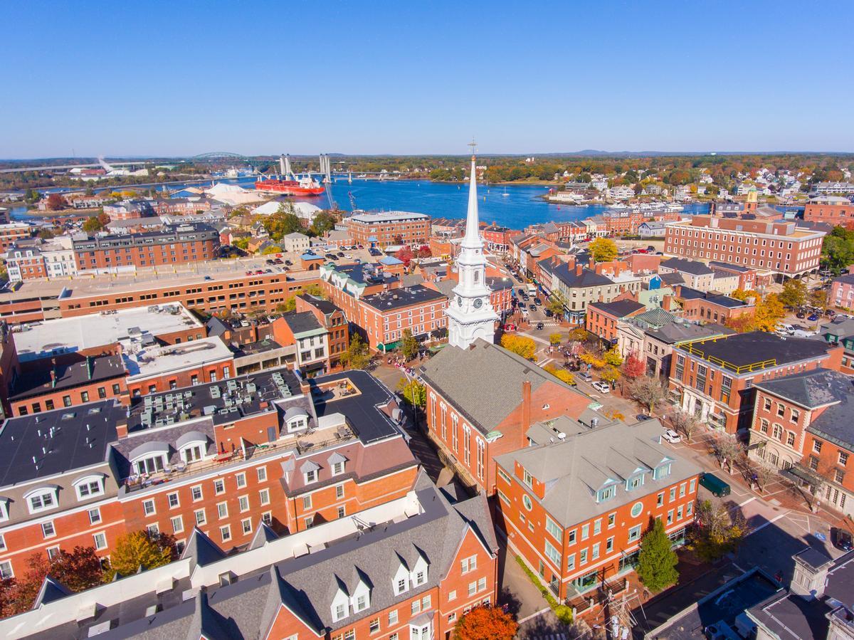
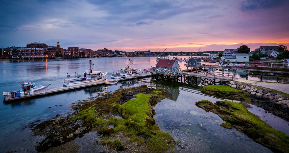
Portsmouth - about an hour from Boston by car
For us, Portsmouth was one of the top places to vacation not just in New Hampshire, but all of the USA. The city is beautiful, sunny, and the brick buildings make the streets exciting to explore.
Walking through downtown, you'll be surrounded by old homes, nice shops, and comfy cafés. If you like eating fish, you will find some of the best seafood in New England in Portsmouth.
I recommend heading to the Strawbery Banke Museum. It's a unique open-air museum that makes you feel like you've gone back 300 years in time. There are well preserved houses, gardens, and costumed interpreters so it's interactive for kids.
Looking to take lots of nice vacation photos? Don't miss the lovely Portsmouth Harbor Lighthouse and Whaleback Light at sunset.
We’ve found a guided tour super convenient with the help of a local guide.
Need some space to relax with a view? Drive to beaches like Jenness State Beach in Rye and Hampton Beach State Park in Hampton for a half-day.
What I loved best:
Dinner at Black Trumpet Bistro. You'll find it in an old brick warehouse near the waterfront. I ordered the seared duck breast with black garlic glaze and polenta, my favorite highlight.
Need a place to stay? We based ourselves at 3-star The Hotel Portsmouth (around $138/night) for seven days.
Upper Valley / Dartmouth–Lake Sunapee
This region has wonderful activities along the Connecticut River.

Hanover
We came to Hanover for a fall foliage weekend and it was so dreamy. My son and I headed to Montshire Museum of Science, which was a huge hit. It’s very interactive for kids.
After, the Old Constitution House and the Enfield Shaker Museum gave us a lot of local history which we loved.
Last but not least, in winter, the Dartmouth Skiway and Saskadena Six ski areas offer great local slopes (my sister-in-law is a skier and she's still raving about her NH ski trip).
What I loved best:
Grilled trout for lunch at Pine was my favorite highlight and totally worth a day trip. You'll find it inside the Hanover Inn just steps from Dartmouth’s campus.
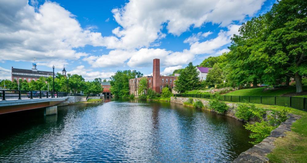
Claremont
My friends were raving about the Claremont Opera House which is why we first planned a weekend in Claremont. We saw a dance performance but they host many unique events. Although the space is much smaller than what we are used to in New York City, the acoustics are great and it was a lovely evening.
If you are not going for a performance, I recommend starting downtown earlier in the day. The restored mill district is very cool and you can learn about Claremont’s industrial past. Walking along the Sugar River and stopping for coffee is also wondeful.
New Hampshire's White Mountains
This is the heart of the state’s outdoor adventure and one of New England’s most iconic landscapes.

Lincoln
When I'm in the mood for summer outdoor adventure, I love visiting the White Mountains, especially when temperatures get too high where we live in Texas.
Lincoln was about two hours north of Boston. I adored the covered bridges, and views of NH peaks in the distance.
You shouldn't miss riding the White Mountain Express Gondola. You get to sit in a four-passenger cabin seats and relax admiring the White Mountain National Forest at your feet for about 12 minutes. Adult tickets are $35. This gondola ride is why I think Lincoln is one of the best places to enjoy a New Hampshire vacation.
In the summer, we’ve also hiked trails in Franconia Notch State Park ($18 for Flume Gorge, otherwise free), explored the Flume Gorge, and taken scenic drives along the Kancamagus Highway.
What I loved best: I love Moose on the Run Cafe for my coffee and snacks.
North Conway - 1 hour and 25 minutes from Portland, Maine
What stood out the most for me was North Conway's downtown, which I thought was one of the most beautiful in New England. You'll find many nice shops and restaurants. Compared to Lincoln, it feels more compact and walkable. I think it's a true New Hampshire gem and one of my favorite places in New Hampshire to visit.
Diana’s Baths is a super unique spot just 5 minutes from downtown. The waterfalls are wonderful to cool off in, as well as kid friendly. The trail to reach the falls is straightforward, but be careful not to slip on the rocks. I have to warn you that parking near Diana’s Baths is very limited and there is a small fee in the summer. You really need to get there early to avoid disappointment.
What I loved best:
For me, North Conway was one of the best places to visit in New Hampshire. Lunch at Underground Bakery & Cafe where we picked up delicious cupcakes. We also loved picking up treats at Zeb’s General Store!
