
Best Places to Visit in Missouri

Searching for the best places to visit in Missouri and things to do there? Well, you are in the right place! This state might not always make the top of people’s travel lists, but we found Missouri to be a quiet gem on our recent four week road trip. This is exactly why I decided to share my favourite experiences in Missouri so that you can use my guide as an inspiration to plan your own road trip.
With rolling Ozark hills, serene rivers, historic towns, unique hotels and resorts, and those famously wide-open skies, Missouri offers a heap of things to see and do. Here are my favorite spots and I hope you enjoy them too.
- Best Time to Visit Missouri - Worst Time to Visit Missouri
- How to Get to Missouri - How to Get Around
- Best Places to Visit in Eastern Missouri: - #1. St. Louis - #2. Ste. Genevieve
- Best Places to Visit in Western Missouri: - #3. Kansas City - #4. Independence
- Best Places to Visit in East-Central Missouri: - #5. Defiance - #6. Meramec Caverns
- Best Day Trips in Southwest Missouri: - #7. Springfield - #7. Joplin - #9. Branson
- Best Places to Visit in Southeast Missouri: - #10. Elephant Rocks State Park
- Best Places to Visit in Central Missouri: - #11. Ha Ha Tonka State Park
Best Time to Visit Missouri
April to May for blooms; and September to October for colorful foliage.
Worst Time to Visit Missouri
July and August, when heat and humidity can be intense. January to February can also be challenging due to cold temperatures, snow, and occasional ice storms that impact travel.
How to Get to Missouri
- By Air: Fly into St. Louis Lambert International (STL) or Kansas City International (MCI).
- By Car: Missouri is easy to reach by road, with major highways like I-70, I-44, I-55, and I-35 connecting cities across the Midwest and beyond.
- By Train: Amtrak routes such as the Missouri River Runner (St. Louis–Kansas City) and Texas Eagle (Chicago–St. Louis–Texas) provide rail access.
How to Get Around Missouri
Having a car is the easiest way to explore Missouri, especially for visiting the Ozarks, small towns, and state parks.
In cities like St. Louis and Kansas City, you can use public transit, rideshares, and light rail (St. Louis MetroLink).
Best Places to Visit in Eastern Missouri
I think this is one of the most rewarding regions of the state to explore if you love history and natural beauty like we do.
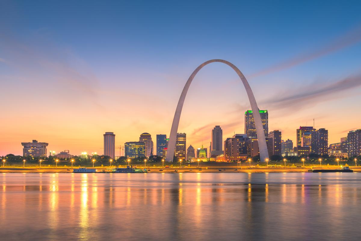
St. Louis - 4 Hours from Kansas City, MO
This awesome city is my #1 place to visit in Missouri, with its T heaps of things to do and the Gateway Arch (of course!).
You'll probably be excited to start at the Gateway Arch. I personally was completely taken by its soaring height and elegant design!
Next, my favorite part of the morning was wandering along the Mississippi Riverfront, where we walked hand in hand with the water stretching endlessly beside us and the Arch rising behind the skyline.
After, we made our way into Downtown West and Midtown, neighborhoods full of character, with cozy cafés, and museums. I have to warn you, though, that parking can be a challenge!
After lunch, one of my absolute highlights was visiting the World Chess Hall of Fame in the Central West End. It's such an inspiring, beautifully designed space filled with artful chess sets, exhibits celebrating grandmasters, and even a record-breaking 20-foot king outside.
Next day, one hidden highlight was the Soulard Farmers Market, where we shared local bites, sampled fresh treats, and turned lunch into a fun little adventure.
In addition, I loved exploring the Missouri History Museum, which gave us thoughtful insight into the city’s past and sparked great conversations as we moved through the exhibits together.
Dinner in the Central West End at Retreat Gastropub was the perfect ending to the day, with incredible food.
As night fell, the city lights reflecting off the Mississippi created a calm, almost magical feeling—we weren’t ready for the day to end.
After a flight into Lambert Airport and a short ride downtown, we checked into 4-star HoteLumière at the Arch (from $129/night) for four fun days.
What I loved best:
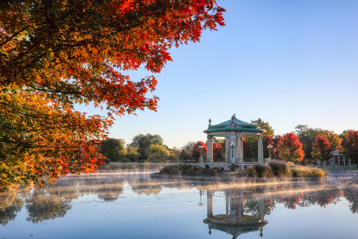
Exploring the Missouri Botanical Garden was Chris and our son a highlight for me, alive with summer blooms and shaded pathways.
Ste. Genevieve - 1 hour from St. Louis
I recommend starting in the historic district, where centuries-old French colonial homes line the streets.
My favorite part was walking slowly past the old houses and gardens, imagining the lives lived there long ago.
Next, Downtown Ste. Genevieve had a gentle, welcoming rhythm, with antique shops, galleries, and cafés.
We shared a leisurely lunch at a local spot, savoring hearty Midwestern comfort food that felt especially satisfying after a morning of exploring.
A hidden highlight was stopping at a nearby winery in the afternoon, where we looked out over rolling vineyards.
After a short drive south from St. Louis, I based myself for five days at https://booking.tpx.gr/MT8xvuhu (from $165/night) in Ste. Genevieve, one of my favorite places to visit in Missouri.
What I loved best:
Touring the Bolduc House Museum, a perfectly preserved 18th-century French colonial home was my favorite highlight.
Best Places to Visit in Western Missouri
Western Missouri is where big-city energy meets deep-rooted history and Midwestern hospitality.
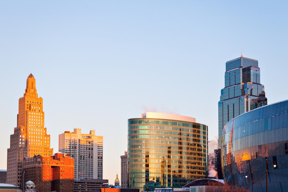
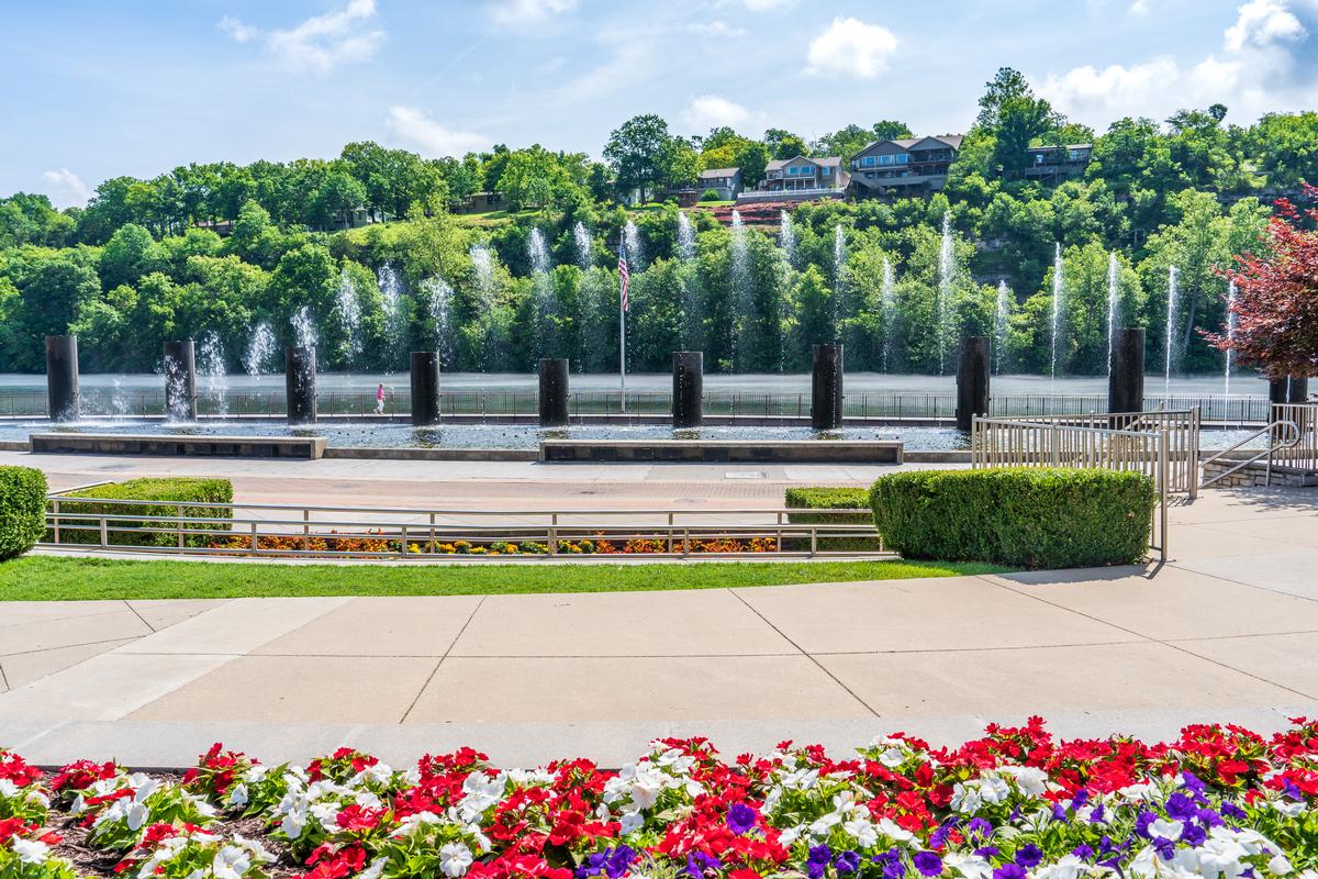
Kansas City
Chris and I both absolutely love the "City of Fountains", and have been many times.
The first thing we did was drive downtown near the Power and Light District. . Walking around, we noticed how affordable and lively everything felt.
Next we headed to Union Station which is near Crown Center and totally spectacular.
We spent time inside museums and just wandered, it was cool and interesting. Since there is so much to take in, we decided to join a guided tour with a local guide on our first visit which was a great idea.
The highlight of my visit was the Kauffman Center for the Performing Arts which was our next stop, an architectural masterpiece with sweeping glass walls and soaring curves that invite you to step inside and catch a performance by the Kansas City Symphony.
Later we explored the Crossroads Arts District with murals everywhere.
For lunch we tried Kansas City BBQ nearby, which was the best experience possible. The food alone makes this city worth the trip!
We ended the night walking by the riverfront, calm and beautiful.
We flew into Kansas City International Airport (MCI) at the start of our journey and spent five comfortable days at The Ambassador Kansas City exploring the city. The Ambassador Kansas City won the 4-Diamond (AAA Diamond) award so you can trust that it's a quality place.
What I Loved Best:
My highlights? Taking time in the Nelson-Atkins Museum’s sculpture garden was my personal highlight, then heading to Joe’s Kansas City Bar-B-Que for dinner. I ordered the Z-Man sandwich: brisket, onion rings, smoked provolone, all stacked on a soft kaiser bun. The meat was smoky and tender, the onion rings crackled when I bit in, and the sauce left a little warmth on my fingers. We ate at a patio table while the scent of hickory hung in the evening air.

Independence - 3 hour 40 minutes from St. Louis
When I visited the “Queen City of the Trails” this month, I loved seeing its stately 19th-century homes. From its presidential landmarks to its pioneer history, Independence radiated a sense of timeless Americana and warm Midwestern hospitality.
After a short 20-minute drive east from downtown Kansas City, I arrived in a place that felt like a living museum, with the legacy of westward expansion, Civil War echoes, and Harry S. Truman’s life.
We toured the
What I Loved Best:
Learning about wagon-train journeys at the National Frontier Trails Museum was my favorite highlight.
Best Places to Visit in East-Central Missouri
This region is known for its scenic river valleys, historic towns, and natural attractions.
Defiance
Set in the heart of wine country, Defiance gave us a day that was perfect for reconnecting and enjoying time together.
We started the morning driving along Highway 94, with vineyard and river views.
We explored the Katy Trail first, with the river occasionally peeking through. Lunch was at a winery bistro, where we sampled local flavors.
One of the most relaxing moments was simply sitting outdoors. As evening approached, the golden light over the vineyards felt almost magical.
What I Loved Best:
Of course, no trip to the "Gateway to Missouri Wine Country" would be complete without visiting its vineyards. The highlight of my stay was an afternoon at Defiance Ridge Vineyards, where I sipped locally made wines and listened to live music.
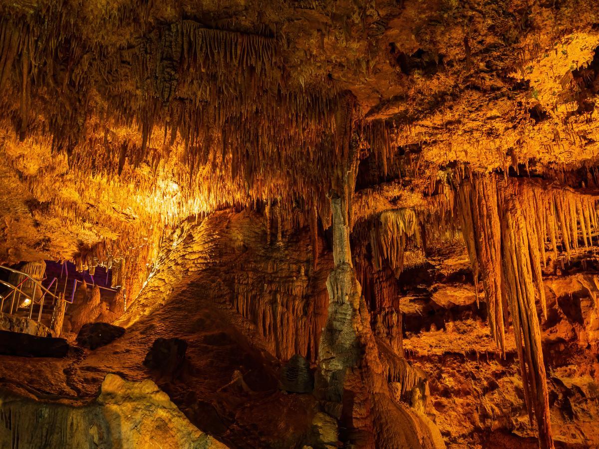
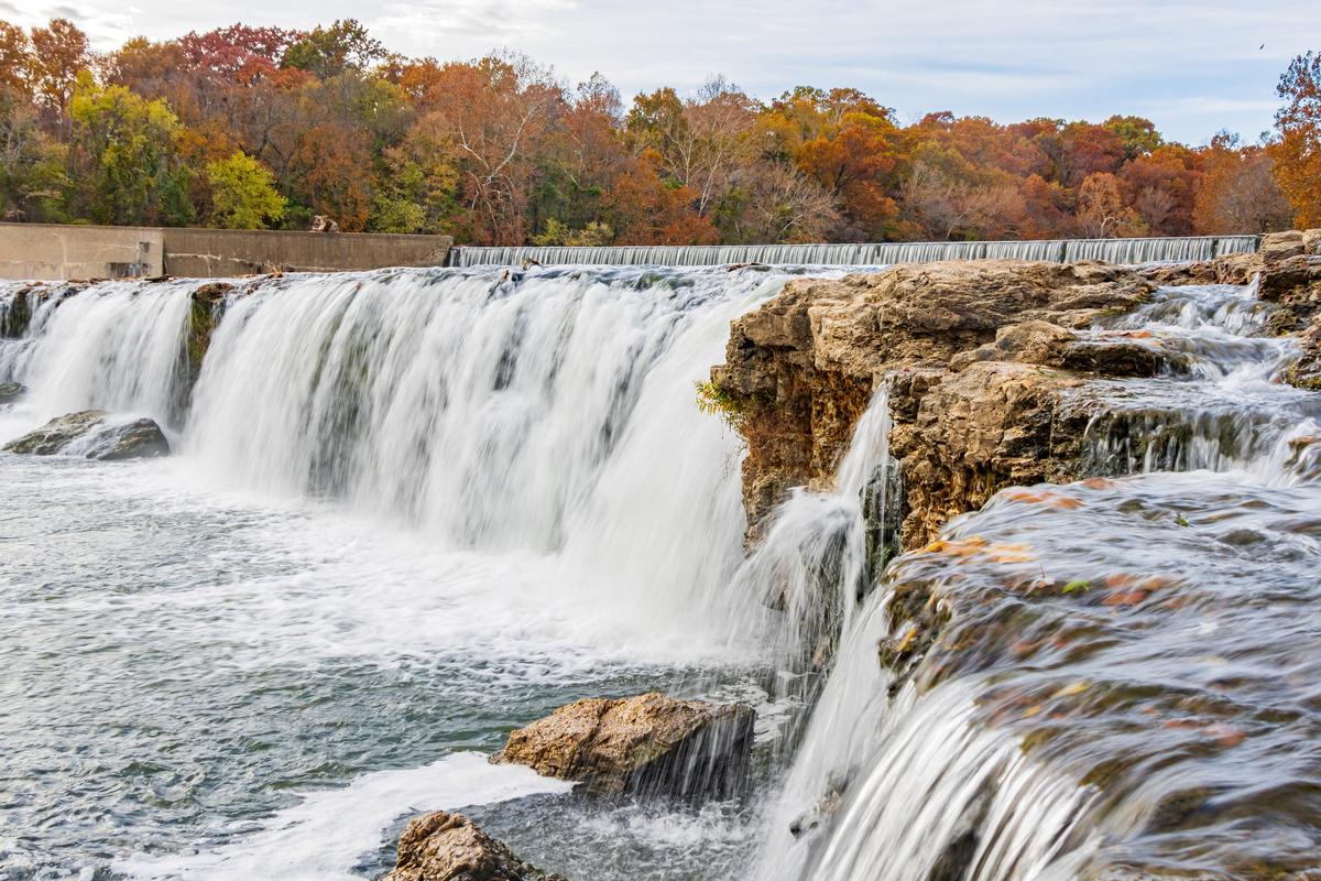
Meramec Caverns
Missouri’s most famous cave felt like stepping into a secret, glowing world where nature's artistry had been at work for millions of years.
I loved Meramec Caverns with its cathedral-like chambers, mineral formations, and hidden passageways.
It was an easy hour’s drive southwest of St. Louis along old Route 66. When we entered, the cool air drifting from the cave mouth instantly set the tone for an unforgettable journey below ground.
You can go on a guided tour through vast chambers like the Wine Table Room, with its rare, delicate formations; the Stage Curtain, rippling like frozen fabric; and the enormous Ballroom.
What I Loved Best:
The guide shared stories of the cave’s use as a hideout for Jesse James and a stop along the Underground Railroad, adding layers of history, my favorite highlight.
Best Day Trips in Southwest Missouri
Southwest Missouri is packed with memorable destinations that are perfect for easy, rewarding day trips.
Springfield - 2 Hours 45 minutes from Kansas City, MO
This city, surrounded by gentle rolling hills, one of my favourite places to visit in Missouri. I especially love its mix of nature, local food, and nostalgia.
After an easy 45-minute drive north from Branson, we arrived in a place where Route 66 nostalgia mingled with craft breweries, college-town energy, and a thriving local arts scene.
We explored the Discovery Center’s hands-on exhibits, browsed the boutiques and murals of downtown, strolled through the serene Mizumoto Japanese Stroll Garden, and toured the fascinating Wonders of Wildlife National Museum & Aquarium. Wilson’s Creek National Battlefield is another highlight for history buffs that completely won me over.
Need a place to stay? Check out 2-star Bass Pro Shops Angler's Lodge.
What I loved best:
Touring Fantastic Caverns, the only ride-through cave in North America was magical and my personal highlight.
Joplin - 4 hours 15 minutes from St. Louis
Ready for a laid-back getaway with surprising natural beauty? Check out Joplin, a real standout.
First we admired the bold public art murals that tell the city’s story, then visited the George A. Spiva Center for the Arts. We stayed at an affordable renta.
What I Loved Best:
After lunch, we visited the fascinating Joplin Museum Complex with its mining exhibits and Bonnie & Clyde connections, my favorite highlight.
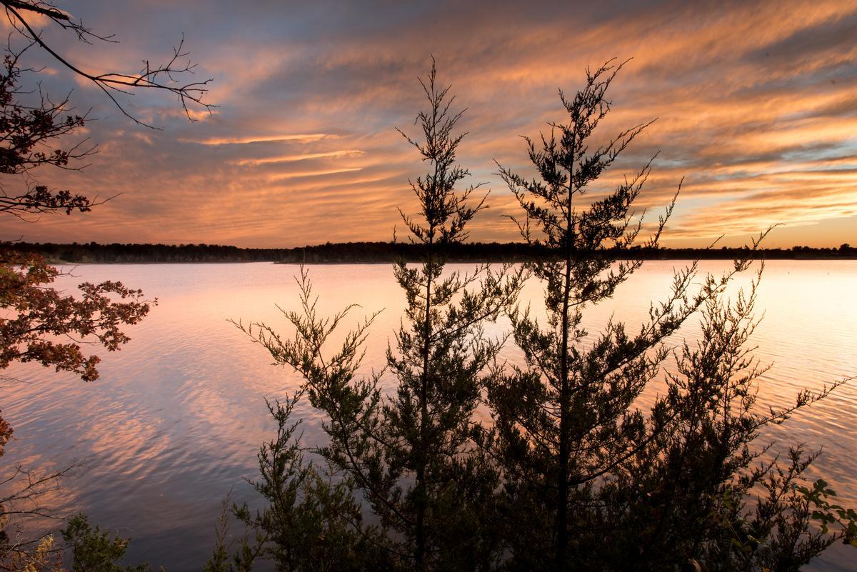
Branson - 3 Hours 15 minutes from Kansas City, MO
I thought this lively Ozark town was absolutely enchanting, especially when it comes to nature!
After a scenic 3.5-hour drive southwest from St. Louis through winding Ozark backroads, we arrived in a place with old-fashioned Americana, country music, and lakefront leisure.
We toured the fascinating Titanic Museum, strolled through the charming shops of Branson Landing along the waterfront, we cruised across Table Rock Lake at sunset, and took in a rousing show at the historic Dick Clark’s American Bandstand Theater. We stayed two nights at the cozy and romantic 4-star Chateau on the Lake Resort Spa.
What I loved best:
Watching the sunset over Table Rock Lake in the fall was my personal highlight.
Best Places to Visit in Southeast Missouri
Southeast Missouri stands out for its striking natural landscapes, historic sites, and quiet charm.
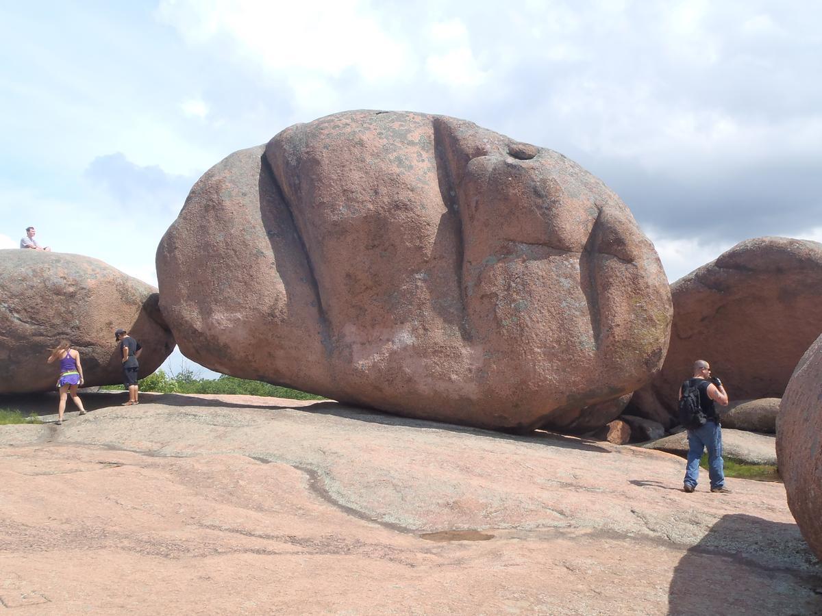
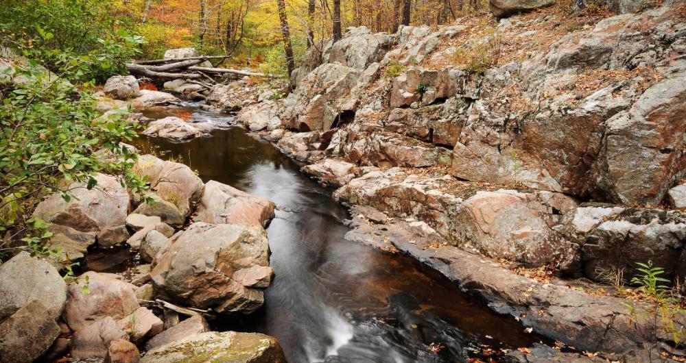
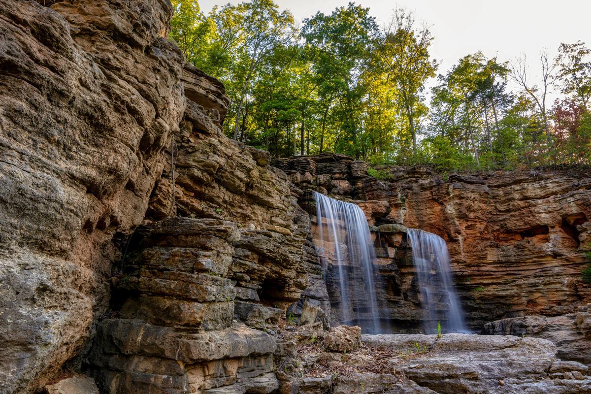
Elephant Rocks State Park - 1 hour 30 minutes from St. Louis
The massive granite boulders, some as big as houses, looked like a line of circus elephants parading through the forest.
First we walked along the Braille Trail. This place feels like a hidden gem because it’s not as crowded as other parks, yet the scenery is absolutely spectacular.
We packed snacks and just hung out near the rocks, which turned into one of the best simple experiences of the trip.
What I Loved Best:
Elephant Rocks is also really affordable since it’s a state park, which makes it an awesome option for a quick adventure.
Best Places to Visit in Central Missouri
Central Missouri sits at the heart of the state, offering a rich blend of history, culture, and scenic landscapes.
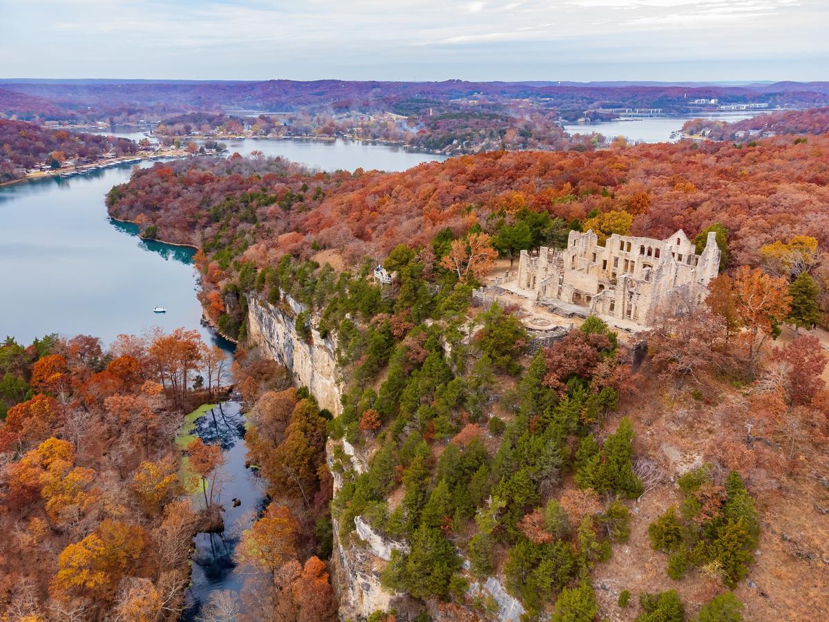
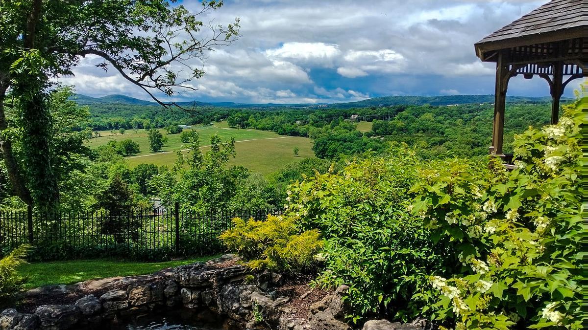
Ha Ha Tonka State Park - 2 hour 45 minutes from St. Louis
This park was one of the most breathtaking and surprising places we’ve explored in Missouri and a brilliant vacation idea.
First thing we did was walk toward the castle ruins, which was honestly the coolest and most unusual experience.
Seeing those stone walls rising above the trees felt like magic, almost a dream, and totally see in my photos.
Next we wandered along the trails, and the views over the Lake of the Ozarks were absolutely the best.
The boardwalk paths were an awesome idea, making the hike easy, family friendly, and very scenic.
After that we explored the sinkholes and natural bridges, which was such an interesting and rare experience. The water below was clear, one of the most amazing sights in Missouri.
We then found a quiet spot to relax, which turned into my favorite part of the day.
What surprised me most was how peaceful it felt, like a hidden escape from everything.
The trails were well marked and felt safe, making it a brilliant idea for a family trip.
Later we headed back toward the castle again because it really is the absolute best feature.
Sunlight hitting the ruins made the whole place feel dramatic, magical, and almost unreal.
Ending the day there felt special, a truly exceptional experience and one of our Missouri trips.
We stayed at the 3-star Old Kinderhook Resort, Golf Club for two nights, near Ha Ha Tonka State Park.
What I Loved Best:
For me, Ha Ha Tonka State Park is one of the best places to visit in Missouri.
We loved how the trails led us from the towering stone castle remains to quiet boardwalks by the spring below, my personal highlight.

