Places to Visit in Maine

Planning a vacation to Maine and wondering where to go? I have you covered.
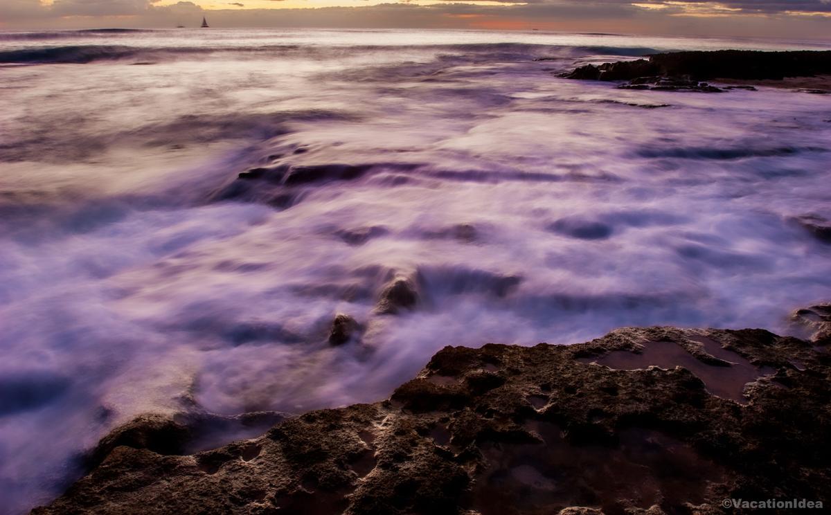
Maine is a state of rugged coastlines (over 200 miles), charming seaside towns, and endless natural beauty, to me, making it one of the most captivating destinations in New England.
I had the chance to explore it frequently while living on the East Coast for 10 years, and it quickly became one of my favorite escapes we still frequently return to. This is exactly why I decided to share my favourite experiences in Maine so that you can use my guide as an inspiration to plan your own road trip.
Whether you’re planning a summer coastal getaway, a fall foliage trip, or a romantic winter retreat, The Pine Tree State has no shortage of incredible places to visit and experiences to enjoy. Here are the ones I explored that I recommend from our recent four week road trip, and I hope you’ll love them too.
- Best Time to Visit Maine - Worst Time to Visit Maine
- How to Get to Maine - How to Get Around
- Best Places to Visit in Maine - Greater Portland / Casco Bay
- - #1. Portland - #2. Freeport
- Best Places to Visit in Southern Maine
- - #3. Cape Neddick and Cliff House Maine - #4. York - #5. Kennebunkport
- Best Places to Visit in Midcoast Maine
- - #6. Georgetown - #7. Rockland- Schooner Stephen Taber - #8. Belfast - #9. Camden
- Best Day Trips in Maine - Downeast / Eastern Maine
- - #10. Bar Harbor - #11. Bangor
Best Time to Visit Maine
For the best weather, the ideal time to visit is June to September. My favorite time is late September to early October which is especially beautiful for fall foliage with fewer crowds.
Worst Time to Visit Maine
Winter in Maine is harsh. Lots of snowfall and icy roads restrict travel. In addition, many attractions and coastal towns also close or reduce hours during winter.
How to Get to Maine
- By Air: Fly to Portland International Jetport (PWM), which offers the best access to southern and coastal Maine. Smaller regional airports also serve Bangor (BGR) and Bar Harbor (BHB).
- By Car: Driving is the best popular option, especially if you are coming from New England and the Northeast. I-95 runs the length of the state, connecting southern Maine to Bangor and beyond, while coastal routes like US-1 offer scenic detours.
- By Train: Amtrak’s Downeaster is a comfortable option. It runs between Boston and Brunswick, with stops in Portland and other southern Maine towns.
How to Get Around Maine
Having a car is the best way to explore non-city destinations in Maine.
In cities like Portland, you can get around by walking, biking, or using local buses.
Best Places to Visit in Maine - Greater Portland / Casco Bay
This is where Maine’s urban energy meets classic coastal beauty.

Portland
This city (just two hours from Boston!) completely won me over with its views, food and heaps of things to do. We flew from Austin to Portland (about 4 hours with a layover, fares around $200–$320 round trip) and landed in a compact city of roughly 68,000.
Instead of renting a car right away, we explored Portland on foot and by bus. The METRO Route 8 looped us to the waterfront and the arts district. $2 fare was so affordable!
I recommend starting at the Old Port, one of my favorite places to visit in Maine.
My favorite part was walking along the working waterfront, watching lobster boats come and go while holding hands. Heads up that parking can be a challenge!
Downtown Portland was charming, with historic buildings, indie bookstores, art galleries, and cozy cafés.
We shared a bowl of creamy clam chowder at a small local spot, and it was the perfect comfort food.
In addition, downtown I loved browsing the local shops filled with Maine-made goods, from sea glass jewelry to gourmet chocolates.
Next day, we visited the Portland Museum of Art ($18 admission), walked around Deering Oaks Park for some exercise (55 acres with ponds and trails), and capped the day with oysters and craft beer in the Old Port at Street & Co.
In the afternoon, I couldn’t resist hopping on a ferry out to Peaks Island (17 minutes one way from Portland, $14 for an adult, $7 for a child) - the short ride gave us spectacular bay views.
If this is your first time in Portland, I recommend booking a tour with a local guide. Portland Explorer (formerly Maine Brews Cruise) is a fun activity to do with friends.
For lodging, we booked the 4-star Portland Harbor Hotel ($185) for two days, centrally located and easy for a car-free visit.
Strolling along the Eastern Promenade at sunset with Chris was my personal favorite...
Freeport - just a 25-minute drive from Portland
This turned out to be one of the coolest towns I’ve explored in New England, and honestly, it’s an absolute dream for a weekend getaway! Why? First off, Freeport is the famous home of L.L.Bean since 1917. The flagship store is actually open 24/7 right downtown so you can't miss it. In addition, from Portland, it was just a quick 25-minute drive north to Freeport, which was perfect for a quick Maine day trip.
First thing I recommend heading to L.L.Bean headquarters, which was my favorite free experience. After, you can check out outlet shops nearby. We grabbed coffee from a small café near Main Street too.
Then we drove a few minutes to Wolfe’s Neck State Park, which is right near Casco Bay and absolutely spectacular. You'll find scenic coastal trails with ocean views, quiet woods, and that fresh Maine air.
When we needed a food break, we had great pizza at Tuscan Brick Oven Bistro.
Dinner was casual and delicious, awesome barbecue at Buck's BBQ & Studio Bar.
The next morning we took a scenic drive toward nearby Brunswick. Later, I stopped at the Freeport Historical Society ($5 donation) to learn about the town’s shipbuilding and farming past before exploring Harraseeket Harbor.
Later, I also loved stumbling upon the Desert of Maine, which was one of the most unusual and underrated attractions I’ve ever seen in New England (a one of the best things to do in Maine!). It’s a quirky hidden gem where I walked across rolling sand dunes surrounded by forest...it felt so unique! You can buy tickets online for $21.
We checked into Harraseeket Inn ($185) for two days, a classic New England lodge with cozy fireplaces and a restaurant focused on locally sourced food.
What I loved best:
Hiking along the wooded trails along the water was my favorite highlight.
Best Places to Visit in Southern Maine
This is where rugged coastline, historic seaside villages, and sandy beaches come together in their most iconic form.
Cape Neddick and Cliff House Maine
This is one of my favorite coastal spots in Maine because it gives you that perfect mix of rocky shoreline, postcard-worthy views, and peaceful New England charm. Cape Neddick is one of my favorite places to visit in Maine.
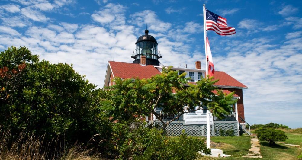
The first thing we did was pull over to see the iconic Nubble Lighthouse which was the perfect first stop!
After that we wandered along the rocky shoreline, which was so peaceful.
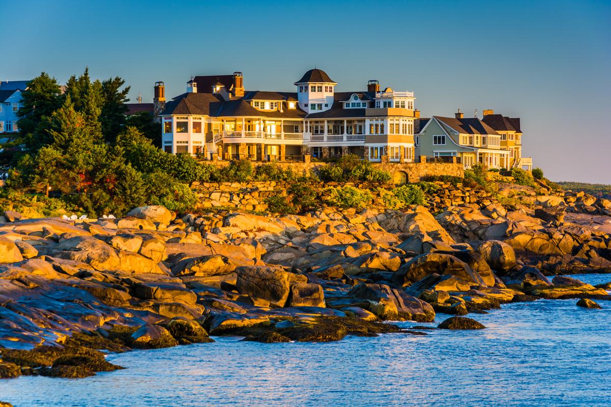
Next we headed to Cliff House Maine, one of my favorite vacation ideas. It's situated dramatically over the cliffs near Cape Neddick, and walking in felt like the absolute best moment of the trip. The ocean views were insane, vibrant blues crashing below us, and it instantly felt romantic.
We explored the grounds first, and then relaxed inside, enjoying cozy luxury vibe in our room for two days.
Dinner was next, and eating while watching the sunset over the Atlantic was the best experience, joyful and unforgettable. The food was amazing, fresh and local, and the whole night felt like one of those rare weekend moments you wish you could replay.
Waking up early the next morning was worth it, because the sunrise over Cape Neddick was spectacular, totally underrated, and my favorite highlight.
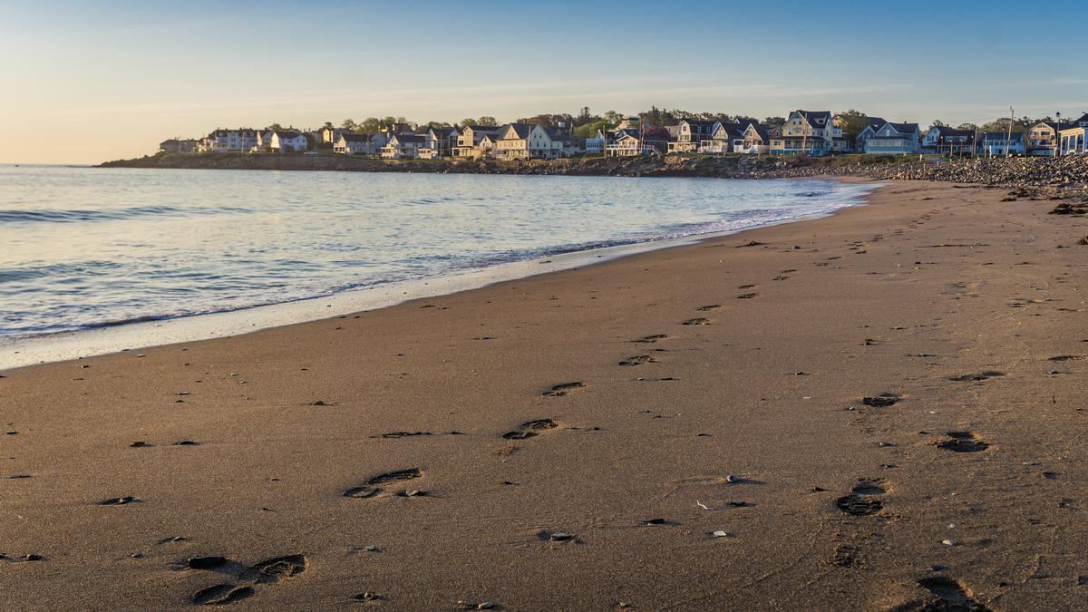
York
Ready for a classic Maine beach getaway? Check out York, for me, a real standout, just 8 minutes from our last stop in Cape Neddick!
First head to York Harbor, where classic New England homes and salty ocean air set an easygoing tone.
One of my favorite moments was walking along Long Sands Beach early in the day. The wide shoreline gave us plenty of space to kick off our shoes.
My personal highlight was an amazing BLT at Lobster Cove where are refueled for lunch.
Later, we explored Short Sands Beach and the surrounding village as well, popping into small shops filled with local art, coastal gifts, and handmade goods.
What I loved best:
The standout experience was my visit to Wiggly Bridge Distillery, a craft distillery named after the town’s charming miniature suspension bridge nearby.
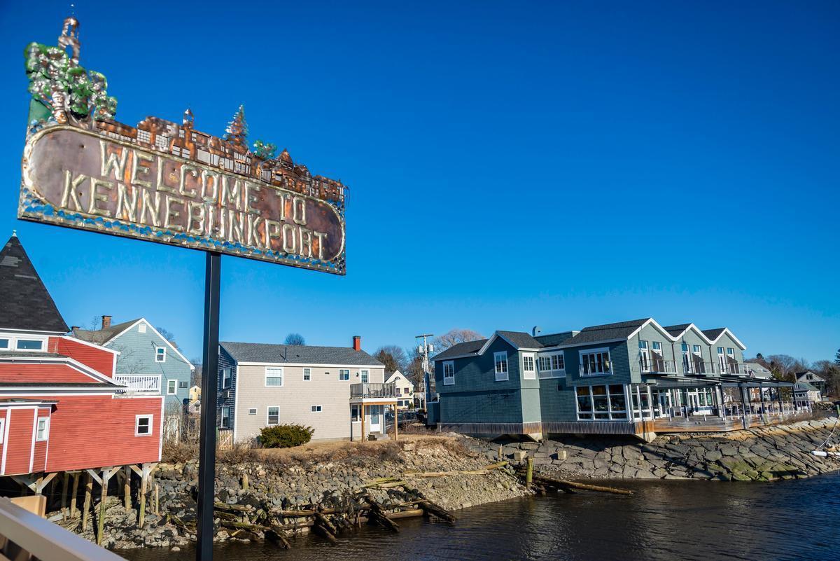
Things to Do in Kennebunkport
I thought that this was one of the best day trips in Maine when I moved to the East Coast. Why? First off, it's easily accessible from Portland, just a 40-minute drive south. In addition, Kennebunkport offers a number of diverse things to see and do, so we were never bored.
First, strolling through Dock Square, we admired the classic shingled 18th- and 19th-century buildings, fishing boats, and locally owned boutiques.
My favorite stop was a cozy café near the harbor, where we shared flaky pastries and hot coffee.
Next, visiting Seashore Trolley Museum ($15 admission) was a highlight. We also stopped by a local market to pick up fresh treats and Maine-made goodies.
A short drive brought us to Goose Rocks Beach, where we walked barefoot along the wide shoreline, listening to the waves and ate our picnic lunch.
Later in the afternoon, we explored Cape Porpoise, a peaceful fishing village nearby.
What I loved best:
Goose Rocks Beach was my personal highlight. Its soft sand and wide shoreline are not to be missed at sunset.
We stayed at the Captain Lord Mansion ($235) for two days, a historic 1812 sea captain’s home turned elegant inn.
Best Places to Visit in Midcoast Maine
Midcoast Maine is hope to working harbors, sailing towns, and rocky peninsulas.
Georgetown
When we spent time here this month, we felt like we had uncovered one of the most spectacular hidden gems on the coast. Georgetown was peaceful, beautiful, and full of unique charm.
We drove about 1 hour north from Portland to reach Georgetown on our journey through Maine, a rural island community of around 1,000 people connected to the mainland by bridge.
I recommend Reid State Park as your first stop, where long stretches of sandy beach met dramatic rocky shoreline. It was honestly one of the absolute best coastal landscapes we had ever seen in Maine.
After we discovered Five Islands Lobster Co., a simple dockside shack that served some of the most amazing and affordable lobster rolls and seafood we’ve ever tasted.

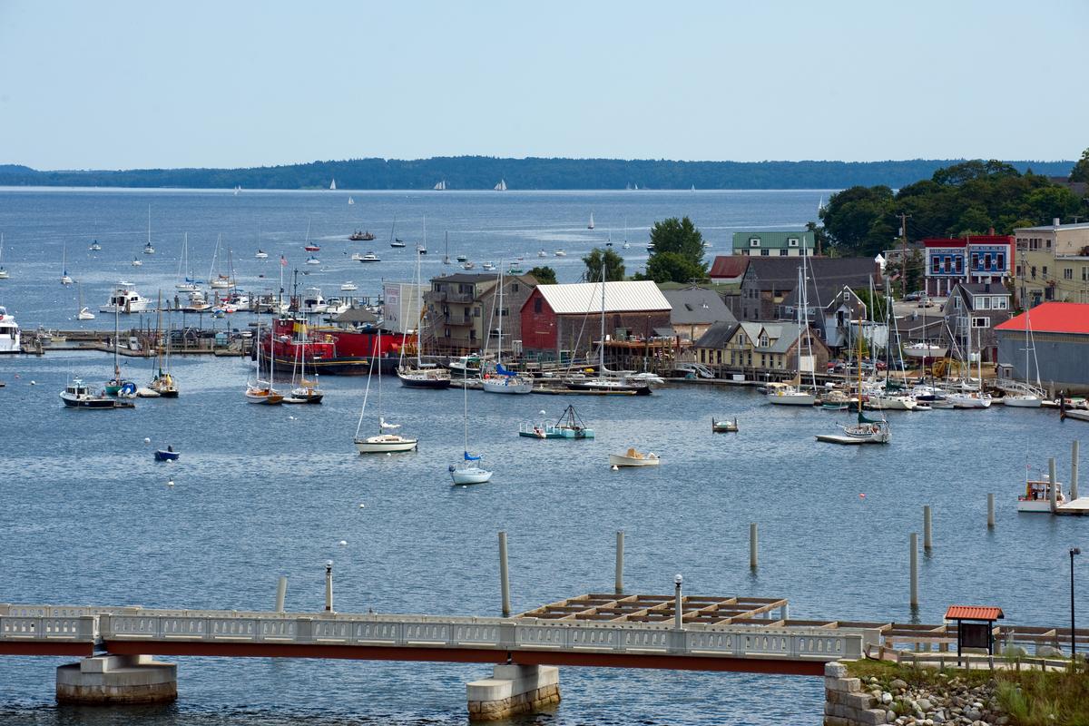
Rockland
When we arrived, we were instantly struck by how vibrant and welcoming this coastal town felt, and it quickly became one of my best places to visit in Maine!
First I recommend strolling through the lively downtown. After, one of our absolute best experiences was visiting the Farnsworth Art Museum, which showcased both local and nationally renowned artists.
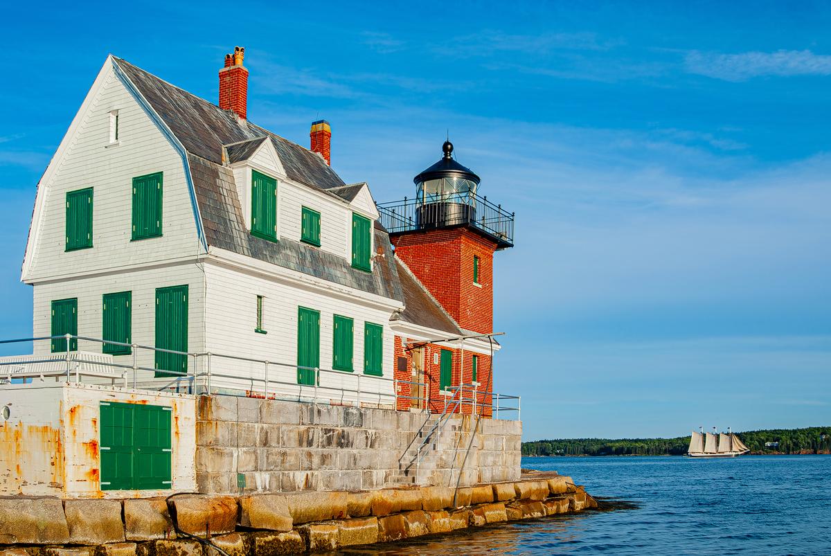
We couldn’t get enough of the spectacular Rockland Harbor, where lobster boats and sailboats floated against a backdrop of islands. Walking along the mile-long Rockland Breakwater to the lighthouse was one of the coolest and most unusual adventures of our trip!
We also discovered Rockland’s foodie side, with its fresh lobster shacks, farm-to-table restaurants, and craft breweries.
We drove about 1 hour 45 minutes northeast from Portland to Rockland. We stayed at the LimeRock Inn, a Victorian B&B with wraparound porches.
What I loved best:
I loved timing our trip with the Maine Lobster Festival last month, with delicious food.

Schooner Stephen Taber
Launched in 1871 and still sailing today based out of Rockland, this is one of the most authentic windjammer experiences I’ve ever had. The Stephen Taber gives you access to miles of open water and scenic views. In addition, the laid-back atmosphere is far removed from crowded cruise ports or touristy waterfronts.
I was interested to learn that Schooner Stephen Taber is actually a National Historic Landmark and the oldest documented sailing vessel in continuous service in the United States. Imagine experiencing that as well as drifting past hidden coves, lighthouses, and the spectacular rocky shoreline of Penobscot Bay!
Meals onboard are fresh, locally sourced dishes and often enjoyed on deck with ocean breezes and priceless views.
What I loved best:
To me, what makes this such a gem is how it combines history, adventure, and relaxation.
Belfast
Set at the mouth of the Passagassawakeag River, this is one of the most quietly charming towns I’ve explored in Maine. I think it’s one of the absolute best getaways I'm in the mood for culture and coastal scenery without the crowds.
We drove about 1 hour 45 minutes northeast from Portland to Belfast. When we arrived, we immediately felt the magic of this coastal town. Once a major shipbuilding and poultry-processing hub, today it blends history with a creative vibe. We stayed at the Yankee Clipper Motel (from $104/night) which was comfortable and affordable.
We loved wandering through the walkable downtown first thing, stopping for coffee. One of the absolute best parts of our trip was strolling along the Belfast Harbor Walk right after.
What I loved best:
We also discovered the Belfast Rail Trail, which was perfect for a romantic walk, surrounded by peaceful nature and sweeping water views.
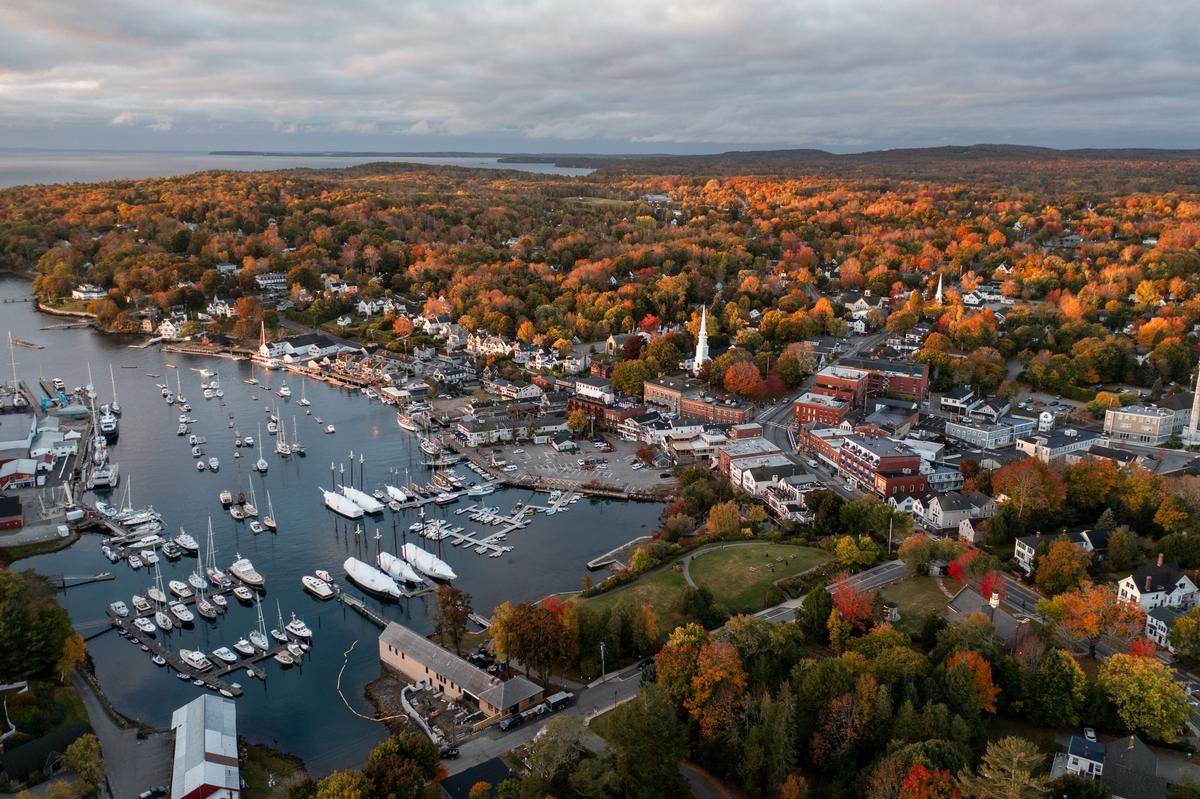
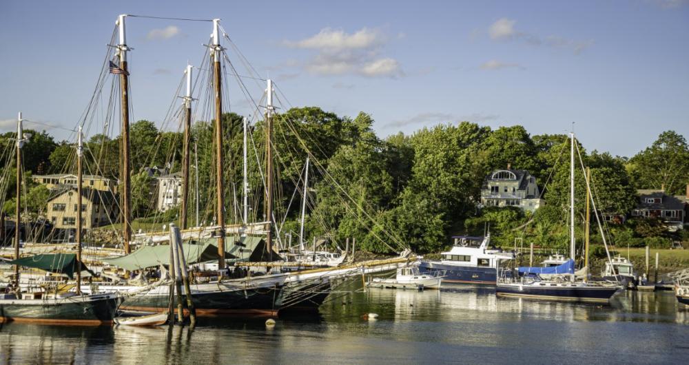
Camden
Located on Penobscot Bay, this is one of the most naturally stunning coastal towns I’ve ever visited. In fact, when we made our way to Camden, we quickly realized why so many people call it the “Jewel of the Coast”. It truly felt like a dream come to life, with its mix of ocean views and mountain backdrops.
We strolled through the harbor first, where sleek sailboats and colorful lobster boats bobbed along the docks.
One of our favorite things next was hiking up Mount Battie in Camden Hills State Park. The short climb rewarded us with the absolute best panoramic views of Penobscot Bay, the town, and even the islands offshore.
In late afternoon, we loved discovering the town itself, including art galleries, and unique boutiques.
The restaurants here were spectacular—we enjoyed fresh lobster, clam chowder, and delicious farm-to-table dishes that made Camden’s foodie scene feel like a cool and underrated treasure.
We found the waterfront boardwalk especially magical in the evening, when the lights reflected off the water and the whole harbor seemed to glow—it was the perfect way to end a romantic day.
What I loved best:
Taking a sailing tour was my personal highlight; being out on the water gave us an exciting new perspective of the coastline.
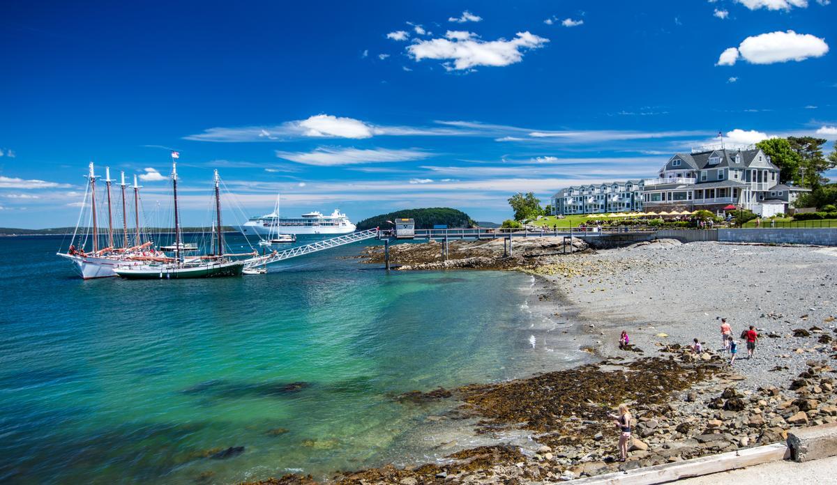
Bar Harbor
Chris and I both absolutely love Bar Harbor, and have been many times. I love the crisp ocean air, dramatic coastal scenery, and that cozy New England charm.
We drove about 3 hours northeast from Portland to this small town of roughly 5,500 on Mount Desert Island, nicknamed "Eden" which was also the town's original name. Once a Gilded Age summer spot, Bar Harbor still has that old-resort feel with Victorian mansions and waterfront promenades. We stayed in a local vacation rental for six relaxing days.
We loved wandering along the waterfront first, where the cool ocean breeze, lobster boats, and sailboats created such a spectacular scene that we kept stopping just to take it all in.
Our favorite hidden gem was the Shore Path, an easy trail that wrapped around the edge of town and gave us the most amazing views of Frenchman Bay.
Next day, we explored Acadia National Park - Driving up Cadillac Mountain gave us breathtaking views we’ll never forget. Just a heads up, this drive requires a timed vehicle reservation (May-Oct), available via Recreation.gov for a fee, alongside a park entrance pass. The scenic 3.5-mile summit road is popular, so book well ahead.
Downtown Bar Harbor was equally awesome, with unique shops, cool cafés, and some of the best seafood restaurants we’ve ever tried (the lobster rolls here were spectacular!).
Hopping on a boat tour to see puffins and whales was my favorite highlight; it was an unusual and unique adventure that made our weekend feel truly exceptional.

Bangor
Ready for a low-key getaway? Check out Bangor (2 hours north from Portland!). A real standout in Maine’s interior! I loved spending late fall weekends here when we lived on the East Coast, and last time it was the perfect last stop on our Maine road trip.
First thing we did was walk around downtown Bangor, which was such an interesting experience with brick buildings, murals, and coffee shops.
After that we headed to the waterfront along the Penobscot River Walkway. Honestly this was one of the best and most relaxing experiences, watching the water flow while thinking how close we were to so much Maine wilderness.
Later we explored the historic streets and checked out some Stephen King landmarks, which was a cool and unusual thing to do since Bangor is basically his hometown and it felt like a hidden storybook.
Next we grabbed lunch at a local spot downtown, and the food was amazing and comforting, one of those joyful meals that makes a family or romantic trip feel special.
In the afternoon we drove a short distance to the Bangor City Forest, which was such a brilliant idea because it felt like a secret forest escape right near the city.
As evening came we headed back downtown and enjoyed dinner. We stayed at the Charles Inn for two days, a boutique hotel right in the historic district.
What I loved best:
For me, Bangor is one of the best places to visit in Maine.
Bangor City Forest, a spectacular network of trails that was perfect for our family walk, was my personal highlight.