Best Places to Visit in Montana

Since I've moved to Texas, the one thing I miss are tall mountain peaks. So you can imagine that I find Montana fun to visit, especially in the summer. I can't get enough of glacier-fed lakes, glimpses of wildlife from the road, unique lodge accommodations, and Yellowstone National Park (yes, a portion of the famous park is located in Montana!). Each place I visited in Montana over the years left a mark. I want to return to all of them soon.
Wherever you wander in Montana, you’ll feel as if you’ve stepped into a living painting. You'll see mountains, lakes, wide-open skies, and the kind of silence that makes you breathe a little deeper. From my two ten-day road trips and adventures across this vast state (it’s one of the most naturally beautiful places I’ve ever explored!), here is my final collection of favorite destinations that truly capture Montana’s magic.
What are the best places to visit in Montana? Yellowstone National Park and Glacier National Park are at the top for sure! If you only have time for one, I would pick Yellowstone. It truly has views that you'll remember forever.
1. Glacier National Park
Distance from Kalispell: About 45 minutes by car
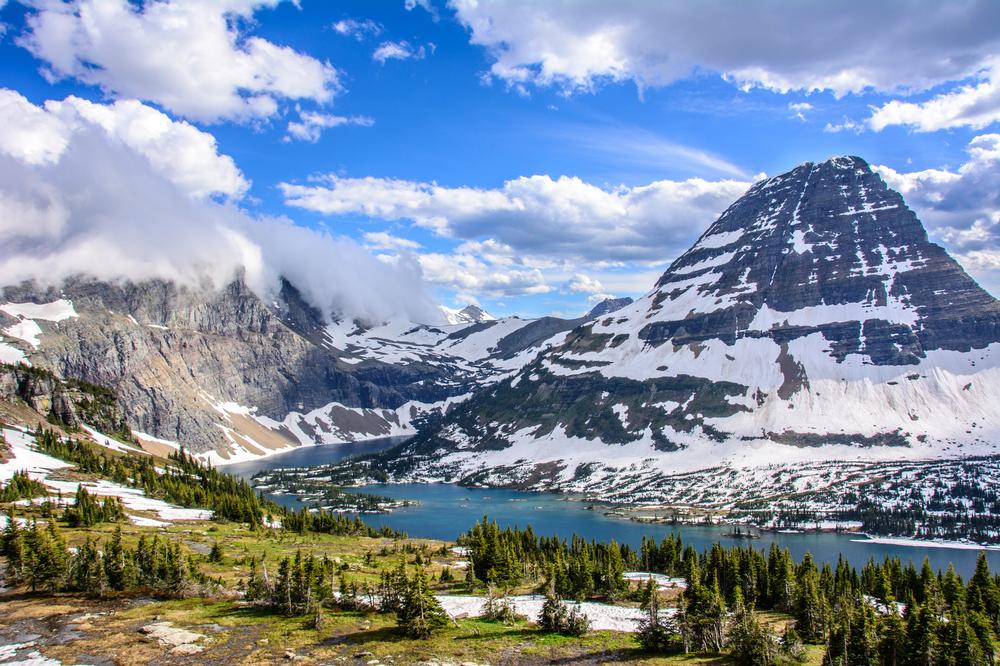
Glacier National Park feels like stepping into a wild world. I found it to be incredibly beautiful and I think that you will too.
I landed in Glacier Park International Airport (FCA) in Kalispell, MT and adjusted my time to Mountain Time Zone. We were spending the night at Many Glacier Hotel ($290) inside the park. The drive from Kalispell in a rental car took us 3 hours.
I especially loved driving on Many Glacier Road from Babb (Montana) to the Many Glacier Hotel and trailheads. We were surrounded by stunning peaks of Mount Grinnell, Mount Wilbur, and Swiftcurrent Mountain. We saw Lake Sherburne and followed along the shoreline.
As we got closer to Many Glacier Hotel, I thought “This is what untouched feels like.”
What I Loved Most: Hiking to Hidden Lake through alpine meadows.
Next time I plan to stay at Apgar Village Lodge (from $159) near the West Entrance.
What to do in Glacier National Park in two days:
- Drive on the iconic Going-to-the-Sun Road, stopping at Logan Pass for sweeping alpine views
- Hike along the Hidden Lake Overlook Trail for a short but stunning walk among wildflowers and peaks
- Take a boat tour on Lake McDonald, the park’s largest and most colorful lake
- Explore the serene Many Glacier Valley, often called the “Switzerland of North America”
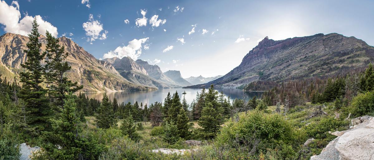
- Visit St. Mary Lake at sunrise for one of the park’s most iconic views
- End your day stargazing. Glacier is an International Dark Sky Park, with dazzling night skies
2. Yellowstone National Park
Distance from Bozeman: About 1.5 hours by car (to the North Entrance at Gardiner, MT)
I visited Yellowstone on a different trip while exploring Jackson Hole. I wrote about it in my places to visit in Wyoming article if you are interested.
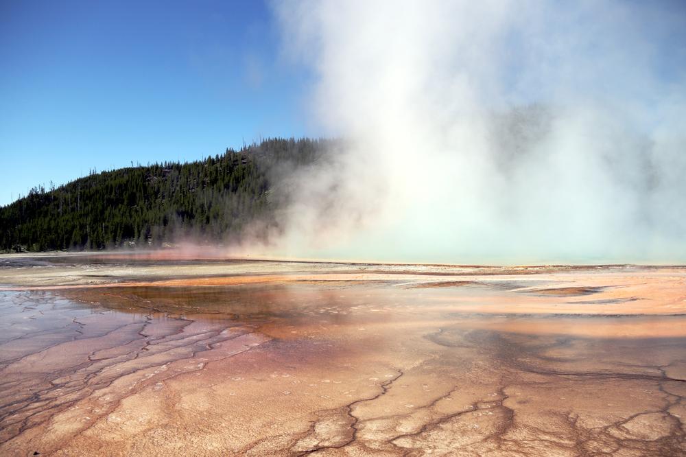
Yellowstone will always be one of my favorite travel memories because it is so different from what I normally see. I was stunned by the beauty of Yellowstone Lake, and the incredible blue of Sapphire Pool. After a long drive, I was fascinated by the colors and features at Mammoth Hot Springs. But Old Faithful will always be my favorite spot.
We kept going back to watch Old Faithful erupt. It was crowded during the day. But at night, my husband and I sat on the bench in front of it and enjoyed the famous geyser all by ourselves. The clear starry night completed the romantic picture.
What to do in Yellowstone in two days:

3. Helena, Montana
Distance from Bozeman: About 1 hour 45 minutes by car
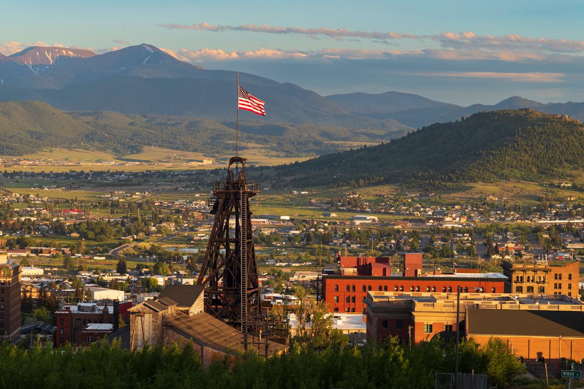
Helena feels like a capital city wrapped in small-town charm, where history and the outdoors sit side by side. Once a booming gold rush town, its roots show in the ornate architecture, grand cathedral, and Victorian mansions that line the streets. Yet just beyond downtown, trails climb into the surrounding hills, offering sweeping views of Montana’s wide-open skies.
I found Helena to be both historic and refreshing — a place where you can walk through the stories of the Old West in the morning and hike into rugged ridgelines by afternoon. It feels connected to Montana’s past but alive with energy today.
What to do in Helena in two days:
- Tour the Montana State Capitol and its historic halls
- Climb to the summit of Mount Helena for panoramic views of the city and surrounding mountains
- Visit the striking Cathedral of St. Helena, inspired by European Gothic design
- Wander through the Mansion District, home to Victorian-era residences from the gold rush
- Learn local history at the Montana Historical Society Museum
- End the day with a stroll or dinner in the lively Last Chance Gulch historic downtown district

4. Billings, Montana
Distance from Bozeman: About 2 hours by car
Billings feels like a crossroads city, both a hub of commerce on the Great Plains and a gateway to Montana’s wide-open spaces. It’s a big city (the largest in the state!). But you'll find it surrounded by rugged landscapes, sandstone cliffs, rivers, and the distant Beartooth Mountains framing the horizon. There’s an energy here that comes from the raw power nature.
What stood out for me was Billings’ mix of urban life and outdoor access. Downtown is lively with breweries, art, and history, while just minutes away you can stand atop the Rimrocks and stare out across the prairie. The Yellowstone River runs through the heart of the city (yes, the same river you drive along in Yellowstone National park!). Billings feels practical and authentic, a working city with a strong sense of community. I could easily live here if winters weren't so rough compared to my home in Texas!
Billings is a great base for exploring Montana. Even if you just stay here for a few nights, it’s a place where you can get a taste of the state’s frontier character while still enjoying the conveniences of a larger city.
What to do in Billings in two days:
- Walk along the Rimrocks for panoramic views over the city and plains
- Visit the Moss Mansion to glimpse Billings’ early 20th-century history
- Explore the Yellowstone Art Museum, showcasing regional and contemporary art
- Take a stroll or bike ride along the Yellowstone Riverwalk
- Sample local brews on the Billings Brew Trail, Montana’s only walkable brewery district
- We ended our first day with sunset views from Swords Rimrock Park

5. Bozeman, Montana
Bozeman struck me as a mountain town with a rare blend of rugged adventure and small-city sophistication. Surrounded by the Rockies, it feels both outdoorsy and vibrant, a place where you can spend the morning on a trail and the evening enjoying craft beer, art galleries, or live music downtown. It’s big enough to have an energy of its own, yet small enough that the mountains always feel close at hand.
We flew about 3½ hours from Austin (1,300 miles) into Bozeman. I toured the Museum of the Rockies ($16 admission), home to one of the world’s largest collections of dinosaur fossils, including a T. rex skull. Downtown, I browsed Main Street’s 19th-century storefronts filled with coffee shops, boutiques, and art galleries. Later, we stopped at the Gallatin History Museum (housed in an 1911 jail, $7 admission). We stayed at the LARK Bozeman ($189), a stylish boutique hotel right on Main Street. Being able to walk everywhere from the hotel felt very grounding.
What to do in Bozeman in two days:
6. Bannack, Montana
Distance from Bozeman: About 2 hours by car
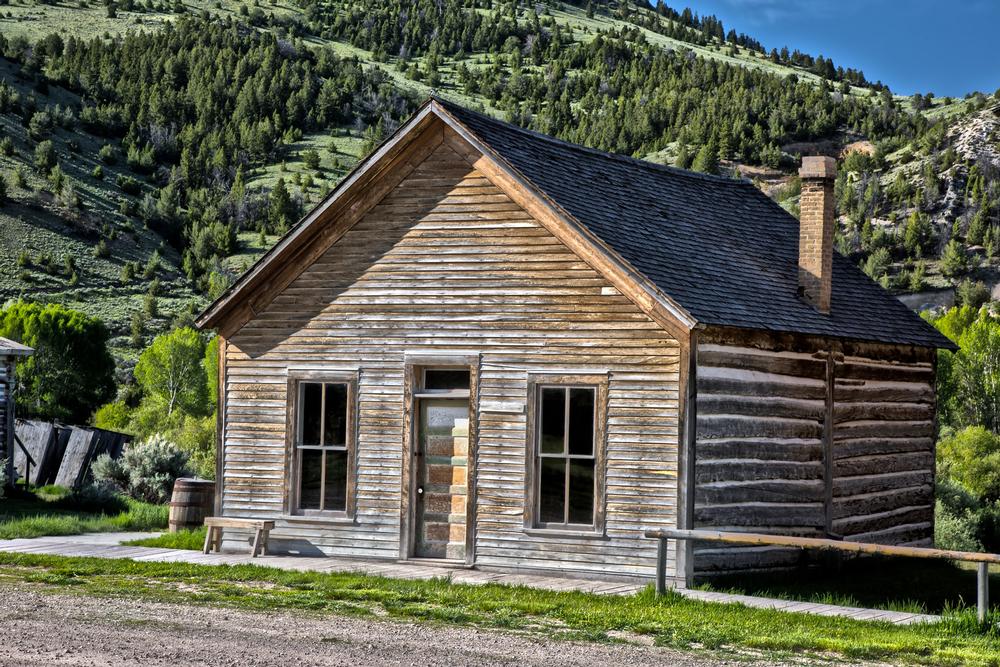
Bannack feels like a town suspended in time, a ghost town that still whispers with the voices of Montana’s gold rush. Once the first territorial capital, it’s now preserved as a state park where weathered wooden buildings, silent streets, and an old schoolhouse stand as if the miners might return any moment. Walking here, you don’t just see history — you feel it, in the creak of a boardwalk or the stillness of the empty saloon.
We stayed in Dillon at the Andrus Hotel ($149), a restored 1917 landmark just25 miles away.
I found Bannack to be both atmospheric and thought-provoking — a place where Montana’s frontier past comes alive in the silence of an abandoned street and the shadow of mountains beyond.
What to do in Bannack in one to two days:
- Wander through the preserved ghost town buildings — over 60 remain standing
- Step inside the historic Hotel Meade, once the social hub of Bannack
- Visit the old Bannack Schoolhouse to to glimpse 19th-century frontier life
- Walk the boardwalks and imagine the gold rush bustle of 1862
- Explore Bannack State Park, including hiking trails and picnic spots nearby
- Attend Bannack Days in July, when the ghost town briefly comes alive with reenactments and music
7. Missoula
Distance from Bozeman: About 3 hours by car
Missoula struck me as a lively river city with a free-spirited energy. Set at the confluence of five valleys and crossed by the Clark Fork River, it’s a place where college-town vibrancy meets mountain adventure. There’s always a sense of motion here — kayakers riding the waves downtown, bikes streaming along trails, and music spilling out of historic venues.
I was sorry to see that The Catalyst Café, my old favorite closed but I discovered The Old Post which serves great pub food (and occasional music).
What stood out most was Missoula’s blend of culture and nature. The University of Montana gives the town a youthful buzz, while local breweries, bookstores, and farmers markets keep it creative and grounded. Yet just minutes away, you can hike up the big “M” on Mount Sentinel or drift along the river. It feels welcoming and dynamic, with a personality all its own among Montana’s cities.
I found Missoula to be both energetic and easygoing — a town where you can spend the day outdoors and the evening enjoying craft beer, live music, or simply the glow of a sunset over the Bitterroot Mountains. It’s Montana at its most spirited.
What to do in Missoula in two days:
- Walk through downtown Missoula, filled with shops, cafés, and historic architecture
- Climb the trail to the “M” on Mount Sentinel for sweeping views over the valley
- Float or kayak the Clark Fork River — even right through downtown
- Browse the stalls at the Missoula Farmers Market. I chatted with friendly locals and watched kids run around.
- Explore the Missoula Art Museum for contemporary and regional works
Conclusion
Traveling through Montana felt like flipping through an old journal, raw, scenic, and real. There’s power in its land, yes, but there’s also power in how it lets you feel your own pace again. Whether you're drawn to the adventure of Yellowstone, the quiet hum of Helena, or the long shadows across the Bozeman hills, Montana meets you where you are, and shows you who you might still be becoming.
Some states you pass through. Montana stays with you.
Booking Checklist
1. Book Your Flight - I use Expedia because I like their mobile app with my itinerary. They've helped me re-book flights on many occasions. Once you reach their Gold tier, support is especially good.
2. Book Your Hotel - I use Booking.com or Expedia, depending on my destination.
3. Book Your Rental Car - I use Expedia.
4. Book your tours on Viator or Get Your Guide.
