

New York City never stops ... and that’s part of its charm. But sometimes, even the most seasoned city soul needs to breathe beyond the skyline. I set out in search of that breath. Not far from the subway lines and skyscrapers, I found gardens that whispered, forests that steadied me, and quiet towns that didn’t ask for attention — only presence. These day trips weren’t just about getting away. They were about coming back with a little more space inside.
Best Day Trips From NYC:
Hudson Valley - 2 hours from NYC
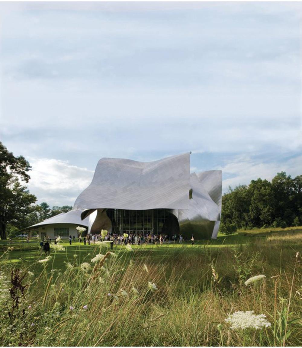
The air smelled like rain and stone, and moss softened every step. As I stood inside Opus 40, surrounded by curved terraces and hand-laid bluestone, I thought, “This was carved with patience most people don’t have anymore.”
What I Loved Most: The quiet—true quiet—between sculpture and sky, where you could hear the wind change direction.
My highlights? A stop at the Edward Hopper House in Nyack—rooms filled with light and restraint, every corner whispering stillness. Later, a warm spinach and feta pastry from Art Café, earthy and flaky, with a cardamom-scented tea that left a trace of sweetness behind.
Plan your day trip:
- Drive Time from NYC: ~1.5–2.5 hours north, depending on stops
- Vibe: Sculptural, introspective, art-soaked
- Highlights: Opus 40, Edward Hopper House, river views, artist towns
- Best Time to Visit: Late spring through fall for open-air wandering
- Cost: Opus 40 ~$15; Hopper House ~$10
- Hours: Both open Wed–Sun, typically 11am–5pm
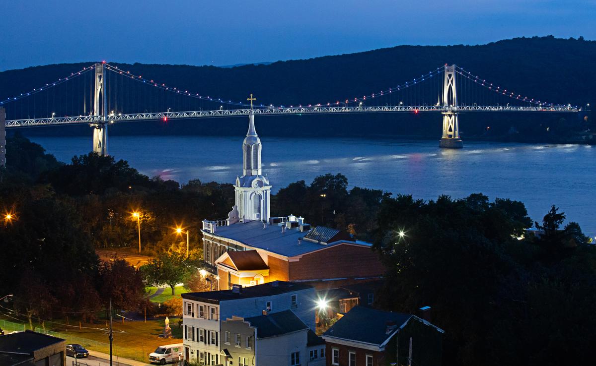
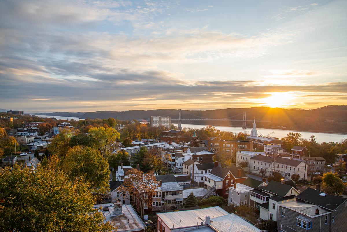
Poughkeepsie Bridges & Bookshops
The train doors opened and the Hudson breeze rushed in—brisk, bright, and full of promise. I stepped onto the platform and thought, “This is close enough to feel easy, far enough to feel free.”
What I Loved Most: Walking the Walkway Over the Hudson, wind in my jacket, river glitter below, and the whole world stretched wide on either side.
My highlights? Lunch at The Crafted Kup downtown—turkey panini with apple slices and sharp cheddar on grilled sourdough, served hot and melty, with the scent of cinnamon chai in the air. It tasted like fall, even in July.
Plan your day trip:
- Drive Time from NYC: ~1.5–2 hours north (or take the Metro-North)
- Vibe: Scenic, low-key, creative
- Highlights: Walkway Over the Hudson, Vassar College campus, bookstores, cafes
- Best Time to Visit: Spring or early fall for cooler walks and clear skies
- Cost: Free to explore; Metro-North ~$35 roundtrip off-peak
- Hours: Walkway 7am–sunset; cafes open daily
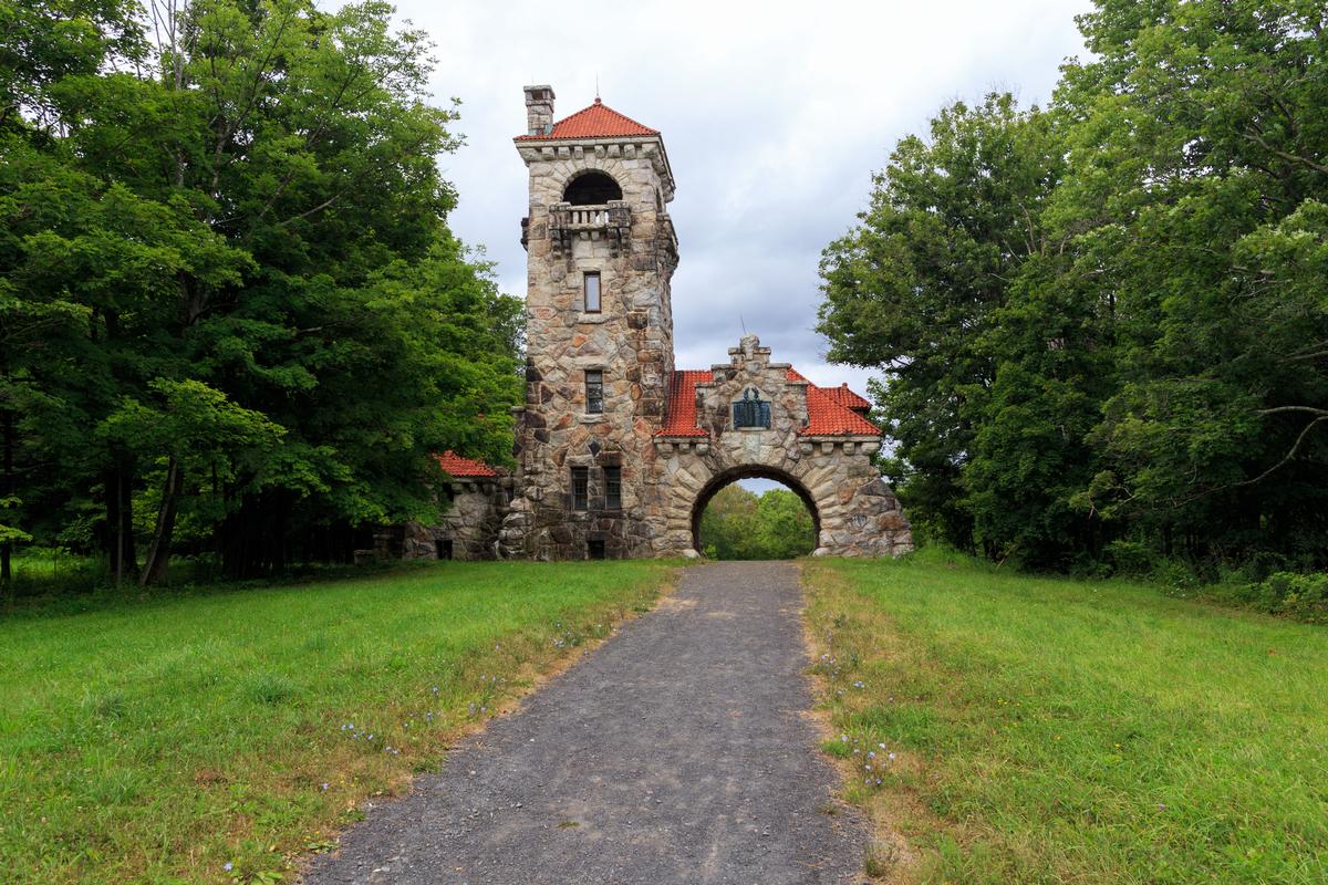
New Paltz Stillness & Stone Houses - 1 hour 30 min From NYC
I walked down Huguenot Street, the stone houses hunched and weathered, and thought, “This place has been waiting a long time.” The air smelled like river water and sun-warmed wood. Even the breeze felt old.
What I Loved Most: The quiet around Historic Huguenot Street—just gravel, leaves, and the sound of my own steps echoing back.
My highlights? A sandwich from Main Street Bistro—grilled eggplant, goat cheese, and roasted red pepper on a fresh roll, still warm and dripping with balsamic glaze. It smelled smoky and tasted like late summer.
Plan your day trip:
- Drive Time from NYC: ~2 hours north
- Vibe: Historic, rustic, thoughtful
- Highlights: Historic Huguenot Street, Mohonk Preserve, local shops
- Best Time to Visit: Fall for color, spring for hiking
- Cost: Free to explore; guided tours ~$12
- Hours: Huguenot Street grounds open daily; shops 10am–6pm
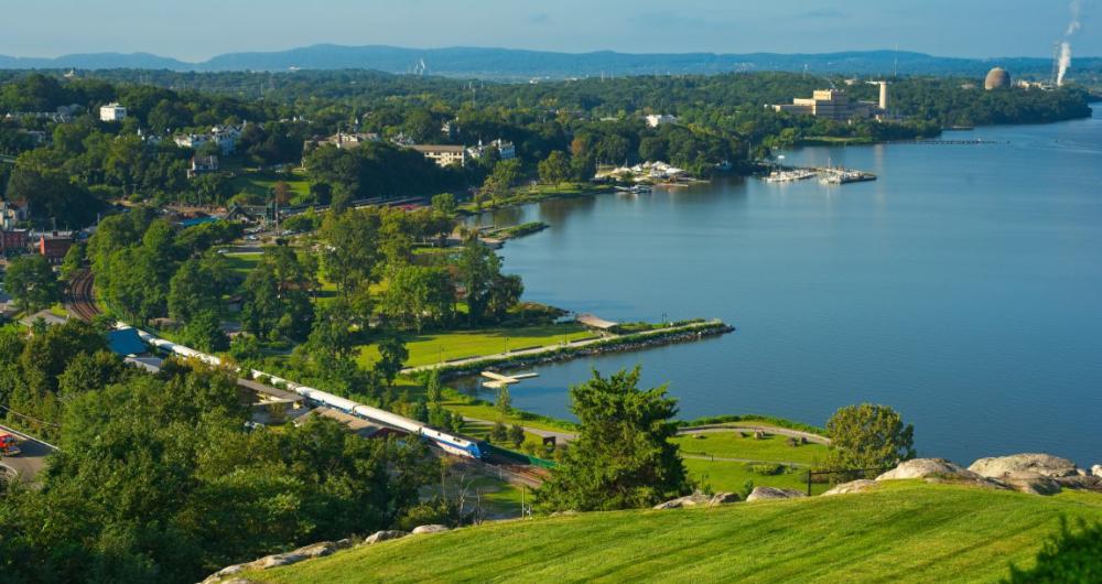
Peekskill: River Views & Creative Sparks
Peekskill felt like a river town slowly waking up—paint peeling from old brick, artists setting up shop in places where machines once roared. I walked the edge of the Hudson, breeze in my hair, and thought, “This place has traded noise for light.”
What I Loved Most: Sitting by the Riverfront Green, sketching clouds and watching the train glide by like a long, quiet breath.
My highlights? A hot bowl of pork tonkotsu at Ramenesque—smoky broth, springy noodles, and a soft egg that melted like butter. It warmed my hands and slowed my pace.
Plan your day trip:
- Drive Time from NYC: ~1 hour north
- Vibe: Riverside, artsy, hushed
- Highlights: Riverfront Green, Hudson Valley MOCA, local galleries
- Best Time to Visit: Late spring through early fall
- Cost: Mostly free; museum ~$10
- Hours: Parks open daily; shops vary
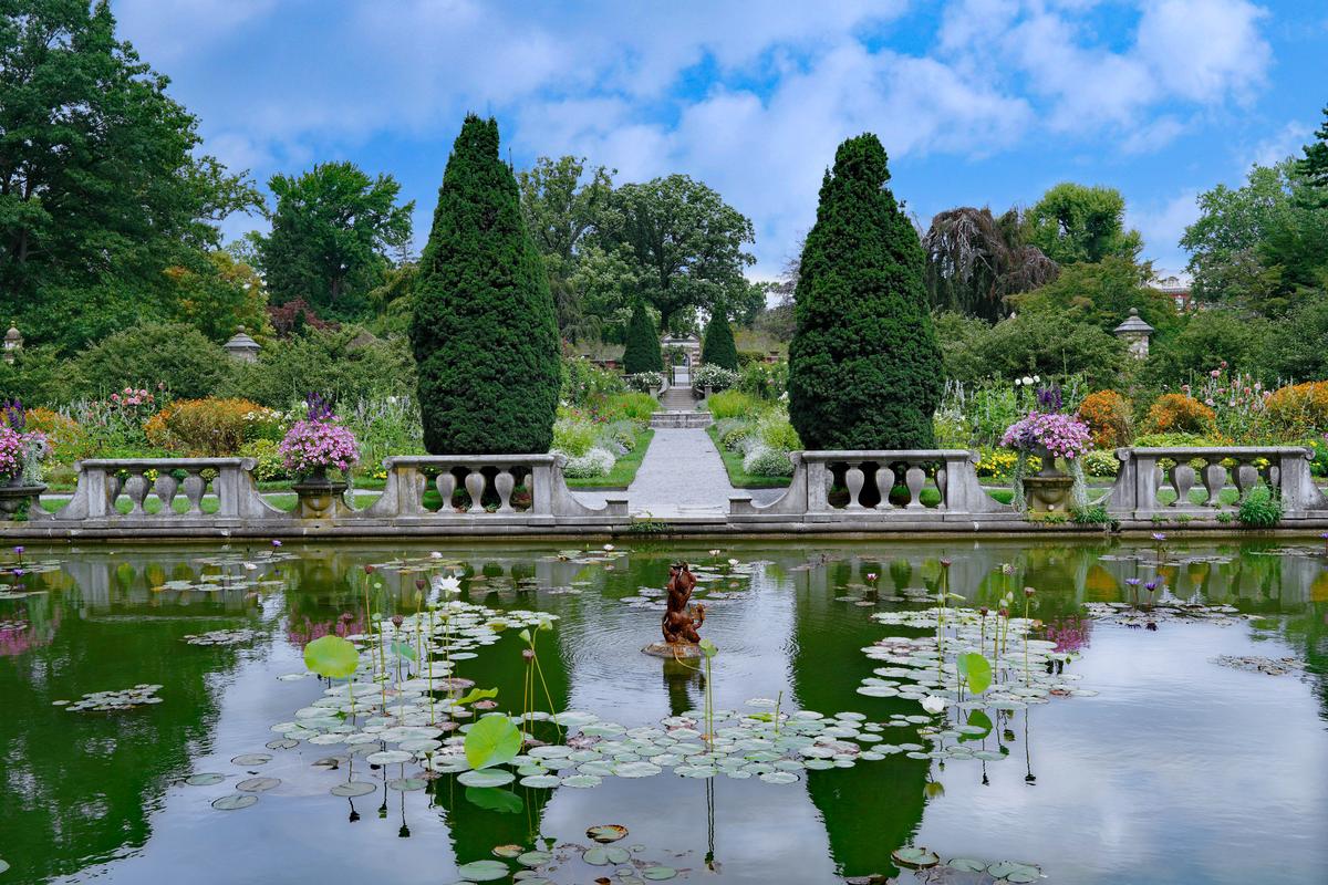
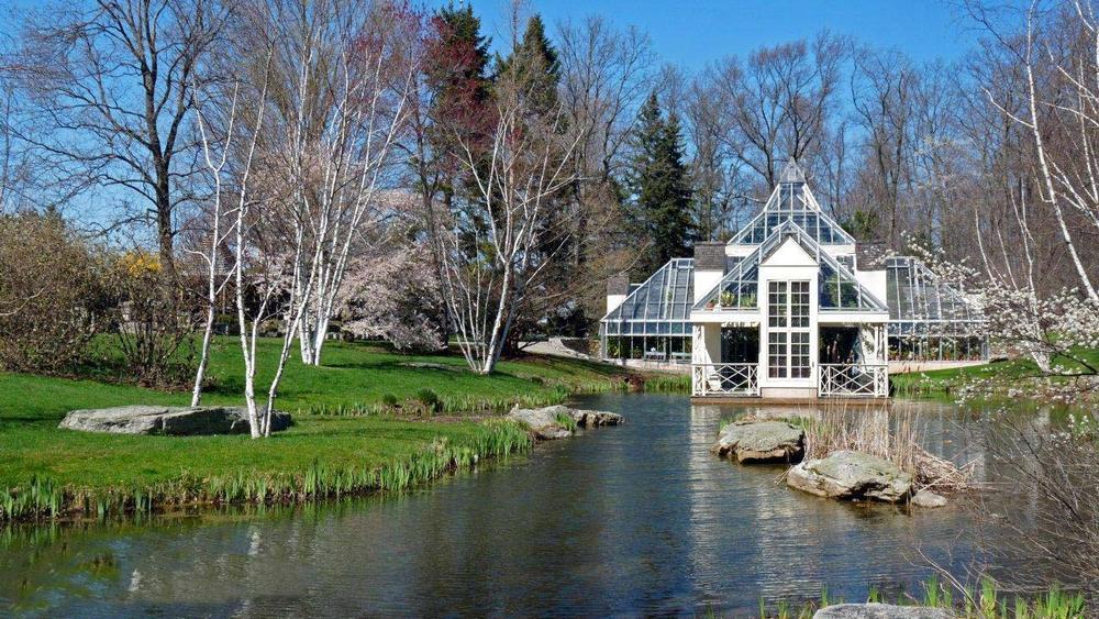
Long Island elegance at Old Westbury Gardens - 45 minutes Day Trip from New York
Old Westbury Gardens felt like a dream preserved — every hedge trimmed, every rose curated. I wandered past fountains and into sunlit rooms where echoes of the Gilded Age lingered softly. It wasn’t just beautiful — it was deliberate, graceful, and gently theatrical. I remember thinking, “Some beauty isn’t accidental — it’s a gift someone built for you to find.”
What I Loved Most: The Walled Garden, where time seemed to slow under the arching roses and the hush of bees at work.
My highlights? Tea and a slice of lemon lavender cake from the on-site café, eaten beneath a pergola while garden scents drifted through the breeze like old perfume.
Plan your day trip:
- Drive Time from NYC: ~1 hour east (Old Westbury, Long Island)
- Vibe: Elegant, floral, nostalgic
- Highlights: Formal gardens, mansion tour, seasonal blooms, photography spots
- Best Time to Visit: Late spring and early summer for peak garden color
- Cost: ~$15–$20 per person
- Hours: Open daily 10am–6pm (seasonal)
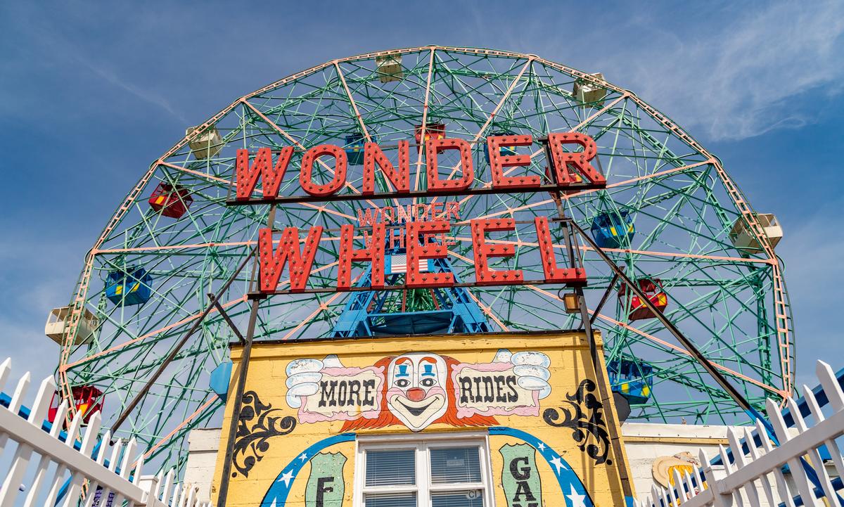
Coney Island History Project: Memory under the Wonder Wheel
I stepped inside the exhibition booth nestled beneath the giant Ferris wheel, and the roar of the boardwalk faded. Inside, oral histories whispered around old photographs, wooden artifacts, and colorful banners that smelled faintly of varnish and sea air. I paused and thought, “This place doesn’t just show history—it speaks it.”
What I Loved Most: Listening to clips of longtime Coney Island residents—carnies, fish entrepreneurs, performers—talking about summers past, while the children pressed their faces to old maps and carnival posters.
My highlights? The free banners stretched out beneath the Wonder Wheel—giant photos of boardwalk crowds, neon signs, and sideshows past. We took souvenir photos next to an original Steeplechase Park horse statue and the Cyclops head from the Spook-A-Rama ride. My child’s fingers traced faded signage and I thought, “Here’s the past, still breathing in bright colors.”
Plan your visit:
- Location: 3059 West 12th Street, next to Deno’s Wonder Wheel Park (Brooklyn)
- Vibe: Nostalgic, neighborhood-rooted, quietly immersive
- Highlights: Oral history booths, free photographic banners, the original Steeplechase horse, Cyclops mask display
- Best Time to Visit: Memorial Day through Labor Day weekends, Saturdays and holidays—open 1 to 7 pm
- Cost: Free admission
- Good to Know: Guided walking tours and oral-history recording sessions available on request, exhibit area small and best experienced slowly
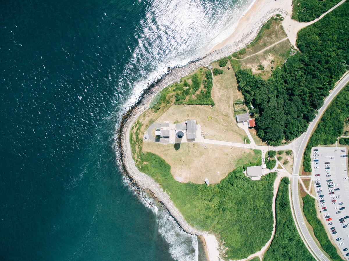
Montauk Mist & Ocean
Fog drifted off the Atlantic as I stood at the lighthouse edge, the surf below loud and steady. “This feels like the end of something,” I thought, as gulls wheeled overhead and the wind pulled at my sleeves.
What I Loved Most: Watching waves slam the rocks beneath the Montauk Point Lighthouse—wild, constant, like the ocean trying to remember its name.
My highlights? Breakfast at Bird on the Roof: a cheddar omelet with chives and thick-cut sourdough, still steaming, with coffee that smelled like earth after rain. Simple, honest, perfect.
Plan your day trip to Montauk:
- Drive Time from NYC: ~3 hours east (Long Island)
- Vibe: Windswept, untamed, end-of-the-road
- Highlights: Montauk Point Lighthouse, beaches, nature preserves
- Best Time to Visit: Late spring or early fall to skip the crowds
- Cost: Lighthouse ~$12; beach access varies
- Hours: Lighthouse 10am–4:30pm; beaches daily
Catskill Carriage - Bespoke Travel Experiences in the Catskills
The ride into the mountains was part of the magic—quiet, cushioned, and without a single wrong turn. Catskill Carriage picked me up where I was and brought me where I needed to be. As we curved through tall trees and open fields, I thought, “This is what letting go feels like.”
What I Loved Most: Being able to relax from start to finish—no logistics, just movement and peace.
Plan your day trip:
- Drive Time from NYC: ~2.5 hours northwest (or take their coach service)
- Vibe: Tailored, transportive, restful
- Highlights: Door-to-door coach pick-up, private cabins, seasonal adventures
- Best Time to Visit: Any season—each one has its own quiet charm
- Cost: Custom packages; coach service included with stay
- Hours: Flexible pick-up times; advance booking recommended
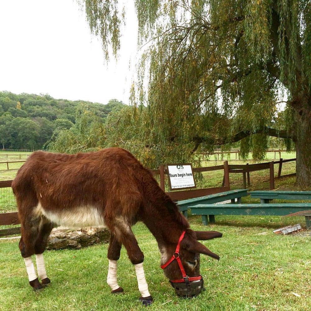
Catskill Animal Sanctuary, Saugerties - 2 hours From NYC
There’s a quiet kind of grace in looking a rescued cow in the eye ... a moment that shifts something inside you. At Catskill Animal Sanctuary, I walked beside goats, listened to the quiet confidence of pigs sunbathing, and met animals who had every reason to mistrust and chose love instead. I remember thinking, “Kindness echoes louder in places like this.”
What I Loved Most: Letting a gentle sheep nuzzle my hand while the guide shared its story of recovery and trust.
My highlights? A vegan BLT made with smoky eggplant bacon and crisp arugula at The Garden Café in Woodstock — thoughtful food that felt like a continuation of the place’s purpose.
Plan your day trip:
- Drive Time from NYC: ~2 hours north
- Vibe: Healing, warm, conscious
- Highlights: Guided animal tours, rescue stories, education on plant-based living
- Best Time to Visit: April to November when tours are active
- Cost: ~$20 adult; discounts for children & seniors
- Hours: Weekends, typically 11am–3pm (reserve ahead)
Green quiet and curated wonder at Stonecrop Gardens, Cold Spring - 1 hour 10 min
Stonecrop wasn’t grand — it was intentional. A tucked-away haven where every plant seemed placed not just to grow, but to speak. I followed gravel paths past alpine flowers and water lilies, every turn like a sentence in a poem I didn’t know I needed. I remember thinking, “This is what calm looks like, leaf by leaf.”
What I Loved Most: Sitting by the lily pond in total silence, except for the breeze and the gentle buzz of bees doing their quiet work.
My highlights? A cappuccino and olive oil cake from Cold Spring Coffeehouse, taken to-go and enjoyed under a tree-lined hill with a view of the Hudson River below.
Plan your day trip:
- Drive Time from NYC: ~1.5 hours north
- Vibe: Botanical, contemplative, soul-soothing
- Highlights: Alpine gardens, greenhouses, woodland paths, scenic Cold Spring village
- Best Time to Visit: Spring through early fall for peak bloom and color
- Cost: ~$10 per adult
- Hours: Mon–Sat, 10am–5pm (seasonal, April–October)
Let the City Go. Let the Stillness Find You.
Each of these places offered something New York doesn’t — not because the city lacks beauty, but because it rarely pauses long enough to show it. In the gardens, preserves, sanctuaries, and river towns beyond the boroughs, I found moments that asked nothing of me. Just to look. Just to breathe. Just to be. And sometimes, that’s all you need to carry back into the noise — a little stillness that stays with you.
Jump to a Spot...
- • Hudson Valley - 2 hours from NYC
- • Poughkeepsie Bridges & Bookshops
- • New Paltz Stillness & Stone Houses - 1 hour 30 min From NYC
- • Peekskill: River Views & Creative Sparks
- • Long Island elegance at Old Westbury Gardens - 45 minutes Day Trip from New York
- • Coney Island History Project: Memory under the Wonder Wheel
- • Montauk Mist & Ocean
- • Catskill Carriage - Bespoke Travel Experiences in the Catskills
- • Catskill Animal Sanctuary, Saugerties - 2 hours From NYC
- • Green quiet and curated wonder at Stonecrop Gardens, Cold Spring - 1 hour 10 min