
Places to Visit in Wyoming

My first trip to Wyoming was decades ago, and it was all for the chance to see Old Faithful. I landed at Jackson Hole Airport with my husband, where we rented a car and spent our first night at The Wort Hotel in Jackson. The next day, we drove through Grand Teton National Park before continuing on to Yellowstone.
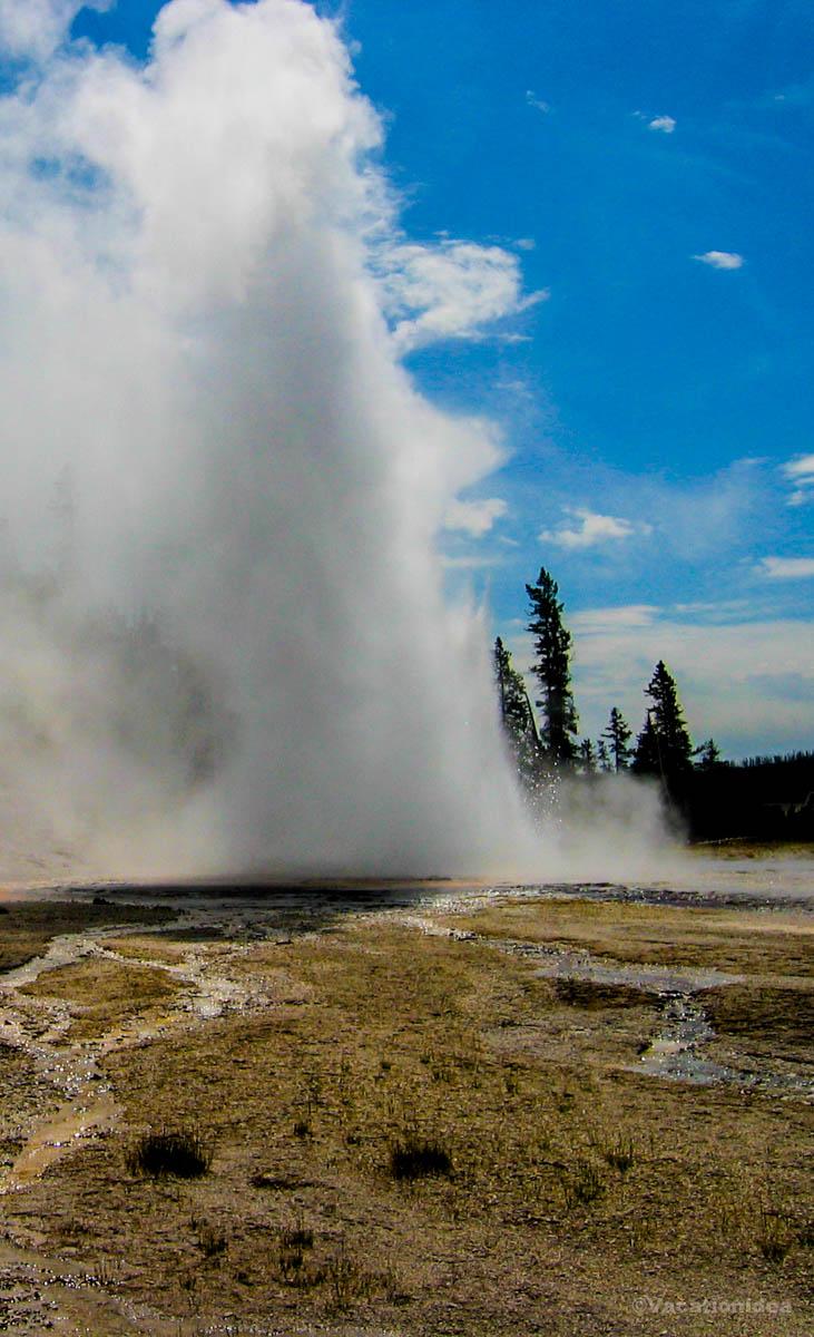
That evening, watching Old Faithful erupt under the stars and then falling asleep at the historic Old Faithful Inn became one of the most unforgettable moments of my life. That’s what Wyoming is like, it surprises you with new adventures at every turn! It’s why I’ll keep going back whenever I can. I hope you, too, find the perfect places for your own getaway.
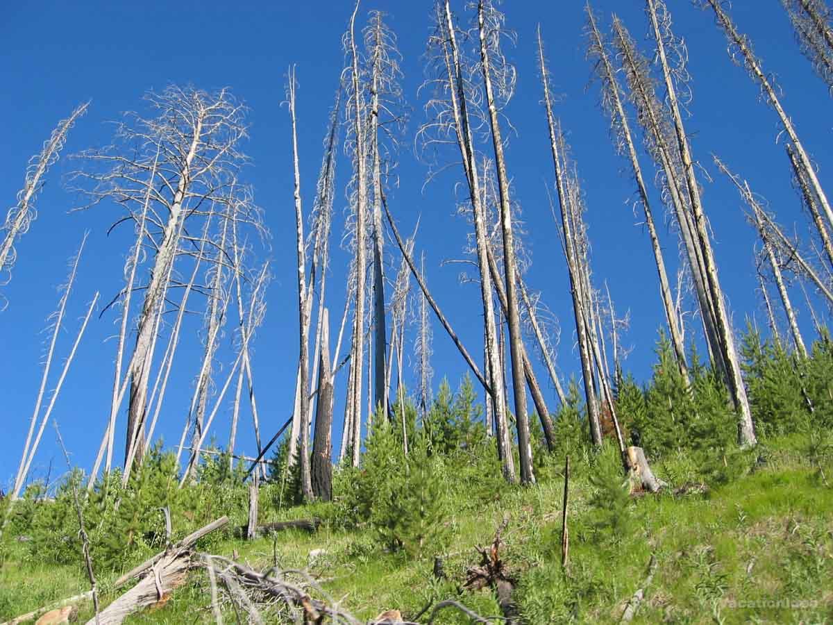
1. Wandering through wild wonder in Yellowstone National Park
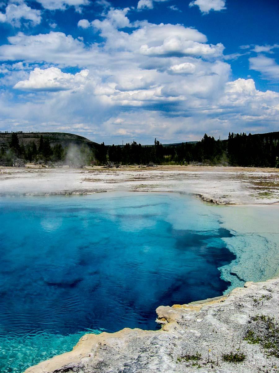
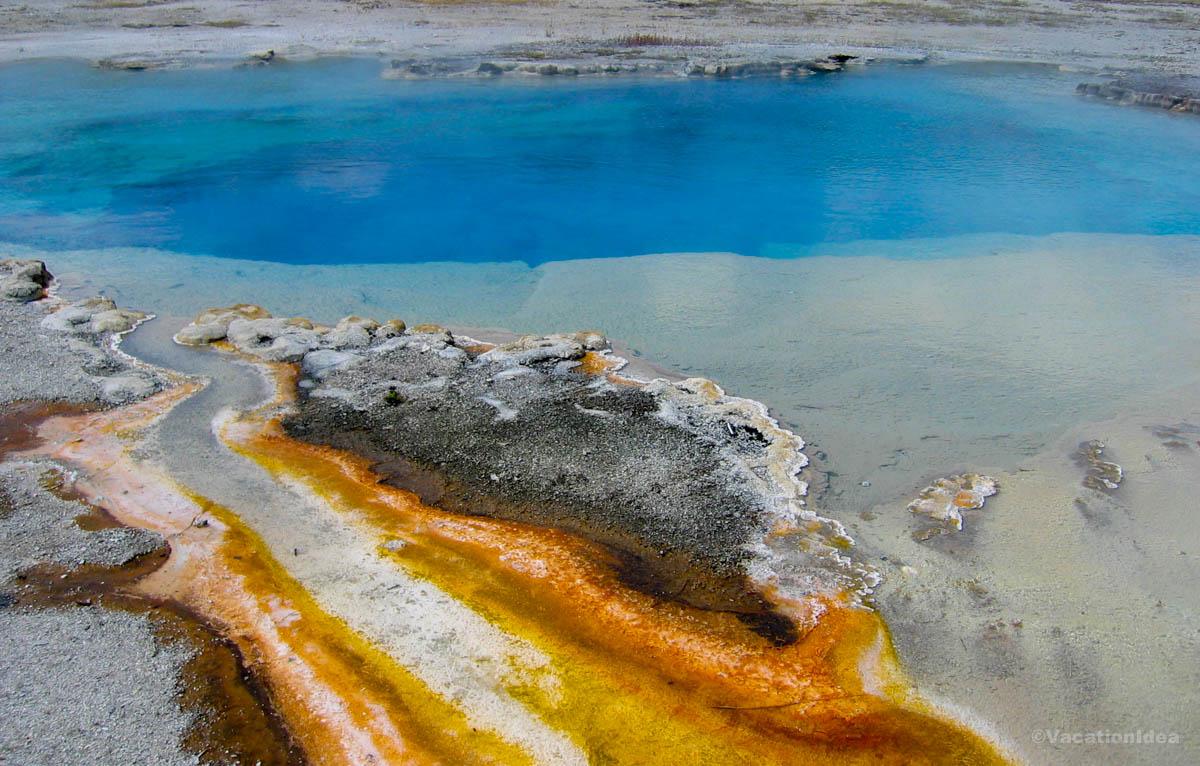
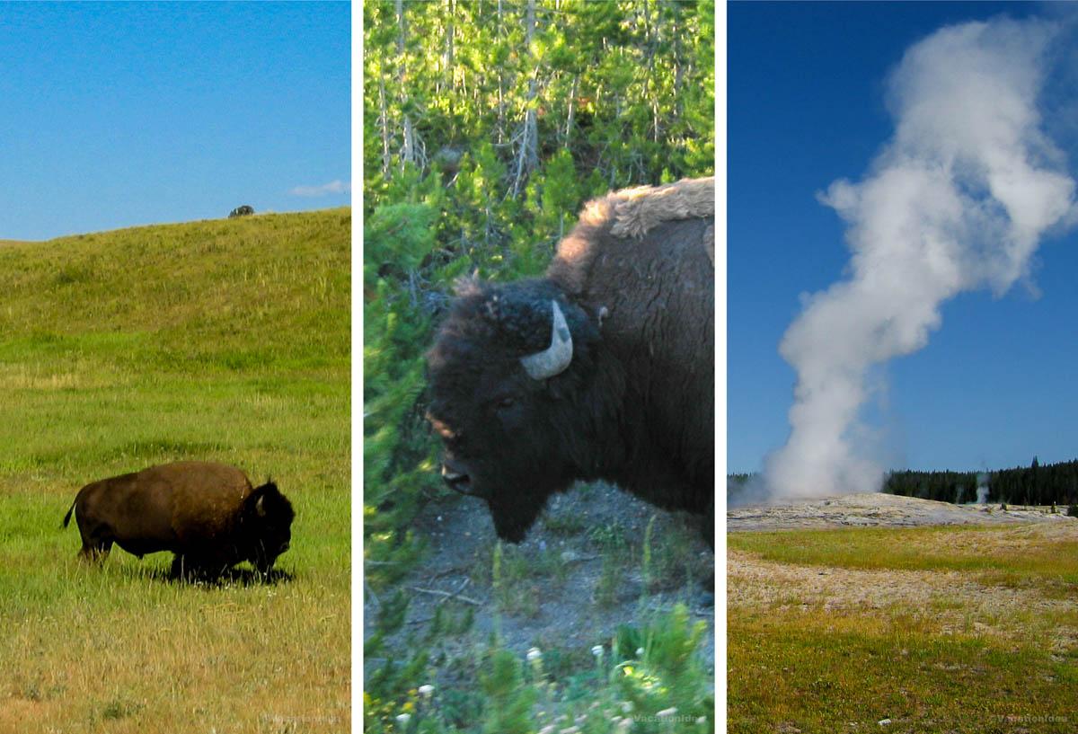
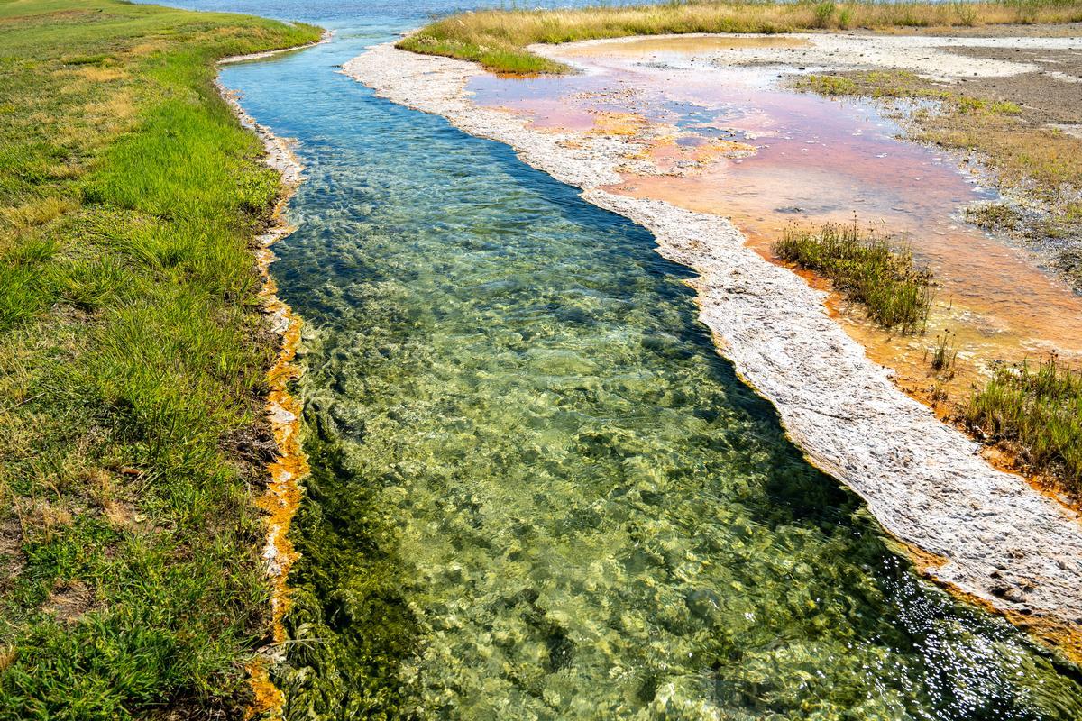
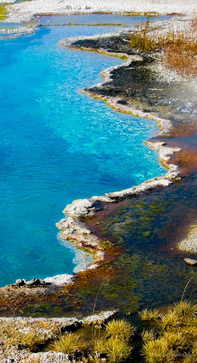
I always suggest getting an early start when you’re on vacation. This is especially true in the summer. As a ranger in Yellowstone told me once, "do as the animals do". You don't see much wildlife when the sun is punishing with its heat. Animals come out to eat and drink early in the morning. Sleep can wait until you get home!Yellowstone felt like the Earth showing off, geysers hissing, bison grazing in the distance, and waterfalls crashing over cliffs older than memory. Walking along the boardwalk at Grand Prismatic, I was in awe of the surreal colors rising in steam.
I remember thinking, "This isn’t just a park... this is a living planet, breathing beneath my feet." Every turn brought something new: a herd of elk, a boiling spring, a sudden hush in the forest. Yellowstone reminded me how small and lucky we are to witness it.
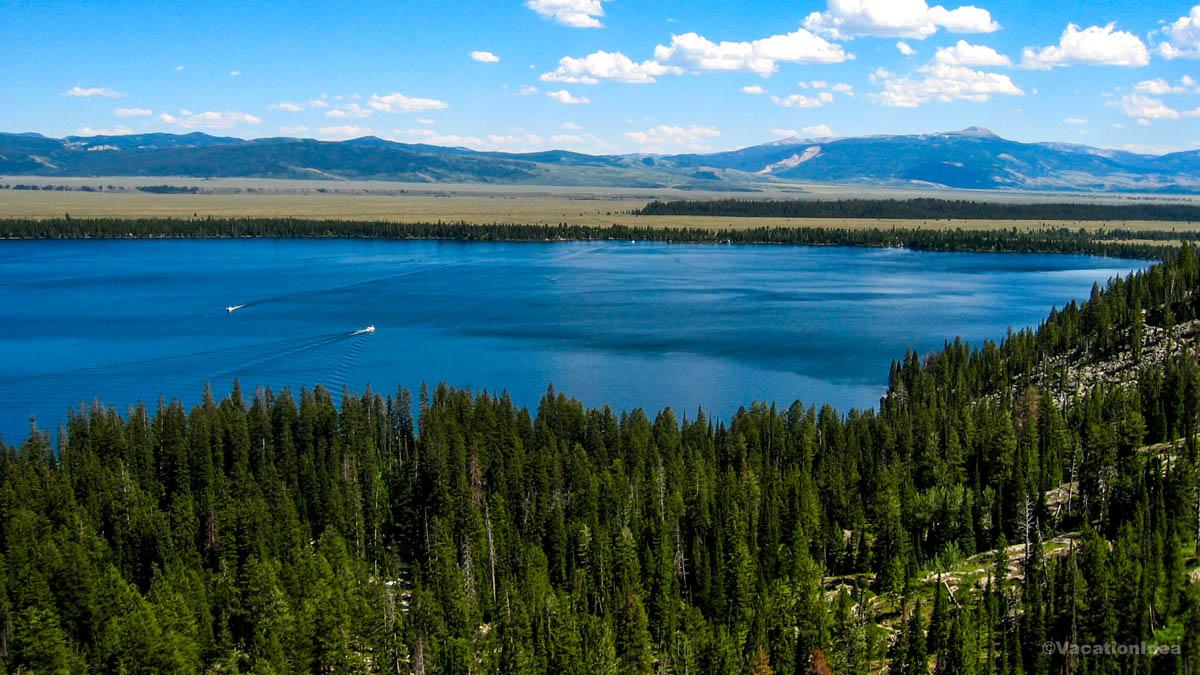
What I Loved Most: Sitting beside Yellowstone Lake at dusk, the air crisp and quiet, and watching the sky stretch wide over water that looked like glass.
My highlights? A hearty lunch at Old Faithful Inn Dining Room. It was buzzing with visitors who were excited to witness an Old Faithful eruption. I had the bison meatloaf with mashed potatoes and huckleberry sauce.
My feet were tired after miles of exploring geysers. I sat in a giant lather armchair next to the fireplace in the lobby and enjoyed the ambiance.
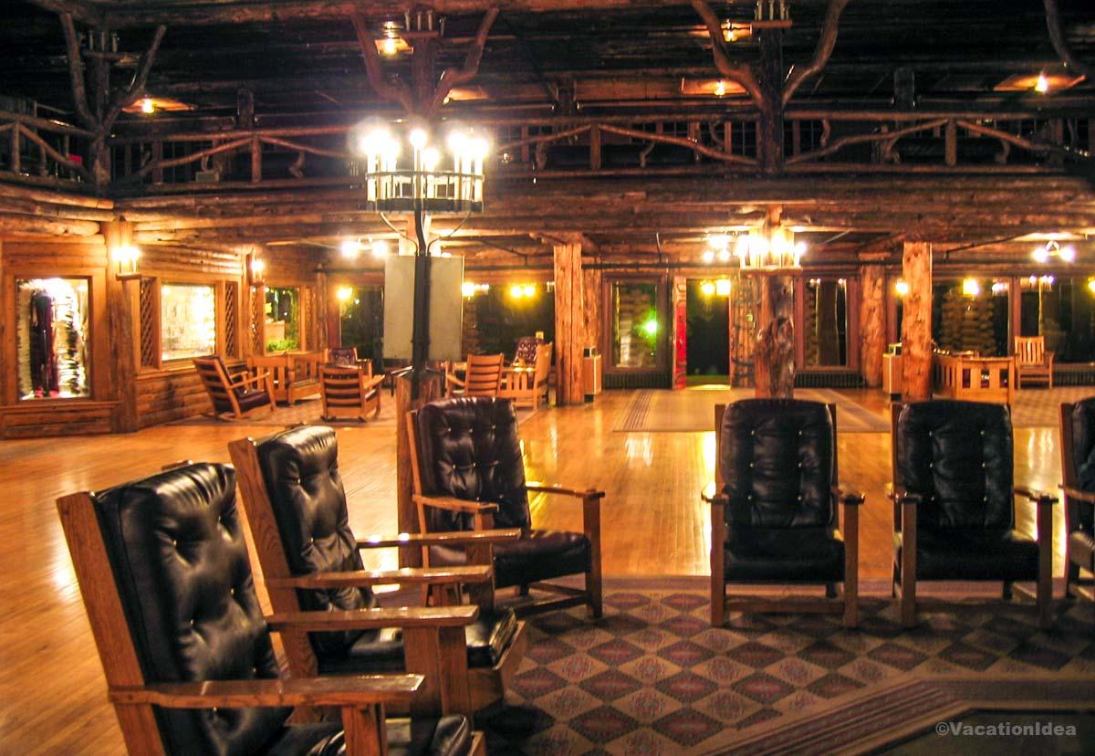
2. Relaxing at Old Faithful Inn
As I mentioned in my intro, we watched the Old Faithful geyser late into the night and spent the night at Old Faithful Inn.
Old Faithful Inn Travel Tips
- Drive Time from Jackson Hole: ~2.5 hours through Grand Teton NP into Yellowstone
- Where to Stay: Old Faithful Inn (historic wing rooms from $200+, newer wing $350+), Snow Lodge nearby ($250), campgrounds outside the area ($40)
- Where to Eat: Old Faithful Inn Dining Room ($20–35), Bear Pit Lounge (casual $12–18), nearby Snow Lodge restaurant ($25–30)
- Vibe: Historic, rustic, timeless
- Must-see: Old Faithful eruptions, Inn’s lobby and porch, Upper Geyser Basin
- Hidden Gems: Morning Glory Pool (short hike from the Inn), Firehole River picnic areas
- Best Time to Visit: Early morning or evening to avoid peak crowds
- Cost: Staying at the Inn $200–$400; dining moderate; geyser viewing free
- Hours: Geyser erupts roughly every 90 minutes; Inn lobby open to visitors daily
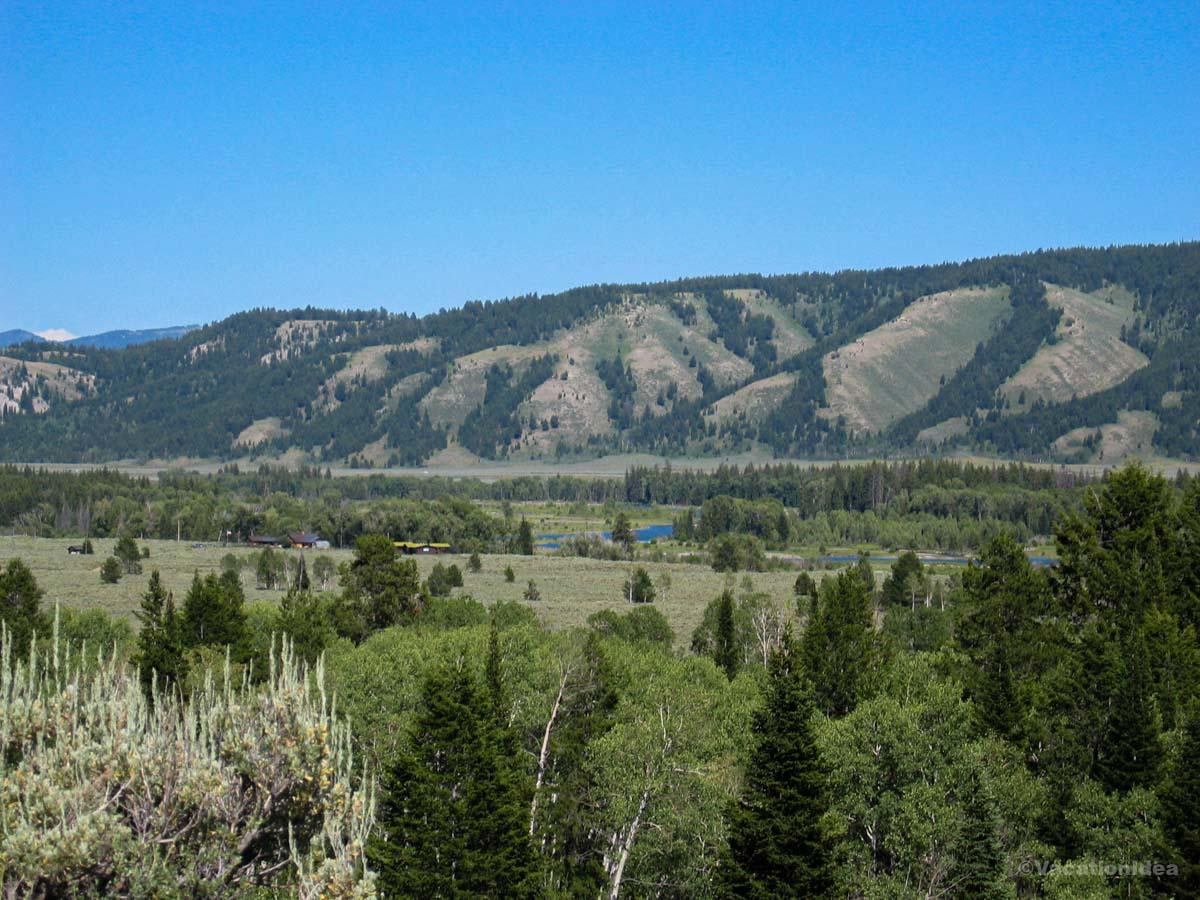
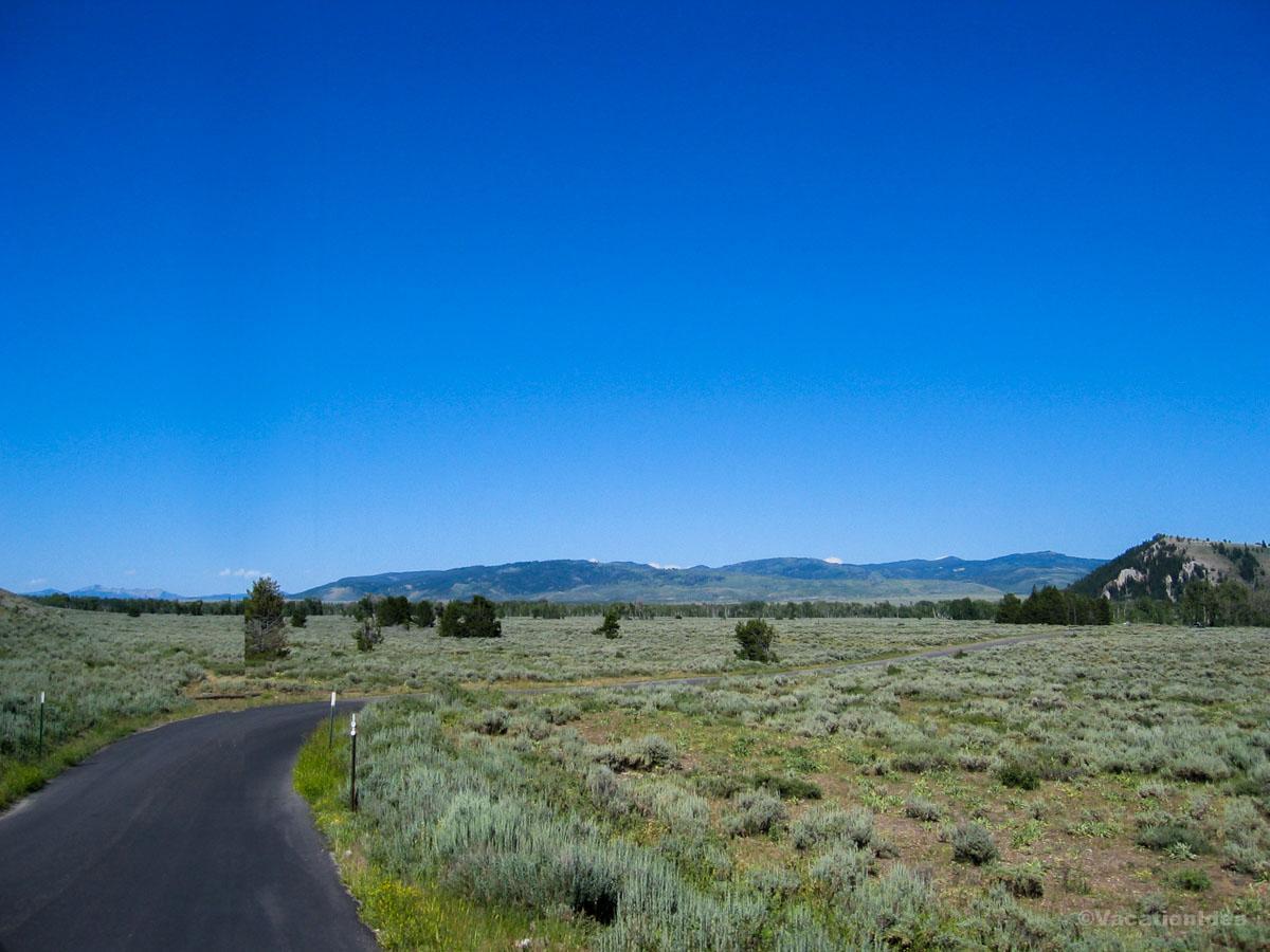
3. My photo of a quiet road through Jackson Hole Valley
After enjoying Yellowstone, we drove back to Jackson Hole. I wrote about my hotel choices in Jackson Hole here, including which ones I recommend for family travelers or romantic stays.
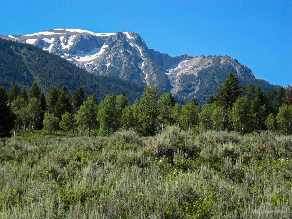
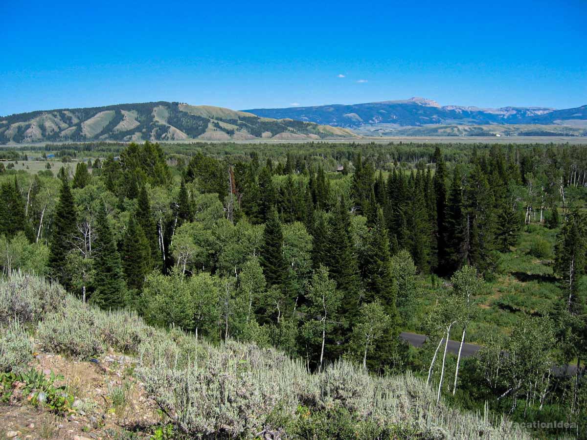
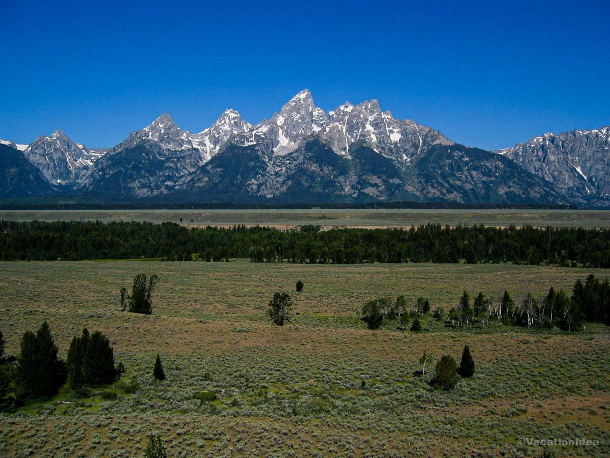
Jackson Hole was all wide valleys and wild soul. The Tetons sliced into the sky like a painting come to life, and the whole town carried a cool, Western ease. Walking through downtown Jackson, I felt suspended between a frontier past and a mountain-sport present.
I remember thinking, "If freedom had a view, it would look like this." It wasn’t just the scenery, it was the feeling that adventure was always just around the bend.
You can enjoy a boat ride across Jenny Lake, take the tram at Teton Village up to sweeping overlooks, or stroll through downtown shops and art galleries.
My Highlight:
When I hiked the Hidden Falls trail (free entry with park admission), I felt both small and exhilarated. The sound of rushing water grew louder until the falls appeared, cascading with a strength that made us linger, letting the mist cool our faces.
Where To Eat: You can try Snake River Grill on the Town Square. Their elk medallions came perfectly seared, rich, and earthy, a taste of the wild but presented with care. The cozy wood interior made it feel both rustic and warm.
The Cons: The beauty comes with popularity. Summer crowds can mean longer waits for meals and busy trailheads. You’ll want to plan ahead and start your hikes early in the day.
Jackson Hole Travel Tips
- Flight Time from Austin: ~3 hours direct to Jackson
- Where to Stay: Mountain Modern Motel ($180), Campgrounds inside Grand Teton NP ($40)
- Where to Eat: Snake River Grill ($30–45), Persephone Bakery ($15), Local Restaurant & Bar ($28)
- Vibe: Rugged, scenic, western-chic
- Must-see: Jenny Lake, Teton Village tram, Town Square
- Hidden Gems: National Elk Refuge (winter), Jackson Hole Rodeo (summer evenings)
- Best Time to Visit: Summer for hiking; winter for skiing; fall for golden aspens
- Cost: Park entry $35 per vehicle; downtown parking $10/day; food and lodging vary
- Hours: Trails dawn to dusk; restaurants generally 11am–10pm
4. Stepping into the spirit of the West in Cody
We left Jackson Hole early in the morning, heading east toward Cody. The drive took about 4.5 hours, winding through mountain passes and open plains. The road traced the edge of Yellowstone, so the scenery kept shifting, jagged cliffs, wide valleys, and the kind of big sky that makes you roll down the window just to breathe it in.
My goal was simple: experience the spirit of the Old West, learn more about Buffalo Bill, and end the day with a hearty meal before resting in town.
Cody felt like a crossroads, history pressed close, yet the town was alive with rodeo posters and rustic storefronts. The Shoshone River cut nearby, carrying its own rhythm through the valley.
I walked through the Buffalo Bill Center of the West and thought, “This place doesn’t just tell stories, it keeps them alive.”
You can enjoy an evening at the Cody Nite Rodeo (June–August), wander through Old Trail Town with its authentic frontier buildings, or simply walk down Sheridan Avenue lined with shops and western saloons.
My Highlight:
When I visited the Buffalo Bill Center of the West ($23 adult admission, kids $16), I felt immersed in the rugged past. The galleries stretched from Plains Indian history to western art, each room adding a layer to the story of the frontier. My son loved the interactive exhibits, and I found myself lingering longer than I expected.
Where To Eat: You can try Wyoming Rib & Chop House. Their bison ribeye came tender, smoky, and perfectly grilled, the kind of meal that tasted like it belonged here. The atmosphere was casual but warm, filled with families and travelers swapping stories of the road.
The Cons: Cody is small, so lodging can book quickly in summer. You should expect higher prices during peak season, and if you’re not into rodeo or western history, options feel a little limited.
Cody Travel Tips
- Drive Time from Jackson Hole: ~4.5 hours east, through Yellowstone
- Where to Stay: Irma Hotel ($140), Comfort Inn ($120), campgrounds nearby ($35)
- Where to Eat: Wyoming Rib & Chop House ($25–40), Proud Cut Saloon ($18), Granny’s Restaurant ($12–15)
- Vibe: Western, historic, rugged
- Must-see: Buffalo Bill Center of the West, Old Trail Town, Cody Nite Rodeo
- Hidden Gems: By Western Hands artisan gallery, Shoshone Canyon trails
- Best Time to Visit: Summer for rodeo and museums; fall for crisp weather and fewer crowds
- Cost: Rodeo tickets $25 adults; museums $23; parking generally free in town
- Hours: Museums 8am–6pm in summer; rodeo nightly at 8pm (June–Aug)
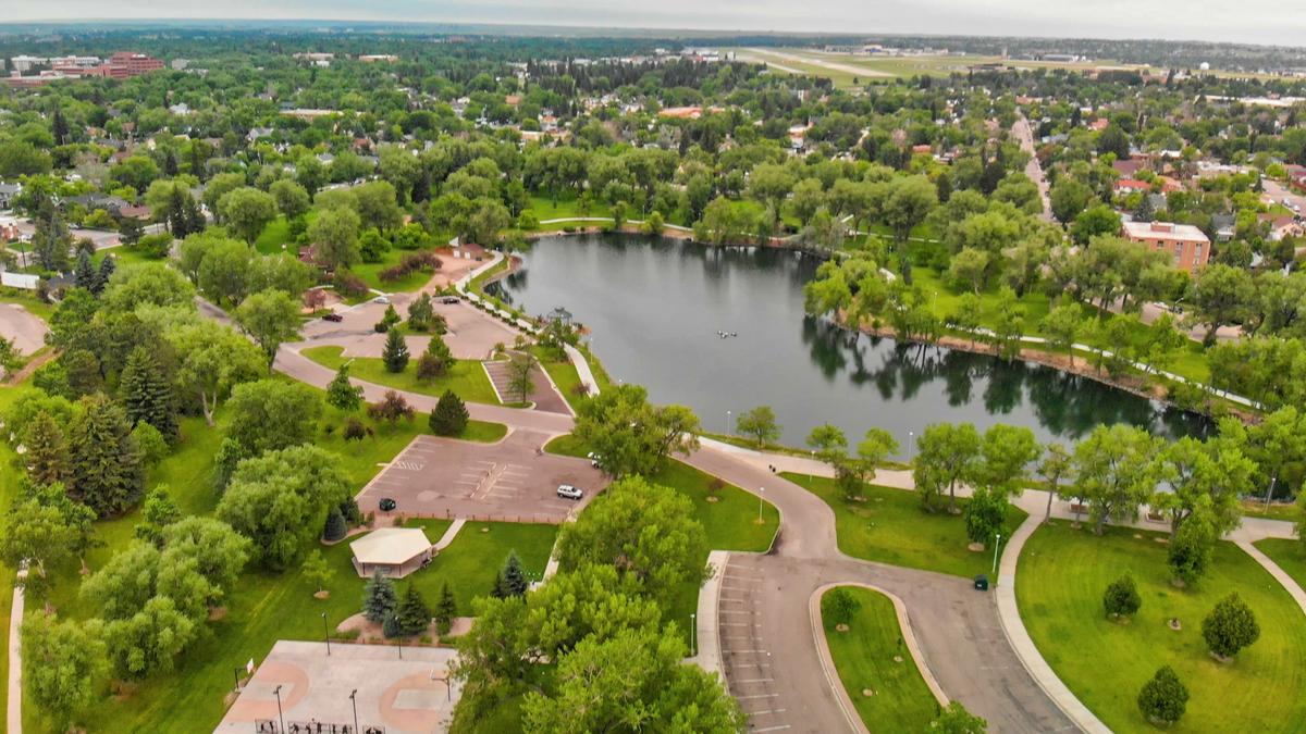
5. Roaming through history and heritage in Cheyenne
We left Cody in the early morning, heading southeast toward Cheyenne. The drive stretched about 6 hours, crossing plains that seemed endless. The Tetons and Yellowstone mountains gave way to wide open skies, golden grasses, and the occasional herd of pronghorn. By the time we pulled into town, the sun was lower and the Wyoming state capital felt both historic and surprisingly quiet.
My plan for Cheyenne was to connect with its frontier past, see the historic landmarks, and settle into the rhythm of a town that once pulsed with railroads and cattle drives.
Cheyenne felt rooted in its western pride. Brick streets framed by old theaters and government buildings mixed with murals and cowboy boots at every corner. The Union Pacific Depot stood tall as a reminder of how railroads shaped this place.
I stood in the plaza by the Depot, watching a freight train rumble past, and thought, “This town is still carried by the rails that built it.”
You can enjoy a guided tour of the Wyoming State Capitol, browse the Frontier Days Old West Museum, or just walk Sheridan Street lined with western shops and bronze statues.
My Highlight:
When I visited the Cheyenne Frontier Days Old West Museum ($15 admission, kids $10), I felt drawn into the grit and spectacle of the world’s largest outdoor rodeo. The exhibits of saddles, posters, and rodeo history made me imagine the noise of the arena. Even off-season, the museum kept the excitement alive.
Where To Eat: You can try The Albany, right across from the Depot. Their chicken-fried steak arrived golden and crisp, with mashed potatoes that tasted like comfort itself. The setting was casual, with wooden booths that felt unchanged for decades.
The Cons: Cheyenne can feel quiet outside of Frontier Days (late July). If you come in off-season, expect fewer events and a slower pace, which may not appeal if you’re chasing constant activity.
Cheyenne Travel Tips
- Drive Time from Cody: ~6 hours southeast across open plains
- Where to Stay: The Historic Plains Hotel ($140), Fairfield Inn ($120), Little America Hotel ($160)
- Where to Eat: The Albany ($15–20), Rib & Chop House ($25), Luxury Diner ($12)
- Vibe: Railroad town, western pride, small capital city
- Must-see: Union Pacific Depot, State Capitol, Frontier Days Old West Museum
- Hidden Gems: Cheyenne Botanic Gardens, Big Boy Steam Engine display
- Best Time to Visit: Late July for Frontier Days; spring and fall for mild weather
- Cost: Most attractions $10–15; free walking tours of downtown; parking free in many areas
- Hours: Museums 9am–5pm; restaurants generally 11am–9pm
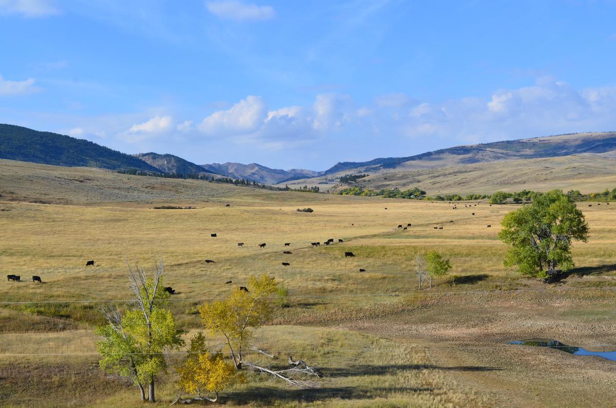
6. Finding quiet strength in Casper
We left Cheyenne in the morning, heading northwest toward Casper. The drive was about 3 hours, and as the miles passed, the land opened wide, rolling prairie, wind farms spinning on distant ridges, and a sky that seemed bigger with every turn. The Platte River eventually guided us into town, where modern buildings and rugged landscapes blended together.
My goal for Casper was to learn more about its pioneer history, spend time along the river, and end the day with a hearty Wyoming meal.
Casper felt practical and welcoming, with its roots still tied to the Oregon Trail. The air carried a mix of sage and river coolness, and the mountains in the distance stood as a quiet reminder that adventure was never far away.
I walked through the National Historic Trails Interpretive Center and thought, “The journey west wasn’t just miles, it was grit, hope, and survival.”
You can enjoy river walks along the Platte, visit the Interpretive Center, or take a short drive up to Casper Mountain for sweeping views of town and endless prairie beyond.
My Highlight:
When I toured the National Historic Trails Interpretive Center (free admission), I felt transported back to the pioneer era. The wagon replicas and immersive exhibits made me imagine what it was like to cross this land on foot or by oxen. My son loved climbing into the covered wagon, a tangible connection to history.
Where To Eat: You can try FireRock Steakhouse. Their wood-fired ribeye arrived with a smoky crust and tender center, filling the room with the rich smell of hickory. It was a meal that matched the strength of the landscape outside.
The Cons: Casper is quieter than Jackson or Cheyenne. Nightlife is limited, and some attractions close early. If you’re looking for constant activity, you may find it more of a “pause point” than a high-energy stop.
Casper Travel Tips
- Drive Time from Cheyenne: ~3 hours northwest
- Where to Stay: Ramkota Hotel ($120), Hilton Garden Inn ($130), Casper KOA campground ($35)
- Where to Eat: FireRock Steakhouse ($25–40), Eggington’s (breakfast $12–15), Racca’s Pizzeria ($15–20)
- Vibe: Pioneer heritage, river town, outdoorsy
- Must-see: National Historic Trails Center, Platte River walk, Casper Mountain
- Hidden Gems: Tate Geological Museum (free), Garden Creek Falls on Casper Mountain
- Best Time to Visit: Summer for hiking and river walks; winter for skiing on Casper Mountain
- Cost: Most museums free or under $10; food and lodging moderate
- Hours: Museums 9am–5pm; restaurants generally 11am–9pm
7. Relaxing in the healing waters of Thermopolis
We left Casper in the late morning and drove northwest toward Thermopolis. The trip took about 2.5 hours, the road carrying us past sagebrush plains, rocky buttes, and wide skies. As we got closer, the air shifted, faint whiffs of mineral warmth hinted at what this little town was known for.
My plan in Thermopolis was simple: soak in the famous hot springs, visit a bit of local history, and find a meal that felt like it belonged in a small western town.
Thermopolis felt like a hidden pocket of relaxation tucked into Wyoming’s rugged landscape. The Big Horn River rushed nearby, and steam rose in the distance from the pools that drew travelers for generations.
I stepped into Hot Springs State Park and thought, “This is where the land feels alive beneath your feet.”
You can enjoy free soaks at the State Bath House, explore colorful terraces of mineral deposits, or take a short hike along the swinging bridge across the Bighorn River.
My Highlight:
When I soaked at Hot Springs State Park (free, 20-minute limit per visit), I felt the tension from the road slip away. The mineral water was hot but not overwhelming, and as steam rose around me, I looked up at the canyon walls glowing in the late afternoon sun. It was peaceful in a way that felt timeless.
Where To Eat: You can try One Eyed Buffalo Brewing Company. Their bison burger came juicy and smoky, served with fries that tasted freshly made. The setting was relaxed, with locals gathered around wooden tables talking about fishing and hiking.
The Cons: Thermopolis is small, so options for lodging and dining are limited. The mineral smell near the springs takes a little getting used to, and evenings are very quiet.
Thermopolis Travel Tips
- Drive Time from Casper: ~2.5 hours northwest
- Where to Stay: Hot Springs Hotel ($120)
- Where to Eat: One Eyed Buffalo Brewing ($15–25), Black Bear Cafe ($12), Nature’s Corner ($10–15)
- Vibe: Relaxed, small-town, geothermal
- Must-see: Hot Springs State Park, State Bath House, Swinging Bridge
- Hidden Gems: Wyoming Dinosaur Center, petroglyphs at Legend Rock
- Best Time to Visit: Spring and fall for mild weather; winter for steaming springs against snow
- Cost: State Bath House free; museums $10–15; lodging moderate
- Hours: Bath House open daily 8am–5:30pm; most restaurants close by 9pm
8. Why I’ll Always Come Back to Wyoming
Wyoming wasn’t flashy, and it didn’t try to impress. But that’s what made it unforgettable. It gave me silence when I needed space to think. Adventure when I needed to feel alive. And a string of unexpected moments that linger long after the trip ends. I left feeling like I’d traveled both outward and inward, further into this wild land and further into myself.
I remember sitting at a roadside overlook, wind in my hair, watching the last light hit the mountains. And I thought, "This isn’t a once-in-a-lifetime trip. This is a place I’ll come back to whenever I need to remember who I am." If you’re looking for something real, raw, and quietly beautiful, Wyoming is waiting for you too.
If you love Wyoming, try one of these vacations next:
Booking Checklist
1. Book Your Flight - I use Expedia because I like their mobile app with my itinerary. They've helped me re-book flights on many occasions. Once you reach their Gold tier, support is especially good.
2. Book Your Hotel - I use Booking.com or Expedia, depending on my destination.
3. Book Your Rental Car - I use Expedia.
4. Book your tours on Viator or Get Your Guide.
