Best Places to Visit in Idaho
Searching for the best places to visit in Idaho? Well, you are in the right place! Idaho is a state of rugged mountains, scenic lakes, and charming towns, for me making it one of the most underrated places to explore in the U.S. Having traveled through its landscapes and communities recently on a four week road trip, I’ve found that The Gem State offers a perfect mix of outdoor adventure, relaxation, and local culture.
This is exactly why I decided to share my favorite things in Idaho so that you can use my guide as an inspiration to plan your own road trip.Here are the ones I recommend, and I think you’ll enjoy them too.
- Best Places to Visit in Southwestern Idaho
- - Boise - Bruneau Dunes State Park
- Best Places to Visit in Central Idaho
- - Salmon - Ketchum - Wild Love Preserve
- Best Things to Do in Eastern Idaho (Upper Snake River Plain)
- - Pocatello - Idaho Falls
- Best Day Trips in North Idaho
- - Sandpoint - The Route of the Hiawatha - Wallace - Coeur d’Alene
- Best Places to Visit in the Greater Yellowstone Region
- - Yellowstone National Park (West Entrance)
Best Places to Visit in Southwestern Idaho
I think this is one of the most diverse and accessible regions in the state where you can see open desert landscapes, river canyons, and lively mountain towns.
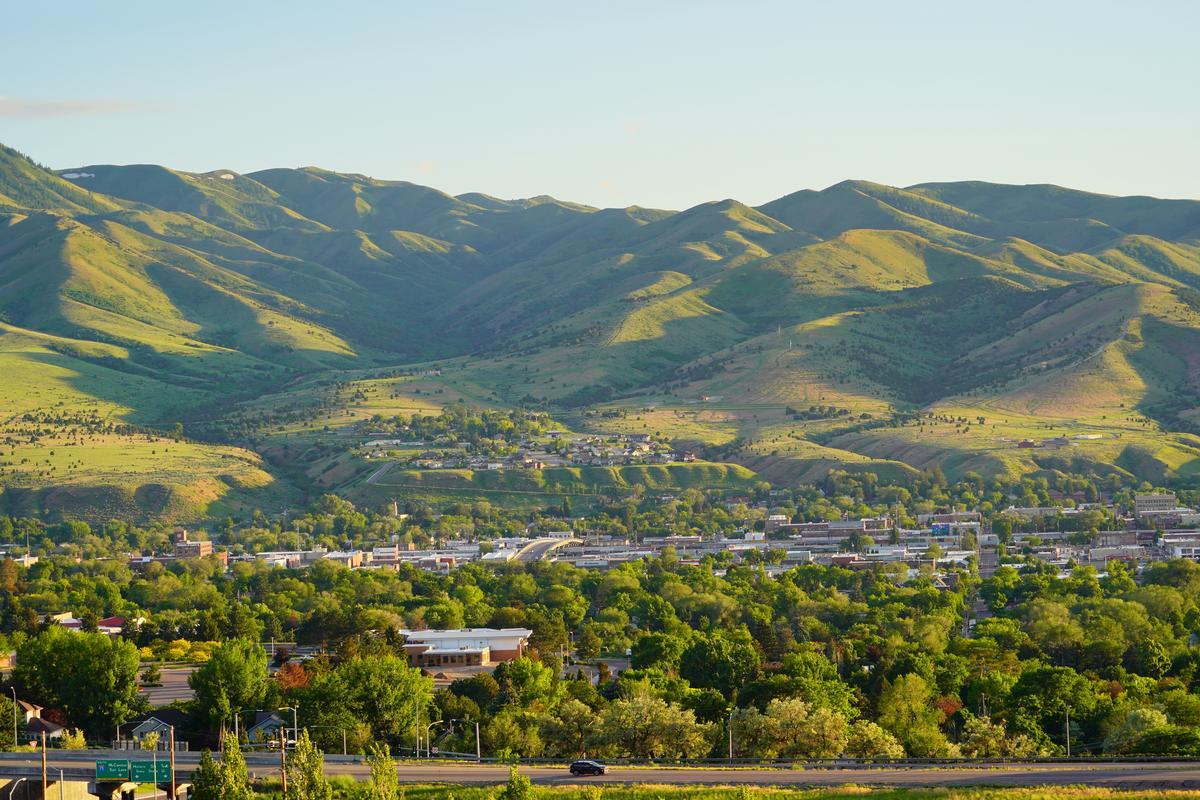
Boise
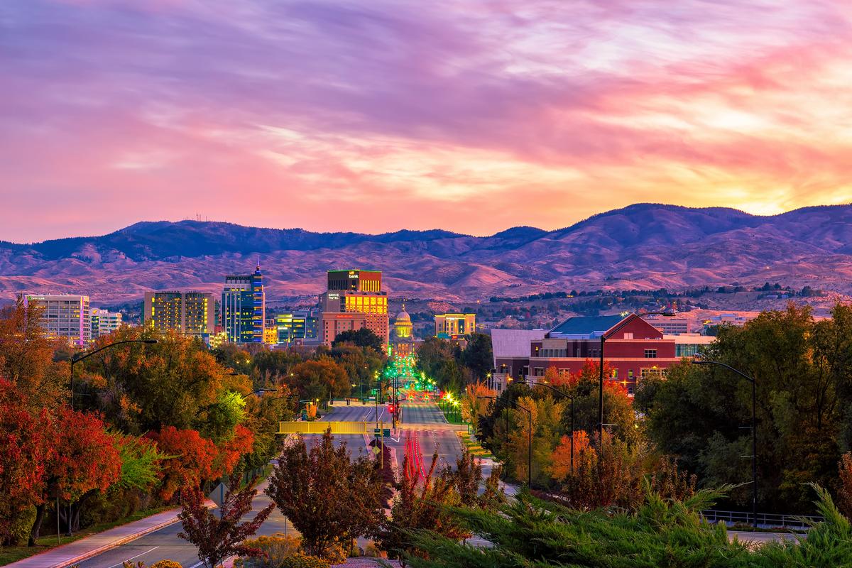
Ahh Boise, Idaho...the city that quietly surprises almost everyone who visits with lots of great outdoor adventure, creative culture, and small-city charm in a way that’s hard to beat.
If you’ve never been, it’s easy to underestimate just how cool this place is. With its vibrant downtown, access to nature, and relaxed pace of life, Boise is a destination I recommend to anyone who loves the outdoors, good food, and laid-back exploration.
What I love about Boise is how seamlessly nature and city life come together. The Boise River Greenbelt stretches for over 25 miles and winds right through town, making it easy to bike, walk, or simply relax along the water. Downtown Boise is compact and walkable, filled with local shops, breweries, and coffee spots, while the nearby foothills offer endless hiking and scenic views just minutes from the city center.
And let’s talk food — Boise’s culinary scene punches well above its weight. From Basque cuisine (Boise has one of the largest Basque communities in the U.S.) to modern farm-to-table restaurants, there’s no shortage of great places to eat. A stroll down Basque Block followed by dinner at a local favorite is a must.
We found that Fork Restaurant is a perfect spot for dinner since it offers creative, farm-to-table American dishes served in a lovely space.
Boise is also incredibly easy to visit. The airport is only about 10 minutes from downtown, making arrival painless compared to larger cities. If you’re road-tripping, the drive through Idaho’s wide-open landscapes is part of the experience. Once you’re there, getting around is simple — whether by car, bike, or on foot.
Having read up on the city’s early pioneer days and its roots in the Gold Rush era, I loved seeing how that spirit of adventure still lingers in the "City of Trees". I spent two days strolling along the 25-mile Boise River Greenbelt, visiting the Idaho State Capitol, checking out local art at the Boise Art Museum, and wandering the historic Hyde Park District with its cozy cafés and boutiques. My son has recently become interested in ghost hunting games as a teenager so the Old Idaho Penitentiary was fascinating to him, but I wouldn't bring a smaller child because it's too eerie, although it offers such an interesting window into the state’s Wild West past. I have to warn you, though, that parking can be a challenge!
Boise’s art scene was another surprise and we loved seeing murals, galleries, and even unexpected sculptures scattered throughout downtown which all gave the city such a creative vibe, and The Freak Alley Gallery, with its outdoor street art, was absolutely the best hidden gem.
Just a heads up though, Boise has a lot to see and do! The first time we visited, we found a tour with a local guide incredibly helpful, especially the local food tour.
What I loved best:
We flew from Austin to Boise (nonstop about 4 hours, fares around $150–$250 round trip). We stayed two nights at the 3-star Grove Hotel, which won the prestigious AAA Four Diamond award so you can trust that you'll be in good hands. We moved to a local, more affordable vacation rental for seven days afterwards (there are lots of great options!).

Bruneau Dunes State Park - 1 hr 15 min day trip from Boise
This was one of the most unexpectedly magical day trips from Boise when we were base there. The drive from Boise felt like part of the experience—watching the landscape gradually open up and grow quieter as we left the city behind.
We arrived to sweeping views of massive sand dunes rising out of the sagebrush, their soft curves glowing gold against the blue sky.
Climbing the dunes together was both challenging and playful, laughing as our feet sank into the sand and stopping often just to take in how quiet and vast everything felt.
Reaching the top of Bruneau Dunes was worth every step—the view stretched endlessly, making us feel small in the best possible way.
Later, we rented sandboards and tried sliding down the dunes, which quickly became a mix of exhilaration, clumsy tumbles, and shared laughter we’ll never forget.
As evening settled in, the desert cooled and the colors shifted to warm pinks and purples, turning the landscape into something almost surreal.
A highlight I didn’t expect on a simple day trip was visiting the park’s observatory after dark, where we lay back and watched stars fill the sky, brighter and more numerous than I’d ever seen before.
Learning about the park’s unique geology and how these dunes formed added a quiet sense of wonder—it made the place feel ancient and special.
For me, Bruneau Dunes State Park is one of the best places to visit in Idaho because it's peaceful and unique!
The view from the top was my favorite highlight and made every effort worth it. I enjoyed a sweeping panorama of desert, distant mountains, and the tiny blue shimmer of Bruneau Dunes Lake below.
Best Places to Visit in Central Idaho
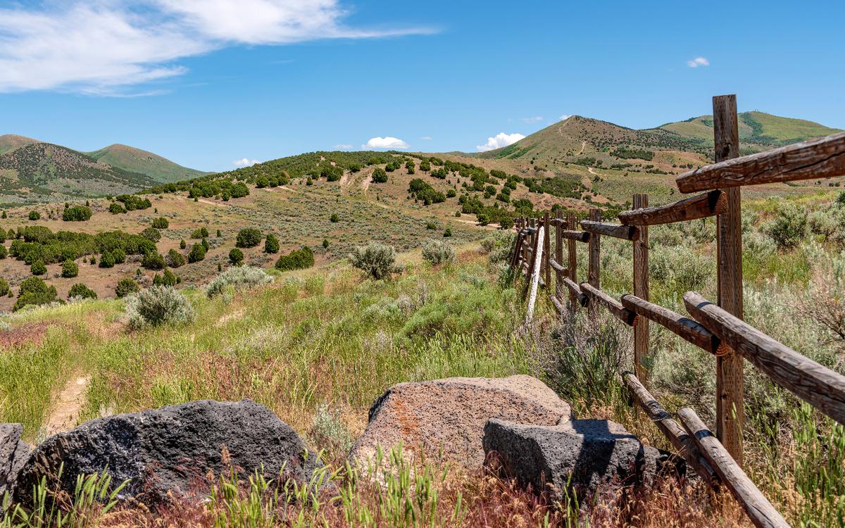
Central Idaho is the wild heart of the state, with rugged mountain ranges, deep river canyons, and some of the largest roadless areas in the Lower 48.
Salmon
This is one of the best hidden gem towns in Idaho, tucked away near the border of Montana and surrounded by wild mountains and rivers.
We first arrived after a long scenic road trip from Idaho Falls (3 hours, 160 miles).
Our first stop next morning was right downtown Salmon, which is small but vibrant and full of character, and walking around felt like discovering an underrated place most people skip.
We grabbed coffee and breakfast and it was such a cool, affordable way to ease into the day before heading out for adventures.
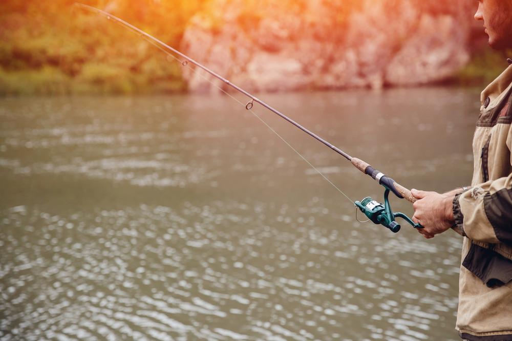
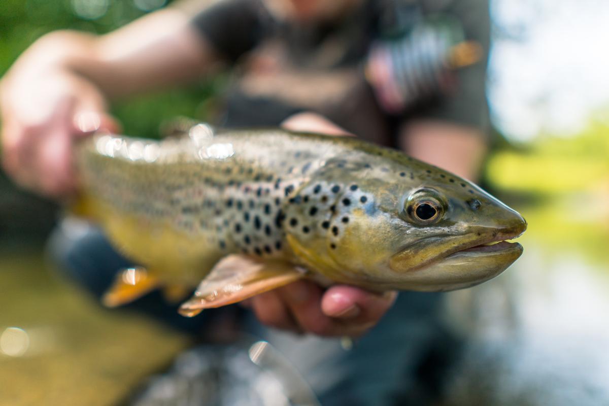
Next we headed toward the Salmon River, which is absolutely the best part of the area, and seeing it in person was spectacular and even better than my photos.
We spent hours just walking along the riverbanks, watching the water move fast and listening to nothing but nature, which was such a joyful experience.
After that we explored the Sacajawea Interpretive, Cultural & Educational Center this month (open seasonally, $5/person or $12/family), which tells the story of the famed Lemhi Shoshone woman and the Lewis and Clark Expedition that passed through here.
Later in the afternoon we went for a scenic drive into the surrounding mountains, which felt like the absolute best hidden escape and honestly a brilliant idea.
Dinner back in town was relaxed and family friendly, and the food tasted even better after such an exciting day.
As the sun set, Salmon felt romantic, quiet, and unique, and we knew this underrated Idaho gem was already becoming one of my favorite travel experiences ever.
The outdoor opportunities around Salmon are absolutely spectacular and next day we found the trails in the Salmon-Challis National Forest home to some of the most magical hikes, with hidden lakes, mountain views, and wildlife encounters. It’s a brilliant idea for a weekend getaway if you love adventure.
We checked into 3-star Stagecoach Inn for two relaxing days.
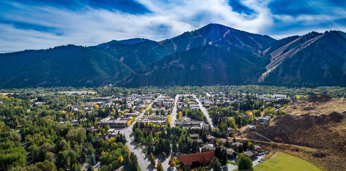
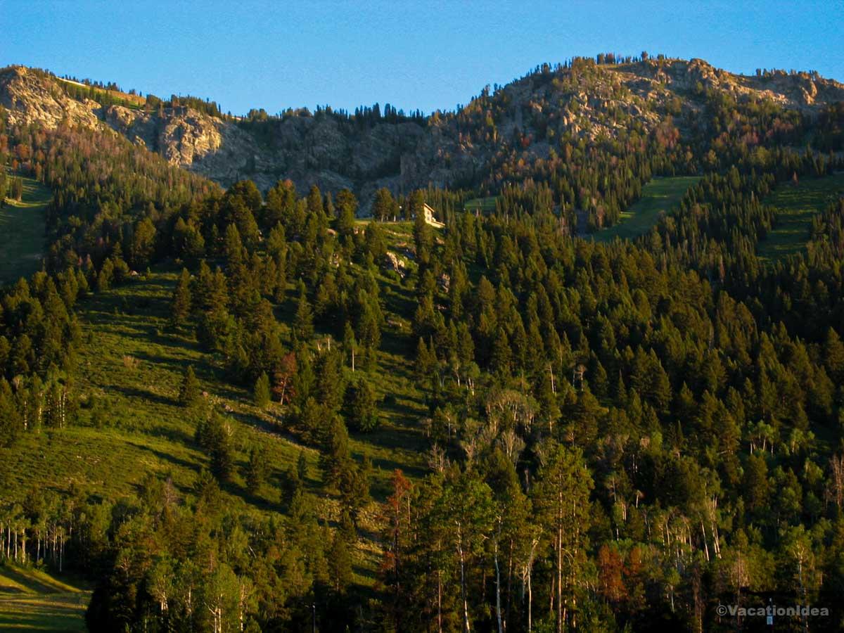
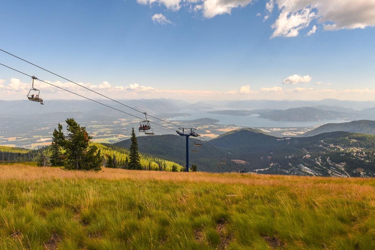
Ketchum, Sun Valley
This primary town in the Sun Valley area adjacent to the Sun Valley resort, instantly charmed me with its rugged mountain beauty tucked in the Wood River Valley, crisp and clean, and framed by the majestic peaks of the Sawtooth Mountains.
We drove northeast from Boise about 2 hours 45 minutes into Ketchum nestled in the Wood River Valley.
Over two days, I immersed myself in the rhythm of Ketchum life by visiting the Sun Valley Museum of Art for 90 minutes, browsing the Gallery Walk downtown, and enjoying a leisurely lunch at Enoteca, where local wines and wood-fired pizzas hit the spot after a morning hike.
One of my favorite stops was Independent Goods, a beautifully curated local shop filled with handcrafted Idaho-made treasures, from leather goods and ceramics to small-batch candles.
For dinner, I recommend The Pioneer Saloon which was just honored with the 2025 James Beard Foundation “America’s Classics” Award.
We stayed at the trendy 3-star Limelight Hotel Ketchum where I loved lounging with a view on the cozy lounge chair on our 2-bedroom Residence balcony!
What I loved best:
I also thought the Ernest Hemingway connection was fascinating and visiting his memorial by Trail Creek was one of the most meaningful, interesting stops of my trip because it added a unique cultural layer to all the outdoor fun.
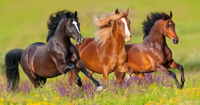
Wild Love Preserve
Nestled near the Salmon-Challis National Forest outside Challis, this amazing nonprofit sanctuary is dedicated to protecting wild horses, and I think it's one of the coolest and most inspiring hidden gems in the state.
From Boise, it's about a 3.5-hour drive to Challis, where Wild Love Preserve manages over 250 wild horses across 150,000 acres of public land partnerships. I instantly thought our journey was worth it!
You can really feel the magic of the place and seeing wild horses roaming freely across the rugged landscape is absolutely spectacular! They don’t just rescue and care for horses at Wild Love Preserve; they work with local communities, wildlife, and the environment to ensure a sustainable future, a brilliant place that's super meaningful to visit.
For me, this is an absolute best Idaho treasure...exceptional, inspiring, and a meaningful getaway to enjoy the West.
Best Things to Do in Eastern Idaho (Upper Snake River Plain)
Anchored by welcoming communities like Idaho Falls and Pocatello, the region offers easy access to waterfalls, lava fields, scenic byways, and rich pioneer history.
Pocatello
This town (just over 3 hours from Boise) turned out to be one of the most underrated road trip gems in southeastern Idaho, tucked between the Portneuf Range and the Snake River Plain. There are heaps of amazing things to do here!
We started by strolling through Old Town Pocatello, where historic brick buildings, local shops, and colorful murals gave the area a charming, lived-in feel.
My favorite stop was a cozy local café where we shared fresh pastries and hot coffee—it was the perfect way to ease into the day together.
We wandered onto the Idaho State University campus, and I loved the open lawns and mountain views surrounding it, with peaceful paths that felt ideal for a slow, romantic walk. We popped into Idaho Museum of Natural History right on campus.
In the afternoon, we explored Ross Park, following the trails along the Portneuf River and soaking in the calm beauty of nature just minutes from downtown.
I found the Museum of Clean surprisingly fun for adults too—it was quirky, interactive, and unexpectedly entertaining, bringing out our playful side.
For a unique touch, we drove just outside town to enjoy the wide-open scenery, watching the sun dip behind the hills while we talked and relaxed together.
Early dinner outside on the patio at Beet and Basil ended the day on a warm, note, with comforting dishes and a welcoming atmosphere that made us want to linger.
We stayed at 2-star TownePlace Suites by Marriott Pocatello and I spent two days exploring.

Idaho Falls
Chris and I both absolutely love Idaho Falls, and have been many times. This place felt like one of the most amazing hidden gems in eastern Idaho, sitting right along the Snake River with the spectacular falls as its centerpiece.
From Boise, it was a long but scenic drive east (about 4 hours 45 minutes, 275 miles along I-84 and I-15) into Idaho Falls. I spent five days soaking in the area, visiting the Museum of Idaho which beautifully tells the story of the region’s pioneer and natural history, checking out the Art Museum of Eastern Idaho, and browsing the little antique shops and boutiques downtown. Dinner at The SnakeBite was a treat because it was casual, local, and full of personality, and I also couldn’t resist stopping for coffee and pastries at Villa Coffeehouse the next morning.
I loved that there were so many day trip opportunities nearby, including the Craters of the Moon National Monument (1 hour 25 minutes drive), a surreal landscape of lava fields and rugged trails, and another out to the Heise Hot Springs for a relaxing soak (just 30 minutes from Idaho Falls). West Yellowstone is just 1 hour 45 minutes from Idaho Falls, so you can visit Yellowstone National Park from here too which I haven't tried yet because we usually base ourselves in Jackson Hole, WY, but it's on my to-do list because we met many people in Yellowstone who insisted it was the way to go!
We spent three nights at the historic Destinations Inn, and our themed suite made it a fun, one-of-a-kind stay.
What I loved best:
I thought the riverwalk was the absolute best way to see the city as it stretched for miles, and I loved how it offered both peaceful spots and vibrant views of downtown.
Best Day Trips in North Idaho
This region is ideal for day trips thanks to its compact geography and rich mix of lakes, forests, mountain towns, and historic sites.
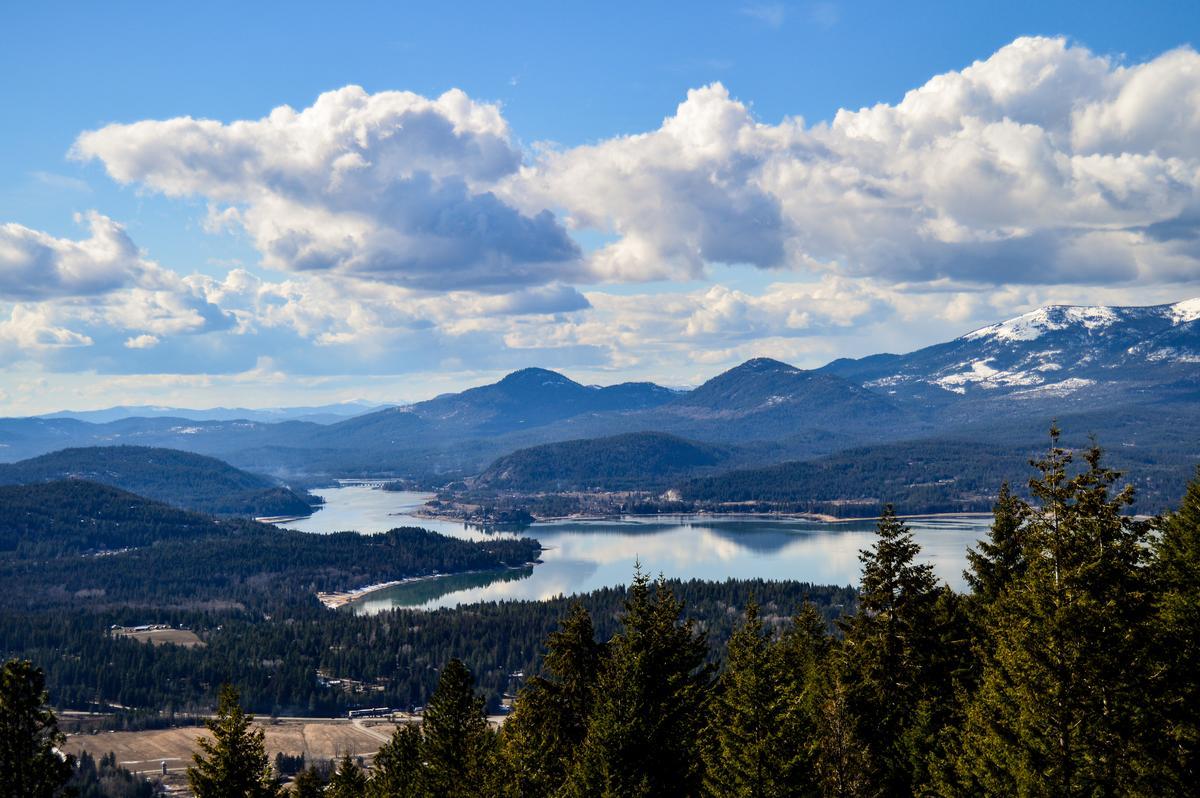
Sandpoint
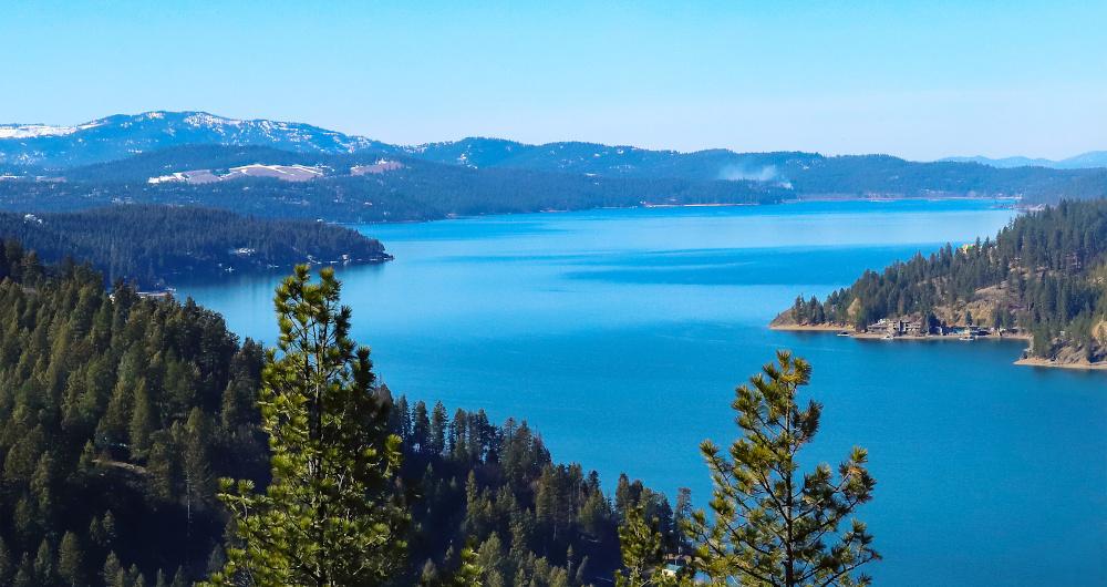
Tucked between towering mountains and one of the deepest lakes in the country, I think this is one of the most stunning and unspoiled places in Idaho, and actually all of the Northwest USA! I loved that Sandpoint offers miles of pristine shoreline, and alpine scenery. Best of all, it feels wonderfully removed from big-city busyness.
The drive north from Coeur d’Alene for an hour was beautiful in itself, and when we reached downtown, I found a small, artsy lakeside town filled with local galleries, indie shops, and inviting cafés.
We started by strolling through downtown Sandpoint, where local boutiques, art galleries, and cozy cafés lined the streets, creating a relaxed and cheerful atmosphere just steps from the water.
My favorite stop was a waterfront coffee shop where we shared pastries and warm drinks while watching boats drift across Lake Pend Oreille—it was the perfect way to begin our morning together.
We wandered along the Sandpoint City Beach and boardwalk, and I loved how the lake and surrounding mountains framed everything, making even a simple walk feel romantic and unhurried.
In the afternoon, we explored nearby trails, soaking up the fresh mountain air and peaceful forest views that made it feel like we were far away from everyday life.
I found the local art scene surprisingly vibrant—small galleries and public art pieces added creativity and character to the town and gave us plenty to talk about.
For a unique touch, we took a short drive to enjoy scenic overlooks around the lake, pausing to take photos and enjoy quiet moments together.
Dinner at a locally owned restaurant downtown ended our day on a cozy, romantic note, with fresh Northwest-inspired dishes and a warm, intimate ambiance.
What I loved best:
The historic Cedar Street Bridge Public Market, built right over Sand Creek, was my personal highlight—a cozy maze of artisan stalls, local food, and handmade crafts.
In addition, the views of Lake Pend Oreille at sunset were unforgettable, capturing everything I love about Sandpoint—natural beauty, calm moments, and time well spent together.
Chris, our son and I stayed at Cedar Street Hotel and Suites for three relaxing days.
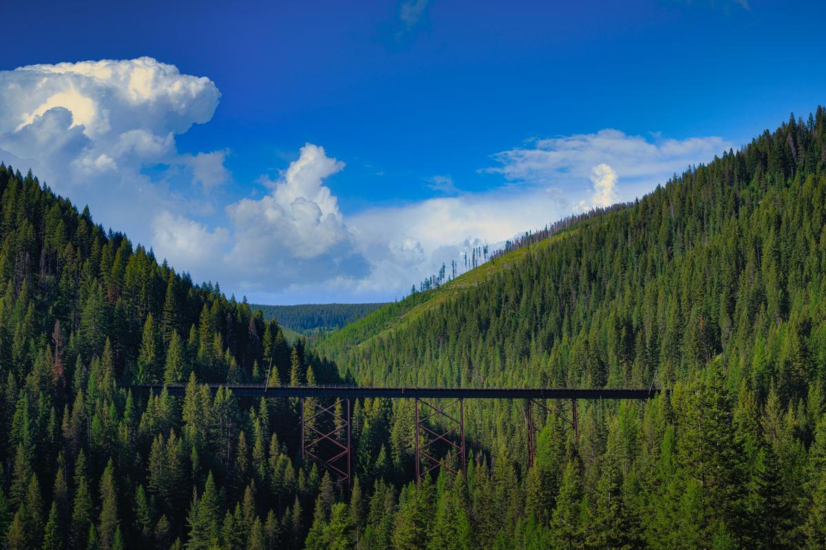
The Route of the Hiawatha
Riding on this trail in northern Idaho was one of the most spectacular and unforgettable adventures I’ve ever had and I think it's the best day trip from Spokane (2 hours and 30 minutes from Spokane). Tucked in the Bitterroot Mountains near the Montana border, this 15-mile scenic trail felt like a dream come true for both casual riders and outdoor enthusiasts like me.
From Wallace, Idaho, it was about a 30-minute drive east (18 miles on I-90) to the trailhead at Lookout Pass hiking and mountain biking trail is located near the city of Avery, Idaho).
I loved how the route followed the old Milwaukee Railroad line, turning historic train tunnels and high trestle bridges into the coolest bike path, and the views along the way were absolutely breathtaking!
I loved combining outdoor exercise with adventure and thought it was cool to learn that the historic railroad was the very first American route to use electric locomotives during the early 20th century, extending through Idaho and Montana's Bitterroot Mountains region!

Wallace
This felt like one of the coolest and most unusual small towns I’ve ever explored, and I found it absolutely fascinating to learn that it's known as the “Silver Capital of the World,” because it has produced over 1.2 billion ounces of silver since the 1880s!
Once we parked downtown, the first experience was just walking along the streets, because Wallace is small, vibrant, and full of unique historic buildings that feel frozen in time in the coolest way.
After that we grabbed coffee and breakfast at a local café, which was affordable, cozy, and honestly one of my favorite little stops of the whole weekend getaway.
We spent time exploring the old storefronts and quirky museums, learning about mining history and the town’s wild past, and it felt like an amazing underrated experience you don’t expect in Idaho.
Lunch came next at a classic spot downtown, and the food wasn’t fancy but it was the best comfort meal, joyful and perfect after walking around all morning.
In the afternoon we popped into antique shops and art galleries, which felt like a hidden gem activity and made Wallace feel creative and interesting.
What surprised us most was how friendly and relaxed everything felt, making it a welcoming vacation stop.
By late afternoon we slowed down, sat on a bench downtown, and just people-watched, which felt like the absolute best way to soak it all in.
Next day, we took the 1 hour 15 minute Sierra Silver Mine Tour ($20 for adults), and wandered the Northern Pacific Depot Museum.
Seeing the "Wallace Center of the Universe" manhole cover sign in town was my personal highlight in the afternoon next day!
Driving east from Coeur d’Alene for about 50 minutes, we reached Wallace where we stayed at 3-star Wallace Inn for two days. It honestly felt like a brilliant idea for a spontaneous day trip, but I was glad we were staying longer.
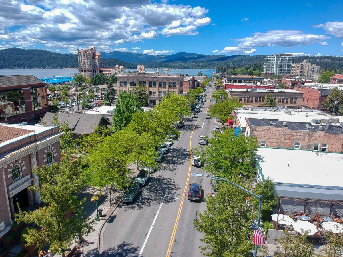
Coeur d’Alene
This place completely won me over and I think it’s one of the most spectacular and exciting places in northern Idaho, tucked right near the sparkling blue waters of Lake Coeur d’Alene. I felt like I had discovered an absolute gem that perfectly mixes outdoor adventure with a vibrant Downtown Coeur d’Alene, so trust me, it's absolutely one of the best places to visit in Idaho!
I spent two perfect days exploring the Tubbs Hill Nature Trail for its panoramic lake views, browsing local art at the Art Spirit Gallery in business for 30 years, and learning about the area’s Native and pioneer history at the Museum of North Idaho. For dining, I loved the lakeside elegance of Cedar’s Floating Restaurant, where I enjoyed local trout as the sun set over the water.
What I loved best:
One of my favorite things to do was walk along the Boardwalk, which is actually the world’s longest floating boardwalk, and it was such a cool and unusual experience to be surrounded by water views in every direction, and I loved seeing the boats drift by while the mountains framed the horizon.
Lake views from our bedroom at the iconic 4-star Coeur d’Alene Resort, another AAA Four Diamond winner where I loved waking up to sweeping lake views from my balcony, sipping morning coffee as boats glided by, and the spa’s mineral hot tubs overlooking the water were the perfect way to unwind after a day of exploring!
Best Places to Visit in the Greater Yellowstone Region
This is one of North America’s most extraordinary landscapes, spanning parts of Idaho, Wyoming, and Montana around the Yellowstone Plateau.
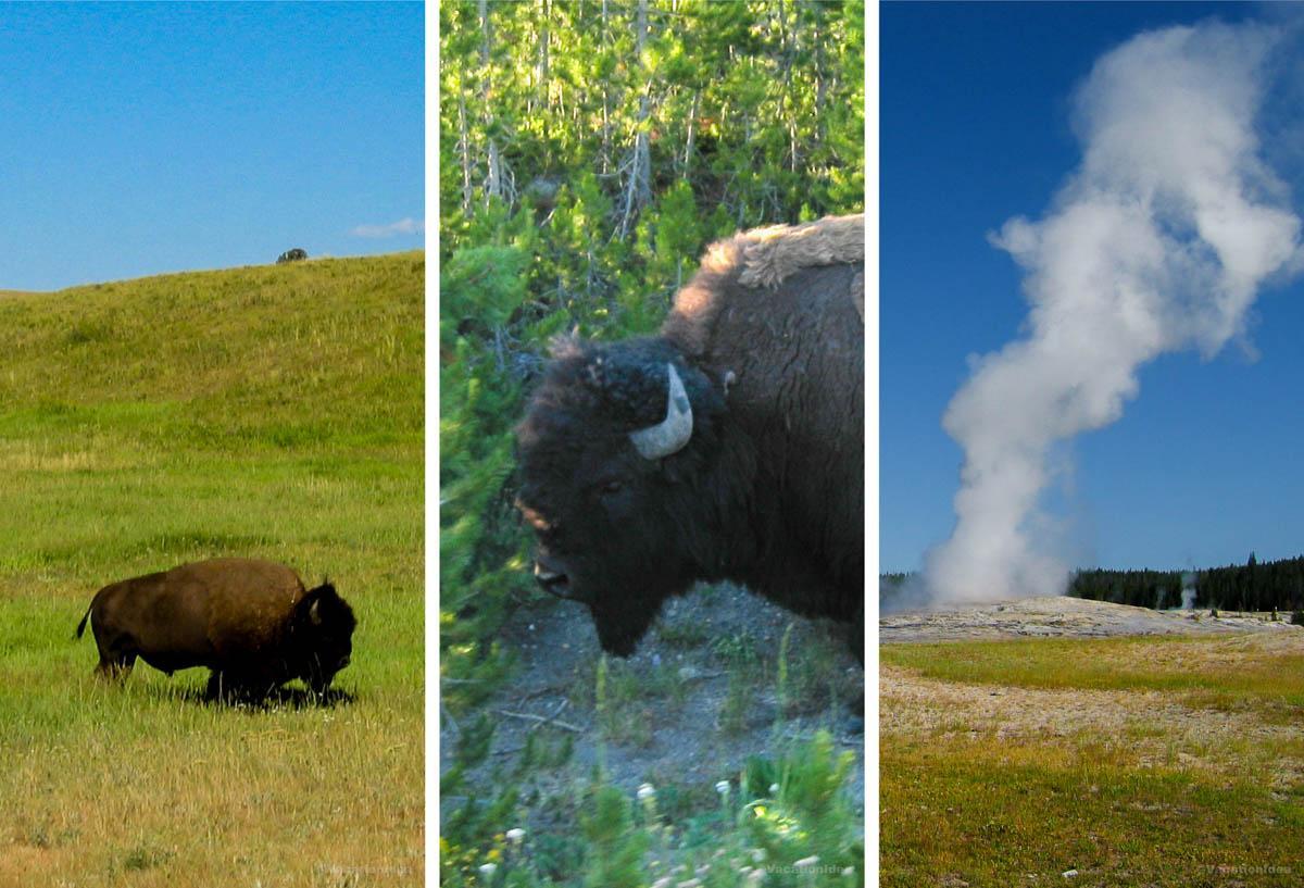
Yellowstone National Park
Sprawling across three states (Wyoming, Montana and Idaho) atop one of the world’s largest volcanic systems, this is one of the most awe-inspiring, otherworldly places Chris and I have ever visited and I think it’s one of the absolute best national parks in America. Why? Yellowstone offers miles of untouched wilderness, sapphire-colored hot springs, waterfalls, and wildlife encounters unlike anywhere else. Visiting Yellowstone gave me that rare feeling of stepping into a world far removed from the everyday.
From Pocatello, it's just under three hours to the western edge of Yellowstone National Park, where Idaho, Montana, and Wyoming all meet in a rugged, untamed corner of the Rockies.
For me, Yellowstone National Park is one of the best places to visit in Idaho.
Watching a geyser erupt at sunset was my personal highlight.