
7 Places to Go in August

We've found August is the best time to soak up summer’s energy. Why? First off, kids are much more relaxed after getting some down time in the summer, maybe even a little bored, so they are easier to travel with. Moreover, August weather tends to be more stable and made for exploring. From my many trips across the U.S. and our recent ten day road trip this month, here are some places I think you absolutely have to see as the summer is ending in August.
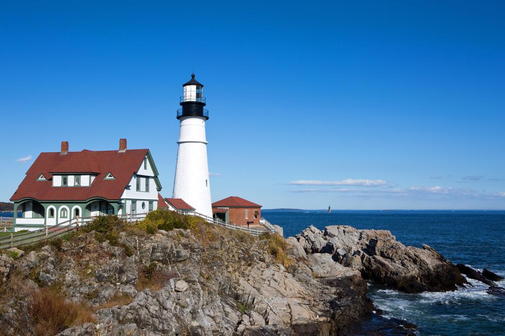
Portland, Maine
I've always loved New England in August and was fortunate to have plenty of time to explore this part of the USA while living on the East Coast for ten years.
For me, one of the coolest destinations was Portland, not just because it had so many attractions but it was also a great base for day tripping into nature.
Now, first things first, August weather was absolutely perfect for boat tours, walking around Old Port historic waterfront area, nearby beaches, and romantic sunsets over Casco Bay.
One spot you absolutely shouldn’t miss is Portland Head Light. I think it's New England's most iconic lighthouse. It’s just a short drive away in Cape Elizabeth. Trust me, the coastal views alone make the trip worth it.
Back in town, you can stroll along Commercial Street, visit local art galleries, check out the working fish piers, or relax with a craft beer. In fact, locals bragged to me that Portland has more breweries per capita than almost anywhere in the country!
I will say that it’s easy to wander aimlessly and lose track of time, especially if this is your first time visiting Portland. On our first visit, we found that taking a tour with a local guide helped us get oriented and make the most of our vacation. For me, the "Trolley City Tour with Portland Head Light Stop" is a standout because it covers all the most important stops in a short time without having to walk a lot which made things easy for my family.
- Average August temperature: 62°F – 75°F (17°C – 24°C)
What I loved best:
I especially enjoyed corned beef hash with poached eggs for brunch at Hot Suppa, my favorite highlight.
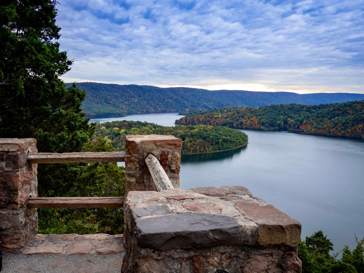
Altoona, Pennsylvania
I was wowed by this place! A friend recommended Lakemont Park on the lake in Altoona which is why we made a day trip here in August. In addition to great hiking and heaps of photos of the lake, we enjoyed historic buildings in Downtown Altoona.
A hidden highlight was visiting the Railroaders Memorial Museum after a filling lunch at a local spot.
- Average August temperature (Altoona, PA): 57°F – 79°F (14°C – 26°C)
We stayed at 2-star Wingate by Wyndham Altoona Downtown two stress-free nights.
Watching the sun set behind the mountains near Horseshoe Curve was my favorite moment.
Gilford, New Hampshire
Like the idea of a New England vacation but prefer a lake to the ocean? Head to Gilford, New Hampshire which was absolutely breathtaking in August.
There was something about this place that instantly made me feel like I’d found a quiet New England treasure. When I lived in NYC for 10 years, a few cherished days in New Hampshire in August were always such a treat.
Chris and I spent hours sitting at the edge of Lake Winnipesaukee in Gilford with our feet in the water and nowhere else to be.
I loved that the mornings were cool, perfect for a hike.
We caught a lakeside concert in August, and discovered the Gilford Old Home Day Parade and Fair. We also rode on the Gunstock Mountain chairlift for panoramic views of the lake and White Mountains .
- Average August temperature: 56.1°F – 77.4°F (13.4°C – 25.2°C)
We flew into Manchester-Boston Regional Airport, drove 1.5 hours north, and spent a week in a vacation rental.
What I loved best:
Exploring Ellacoya State Park, the sandy beach and picnicked right by the water.

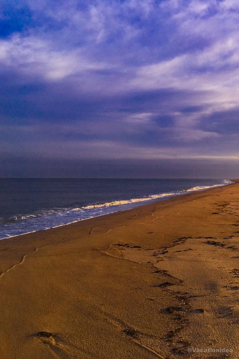
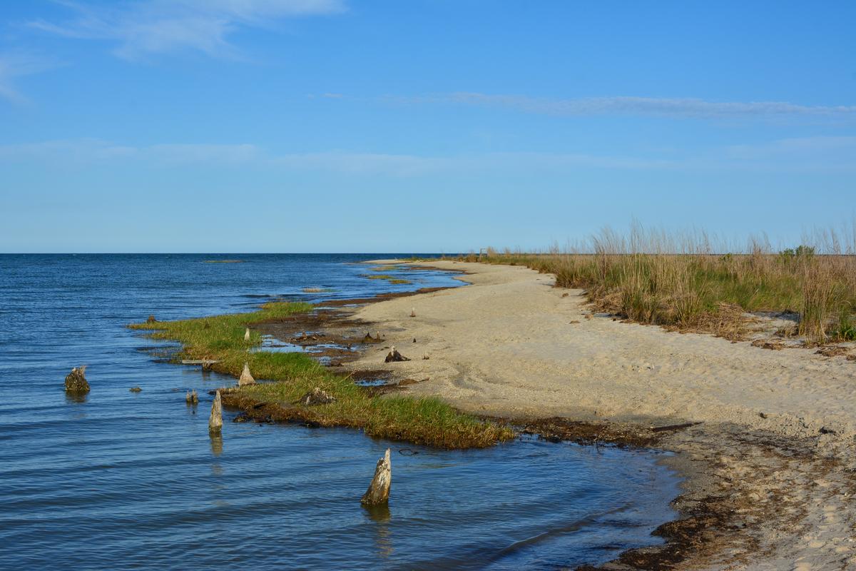
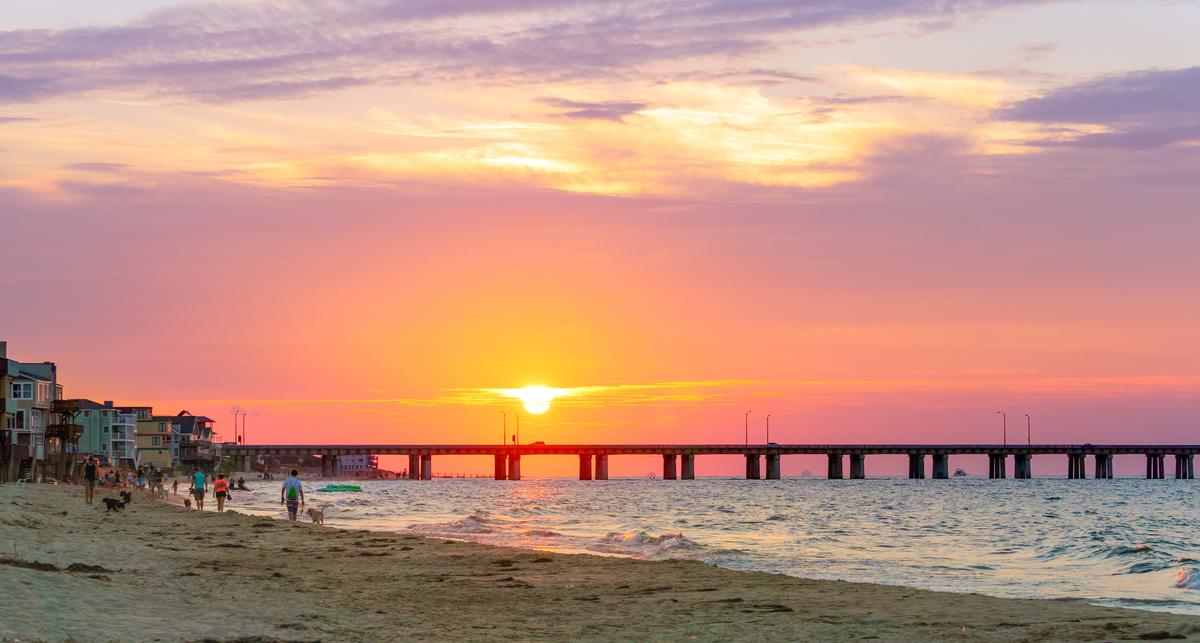
Chesapeake, Virginia
This was one of the most naturally diverse areas I’ve explored in coastal Virginia, and it was honestly one of the best outdoor August places on the East Coast to visit.
I have to warn you that August is one of the peak summer months here so there are lots of people around. However, the daytime warmth made it ideal for paddling and exploring, while the evenings brought just enough coolness to enjoy dinners outdoors.
I also discovered some lively late-summer happenings, like the Chesapeake Farmers’ Market, full of fresh local produce and crafts.
We flew into Norfolk International Airport, a quick 25-minute drive away, and began our trip with a stop at the Great Dismal Swamp National Wildlife Refuge. Another highlight was wandering through Northwest River Park where you'll find shaded trails.
- Average August temperature (Chesapeake, VA): 73°F – 85°F (23°C – 29°C)
What I loved best:
For me, Chesapeake is one of the best places to go in August in the USA because it's peaceful and relaxing!
Enjoying a short drive to nearby Virginia Beach for oceanfront views, then returned to Chesapeake for its quieter.
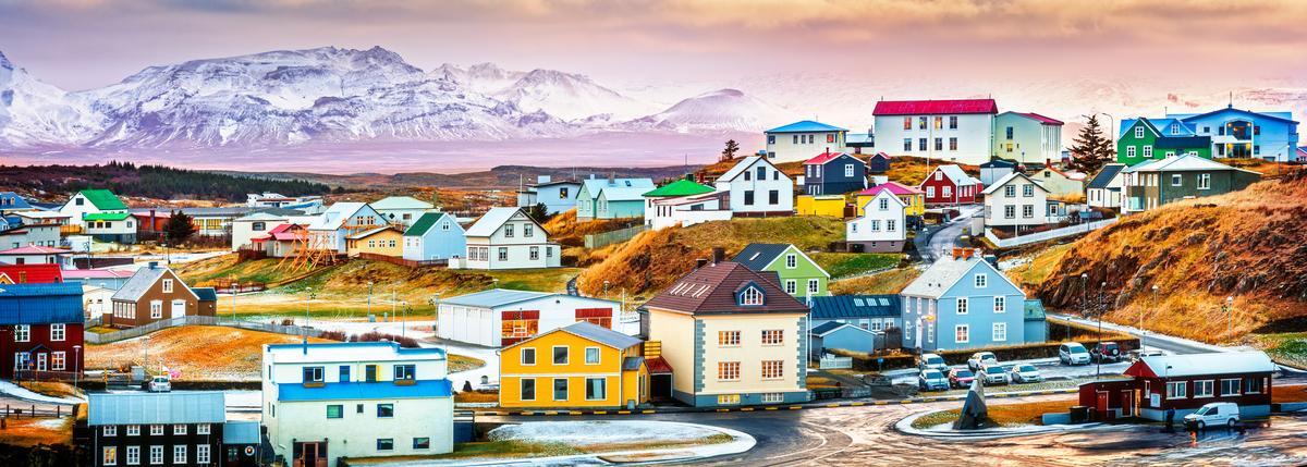
Iceland
I thought this entire country was one of the most breathtaking outdoor-focused destinations! In the mood for an international vacation in August? For something completely unique, head to Iceland, one of my favorite romantic getaways in the world.
This place offers some of the most untouched landscapes I’ve ever experienced. I honestly think it’s one of the absolute best destinations for nature lovers in late summer, especially in August. There are heaps of unique things to do in Iceland, whether you want to relax or explore a lot! Enjoy waterfalls, glaciers, and volcanic landscapes under nearly endless daylight.
I discovered there were also some incredible summer festivals and events this month such as the Reykjavík Culture Night (Menningarnótt) with street parties, art, and fireworks. Then there is the magical Þjóðhátíð (National Festival) in the Westman Islands. You'll find bonfires, live music, and fireworks. The whole country seemed alive with celebrations in August!
We flew into Keflavík International Airport, just 45 minutes from Reykjavík, and spent 10 days packed with adventures. You can enjoy soaking in the Blue Lagoon, hiking through Þingvellir National Park on the Golden Circle, chasing waterfalls like Seljalandsfoss and Skógafoss, spotting puffins at Dyrhólaey, taking a glacier hike on Vatnajökull, and relaxing in natural hot springs.
- Average August temperature: 50°F – 59°F (10°C – 15°C)
The only drawback? The scenery was breathtaking, but August is peak season. Accommodations are more expensive, and some spots felt overrun with tourists.
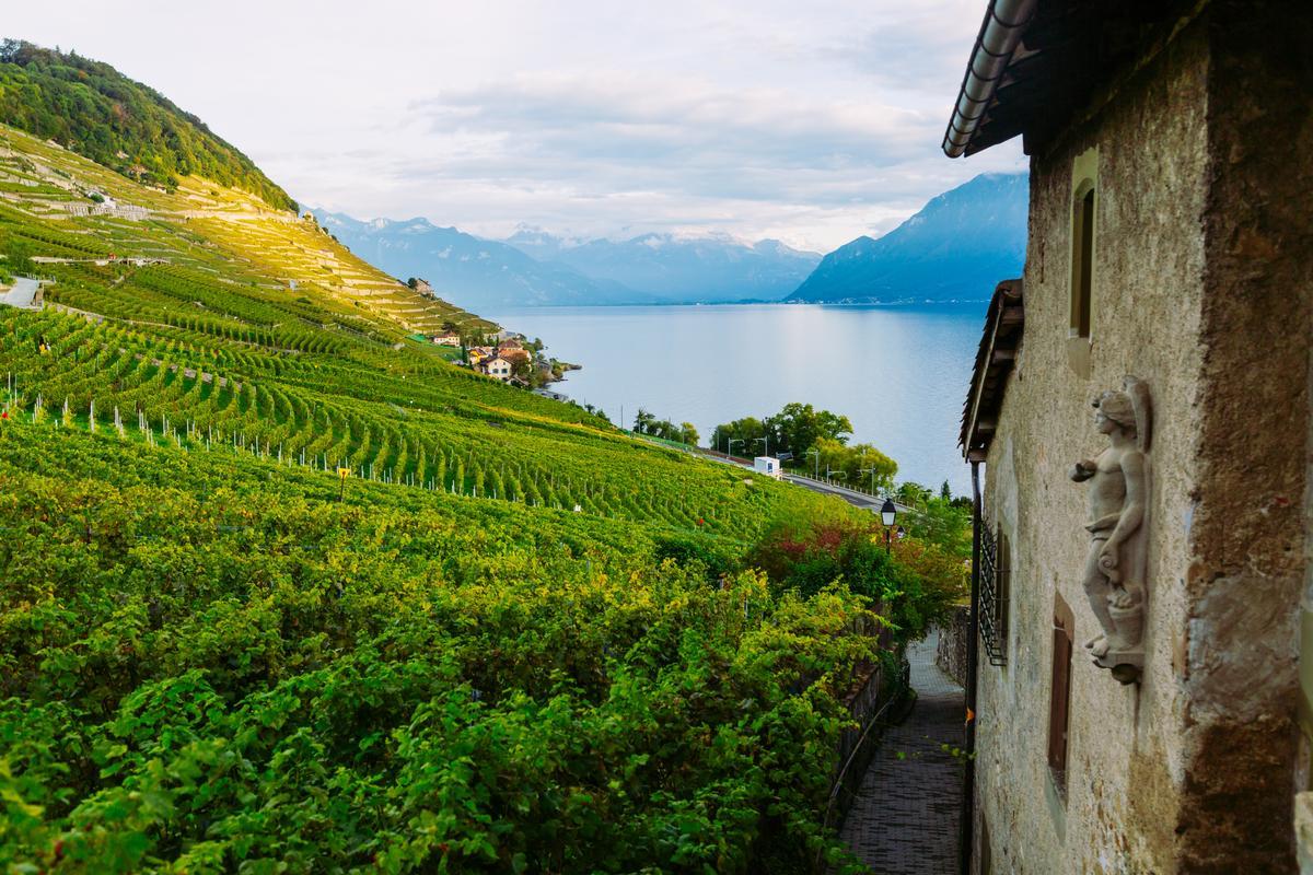
Geneva, Switzerland
I thought this was one of the most underrated cities in Europe! While spending two weeks in the Swiss mountains, we took a side trip to Geneva in August. My favorite was the Fêtes de Genève, a spectacular festival with fireworks and concerts.
You'll find Geneva alive with water-based activities, open-air dining, and seasonal highlights.
You can stroll around the Old Town, browse a Sunday flea market, and explore iconic landmarks like the Jet d’Eau and the flower-lined Jardin Anglais.
- Average August temperature (Geneva, Switzerland): 57°F – 78°F (14°C – 26°C)
A downside? I have to warn you that parking can be a challenge in August! Also, prices were sky-high. From hotels to simple meals, we ended up spending more than expected.
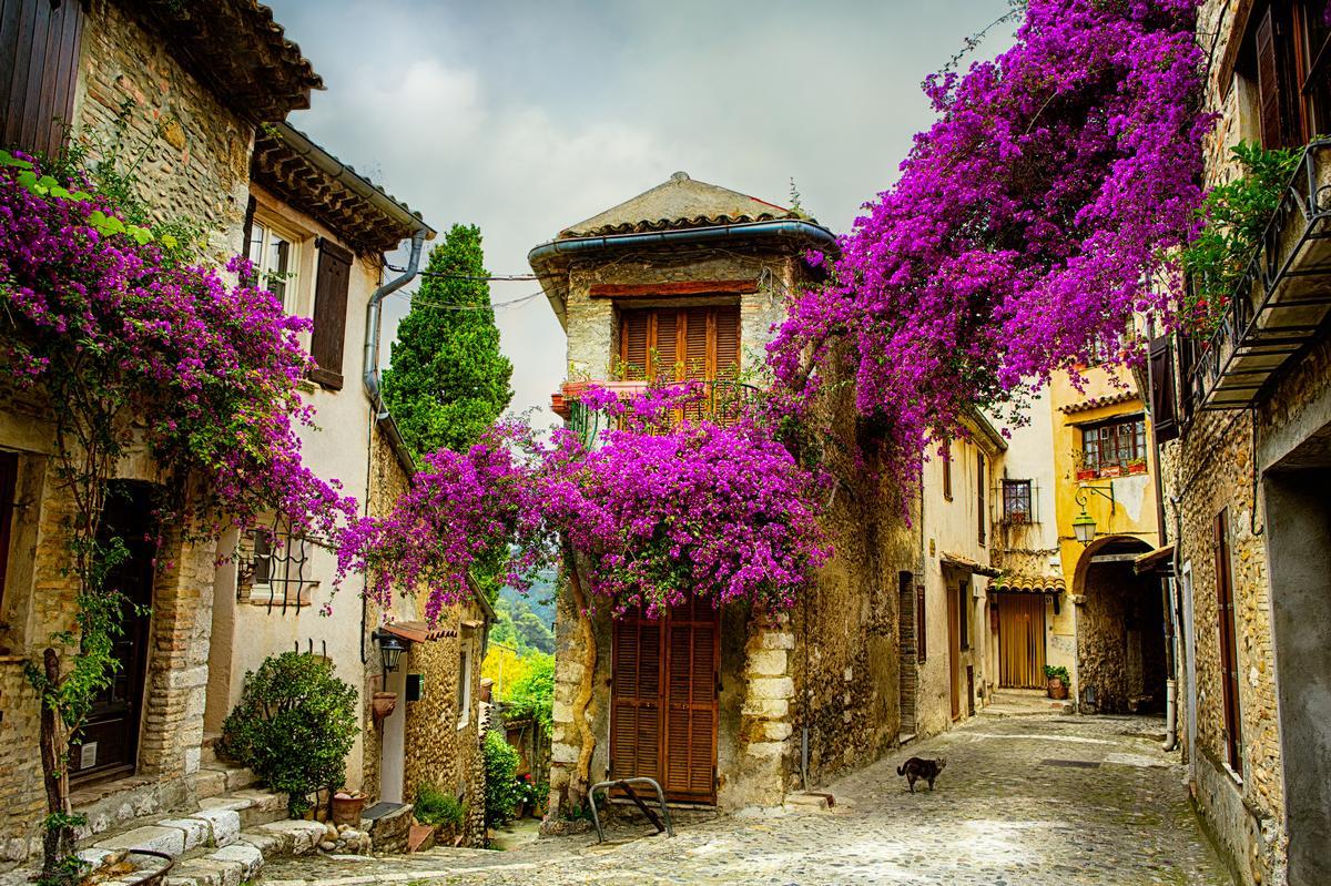
Provence, France
Ready for a romantic road through France? Provence in August was one of the best places we’ve ever been: romantic and full of unforgettable experience. I based myself here for a week in an affordable vacation rental.
You can enjoy the lavender fields outside Valensole, visit the lovely hill towns near Aix-en-Provence, and visit the vineyards near Châteauneuf-du-Pape.
- Average August temperature (Provence, France): 64°F – 82°F (18°C – 28°C)
You'll find hotels for every budget in Provence.
For me, Provence was one of the best places to visit in August.
A downside? Lavender fields in full bloom were unforgettable, but August was blazing hot. Walking through villages at midday left me searching constantly for shade.
