Places to Visit in Southern (and Central) California
Visiting SoCal and wondering where to go? There are so many fun places to visit in California! Having explored California's diverse corners from North to South for 30 years, I’ve found that The Golden State offers an ideal balance of natural beauty, cultural richness, amazing beaches, and endless opportunities for adventure or relaxation.
This is exactly why I decided to share my favourite things in Southern and Central California so that you can use my guide as an inspiration to plan your own road trip. Here are the places and activities I recommend from my recent four week road trip I explored, and I hope you’ll love them too.
- Best Places to Visit on the Southern California Coast
- Best Time to Visit - Worst Time to Visit Southern & Central California
- How to Get to Southern & Central California - How to Get Around
- - #1. Dana Point - #2. Carlsbad
- Best Places to Visit on the Central Coast & Wine Country
- - #3. San Luis Obispo - #4. Santa Barbara - #5. Solvang & Old Mission Santa Ines - #6. Santa Ynez - #7. Paso Robles
- Best Places to Visit in Greater Los Angeles
- - #8. Pasadena - #9. Los Angeles - #10. Redondo Beach - #11. Camarillo - #12. Santa Monica - #13. Catalina Island
Best Time to Visit Southern & Central California
If your travel plans are flexible, I think the best months are March to May and September to November. You'll find mild weather, fewer crowds, and great outdoor conditions!
Worst Time to Visit Southern & Central California
The most challenging times to visit are July and August, when coastal areas are crowded. In addition, in peak summer, inland regions like the Central Valley and deserts experience extreme heat, and prices peak. Another less-ideal period is winter (December–February) when beaches are cold and windy. In addition, if you’re planning to drive through mountain passes, snow can cause road closures.
How to Get to Southern & Central California
- By Air: Fly into one of the major airports such as Los Angeles International (LAX) and San Diego International (SAN).
- By Car: Southern and Central California are ideal for road trips. Scenic highways like Highway 1 (Pacific Coast Highway), I-5, and US-101 connect beaches, cities, wine regions, and national parks.
- By Train: Amtrak California routes such as the Pacific Surfliner (San Diego–Los Angeles–Santa Barbara) and Coast Starlight (Los Angeles–Bay Area) offer scenic, relaxed travel.
How to Get Around Southern & Central California
Having a car is the easiest and most flexible option - it will take you to hidden spots which are the most rewarding to visit!
In cities like Los Angeles, San Diego, you can also use rideshares and public transit.
Best Places to Visit on the Southern California Coast
I love visiting this region for an unbeatable mix of sun, scenery, and culture.
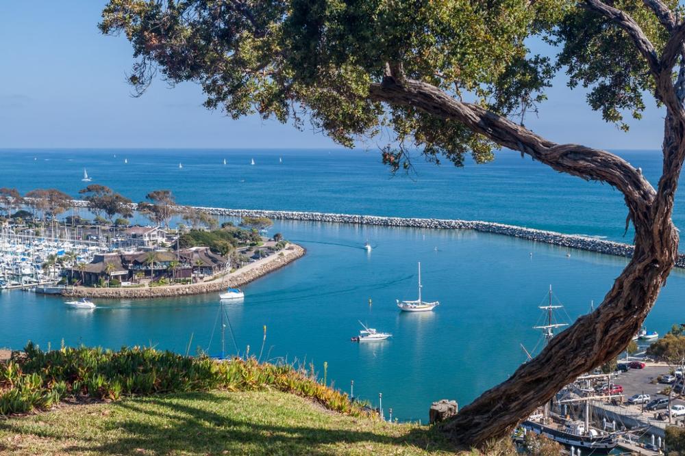
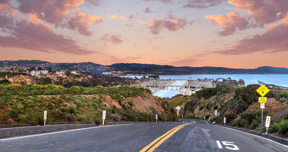
Dana Point
This is one of the most relaxed and romantic seaside towns I’ve explored on our road trip. I think it’s one of the absolute best places to visit in Orange County (just 1.5-hour drive south from LA!) and my #1 place to visit in SoCal.
We started our day at Dana Point Harbor, where we had the most splendid time looking at sailboats and watching the marina wake up. You can check out the harbor shops next. To rest our feet, we stopped for espressos and croissants at Coffee Importers right in the harbor.
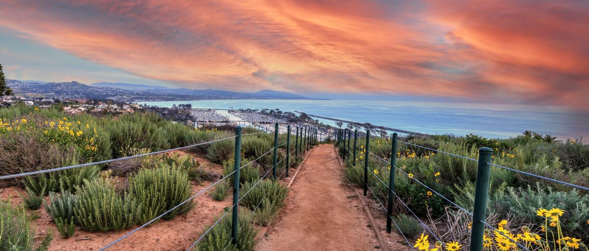
Next, don't miss the Bluff Top Trail at the Dana Point Headlands, with sweeping views of the Pacific.
Afterwards, one hidden highlight was Doheny State Beach, where we kicked off our shoes for a while. You can enjoy a simple beach walk - we had the most peaceful moments of our day trip here.
I loved going on a dolphin-watching cruise in the afternoon, where we sat side by side on the open deck, feeling the ocean breeze and spotting dolphins and whales in the ocean.
Dinner al fresco at Wind & Sea Restaurant serving fresh-caught seafood was incredible.
As night fell, the harbor lights shimmered across the water, and the entire town felt dreamy, exactly the kind of place that makes you wish weekends lasted longer.
We decided to spend four days at 2-star Dana Point Marina Inn (around $114/night) which was a great idea.
What I loved best:
Watching the sunset from the cliffs above the Dana Point harbor was my personal highlight.

Carlsbad
This is one of those effortlessly charming beach towns and it quickly became one of my favorite vacation ideas in SoCal, just 30 minutes from Dana Point.
I recommend strolling through Carlsbad Village first to get used to the relaxed energy, with palm-lined streets, and ocean breezes.
One of our favorite experiences was joining Carlsbad Food Tours, which turned out to be the perfect introduction to the town. Sampling our way through local restaurants, cafés, and dessert spots will give you a real sense of Carlsbad’s culinary personality. I thought it was such a fun, social way to discover lots of places we never would have found on our own.
Afterwards, check out small boutiques and local art shops - I especially admired the handmade jewelry inspired by the ocean.
You can stop at Vinaka Cafe, a cozy coffee shop in the village for lattes and pastries.
Before heading to the beach, we popped into a local market to grab snacks and fresh fruit, perfect for a beach picnic. Just a short walk will take you to Carlsbad State Beach, where we strolled along the sand, and had a fun family picnic with Chris and our son.
A few months later we returned to Carlsbad just for the Flower Fields (you have to time it early to mid-May!), where rows of blooms stretched toward the horizon and made the whole afternoon feel almost surreal.
What I loved best:
Dinner in Carlsbad Village capped off the day beautifully and was my favorite highlight.
Best Places to Visit on the Central Coast & Wine Country
This is a region defined by natural beauty, relaxed charm, and world-class vineyards.
San Luis Obispo
Ready for a culture-rich California getaway? San Luis Obispo is a standout and!
I found that this laid-back Central Coast gem made the perfect early summer getaway with my husband and son. I recommend timing your visit so that you can enjoy the farmers’ market, a real standout with fresh produce and such lovely flowers!
In the morning, walk along the scenic Bishop Peak trail, or cycle along the Bob Jones City-to-Sea Trail if bike is more your thing. In the afternoon, we personally loved exploring the historic Mission San Luis Obispo de Tolosa.
Next day, we enjoyed cool coastal breezes driving Highway 1, discovering unusual beaches and quiet pull-offs near Avila Beach.
What I loved best:
My personal highlight were delicious cinnamon rolls and coffee one morning at The Bridge Cafe, a social enterprise restaurant. I thought dining here has an extra layer of meaning because you’re dining in a place that gives back.
I love how San Luis Obispo remains a hidden favorite despite being near major California destinations - it sits close to famous Big Sur but feels more affordable, relaxed, and refreshingly authentic, which I really appreciate.
We drove just under 40 minutes south from Paso Robles and spent two easy days at the 3-star Madonna Inn, a quirky landmark hotel with over-the-top themed rooms.
Santa Barbara
I think this is one of the most naturally beautiful and effortlessly charming cities I’ve visited on a road trip. I think it’s one of the absolute best coastal romantic weekend getaways in the U.S.
I suggest heading to East Beach first, with a lovely walk by the water. My favorite early moment was strolling out onto Stearns Wharf. I have to warn you, though, that parking can be a challenge!
For lunch, Mesa Burger was a big hit with my son with its handcrafted burgers, using a custom beef blend served on brioche buns.
Next logical stop is downtown Santa Barbara. If you are like me, you'll love its easy, romantic energy, with Spanish-style architecture, local boutiques, and sidewalk cafés.
After coffee, we visited the Santa Barbara County Courthouse, especially the clock tower for panoramic views of the city and coastline.
In the evening, we loved our dinner at The Lark restaurant with its locally-sourced, seasonal ingredients from the Central Coast. The food is designed for sharing ("family-style") with sizable plates which were perfect for the three of us.
If you are on a romantic couples getaway, you should also check out Sustainable Wine Tours which offer luxury transportation, behind-the-scenes access and specialise in tours of small-production, private vineyards and wineries.
Another favorite highlight next evening was Convivo Restaurant and Bar at the Santa Barbara Inn right on East Cabrillo because we loved their decor with vintage wood floors, booth seating and big arched windows. Since the menu is always changing at Convivo based on the seasons, I can't tell you exactly what to oder but you can't go wrong with a mixed seafood grill.
We also loved taking a sunset sail from the harbor and the affordable trolley tour through town which let us see a lot in a short time without getting overly tired.
We drove about 1.5 hours north from Los Angeles into "The American Riviera" and stayed at the elegant 4-star Kimpton Canary for four amazing days.
What I loved best:
My favorite highlight was watching a sunset on the beach, such a simple, free activity that was super memorable on vacation!
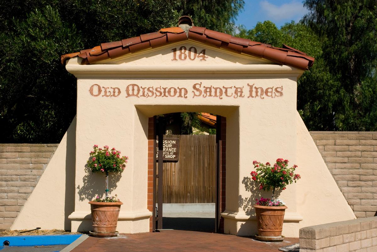
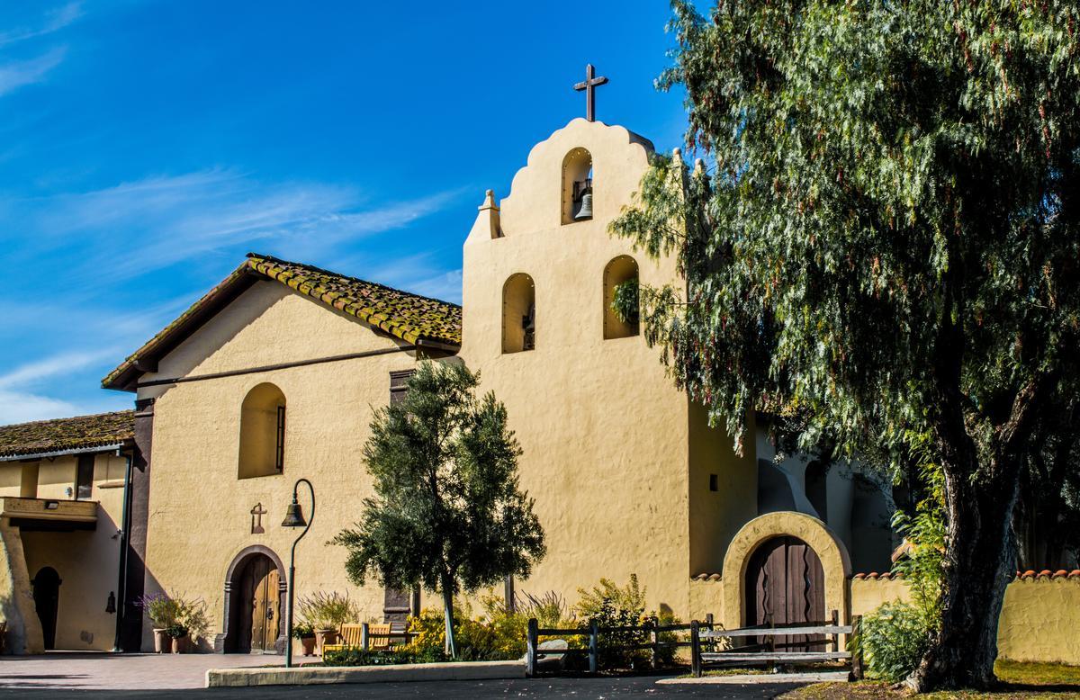
Solvang & Old Mission Santa Ines - 2 hours 30 minutes from LA
This whimsical Danish town is such an iconic place to visit! Our first stop was Old Mission Santa Inés, one of my favorite discoveries in Southern California, a true hidden gem.
We spent our days in Solvang cycling through the rolling countryside, sampling authentic Danish pastries at Mortensen’s bakery, browsing antique shops, and visiting the Elverhøj Museum of History & Art.
What I loved best:
Lunch at Solvang Restaurant was my personal favorite (we went twice!) because it's cozy and unique with its Danish eats like the must-try aebleskiver, a Dutch jam-filled donut.
We stayed at the boutique 4-star Landsby Hotel (around $203/night) for four nights where we enjoyed its chic Scandinavian design. Quick tip: if you are planning a romantic weekend getaway at the Landsby Hotel, book a room with a jetted tub and fireplace for extra luxury.
Santa Ynez
We absolutely loved exploring beyond Solvang all around the Santa Ynez Valley.
The small towns scattered throughout the valley (Los Olivos, Solvang, and Santa Ynez) all felt so inviting, with charming streets, friendly tasting rooms, and (mostly) sunny weather.
What I loved most was how easy it was to slow down and reconnect on our romantic getaway.
We started the morning with sipping coffee on a quiet patio. Then we headed to Art Spot in Santa Ynez, one of those delightful, soul-stirring discoveries I can’t stop recommending. It truly is an amazing local attraction if you adore local art and creative energy.
After, we enjoyed exploring the back roads near Los Olivos, where we stumbled upon small, family-run wineries.
Casual dinner at Nella Kitchen & Bar in Los Olivos (just 10 minute from our hotel!) was a standout where we had great pasta.
What I loved best:
Driving through the valley at dusk was my favorite highlight, with vineyards fading into the horizon and the air cooling just enough, I felt completely at peace.
Best Places to Visit in Greater Los Angeles
Beaches, iconic neighborhoods, and cultural landmarks ... that's Greater Los Angeles!
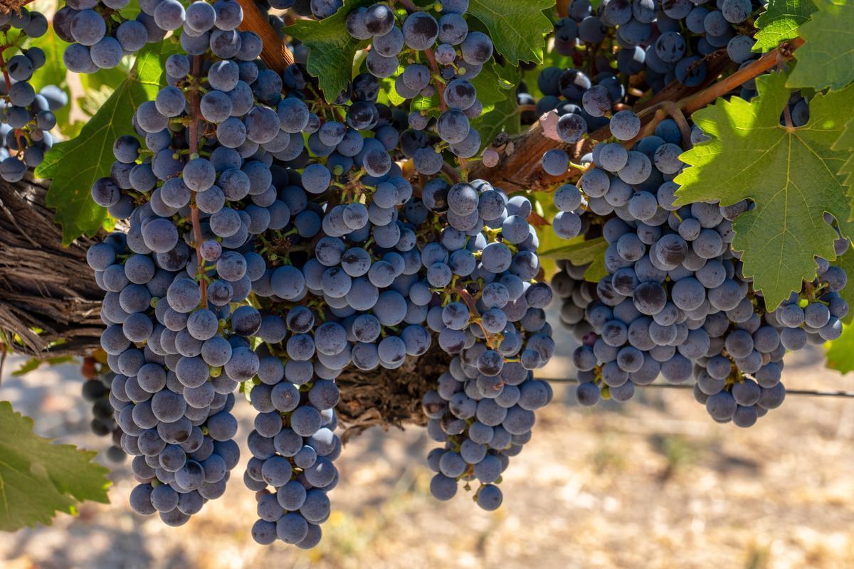
Paso Robles
If you want to really know California wine, you absolutely mustn't miss this inviting wine region on your road trip. Honestly, I think it’s one of the best destinations for couples celebrating an anniversary or a birthday.
First, head to lively downtown Paso Robles and just enjoy walking around for a while. Later, we visited Eberle Winery and Allegretto Vineyard, my favorite wine stops.
Next day, Chris and I relaxed at Franklin Hot Springs, visited the Estrella Warbirds Museum, and tasted great local olive oils.
What I loved best:
Dinner at Il Cortile Ristorante to celebrate our anniversary, a 2-minute walk from the hotel was my favorite highlight, offering a seasonal menu of homemade pastas, fresh seafood, and top-quality meats.
We spent five relaxed days at the the boutique Hotel Cheval just off the town square.
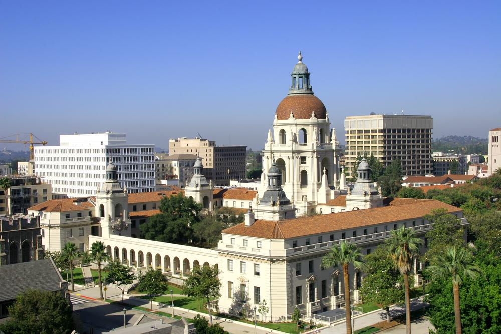
Things to Do in Pasadena
This has always felt like one of California’s most underrated gems to me and it instantly became one of my favorite vacation ideas in SoCal. From downtown Los Angeles, it was a quick 20-minute drive northeast into Pasadena.
We started by strolling through Old Pasadena, where historic brick buildings house cool boutiques, cafes, and lively restaurants.
Next, the Norton Simon Museum is a brilliant idea for a cultural stop, offering an amazing, underrated collection near Colorado Boulevard.
After stopping for lunch at 1919 Cafe, we explored the Huntington Library and Gardens in nearby San Marino (about 10 minutes by car). Walking through the Japanese and Desert Gardens was one of the most spectacular experiences we've had in California!
In fact, for architecture lovers, Pasadena is a dream, especially with iconic Craftsman homes near Orange Grove Boulevard. I thought the Gamble House was a unique and interesting highlight, showcasing California’s most famous Arts and Crafts design.
We loved how walkable Pasadena felt, especially around South Lake Avenue with its trendy shops and cafes. We found this area especially joyful when we returned in the evening with lights and lively streets.
Food was another big win, with everything from casual brunch spots to romantic, upscale dining options.
Next day, we spent time hiking in Eaton Canyon, just minutes from the city, and the waterfall felt like a hidden reward.
We spent a long three day weekend at the Langham Huntington, a grand 1907 estate turned luxury hotel.
My personal highlight was a healthy salad of organic greens on the rooftop patio at Granville for lunch.

Los Angeles
We absolutely love "The City of Angels" and have visited many times. There are heaps of things to do here! To me, Los Angeles feels like one of the most diverse and endlessly fascinating places I’ve ever explored (besides New York, of course, where Chris and I lived for a decade), and I think it’s one of the best destinations on the West Coast.
Even if you’re not a huge movie or beach person, I still highly recommend visiting because of how influential LA is to entertainment, culture, and lifestyle in our country. Just be prepared for distances—Los Angeles is massive, and getting around takes more planning than you might expect.
In fact, Los Angeles has an overwhelming number of things to do both indoors and outdoors. Actually, I think the hardest part is choosing what to see. My son was thrilled by the California Science Center’s hands-on exhibits and seeing the Space Shuttle Endeavour up close, while I loved strolling through the Original Farmers Market, sampling everything from fresh tacos to handmade ice cream. Personally, the Hollywood Walk of Fame, and Griffith Observatory are both must-see. If you have extra time, Rodeo Drive and Venice Beach are also fun (and very different) stops. I think these stops give you a great mix of classic LA glamour, city views, and coastal vibes.
I think the easiest option overall if you are new to the city is an organized tour in LA. It definitely removes the stress of navigating traffic, ensures you hit the most famous sights, and gives you insight into the history and culture of the city. I find that Star Track Tours offer a great way to cover a lot of ground in a short time.
What I loved best:
We made a stop at the legendary Langer’s Delicatessen downtown, and biting into their famous pastrami sandwich was an absolute dream...indulgent, delicious, and unlike anything else in the city.
If you’re looking for theatre in L.A. that’s more intimate, bold, and culturally rich, Fountain Theatre is a standout.
We had dinner at Emporium Thai in Westwood, and we had their delicious Yum Yum soup, and were especially impressed by their gluten-free and dairy-free options.
We often land in LA, stay in an affordable rental for a week.
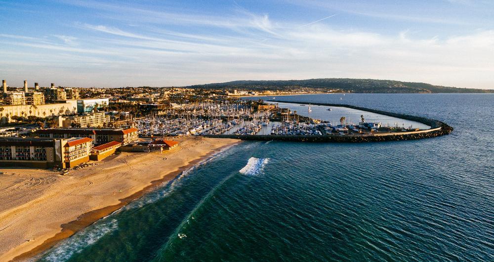
Redondo Beach
Ready for a beach-meets-harbor getaway? Check out Redondo Beach, a real standout that has the ideal mix of outdoor fun and coastal relaxation in my opinion.
From LA, I made the quick 30-minute coastal drive down to Redondo — windows down, ocean on my right, palm trees swaying overhead. I arrived just in time for the Festival of the Kite, when the sky above the pier explodes in color. Around town, the Redondo Beach Farmers Market was bursting with citrus, strawberries, and handmade soaps, while nearby Hermosa and Manhattan Beach were alive with volleyball games and local music spilling out of cafes (be sure to grab a local espresso from Java Man!).
Feeling very active on this trip, first, we loved biking along the scenic Marvin Braude Coastal Trail, then paddleboarding in King Harbor, and strolling along the Redondo Beach Pier at sunset with a basket of crispy fish tacos. Afternoons meant lazy hours on the sand, time to relax with a book, while evenings brought live jazz, and ocean breezes.
What I loved best:
One of my most memorable evenings was dinner at Dominique’s Kitchen, a tucked-away French bistro serving rich onion soup, buttery sole meunière, and a warm neighborhood welcome that made me feel right at home.
I spent two sunny days soaking up the South Bay rhythm from our comfortable base at Sonesta Redondo Beach & Marina.
Camarillo
Camarillo is one of my favorite places to visit when I want sunny weather, peaceful scenery, and that relaxed Ventura County charm. I love that it’s incredibly easy to get to from LA, a perfect day trip (under an hour by car!)
We started the day with the drive up the 101, which was an amazing underrated experience with ocean breezes and mountain views. First thing, had amazing breakfast burritos at Village Cafe and then walked around Old Town Camarillo to ease into the day.
Next, we loved wandering through the Camarillo Premium Outlets, where I found amazing deals on favorite brands and it turned shopping into an adventure for everyone... even my son picked up some back-to-school clothes.
Later on, we drove a short distance to Point Mugu State Park near Malibu, and this was where the magic really kicked in with spectacular cliffs, quiet beaches, and trails that felt untouched.
For lunch, we headed to Old Town Cafe back in town, one of those unique places that ends up being the absolute best meal of the trip.
In the afternoon before heading home, we explored nearby farms and open fields, which felt like such an underrated side of California that most people skip.
What I loved best:
The CAFSoCal - Commemorative Air Force So Cal Wing aviation museum was a highlight for us because it educational, and exciting all at once, with vintage planes and interactive exhibits that made my son feel like we were stepping back into history.
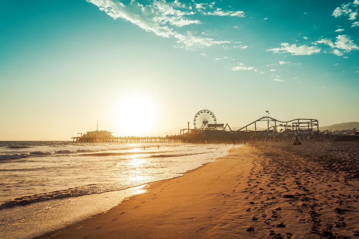
Santa Monica
What I love about visiting this beach town is that it’s easy to reach from other parts of Los Angeles and has more than enough to keep you busy for a full day. I recommend wearing comfortable walking shoes and arriving earlier in the morning, especially if you want to enjoy the beach and pier before the crowds roll in.
To get to Santa Monica, I suggest taking the Metro E Line (Expo Line) to the Downtown Santa Monica station. The ride from central LA takes about 45–50 minutes and costs just a few dollars. Of course, depending on where you’re staying, driving or rideshare might make more sense—but traffic can be unpredictable. I prefer public transit in LA when possible since parking near the beach can be expensive and limited.
The Santa Monica Pier is always my first stop with its iconic Ferris wheel, carnival games, and ocean views feels like pure magic every time. I also love walking along Santa Monica's Third Street Promenade, along the beach path and lively boardwalk.
After our morning stroll, we stopped at Caffe Luxxe, which is actually part of a sleek and sophisticated coffee shop chain which serves great coffee and mouth-watering pastries!
One thing to keep in mind is that Santa Monica blends into nearby neighborhoods like Venice and Malibu, so it’s easy to wander without a plan and miss some highlights. On our first visit, we joined a guided tour with a local guide to get oriented and make the most of our time.
My personal highlight was our romantic dinner at Melisse to celebrate our anniversary, a AAA Four Diamond award restaurant serving an amazing tasting-menu of classic French cuisine and contemporary presentation.
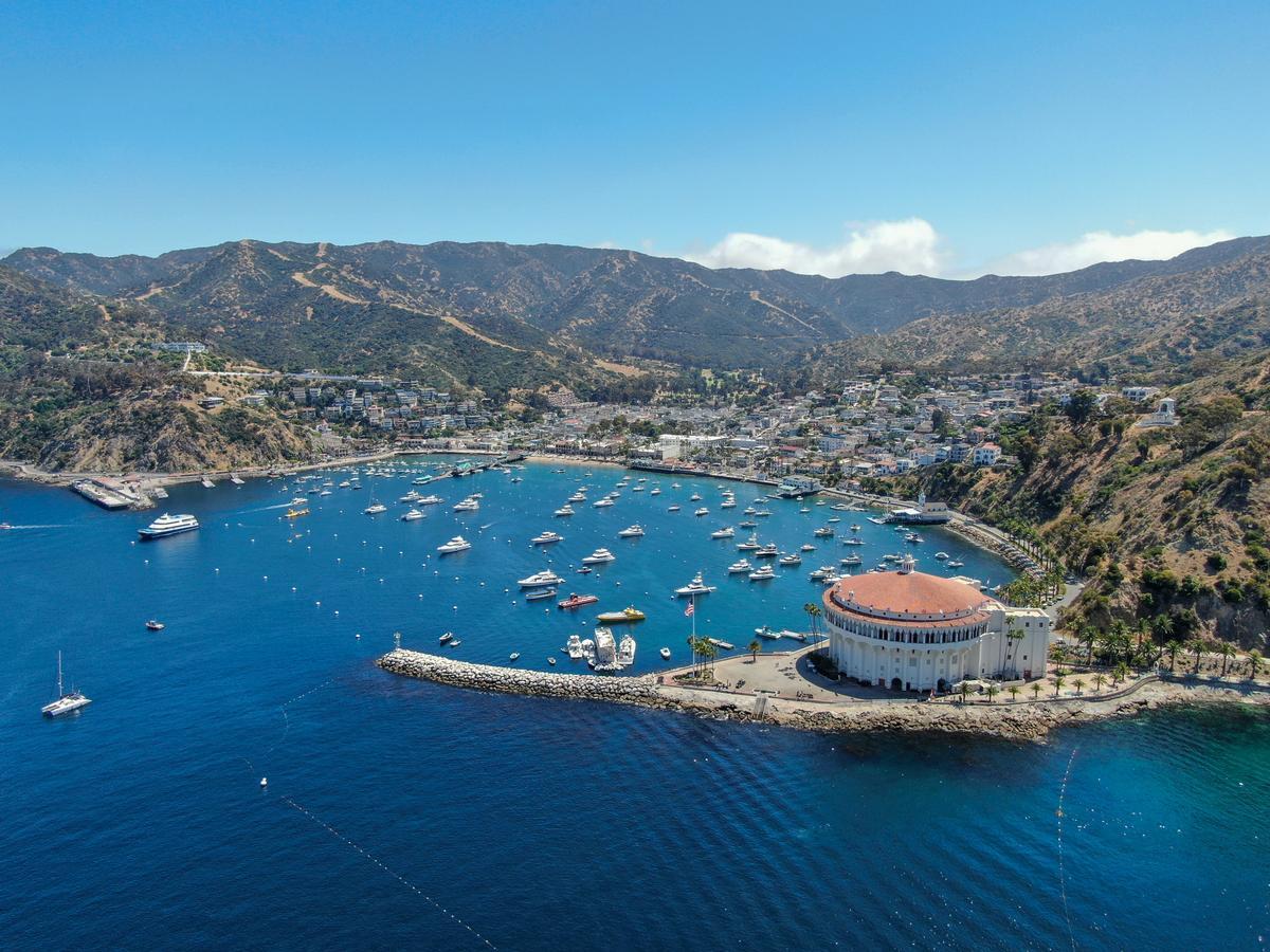
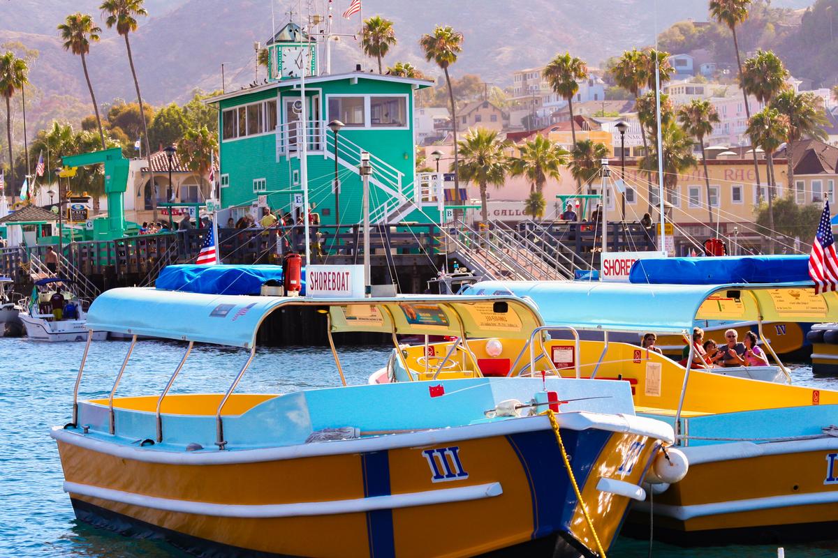
Catalina Island
Ready for a coastal-meets-island adventure? Check out Catalina Island, a real standout! We left the mainland by ferry first thing in the morning from Long Beach (about 1 hour ride, $42.25 one way) and docked in Avalon, the island’s only incorporated city (population around 3,700).
First, strolling along the Avalon waterfront, we admired the pastel buildings and the scenic harbor.
Shortly after, my favorite stop was Catalina Coffee & Cookie Co, where we shared flaky pastries and coffee while watching the morning boats come in...it felt like the perfect, unhurried start to the day.
Next, we wandered through local boutiques and art shops, discovering handmade jewelry and island-inspired finds.
A short trip took us to Descanso Beach, where we stretched out on loungers and went snorkeling, my favorite highlight!
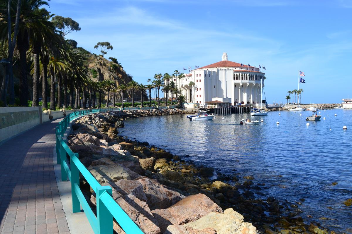
In the afternoon, we explored the iconic Catalina Casino (not for gambling!) for its stunning Art Deco architecture and sweeping views that made the island’s history feel alive.
I loved that Catalina had such an effortlessly relaxed vibe—no pressure to do everything, just space to enjoy being together.
We also made time for a scenic trolley ride, catching glimpses of quiet hills and hidden beaches that felt worlds away from the mainland.
My personal highlight was dinner at Bluewater Avalon Seafood Restaurant where I ordered fish & chips and sat just above the tide, the air salted with sea and citrus.
For the night, we stayed at the 3-star Catalina Island Inn (from $87/night), steps from the harbor and with a garden courtyard that felt like an oasis.
What I loved best:
For me, Catalina Island is one of the best places to visit in California.
Next morning, we hiked on the Trans-Catalina Trail for sweeping vistas that felt a world away, a real standout.