Places to Visit in Montana

Planning a Montana trip and wondering which destinations are worth it? Well, you are in the right place! Since I've moved to Texas, the one thing I miss are tall mountain peaks. So you can imagine that my family and I find our visits to Montana exploring extra special! This is exactly why I decided to share my favourite things in Montana so that you can use my guide as an inspiration to plan your own road trip.
We can't get enough of glacier-fed lakes, glimpses of wildlife from the road, unique lodge accommodations, and Glacier and Yellowstone National Parks (yes, a portion of the world's most famous park is located in Montana!). Just a fair warning that I'm quite biased and have spent most of my time in the Yellowstone Area. Even so, each place I visited in Montana over the years and during my recent four week road trip left a mark and I can't wait to return next summer.
So what is there to do in Montana? First off, you’ll feel as if you’ve stepped into a living painting - You'll see mountains, lakes, wide-open skies, and the kind of silence that makes you breathe a little deeper. In addition, I think that this state is one of the most naturally beautiful places I’ve ever explored. Here is my final collection of our favorite destinations that I hope truly capture Montana’s magic for you to enjoy.
- Best Places to Visit in Montana - Yellowstone Area
- - Yellowstone - Silver Gate Lodging
- Best Places to Visit in Southwest Montana
- - Bozeman - Gallatin River Lodge - Butte
- Best Day Trips in Northwest Montana (Glacier Region)
- - Whitefish - Snow Bear Chalets - Glacier National Park
- Best Cities to Visit in Montana
- - Helena - Missoula - Billings
Best Places to Visit in Montana - Yellowstone Area
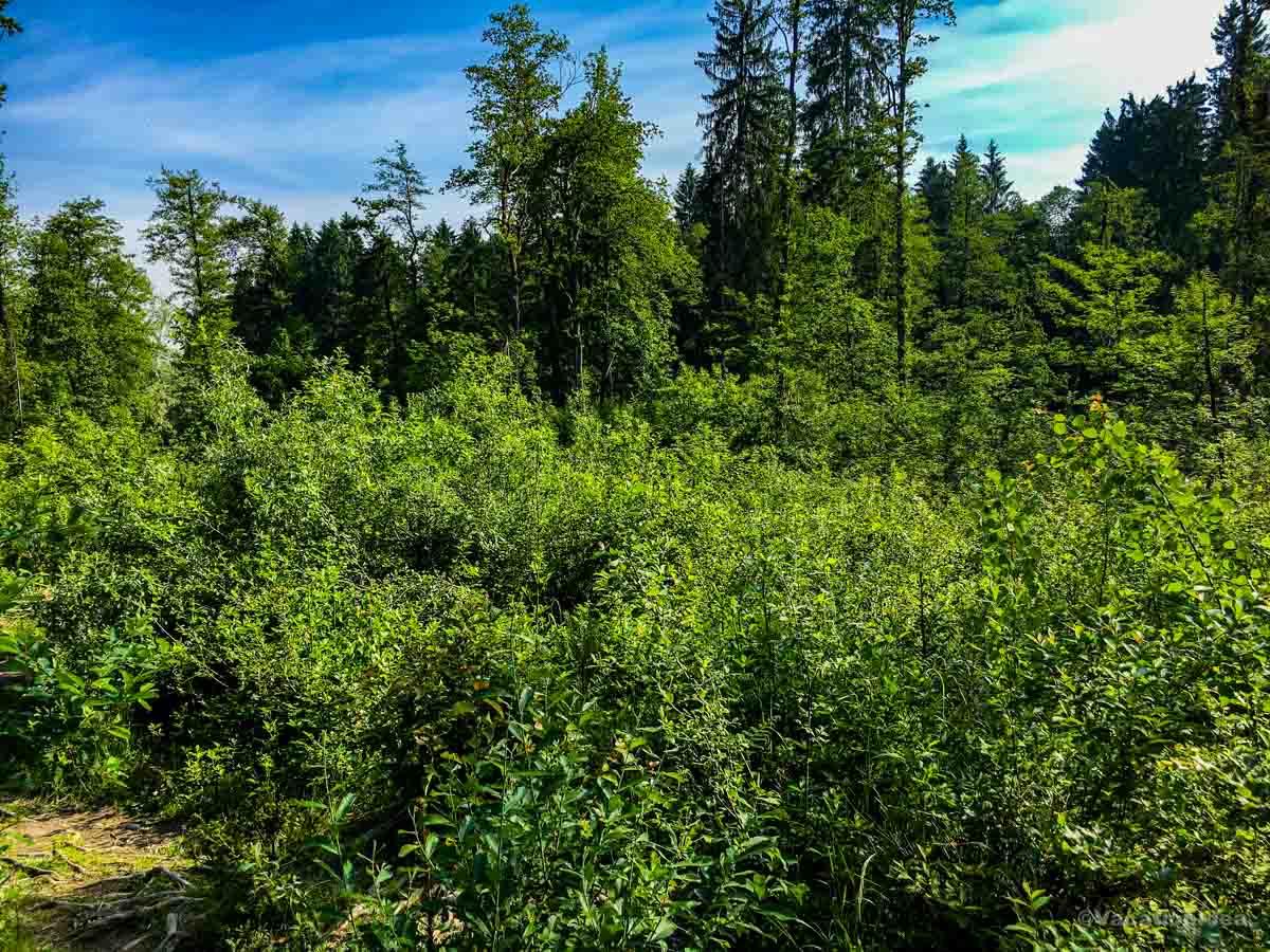
This area is a gateway to one of the most extraordinary natural landscapes in the world.
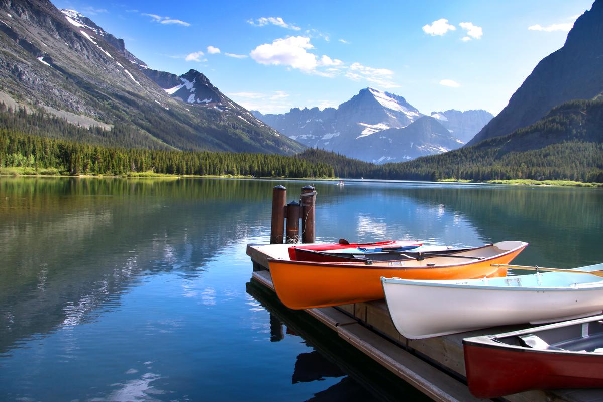
Yellowstone National Park - 1.5 hours from Bozeman
Chris and I both absolutely love Yellowstone, and have been many times. There are heaps of amazing things to do here!
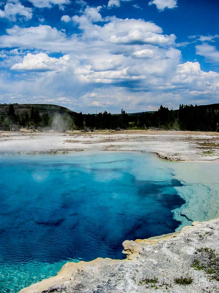
In addition, Yellowstone will always be one of my favorite travel memories and I think it's one of the most beautiful places to visit in the world! Why? First off, I was stunned by the beauty of Yellowstone Lake, and the incredible blue of Sapphire Pool.
Then, I enjoyed walking on the boardwalk at Grand Prismatic Spring and driving through the Lamar Valley. We saw so many bison, moose and other wildlife on our drive that it completely made sense that this area was nicknamed the "Serengeti of North America"! After a long drive, I was fascinated by the colors and features at Mammoth Hot Springs. I instantly thought our journey was worth it!
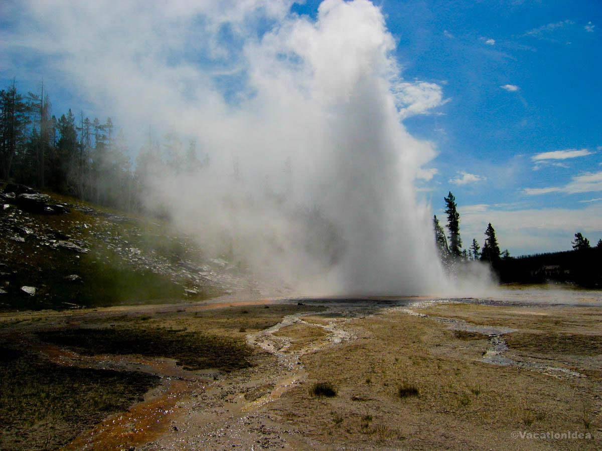
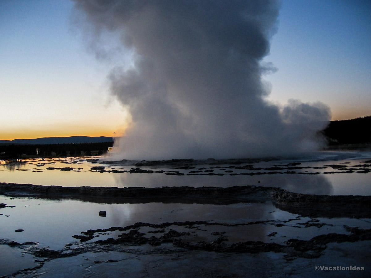
But, after all this natural beauty, at the end of the day, Old Faithful geyser right in front of the historic Old Faithful Inn will always be my favorite spot. We kept going back to watch Old Faithful erupt, well into the night (sometimes you have to wait a while to see a really good eruption!). It was crowded during the day but at night, my husband and I sat on the bench in front of this famous geyser and it all to ourselves. I loved how the clear starry night added to the magic!
If you don't want to drive through Yellowstone by yourself, there are tours with a local guide that you can join starting in Teton Village.
What I loved best:
Ending our day stargazing - the park’s vast skies are breathtaking at night. I would have stayed up the whole night, but we had to drive on next day.
I also visited this national park on another ten day trip while exploring Jackson Hole. I wrote about it in my places to visit in Wyoming article.
A downside? If you are thinking of staying inside the national park. rooms at the Old Faithful Inn sell out well in advance so you need to book ahead!
But, yes, there is affordable camping in Yellowstone. Reservations sell out months in advance! Locals told me that Mammoth Campground actually offers first-come, first-served sites in the off season from October 15 - April 1.
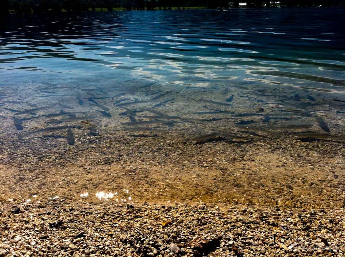
Silver Gate Lodging - 5 minutes from Yellowstone
This is one of my favorite stays to Yellowstone (just 5 minutes to the Northeast Entrance), and honestly, it feels like one of the most quietly magical mountain retreats in the West. Why? I love how it blends simple, rustic comfort with a sense of wild serenity — it’s the kind of place where I can sip coffee on a porch overlooking pine-covered peaks, wander into the park to watch bison at sunrise, then end the day by a crackling fire with a sky full of stars. Everything at Silver Gate Lodging feels peaceful, deeply connected to the landscape, and I highly recommend it as a weekend getaway in Montana!
We drove about 3 hours from Bozeman and stayed in a Creekside Cabin for five wonderful days, with 2 Queen beds (perfect for me, my husband and son). I really appreciated having a full kitchen, and a comfortable bathroom with shower. This place offers a wide range of cabins and homes, so I guarantee that you'll find one that fits the size of your group. For couples, the Tiny Home Cabin is super cute and I could imagine spending a honeymoon here!
I loved that there’s complimentary parking (no unexpected extra parking fee which so often pops up when you travel!), a porch perfect for wildlife watching, and even the soothing sound of Soda Butte Creek in the distance. Silver Gate itself is nestled right outside the Northeast Entrance of Yellowstone, so I had immediate access to Lamar Valley (less than 5 miles away), incredible hiking, fly-fishing spots, scenic drives, and one of the most breathtaking regions of the park.
There’s even a coffee shop on-site where we had morning coffee and picked up snacks for the road which I found super convenient.
What I loved best: I loved that our room was affordable (around $230/night) and pet-friendly.
The only drawback? First off, I had to book months in advance which requires knowing your summer destination. Secondly, the cabins are steps from Yellowstone’s wild beauty, a real hidden treasure, but amenities were very basic which I didn't mind personally but I wanted to mention it because I heard fellow travelers discussing it as a downside.
Best Places to Visit in Southwest Montana
I travel here when I'm in the mood for rugged mountain landscapes and outdoor adventure.
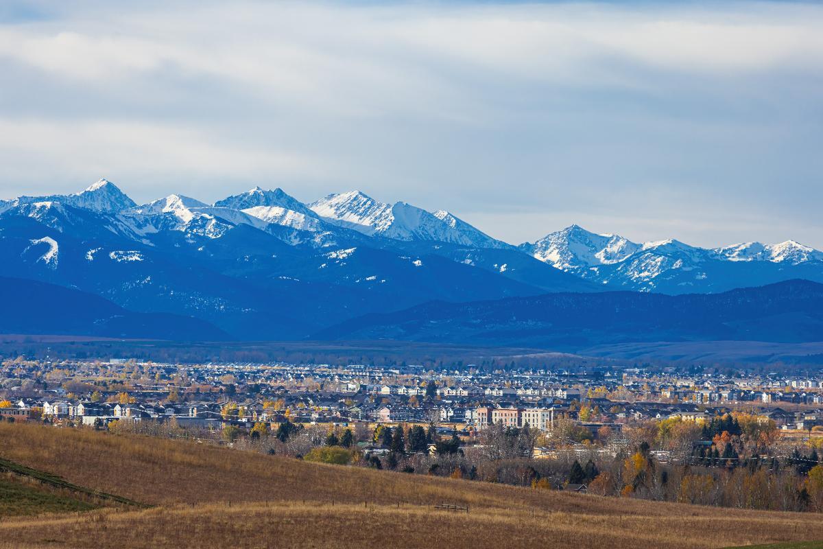
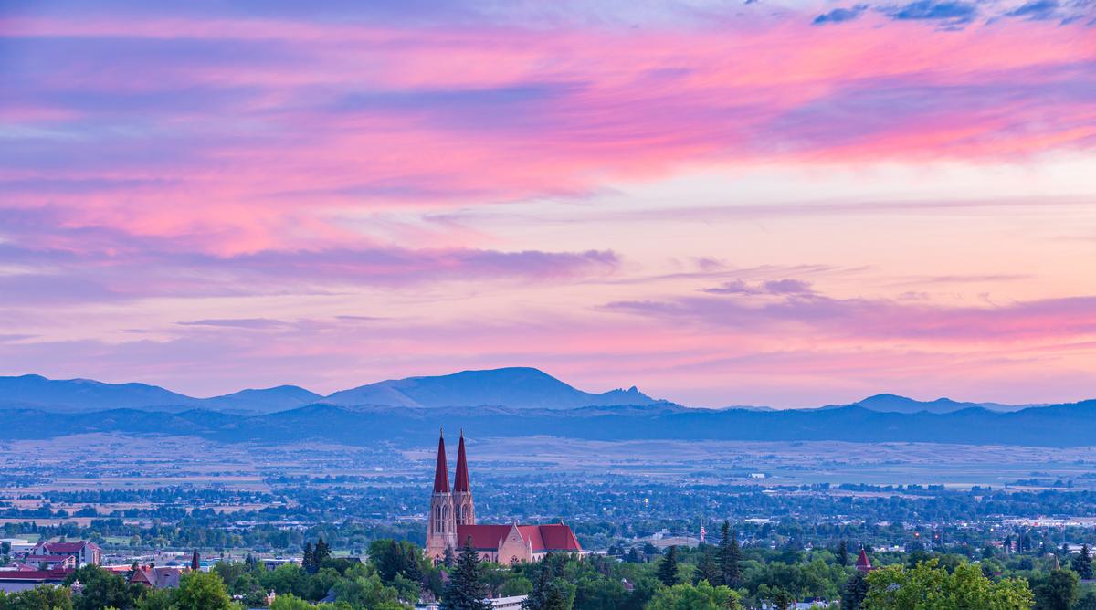
Bozeman, Montana
This mountain town won me over with its rare blend of rugged adventure and small-city sophistication, and I thought it was one of the most brilliant vacation ideas near Yellowstone!
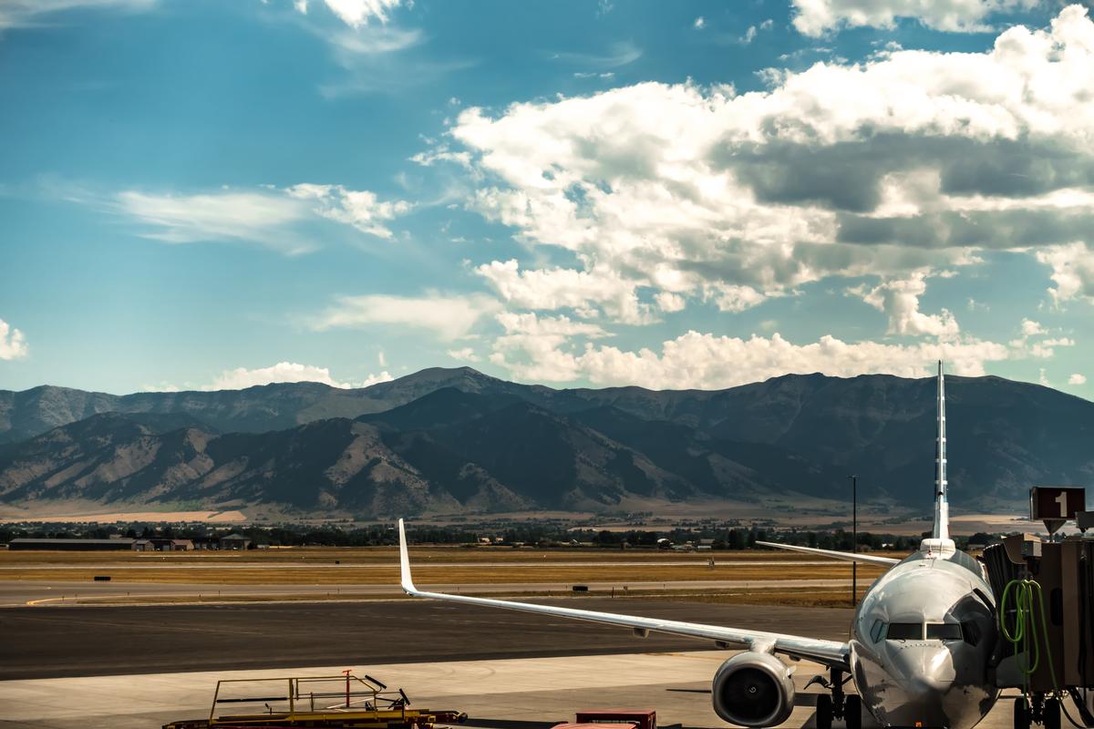
We flew about 3.5 hours from Austin (1,300 miles) into Bozeman.
We arrived first thing in the morning and the crisp mountain air already felt magical.
First stop was downtown Bozeman, which felt vibrant, cool, and surprisingly artsy.
We grabbed coffee on Main Street and people watching became my favorite activity instantly.
Bozeman has this interesting mix of cowboy roots and modern, youthful energy.
Downtown, I browsed Main Street’s 19th-century storefronts filled with coffee shops, boutiques, and art galleries. Later, we stopped at the Gallatin History Museum (housed in an 1911 jail, $7 admission). The first night, we stayed at the LARK Bozeman ($189), a stylish boutique hotel right on Main Street where being able to walk everywhere from the hotel felt very grounding. I have to warn you, though, that parking can be a challenge!
We took our son to the Museum of the Rockies ($16 admission), home to one of the world’s largest collections of dinosaur fossils, including a T. rex skull, one of the absolute best experiences.!
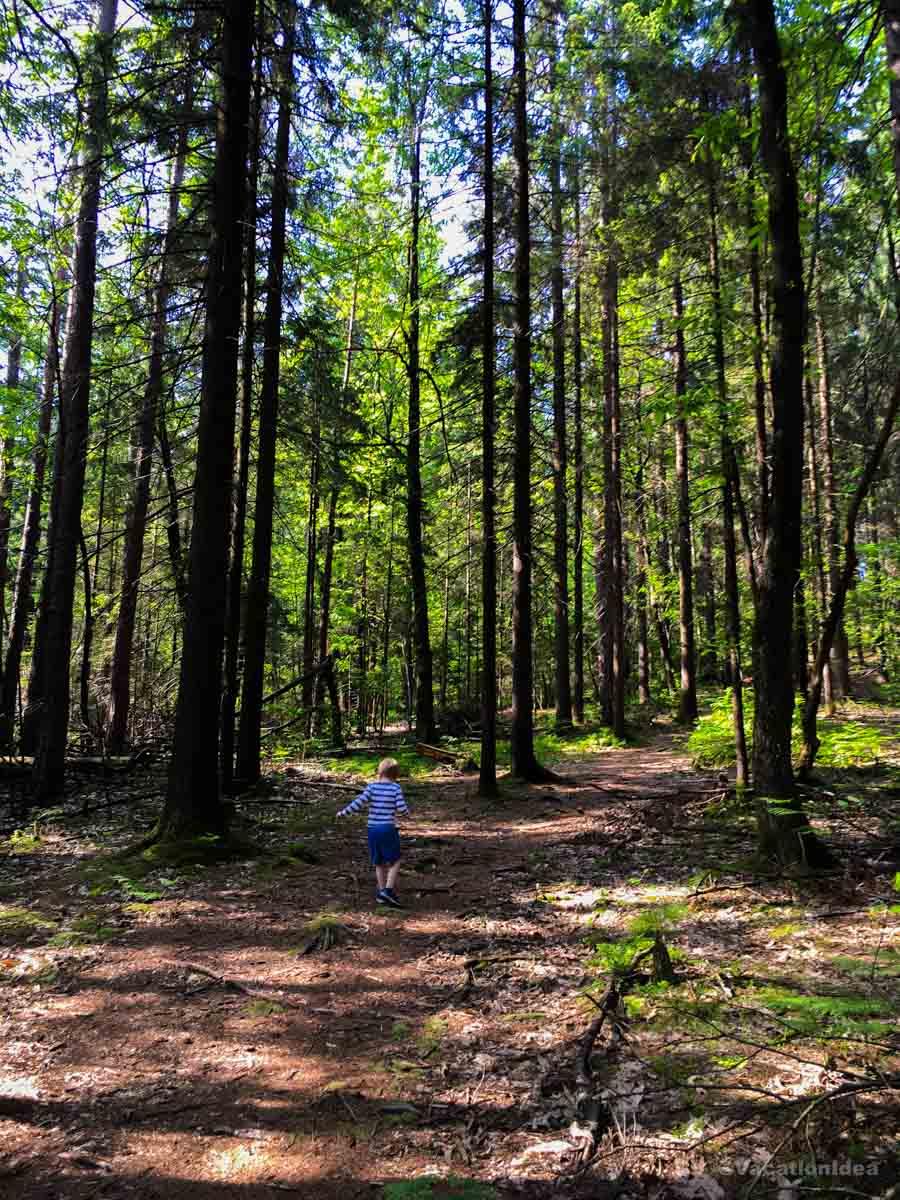
Next we drove just outside town toward Hyalite Canyon, a true hidden gem.
The waterfalls and trails were the most peaceful and joyful part of the day.
We spent hours hiking, stopping constantly to take photos you can see in my photos.
By sunset we returned to town for dinner, which was affordable and surprisingly upscale.
The food scene here is brilliant and easily one of the best in Montana.
That night felt romantic and cozy, with mountain views glowing under the stars.
Overall the experience felt complete, exciting, and deeply memorable.
What I loved best:
Sampling local brews at Bozeman Brewing Company and relaxing in the Bozeman Hot Springs , were both my personal highlights here.
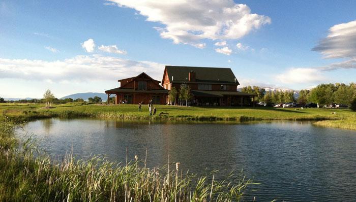
Gallatin River Lodge - 20 minutes from Bozeman
One of my favorite places to stay when we land in Bozeman, what I love most about this place is how it combines boutique luxury with countryside relaxation. The design is warm with rustic timbers, leather accents, and big windows showcasing the views. This lodge to me feels like a hidden retreat along one of Montana’s most iconic fly-fishing rivers.
A one week stay in a Luxury Suite in the Trout Lodge was perfect for me and and Chris! We had a spa-style bathroom with jetted tub, fireplace, and a private balcony, where I enjoyed relaxing after spending a day outdoors.
On the property, you’ll find world-class fly fishing right outside your door, plus expert guides who can take you to nearby rivers and streams.
What I loved best:
The lodge also offers fine dining featuring locally sourced ingredients, my favorite highlight. We also liked the cozy bar, and plenty of quiet spaces to simply read by the fire, and watch discuss wildlife with fellow guests.
A downside? The river views were peaceful, but the lodge’s small size meant limited availability. I realized I had to book well in advance.
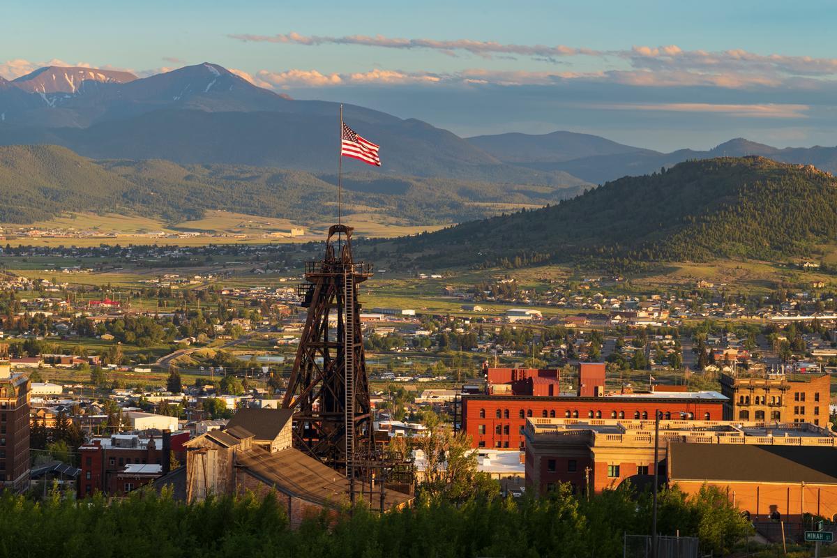
Butte - 1 hour 20 minutes from Bozeman
I absolutely loved visiting this place! Why? First off, it's rugged, historic, and full of character, with this unique haunting beauty. Secondly, nestled high in the Rocky Mountains, to me Butte feels like a living time capsule of the American West, where grand turn-of-the-century buildings, old mine head-frames, and wide-open skies tell stories of boomtown glory and resilience.
After a quick drive on a day trip from Bozeman, the first thing we did was walk through Uptown Butte, and this was honestly one of the best experiences because the historic buildings felt vibrant, unusual, and full of stories.
After that we checked out the World Museum of Mining just outside downtown, and it was such a cool and interesting stop that felt like stepping into a dream version of the Old West.
Next we headed to the Berkeley Pit, which is right near the center of town, and even though it’s strange, it was one of the most unique and unforgettable sights, see in my photos how unreal it looks.
We grabbed lunch nearby and loved how affordable and local everything felt, which made this Montana getaway even more joyful and relaxed.
Later in the afternoon we explored the Granite Mountain Memorial, and this was a moving but important experience that really shows the heart of Butte and why it’s such an amazing underrated place.
As evening came, we wandered around more historic streets and bars, and this part was my favorite because it felt authentic and not touristy at all.
The next morning we drove a bit outside town to see the rolling hills and open skies, and this scenic area near Butte was absolutely spectacular.
What I loved best:
I hiked up to the Our Lady of the Rockies, a striking 90-foot statue that overlooks the city from the Continental Divide — the view from up there was breathtaking, my personal highlight!
Best Day Trips in Northwest Montana (Glacier Region)<
From glacier-carved valleys to charming resort towns, Northwest Montana delivers some of the most unforgettable landscapes in the American West.
Whitefish
This mountain town turned out to be a hidden gem of laid-back Western spirit and it quickly turned into one of my favorite places to visit in Montana! I loved the way historic storefronts wore their rustic character proudly, and how the scent of pine mingled with the breeze from Whitefish Lake. I learned that it's nicknamed "Stumptown" due to the large number of tree stumps left in the area.
We drove 2 hours and 20 minutes north from our previous stop in Missoula when Whitefish’s creative side revealed itself with its great downtown and a cozy two-day stay at Snow Bear Chalets. I enjoyed wandering through the shops along Central Avenue, taking the chairlift up Whitefish Mountain Resort for the incredible views, and slipping away to the lake for quiet picnic.
What I loved best:
Going for a stroll along the Whitefish River Trail in the cool morning air was my personal highlight.
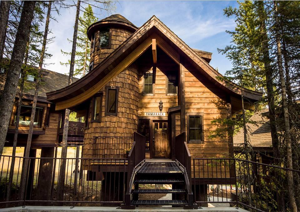
Snow Bear Chalets - 15 minutes from Whitefish
I love how this place blends whimsical, fairytale design with upscale mountain comfort, and it quickly because one of my favorite romantic getaways in Montana! The architecture is stunning, with chalet-style structures shaped like treehouses that I haven't seen anywhere else.
Just steps from Whitefish Mountain Resort and near Glacier National Park, I think that Snow Bear Chalets offers one of the most unique luxury stays in Montana, and best of all, perched high in the treetops.
I really loved our Treehouse Chalet for a relaxing week, which featured a king bedroom loft, gourmet kitchen, fireplace, and floor-to-ceiling windows.
Around the property, there is ski-in/ski-out access, and après-ski evenings by the fire in the winter, as well as hiking trails and day-tripping to Glacier National Park in summer. I loved having such quick access to both Whitefish and Glacier National Park.
My favorite moment was soaking in the hot tub at dusk.
One challenge? Locals told me that winter weather means icy roads and tricky access which visitors often aren't prepared for.
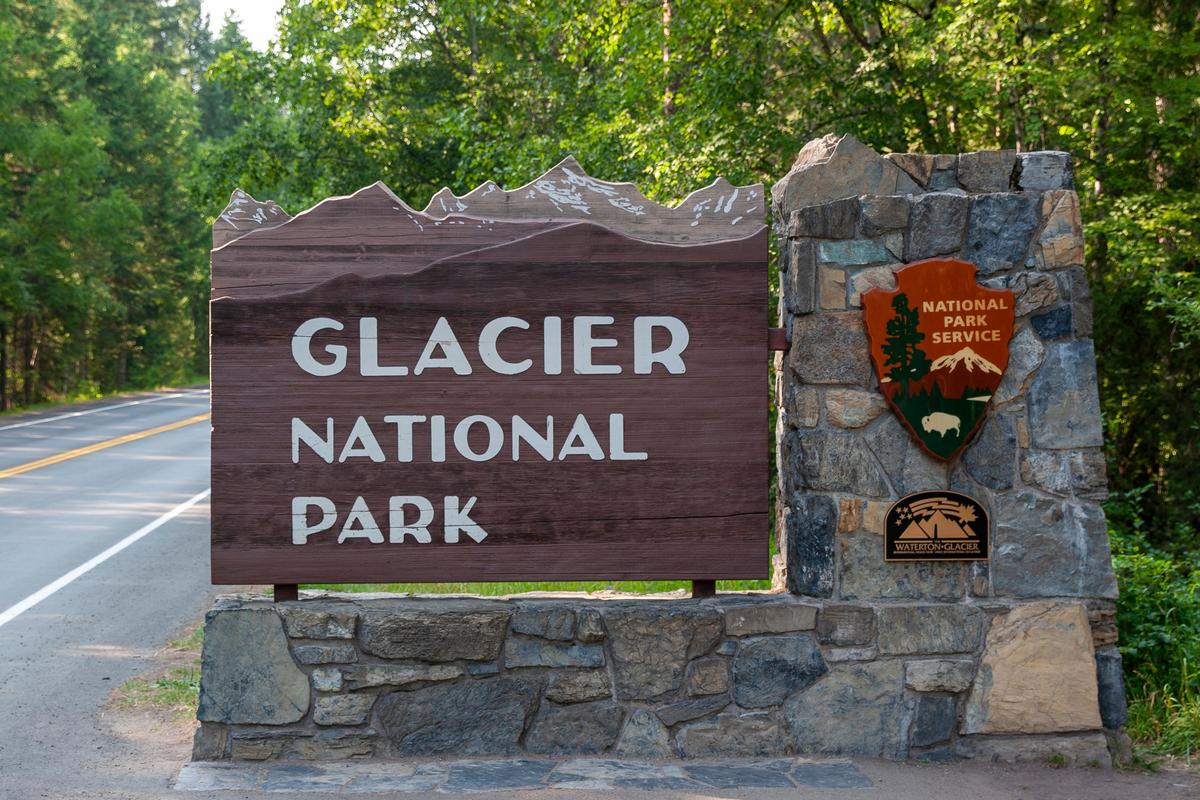
Glacier National Park - 30 minutes from Whitefish
This place feels like stepping into a wild world and that's why I think it's one of the best places to visit in Montana. I found it to be incredibly beautiful and I think that you will too.
I especially loved driving on Many Glacier Road from Babb (Montana) to the Many Glacier Hotel and trailheads. We were surrounded by all these stunning peaks - Mount Grinnell, Mount Wilbur, and Swiftcurrent Mountain. We saw Lake Sherburne and followed along the shoreline.
I thought that our family vacation time was well spent on a boat tour on Lake McDonald, the park’s largest and most colorful lake. Exploring the serene Many Glacier Valley , often called the “Switzerland of North America” is also a highlight.
After just a short drive from Whitefish, we spent the night at Many Glacier Hotel ($290) inside the park.
Next time I plan to stay at Apgar Village Lodge (from $159) near the West Entrance as well.
What I Loved Most: My absolute favorite is ending my day stargazing - since Glacier is an International Dark Sky Park, night skies are some of the best in the world!
Best Cities to Visit in Montana
Montana’s unique cities make it an ideal destination for unforgettable day trips.
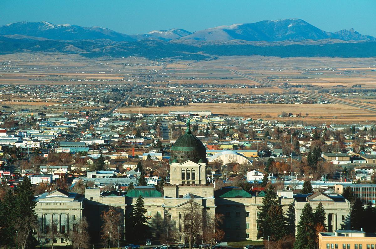
Things to Do in Helena
Ahh Helena, Montana's small capital city with a big Old West soul. Tucked into the foothills of the Rocky Mountains, the "Queen City of the Rockies" is one of those places that surprises you the moment you arrive. What began as a gold rush camp in the 1860s turned into one of the wealthiest cities per capita in the world, and you can still feel that history everywhere you go. If you love history, scenery, and quiet charm, Helena is absolutely worth the trip.
What I love most about Helena (about 1 hour 45 minutes from Bozeman!) is how real its history feels. This isn’t a city that rebuilt replicas — many of its landmarks are the originals. Last Chance Gulch, the main downtown street, sits right on top of the gold strike that started it all. Walking through downtown, you’ll pass preserved 19th-century buildings, historic mansions, and old saloons that once catered to miners dreaming of striking it rich.
One of the standout experiences is visiting the Montana State Capitol. The building itself is beautiful, but the real showstopper is the artwork inside — massive murals and sculptures that tell Montana’s frontier story in incredible detail. Just a short walk away, the Cathedral of Saint Helena feels almost surreal for a city this size. Its towering spires and stained glass look like something you’d expect in Europe, not central Montana.
For lunch, we loved The Hopper Kitchen & Market where I had a great sandwich and fries (my son had a juicy burger). If you are in the mood for Italian, try On Broadway with a unique exposed-brick dining room.
And then there’s the outdoors. Helena is surrounded by trails, lakes, and forested hills, making it one of the easiest places to mix history with nature. You can spend the morning learning about gold rush legends and the afternoon hiking Mount Helena or strolling along the Missouri River.
Helena isn’t about flashy attractions or big-city buzz — it’s about atmosphere. It’s about standing in a quiet downtown street and realizing that some of the most influential chapters of the American West happened right where you’re standing. If you enjoy slower travel, authentic history, and stunning mountain backdrops, Helena is one of those underrated destinations that sticks with you long after you leave.
What I loved best:
Wandering through the Mansion District, home to Victorian-era residences from the gold rush, was my personal highlight.
A downside? There is a risk of wildfires when it's dry and windy so keep an eye on local news while there.
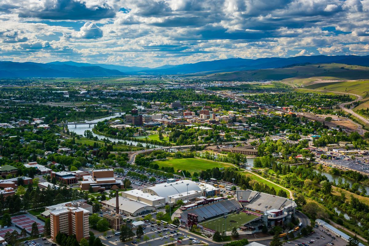
Things to Do in Missoula - 3 hours from Bozeman
This is one of my favorite stops when we are road tripping in Montana! Set at the confluence of five valleys and crossed by the Clark Fork River, there's a so much natural beauty in "The Garden City" and a ton of things to do!
What I love about visiting Missoula is how easy it is to explore without feeling rushed. It’s a small city with a big personality, and there are more than enough unique things to keep you busy for a full day (or two).
I definitely recommend wearing comfortable walking shoes and starting early, especially if you want to mix outdoor time with food and culture. Getting to Missoula is simple. If you’re flying in, Missoula International Airport is only about 10 minutes from downtown, and a rideshare or taxi usually costs around $15–$20 USD one way.
Once you’re downtown, you really don’t need a car—most of the highlights are walkable, and biking is also very popular. If you’re road-tripping through Montana, Missoula makes a perfect stop thanks to its easy access from I-90.
For me, the Missoula Art Museum is the go-to spot for contemporary and regional works, and I recommend the same to every art lover. I discovered The Old Post afterwards which serves great pub food (and occasional music).
If you make the trip to Missoula, I highly recommend spending time along the Clark Fork River. The riverfront trails are beautiful and easy to walk, and you’ll often see locals floating the river in the warmer months. Downtown is full of character, with independent bookstores, coffee shops, and some excellent local restaurants.
The Carousel for Missoula is a fun, quick stop, and the nearby Rattlesnake National Recreation Area is perfect if you want a short hike close to town. You can also stroll through the University of Montana campus, which has great views and a relaxed vibe.
One thing to keep in mind is that Missoula blends city life and nature so seamlessly that it’s easy to wander without a plan and miss some highlights. On our first visit, we found that having a bit of structure helped us make the most of our time.
A guided walking or history tour of downtown is a great way to get oriented. These tours usually last a couple of hours and cover Missoula’s railroad roots, literary history, and local culture, all while keeping things relaxed and engaging.
Alternatively, a half-day river rafting trip on the Clark Fork is an amazing way to experience Missoula like a local. These trips are beginner-friendly, don’t take the entire day, and give you a totally different perspective of the city. If rafting isn’t your thing, a local brewery tour is another solid option—Missoula has a surprisingly strong craft beer scene and plenty of welcoming taprooms.
What I loved best:
Dinner at The Stables was my personal highlight after I worked up my appetite walking around all day.
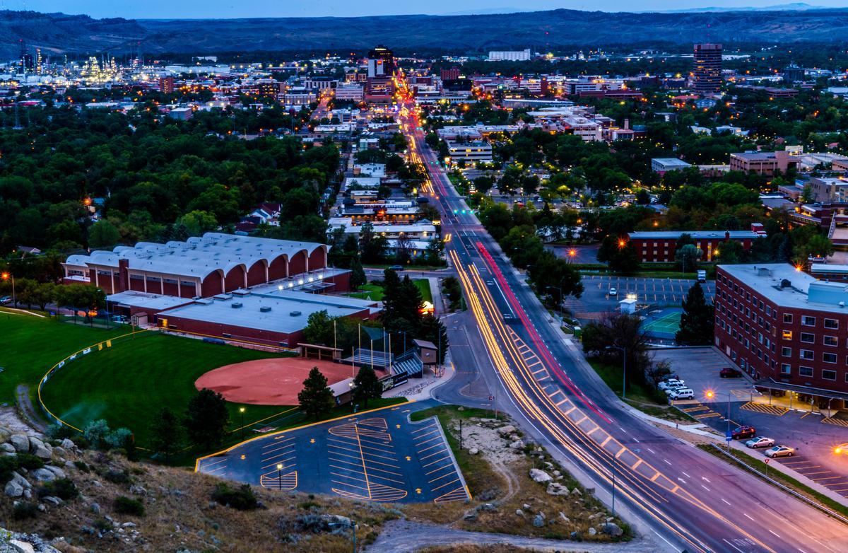
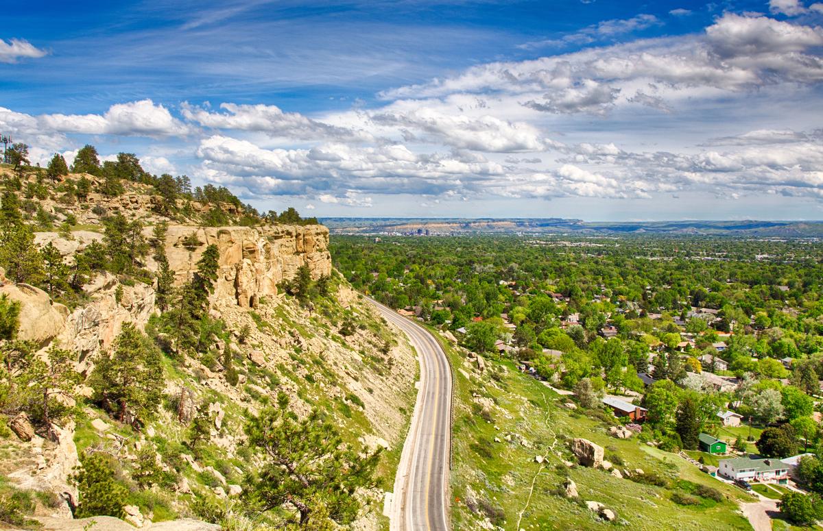
Billings - 2 hours from Bozeman
I think this is such a unique city and for me, it was one of the best places to visit this month! This gateway city surprised us with its blend of Western history, scenic beauty, and relaxed charm that made it one of our favorite Big Sky day trips.
We started downtown, strolling along historic streets where classic brick buildings, murals, and local shops reflected Billings’ railroad roots and modern creative spirit.
It’s a big city (the largest in the state!) but you'll find it surrounded by rugged landscapes, sandstone cliffs, and rivers.
Right after settling into our hotel, one of my favorite stops was the Yellowstone Art Museum, where we explored regional art and Native influences that really grounded us in the culture of the area.
Downtown cafés and breweries pulled us in for coffee and conversation, perfect for slowing down and soaking up the friendly, unpretentious vibe.
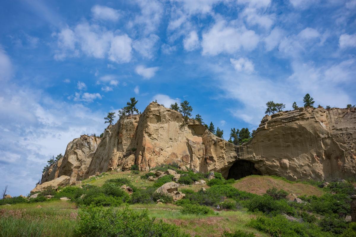
Later, we headed to Pictograph Cave State Park, where ancient rock art and sweeping views made the landscape feel timeless and deeply meaningful.
Lunch at a cozy local steakhouse felt like a true Montana experience—hearty food, warm service, and that relaxed Western hospitality that makes you want to linger
. A hidden gem for us was a scenic drive along the Rimrocks, where dramatic sandstone cliffs and overlook points gave us some of the best sunset views in the state.
As evening settled in, we returned downtown, where live music, soft lights, and the hum of local spots created an inviting energy without ever feeling rushed.
We stayed in a comfortable room with two Queen beds at 3-star DoubleTree by Hilton Hotel Billings for two days.
What I loved best:
For me, Billings is one of the best places to visit in Montana because there's so much to do indoors and outdoors year-round!
Ending the day with sunset views from Swords Rimrock Park was my personal highlight.