

Whenever we speak of cities, towns, or key geographical locations around the Earth, various statistics and pieces of information are associated with these areas. One of the key pieces of information for any global location is its elevation, and this is a general term that tells us how high or low a town or geographic point is, compared to a reference point called a geoid.
Elevation Basics:
1. What Is Elevation
Whenever we speak of cities, towns, or key geographical locations around the Earth, various statistics and pieces of information are associated with these areas. One of the key pieces of information for any global location is its elevation, and this is a general term that tells us how high or low a town or geographic point is, compared to a reference point called a geoid.
Elevation Basics:
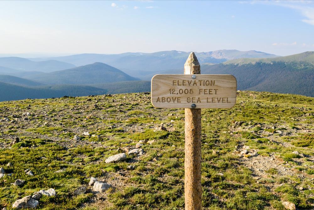
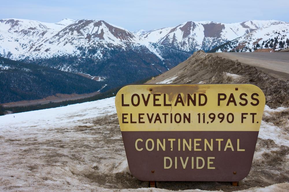
When we're talking about the elevation of cities and mountains, the geoid we usually refer to is sea level. So, if we say that a location has an elevation of 1,000 feet (305 m), this means it is 1,000 feet above sea level. Naturally, sea level can vary all around the world, so the definition of 'sea level' used in elevation calculations is simply the mean sea level.Elevation is the official term used when talking about mountains, too. So when we say that Mount Everest, for example, is 29,029 feet (8,848 m) tall, this is actually a reference to its height above sea level, rather than ground level. Elevation is traditionally measured in meters or feet, with the most common measurement in the United States being feet.
When reading maps, elevation can be displayed in the form of contour or topographic lines. Topographic maps with contour lines show estimated elevation and steepness of various locations and have many uses, both in science and geographic disciplines, as well as engineering and architecture, or even for outdoor activities like orienteering.
Elevation Must Know:
2. Elevation around the World
Most people in the world live in coastal areas which tend to have very low elevations, usually around 500 feet (152 m) or less. However, some people live at much higher elevations. The average elevation can vary enormously from one country to the next.
The average elevation in the Republic of Maldives, for instance, is just 6 feet (1.8 m) above sea level, while the average elevation is at its highest in very mountainous countries like Bhutan and Nepal, which have average elevations of 10,761 feet (3,280 m) and 10,712 feet (3,265 m), respectively.
The average elevation in the United States is 2,493 feet (760 m), but can vary greatly from one state to the next; the state of Colorado, for example, is the highest with a mean elevation of 6,800 feet (2,070 m), while the state of Delaware is the lowest with a mean elevation of just 60 feet (20 m).
3. The Effects of Elevation
Elevation can have strong effects on people. If you spend all of your life in a place with a low elevation like a coastal city and then find yourself in an area several thousands of feet above sea level, you may experience some side effects of this sudden and drastic change.
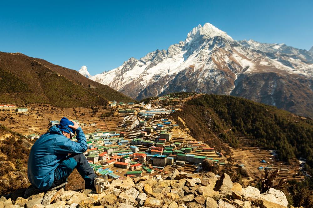
In the same way that animals adapt to their environments, humans have adapted to living at different elevations over the years. For instance, someone who has lived in Nepal all their life will have no problems with the cold temperatures and unique air pressure at high elevations and altitudes, but a visitor from a low-lying country may find it hard to catch their breath in these areas and could even suffer from altitude sickness.
Temperatures tend to get cooler at areas of higher elevation as well, which is why mountains will often be seen with snowy peaks, despite no snow falling down at their bases. When traveling to areas of high elevation, it’s therefore important to be prepared. Wrapping up warm with lots of layers of clothing is essential, and it’s important to note that the effects of alcohol are stronger at high elevations.
4. The Highest and Lowest Elevation Points on Earth
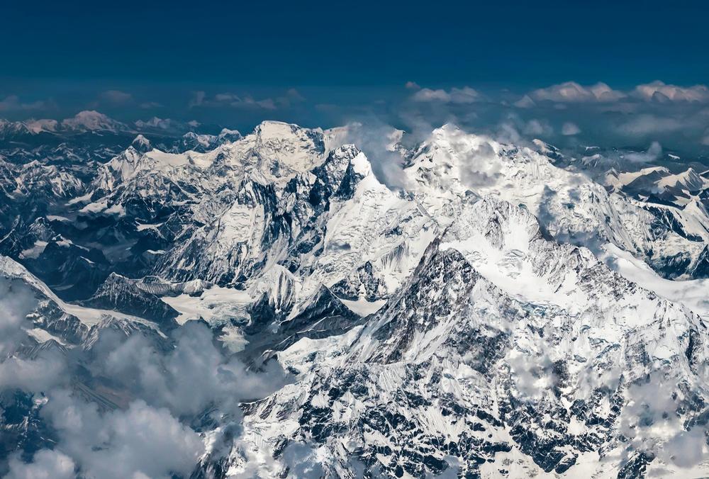
The highest elevation point on the planet Earth is the aforementioned summit of Mount Everest, which is located in the nation of Nepal. The top of this mountain has an elevation of 29,035 feet (8,848 m) and is known for being one of the most impressive natural sights in the world, with many climbers and adventurers attempting to scale it each year. The lowest elevation point recorded on Earth is in the Dead Sea, which is found between the countries of Jordan and Israel and is found at 1,385 feet (420 m) below sea level.
5. Elevation of Major Cities around the World

If you’re traveling to a major city, it can be important to know its elevation. Here are some examples of elevations of major cities:
· New York City – 33 feet (10 m)
· Los Angeles - 285 feet (87 m)
· London – 36 feet (11 m)
· Tokyo – 131 feet (40 m)
· Paris – 115 feet (35 m)
· Shanghai – 13 feet (4 m)
· Beijing – 144 feet (44 m)
· New Delhi – 709 feet (216 m)
· Chicago – 594 feet (181 m)
🖋 How did I do?
Is the article too broad, too narrow, or just right ? Do you like the presentation of photos and text? Let me know in the comments! If you want to see more in this location, I can put it on my editorial calendar. I'm listening!
Plan Your Trip