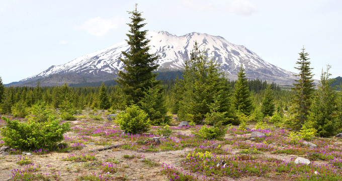
Mount St. Helens is a dynamic part of Washington's Cascade Range and one of the most well-known volcanoes in the United States. Located about 50 miles northeast of Portland, OR and under 100 miles from Seattle, it's an essential stop for anyone interested in geology, history, or outdoor adventure.
Recommended Mount St. Helens Tours:
- Seattle: Mt. St. Helens National Monument Small Group Tour – Price: From $344 per person.
- Portland: The Mt. St. Helens Adventure Tour – Spend a full day crawling, climbing, and hiking with your professional guide. Price: From $319 per person.
- From Seattle: Mount Saint Helens Monument Private Day Trip – This private tour starting in Seattle takes you to one of Washington State's five volcanoes. Price: From $391 per person.
Table of Contents
- Formation and Eruption History
- Elevation Must-Know Facts
- Weather and Climbing Conditions
- Outdoor Recreation and Hiking
Formation and Eruption History
- Formation: Mount St. Helens formed tens of thousands of years ago and is the most active volcano in the Cascade Range.
- Pre-Eruption Status: It was once the fifth highest peak in Washington before the 1980 eruption.
- 1980 Eruption: Occurred on May 18, 1980, and was the deadliest and most destructive volcanic eruption in U.S. history.
- Damage Caused: The eruption killed 57 people and destroyed 185 miles of highway, 15 miles of railway, and hundreds of buildings.
- Preservation Efforts: The Mount St. Helens National Volcanic Monument was established in 1982 for conservation and research.
- Recent Activity: The volcano has had minor activity like steam plumes and a 3.5 magnitude earthquake in 2006 but no major eruptions since 1980.
Elevation Must-Know Facts
- Importance of Elevation: Elevation is crucial in geography as it affects temperature, climate, and human health.
- Measurement: Elevation is typically measured in feet or meters above sea level.
- Elevation Change: Before the 1980 eruption, Mount St. Helens stood at 9,677 feet (2,950 m). It now reaches 8,363 feet (2,549 m) due to a massive debris avalanche.
- State Rankings: Once among the top five, Mount St. Helens is now the 52nd highest peak in Washington.
- Highest Point in Washington: Mount Rainier, at 14,417 feet (4,394 m).
- Lowest Point: The Pacific Ocean, at sea level.
- Average Elevation of Washington: Around 1,700 feet (520 m).
- Highest City: Waterville, at 2,622 feet (799 m).
- City Elevations:
- Seattle: 170 feet (52 m)
- Spokane: 1,843 feet (562 m)
- Tacoma: 243 feet (74 m)
- Vancouver: 171 feet (52 m)
Weather and Climbing Conditions
- Climate: Cold and snowy for much of the year due to its high elevation and location in the Pacific Northwest.
- Temperature Comparison: Significantly cooler than nearby low-elevation cities like Seattle.
- Best Climbing Season: Summer months offer the most favorable conditions, but all routes require physical readiness and care.
Outdoor Recreation and Hiking
- Popularity: Mount St. Helens is a major climbing destination for both beginners and experienced climbers.
- Trail Access: Several well-maintained routes lead to the summit.
- Hiking: The surrounding region is a year-round favorite for hiking and exploration.
Plan Your Trip


