
-
What is Yosemite National Park known for?
- Attracting several million visitors from around the world each and every year, Yosemite is one of America's most famous and beloved national parks.
-
Where is Yosemite National Park located?
- Located in Central California among the Sierra Nevada mountains, with the Sierra and Stanislaus National Forests on either side.
-
How large is Yosemite National Park?
- The park covers an enormous area of 747,956 acres.
-
How many counties does Yosemite National Park span?
- The park spans four separate counties: Tuolumne, Mariposa, Madera, and Mono.
⮕ Yosemite History and Elevation
© lunamarina/stock.adobe.com
-
Why is Yosemite famous?
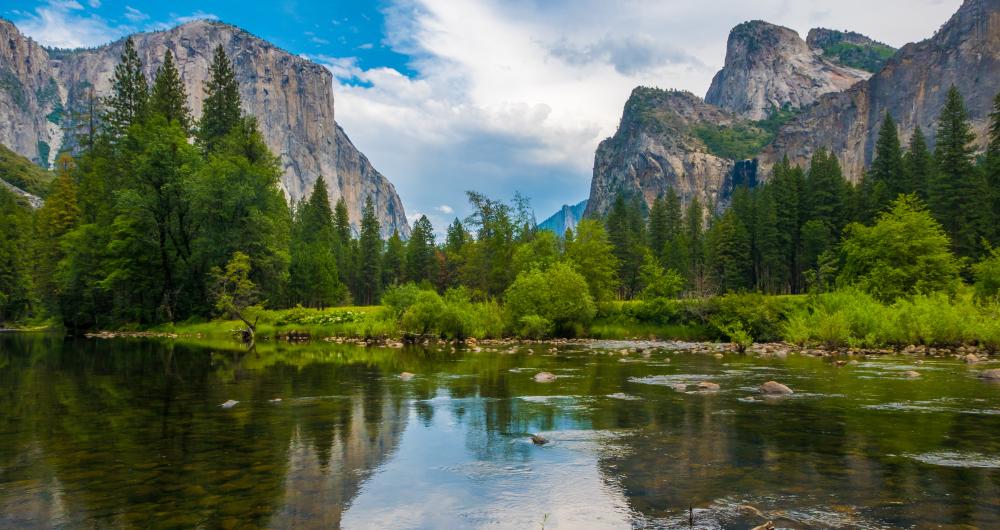
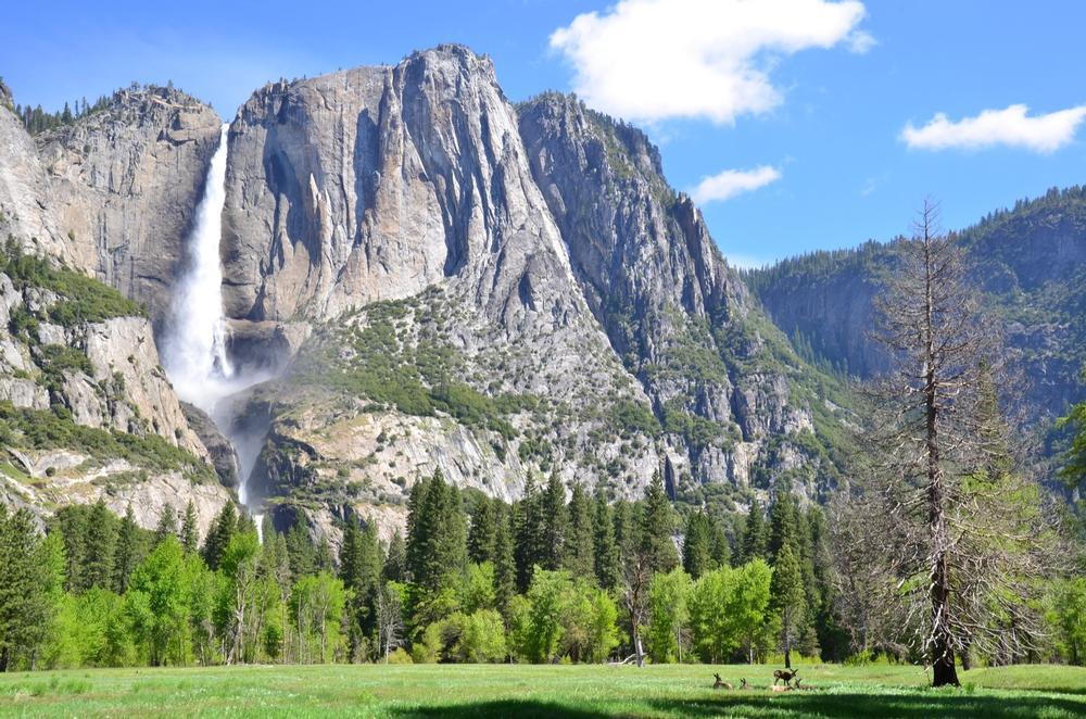
- Given the status of World Heritage Site in 1984, Yosemite is famous across the globe for its stunning scenery and lush vegetation, home to various forests, waterfalls, lakes, cliffs, and more, along with all kinds of wildlife like bears, deer, marmots, bobcats, raccoons, coyotes, cougars, and dozens of birds and fish.
-
What activities are available in Yosemite?
- Yosemite is open all year long for all kinds of activities like nature walks, hiking, scenic drives, rock climbing, skiing, cycling, rafting, and more. It's also been a shooting location for various films, including The Last of the Mohicans.
-
What is unique about Yosemite's elevation?
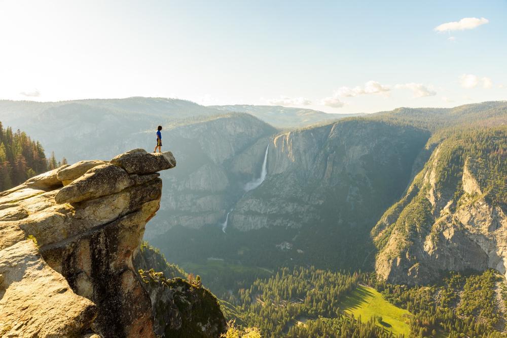
- Another thing that stands out about Yosemite is its elevation. There's a very high differential in elevation seen throughout the park, with some areas being several thousands of feet higher than others. The elevation of Yosemite has a direct influence on the weather conditions in different areas around the park, as well as having an effect on the kinds of plants and animals that can be found in different locations.
-
Where can foodies stop for a great buffet in Yosemite?
- Tip for foodies: Stop at Ahwahnee Hotel for amazing buffet.
⮕ Elevation of Yosemite
© Simon Dannhauer/stock.adobe.com
-
What is the elevation range in Yosemite National Park?
- As previously mentioned, the elevation of Yosemite National Park is one of its most distinctive features. Yosemite features a lot of different landscapes, including both high mountains and low valleys. The elevation of the area is a geographical term used to denote how high it is above sea level. The elevation of Yosemite ranges from as low as 2,127 feet (648 m) to as high as 13,114 feet (3,997 m), meaning that some parts can be relatively low-lying, while others are so high that they are capable of triggering altitude sickness in visitors.
-
What is the highest point in Yosemite National Park?
- The highest point of Yosemite National Park is Mount Lyell. Mount Lyell has an elevation of 13,114 feet (3,997 m) and is found in the Cathedral Range. This mountain was named after a 19th century geologist named Charles Lyell and is a popular climbing spot, with various routes leading to the top. It's one of the highest National Park mountains anywhere in the United States and is one of the highest points in the state of California too.
-
Where is the lowest point in Yosemite?
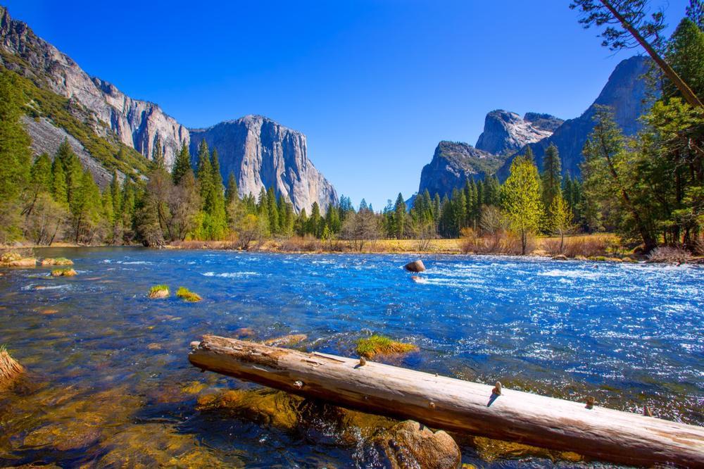
- The lowest point in Yosemite is part of the Merced River down in the Yosemite Valley. This river begins at a very high elevation, with its source being 8,017 feet (2,444 m) above sea level, but loses a lot of that elevation as it travels down towards the coast. The lowest point of Merced River is its mouth in the San Joaquin River, at an elevation of just 56 feet (17 m). However, the lowest point of the Merced River in Yosemite is at 2,127 feet (648 m).
-
What are some other key landmarks in Yosemite?
- Some of the other key landmarks around Yosemite include El Capitan, an impressive rock formation in Yosemite Valley with an elevation of 7,573 feet (2,308 m), Sentinel Dome, which is also found in Yosemite Valley and has an elevation of 8,127 feet (2,477 m), and Half Dome, which has an elevation of approximately 8,844 feet (2,695 m).
⮕ Elevation of Yosemite Compared to California
© A.Hornung/stock.adobe.com
-
What is the elevation of California?
- California, just like Yosemite National Park, has varying landscapes and styles of terrain, leading to very different elevations all around the state. It’s the 11th highest state overall, with a mean elevation of 2,900 feet (880 m). Most of Yosemite National Park is at a much higher elevation than the state average, and the elevation of Yosemite can affect the various temperatures and weather conditions around the park. Higher elevations result in colder temperatures, snowfall, and fewer trees and wildlife, for example.
-
What is the highest point in California?
- The highest point in all of California is Mount Whitney, which is one of the highest mountains in the United States with an elevation of 14,505 feet (4,421 m).
-
What is the lowest point in California?
- The lowest point in California is Badwater Basin, which is found in Death Valley and has an elevation of 282 feet (86 m) below sea level.
-
What are the average elevations of major cities in California?
- Major cities around California include Los Angeles, which has an average elevation of 285 feet (87 m), San Francisco, which has an elevation of 52 feet (16 m), San Diego, which has an elevation of 62 feet (19 m), the capital of Sacramento, which has an elevation of 30 feet (9 m), and San Jose, which has an elevation of 82 feet (25 m).
Map:
Plan Your Trip