

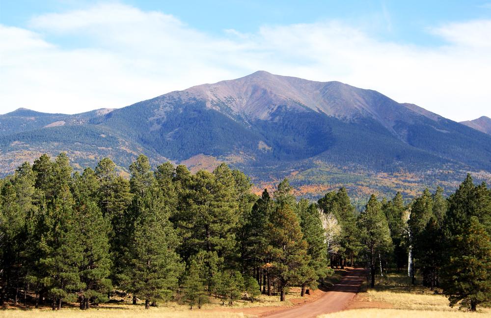
Arizona’s mountain scene is all about contrast: high-elevation escapes, alpine lakes, or quiet trails where I can actually hear myself think. It’s the kind of place where I spend the morning hiking under a bluebird sky and the afternoon sipping coffee in a cozy mountain town.
I’ve got pine-scented air in my lungs, sun on my shoulders, and a stunning view stretching over the Mogollon Rim—all just a few hours from Phoenix. Who knew the desert state had such cool, crisp alpine getaways?
Just a scenic drive lands me in Flagstaff, where ponderosa pines and peaks like Mount Elden and Humphreys Peak set the stage for adventure. For peaceful lakeside trails and wildlife spotting, I head to Greer in the White Mountains—it’s pure tranquility. And when I want that perfect mix of art, culture, and altitude, Prescott delivers with historic charm and the rugged beauty of the Bradshaw Mountains.
"Cool mountain air in the Arizona sun? Sign me up."
Unique Arizona Mountains:
1. Summit the Heights of Agassiz Peak
The majestic 12,360-foot Agassiz Peak is the second-highest in the state, but is often confused for the first because of its lofty appearance. The mountain has the honor of being home to an endangered flower known as the San Francisco Peaks groundsel; because of this, hiking above the treeline is only permitted during the winter months when the ground is covered in snow. The summit offers views all the way to the Grand Canyon, and overnight accommodation is available on the mountain at Agassiz Lodge. Visitors should be aware that they will need to obtain a Kachina Peaks Wilderness Access Permit.
2. Stand in Awe of Agathla Peak’s Towering Beauty

Also known as El Capitan, Agathla Peak is a sacred place for the Navajo people and was named for the animal hair that accumulated on the rock when it was used to clean animal hides. Consisting of an igneous type of rock known as minette, the mountain is part of the Navajo Volcanic Field and is actually an eroded volcanic plug that rises up quite abruptly from the surrounding flat terrain. Reaching the 7,099-foot peak is possible but requires technical climbing skills, and the best time to attempt it is in April, May, and September through November.
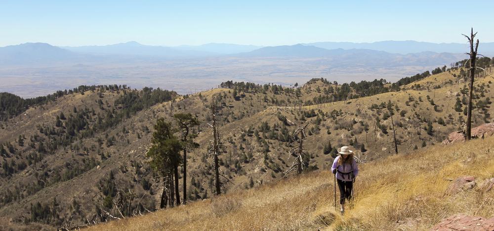
3. Trek Into Sacred Solitude at Baboquivari Peak Wilderness

Only 50 miles away from Tucson, the Baboquivari Peak Wilderness offers some of the best backcountry rock climbing in the state. The wilderness area is 2,065 acres in size, and Baboquivari Peak itself has an elevation of 7,739 feet. There are several different routes to the summit, all of which include both hiking and technical rock climbing. The Forbes Route is often considered to be the easiest; it has a rating of 5.6. The mountain is of great importance in the creation story of the Tohono O’odham people, and climbers often leave trinkets at the summit for the god I'itoi.
4. Explore the Rugged Wonder of Boundary Cone
Part of the western foothills of the Black Mountains, the Boundary Cone is an easily recognizable landmark located only 12 miles away from the Colorado River. The summit sits at 3,430 feet, and a trip up and down the mountain takes approximately 3-4 hours. Although not technically difficult, the ascent should only be attempted by people with some technical rock climbing skills and experience. The mountain is of great religious and cultural importance to several Native American tribes living in the area, and because of this, it is eligible to be included on the National Register of Historic Places.
5. If You Crave Iconic Climbs, Conquer Camelback Mountain, Arizona
Named for its resemblance to the humps of a camel, Camelback Mountain is one of the state's top hiking destinations. There are two main hiking routes: Echo Canyon Trail and Cholla Trail. Both take between 1.5 and 3 hours but are very difficult and should only be attempted by experienced, well-prepared hikers when the weather is appropriate. The mountain gets quite busy, especially on the weekends, and visitors are advised to go early because the entry gates are closed once the park has reached capacity. Limited parking is available, but there are also plenty of bike lock racks.
6. Hike Sky-High Trails at Carr Peak
Located in the Huachuca Mountain range, Carr Peak has an elevation of 9,229 feet. The most popular route up the mountain is the moderately difficult Carr Peak Trail, which can be easily accessed from both the Ramsey Vista Campground and the Reef Townsite Campground. To reach the summit, you'll need to take the short but steep Carr Peak Spur, which is located right off the main trail. In addition to offering excellent hiking, the area is also home to a wide variety of bird species, including 15 species of hummingbird and a number of species unique to the southwest United States.
7. Discover Desert Vistas on Cat Mountain

Easily accessible from Tucson, Cat Mountain is a 3,852-foot peak that offers excellent scrambling and hiking opportunities. The mountain's proximity to the city means that many visitors choose to spend the night in one of the many accommodation options there, but 130 sites are available at the nearby Gilbert Ray Campground for anyone wishing to camp. Because of the mountain's relatively low altitude, visitors are advised to come during the cooler weather of the fall, spring, and winter; March and April are great for wildflower-viewing.
Romantic Arizona Mountains:
8. Wander Wild Landscapes in the Chiricahua Mountains
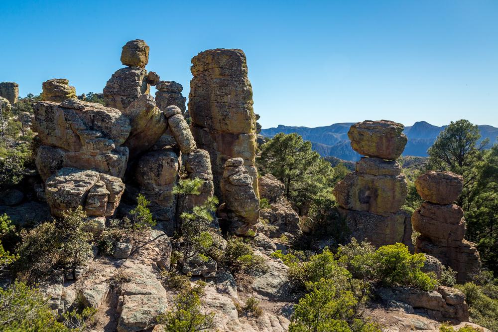
Formed by a tremendous volcanic eruption that occurred approximately 27 million years ago, the Chiricahua Mountains are named after the Chiricahua Apache Indians, who used to inhabit the area. The mountains have a vastly different habitat than the surrounding lowlands, and the range is home to some flora and fauna that cannot be found anywhere else. One of the most notable features is the Chiricahua National Monument, which is full of stunning hoodoos and eroded rock spires that reach heights of more than 100 feet. Plenty of campsites can be found all throughout the mountain range, including the convenient Rustler Park.
9. Reach New Adventures at Four Peaks
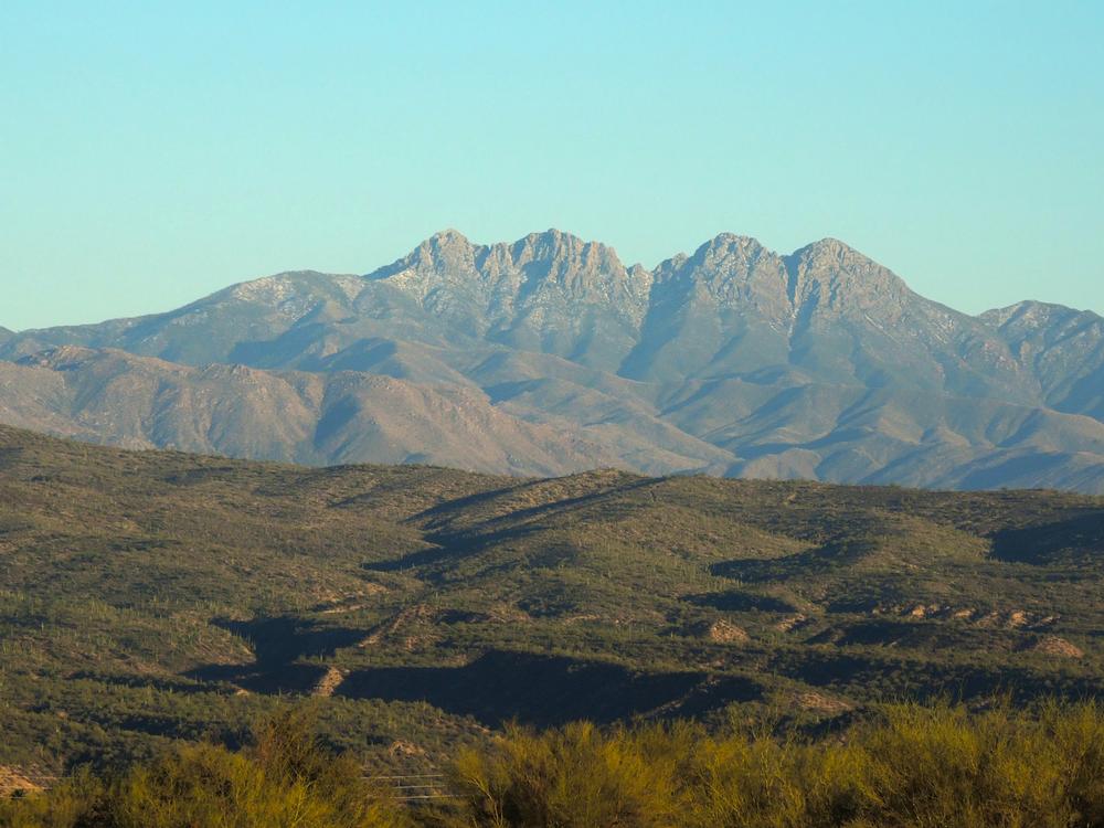
Visible from Phoenix, the Four Peaks rise up more than 6,000 feet from the desert and are one of the area's most notable landmarks. Only the northernmost peak is named; known as Browns Peak, it is the highest of the four but also the least dangerous to climb. The path to the summit involves easy hiking as well as class 3 scrambling, and once at the top, hikers will be able to see approximately 25% of the state of Arizona. It's also possible to traverse all four peaks, although the class 4 route is 10 miles long and quite exposed.
10. If You Seek Sweeping Views, Ascend Fremont Peak

One of the San Francisco Peaks in the northern part of the state, Fremont Peak is the third highest summit in Arizona. The mountain offers better views of the surrounding area than any of the other San Francisco Peaks, but it is not often climbed because of its long approach. The 11,969-foot summit can be reached via the challenging Arizona Snow Bowl-Humphreys Peak Trail, but other popular routes include a trail that leads into the scenic Inner Basin and the Weatherford Trail, which winds its way to the saddle between Fremont and the neighboring Doyle Peak.
📔 I get asked this a lot so I decided to include it:
-
What are some of the highest peaks in Arizona?
- Arizona is home to some of the most majestic peaks in the country, including Humphreys Peak; with an elevation of 12,633 feet, it is the highest point in the state and a popular hiking destination.
-
Are there scenic mountains in Arizona besides hiking destinations?
- If you're more interested in beautiful landscapes than hiking, there are plenty of stunning mountains formed from volcanic lava.
-
When is the best time to visit Arizona’s mountains?
- Don't hesitate to plan a day or weekend trip – the state's sunny southern location means that there are plenty of mountains to visit all year round.
Plan Your Trip