

-
What is Maine’s Lakes and Mountains region?
- Maine’s Lakes and Mountains is a region in western Maine that is part of the iconic Appalachian mountain range, which stretches the length of the United States’ East Coast.
-
What makes this region special?
- This area is an exhilarating mix of mountain ranges and glacial lakes, highly prized for its pristine environment.
-
Is Maine’s Lakes and Mountains a year-round destination?
- Yes, no matter the season, these mountains offer plenty of entertainment for both locals and visitors.
-
What activities can visitors enjoy in this region?
- Visitors can take part in:
- Mountaineering
- Hiking
- Alpine skiing
-
Is there a destination for all types of visitors?
- Yes, there is a perfect mountain destination for everyone, whether they seek adventure or relaxation.
Unique Mountains
Bigelow Mountain
Hike rugged trails and admire sweeping views on this exciting outdoor trip.
© Courtesy of duke2015 - Fotolia.com
- Where is Bigelow Mountain located?
- Bigelow Mountain is situated on the shores of Flagstaff Lake in the western area of Maine.
- How long is the Bigelow Mountain range?
- The mountain runs east to west for approximately 12 miles.
- What are the main peaks of Bigelow Mountain?
- Bigelow Mountain consists of six peaks, including:
- West Peak and Avery Peak – The largest alpine communities.
- North Horn and South Horn – Elevated just above the glacial waters of Horns Pond.
- Cranberry Peak and Little Bigelow – The eastern and western peaks that round out the range.
- What outdoor activities can visitors enjoy at Bigelow Mountain?
- Visitors can enjoy a wide variety of outdoor activities, including:
- Hiking
- Mountain biking
- Climbing
- Skiing
- What are some popular trails on Bigelow Mountain?
- Popular trails include:
- Fire Warden’s Trail
- Appalachian Trail
- Horns Pond Trail
- Bigelow Range Trail
- Where can I find a map of Bigelow Mountain?
- View the map of Bigelow Mountain.
Cadillac Mountain
Catch America’s first sunrise and enjoy romantic summit views in Acadia.
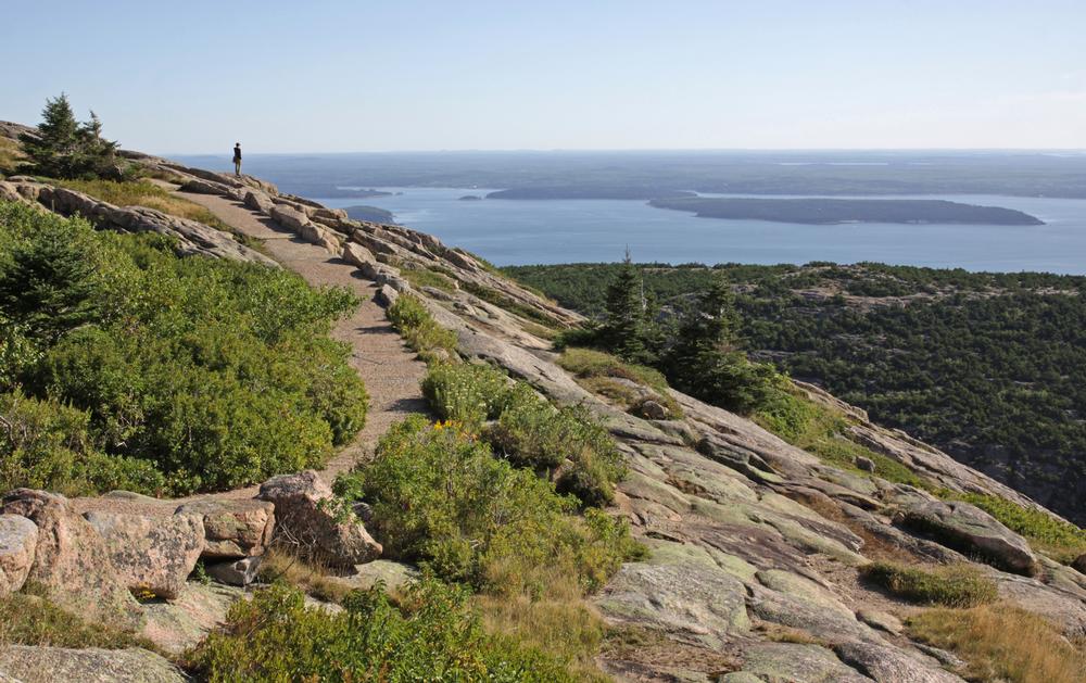
© Courtesy of Chris Hill - Fotolia.com
- What is Cadillac Mountain?
- Cadillac Mountain is an island and mountain range originally established in 1604 by Samuel de Champlain.
- When was the road to the top of Cadillac Mountain built?
- In 1931, a paved road to the top was created for easy access.
- What makes Cadillac Mountain special?
- It is the highest peak on the nation’s eastern seaboard and the highest elevation in Acadia National Park.
- The mountain offers incredible views of Penobscot Bay and Frenchman Bay.
- Why is Cadillac Mountain famous for its sunrise?
- Cadillac Mountain is well-known for having the earliest sunrise in the U.S. during the winter months.
- Is Cadillac Mountain a good destination for climbing?
- Yes! Cadillac Mountain offers excellent climbing opportunities.
- What are the best climbing areas on Cadillac Mountain?
- Great Head in the northern territory is the most developed climbing area.
- Other climbing spots include:
- Otter Cliffs
- Wonder Wall
- Rock Lobster
- These areas provide fun climbs for beginners and experienced climbers alike.
- Where can I find a map of Cadillac Mountain?
- View the map of Cadillac Mountain.
The Crocker Mountain Range
Trek through remote peaks and see wild landscapes on an adventurous hike.
© Courtesy of Betty Sederquist - Fotolia.com
- Where is the Crocker Mountain Range located?
- The Crocker Mountain Range is located in the Carrabassett Region of Maine.
- What is the elevation of the Crocker Mountain peaks?
- The range has twin peaks that reach a soaring elevation of over 4,200 feet.
- North Crocker is slightly taller than South Crocker.
- Why is the Crocker Mountain Range popular with hikers?
- Appalachian Trail lovers enjoy this range for its vigorous yet pleasant hiking trail.
- How long is the Appalachian Trail hike to North Crocker?
- The Appalachian Trail is the only route to reach the summit of North Crocker.
- The hike starts at an elevation of 1,400 feet and reaches an ending elevation of about 2,800 feet, stretching just over 5 miles.
- How do hikers reach South Crocker from North Crocker?
- After reaching the top of North Crocker, hikers need to descend briefly before traversing about a mile to reach the top of South Crocker.
- Where can I find a map of the Crocker Mountain Range?
- View the map of the Crocker Mountain Range.
Romantic Mountains
Dorr Mountain
Climb granite ridges and explore quieter paths near busy Acadia attractions.

© Courtesy of delkoo - Fotolia.com
- Where is Dorr Mountain located?
- Dorr Mountain is located within Acadia National Park on Mount Desert Island.
- Who was Dorr Mountain named after?
- Dorr Mountain was named after George Dorr, the “Father of Acadia.”
- Why is Dorr Mountain a great hiking destination?
- Dorr Mountain is ideal for hikers and climbers who want the same picturesque views as its more popular neighbor, Cadillac Mountain, but without the heavy foot traffic.
- How does Dorr Mountain rank in height within Acadia National Park?
- Dorr Mountain is the second highest peak within Acadia National Park.
- What are the different zones on Dorr Mountain?
- Several trails pass through four different zones on the mountain:
- Hemlock
- Hardwood Forest
- Alpine
- Birch Grove
- Are there any unique trails on Dorr Mountain?
- Yes! In addition to its standard trails, Dorr Mountain features:
- Two scramble trails that reach the summit.
- Hidden trails like Homan’s Path.
- A looping trail that takes visitors past a glacial gorge at the bottom of the mountain.
- Where can I find a map of Dorr Mountain?
- View the map of Dorr Mountain.
Doubletop Mountain
Tackle steep climbs and savor panoramic views during a challenging weekend hike.
© Courtesy of Jeff Schultes - Fotolia.com
- Where is Doubletop Mountain located?
- Doubletop Mountain is located within Baxter State Park.
- What are the key features of Doubletop Mountain?
- Doubletop Mountain features steep edges elevated just above Nesowadnehunk Stream’s west bank.
- Can you hike Doubletop Mountain year-round?
- Yes! Climbing and hiking up the mountain can be done all year round, though trails tend to be snow-covered during the winter.
- Are there ice climbing opportunities on Doubletop Mountain?
- Yes! Moderate ice climbs can be found on the east side of the mountain during winter.
- Where does the main trailhead for Doubletop Mountain begin?
- The main trailhead begins at Foster Field and ascends roughly 2,500 feet.
- The trail covers about 3 miles before emerging onto an open slab with magnificent views.
- What views can be seen from Doubletop Mountain?
- From the open slab, hikers can see:
- Barren Mountain
- The Owl
- OJI
- From the south summit, hikers can view:
- Hunt Spur
- Witherle Ravine
- Lakes Jo Mary and Pemadumcook
- Where can I find a map of Doubletop Mountain?
- View the map of Doubletop Mountain.
Scenic Mountains
Goose Eye Mountain
Walk along the Appalachian Trail and discover this exciting, less-traveled peak.

© Courtesy of wildnerdpix - Fotolia.com
- Where is Goose Eye Mountain located?
- Goose Eye Mountain is situated in the secluded and wild Mahoosuc Range.
- How many peaks does Goose Eye Mountain have?
- Goose Eye Mountain features three peaks.
- What makes Goose Eye Mountain unique?
- It is a relatively unknown summit with several impressive attributes.
- The mountain consists mostly of alpine plant communities and windswept ridgelines.
- What is the best feature of Goose Eye Mountain?
- Goose Eye Mountain is known for its unimpeded and remarkable 360-degree views.
- What can visitors see from the summit?
- The Presidential Range dominates the southwestern horizon.
- New Hampshire’s North Country dominates the west.
- Old Speck (Maine’s third tallest peak) and the Longfellow Mountains can be seen to the northeast.
- Which is the tallest peak on Goose Eye Mountain?
- The west peak is the tallest, while the east and north peaks are just over 100 feet lower.
- What are the most popular hiking trails on Goose Eye Mountain?
- The most popular hiking trails are:
- Wright Trail
- Goose Eye Trail
- Where can I find a map of Goose Eye Mountain?
- View the map of Goose Eye Mountain.
Hamlin Peak
Reach Katahdin’s neighbor and enjoy quiet alpine views on a rugged trip.
© Courtesy of Tim Markley - Fotolia.com
- What is Hamlin Peak?
- Hamlin Peak is actually a lateral ridge of the primary Katahdin mountain range.
- Although connected to the range, it rises a few hundred feet from the butte, allowing it to stand on its own.
- What geological features define Hamlin Peak?
- The peak’s sensational north and south sides are formed by the gigantic Saddle Basin and North Basin.
- How can visitors reach the summit of Hamlin Peak?
- Visitors can reach the summit via two trails:
- Hamlin Ridge Trail
- Saddle Trail
- What are the views like from the summit?
- Both trails are bare during the last mile to the top, providing exceptional views of:
- North Basin
- South Basin
- Tabor Wall
- South Basin Headwall
- Are there climbing routes on Hamlin Peak?
- Yes! Various climbing routes rise from the North Basin leading to the top of the mountain.
- Where can I find a map of Hamlin Peak?
- View the map of Hamlin Peak.
Mountains for Photographers
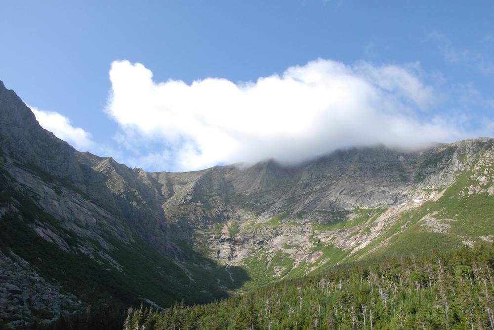
Katahdin Mountain
Summit Maine’s highest point and conquer the iconic Knife Edge on a thrilling adventure.
© Courtesy of Thierry Bonneville - Fotolia.com
- What is Katahdin Mountain?
- Katahdin Mountain is the tallest mountain in Maine, towering above lakes and forests.
- It is located at the end of the Appalachian Trail within Baxter State Park.
- What is unique about Katahdin's shape?
- The mountain is horseshoe-shaped and appears translucent-like from the south due to its granite composition.
- What are the primary peaks of Katahdin Mountain?
- Katahdin features five primary peaks:
- Baxter Summit
- Howe Peak
- Hamlin Peak
- Pamola Peak
- South Peak
- What is the Knife Edge on Katahdin?
- The Knife Edge is the most famous aspect of Katahdin.
- It is an intimidating and thrilling jagged crest that is only a few feet wide.
- This prestigious and legendary traverse connects South Peak to Pamola Peak.
- Are there hiking trails to the summit?
- Yes! There are numerous hiking paths leading to the summit.
- However, almost all trails involve some level of scrambling.
- Where can I find a map of Katahdin Mountain?
- View the map of Katahdin Mountain.
Little Jackson Mountain
Explore scenic trails and spot wildlife during a peaceful fall hike.
© Courtesy of Oksana Ariskina - Fotolia.com
- Where is Little Jackson Mountain located?
- Little Jackson Mountain is situated in the western area of Maine.
- It forms the northern face of the Tumbledown Pond Basin.
- What is the environment like on Little Jackson Mountain?
- The upper areas of the mountain consist of:
- Dwarf spruces
- Bare rocks
- Shrubs
- These features provide magnificent views of the surrounding area.
- What mountains and landmarks can hikers see from Little Jackson?
- Depending on their direction, hikers can see:
- Tumbledown Mountain
- Saddleback Mountain
- Horn Mountain
- Abraham Mountain
- Sugarloaf Mountain
- Big Jackson Mountain
- Mount Blue
- Webb Lake
- Tumbledown Pond
- What are the most popular trails on Little Jackson Mountain?
- The most popular trails leading to the summit are:
- Little Jackson Trail
- Parker Ridge Trail
- Where can I find a map of Little Jackson Mountain?
- View the map of Little Jackson Mountain.
Mansell Mountain
Hike forested paths and enjoy easy coastal views on this quiet Acadia peak.
© Courtesy of Kelsie - Fotolia.com
- Where is Mansell Mountain located?
- Mansell Mountain is located on Mount Desert Island in Acadia National Park.
- How tall is Mansell Mountain?
- By normal standards, it’s not an especially high peak, but at 949 feet, it is one of the taller mountains within the park.
- What is the geological composition of Mansell Mountain?
- The mountain is composed of granite with a pink to gray/green color.
- It features a weathered dome shape.
- What are the views from Mansell Mountain?
- Its height ensures no altitude problems while offering stunning views of:
- The Atlantic Ocean
- Southwest Harbor
- Neighboring islands
- What are the most popular hiking trails on Mansell Mountain?
- There are numerous trails that can be mixed and matched for hikes lasting only a few hours, including:
- Great Pond Trail
- Western Trail
- Perpendicular Trail
- Where can I find a map of Mansell Mountain?
- View the map of Mansell Mountain.
Map:
Plan Your Trip
Table of Contents:
- 1. Bigelow Mountain
- 2. Cadillac Mountain
- 3. The Crocker Mountain Range
- 4. Dorr Mountain
- 5. Doubletop Mountain
- 6. Goose Eye Mountain
- 7. Hamlin Peak
- 8. Katahdin Mountain
- 9. Little Jackson Mountain
- 10. Mansell Mountain