
SoCal is famous for its sunny beaches, but what travelers may have overlooked in their quest for the perfect beach getaway are the gorgeous beaches of Northern California. There are long, sandy leisure beaches, sand dune beaches, and beaches favored by surfers.
Top picks for:
- Whale-watching: Fort Funston Beach, Gualala Point Regional Park
- Sea glass: Glass Beach
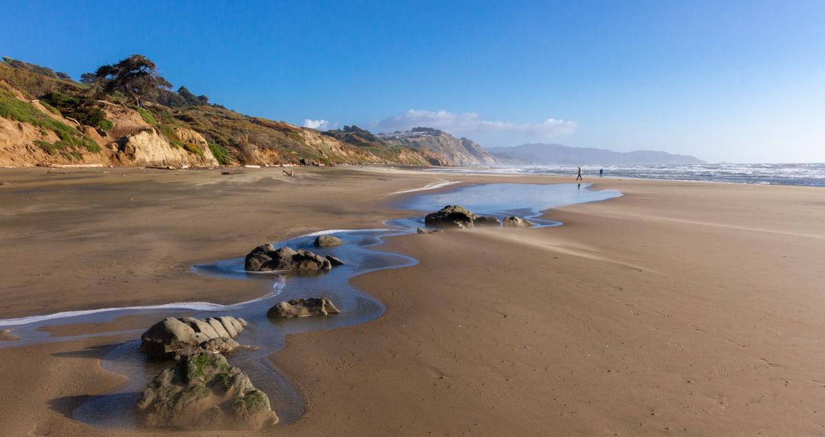
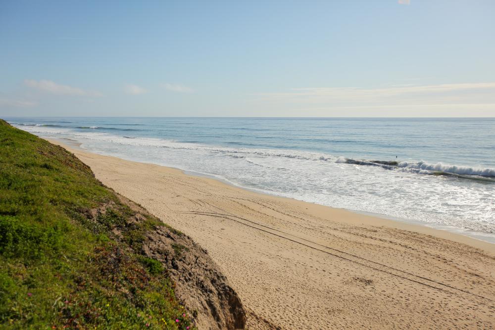
- Families: Baker Beach
For families: Baker Beach
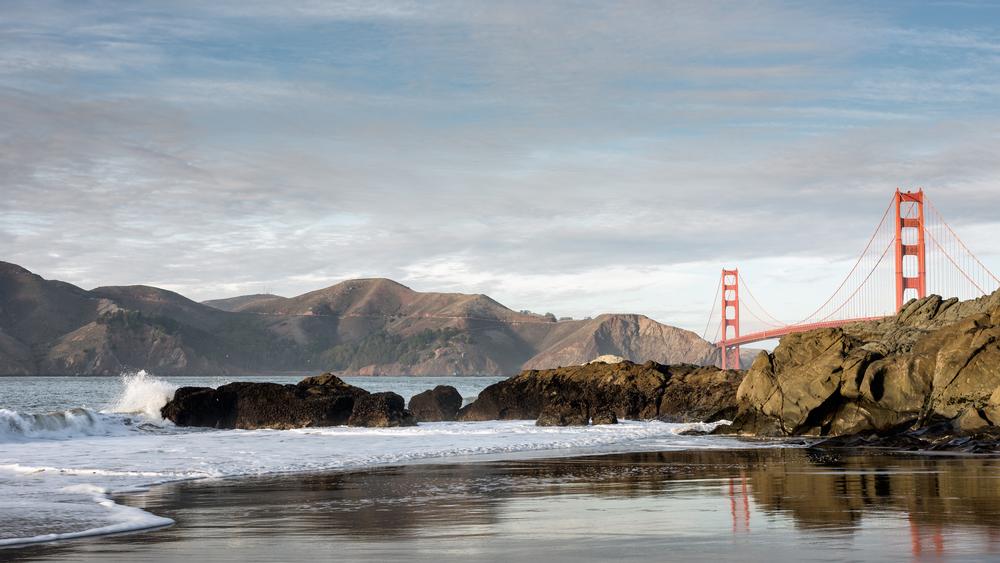
Catch mellow waves near the bridge and enjoy panoramic Golden Gate views.
Location: Trinidad, California
This is a great family beach in the Bay Area, particularly at low tide when the whole gang can go tide pooling together. The only tricky part may be getting to the beach.
- Scenic Access – Visitors park along Scenic Drive and descend a steep trail with cable steps
- Family-Friendly Fun – Ideal for tide pooling and nature discovery during low tide
- Ecological Habitat – Features alder trees, tide pools, and offshore rocks in a dramatic setting
- Respectful Exploration – Tidepool creatures are delicate; avoid disturbing rocks or marine life
Address: Baker Beach, 1237 Scenic Drive, Trinidad, CA
Map: View on Google Maps
For hikers: Black Sands Beach
Surf remote beach breaks and explore the dramatic, rugged coastal cliffs.
Location: Sausalito, California
Nestled in the eastern side of Bonita Cove, Black Sands Beach is in the Golden Gate National Recreation Area. It sits at the bottom of Fisherman's Trail, a dirt path that begins at the trailhead parking area.
- Challenging Access – Hikers descend a steep dirt trail with numerous wooden steps
- Scenic Vistas – Enjoy breathtaking views of Point Bonita Lighthouse from the trail
- Serene Setting – Ideal for sunbathing or fishing on a narrow, peaceful shoreline
- Tide-Aware Visit – Check tide charts, as the beach becomes very narrow at high tide
- Clothing Optional – Unofficially known as a clothing optional destination
Address: Black Sands Beach, Conzelman Road, Sausalito, CA
Map: View on Google Maps
For beautiful coastal views: Caspar Headlands State Beach
Ride gentle surf breaks and explore forest trails above the shore.
Location: Mendocino, California
Caspar Headlands State Beach is located in Caspar, a quaint Mendocino coastal town in a deep cove known as Caspar Anchorage. It is situated between the drainage of two distinct creeks, Caspar Creek and Doyle Creek. Caspar Beach is known as one of the safer places to swim in the area, but the water is typically chilly, and the conditions can change randomly so dangerous rip currents are possible. There is an RV park across the street from the beach, to the south there is a small park called Caspar Headlands State Natural Reserve, and to the north there are hiking trails on a bluff that provide beautiful coastal views.
- Coastal Cove Location – Nestled between Caspar Creek and Doyle Creek in a sheltered anchorage
- Safer Swimming – Known for calmer waters, but rip currents can still occur
- Nearby Camping – RV park conveniently located across the street from the beach
- Bluffside Hiking – Trails to the north offer stunning views of the Mendocino coastline
- Natural Reserve – Explore Caspar Headlands State Natural Reserve just south of the beach
Address: Caspar Headlands State Beach, 14441 Point Cabrillo Drive, Mendocino, CA
Map: View on Google Maps
For photographers: Centerville Beach
Paddle into quiet waves and enjoy vast, windswept sandy stretches alone.
Location: Eureka, California
Centerville Beach is a nine-mile long secluded beach separating the sandstone cliffs of dairy country from the Pacific Ocean. Located just five miles west of the historic Victorian Ferndale area, visitors to this beach will enjoy being surrounded by magnificent sandstone cliffs while viewing birds and other wildlife.
- Secluded Beauty – Nine miles of peaceful shoreline framed by dramatic sandstone cliffs
- Wildlife Viewing – Spot birds and migrating mother whales with calves in April and May
- Outdoor Adventures – Perfect for beachcombing, horseback riding, and coastal bonfires
- Watersports Paradise – Windswept conditions ideal for windsurfing and kiteboarding
- Picnic-Friendly – Great spot for seaside picnics with ocean views
Address: Centerville Beach, 322 First Street, Eureka, CA
Map: View on Google Maps
For surfers: College Cove Beach (Humboldt County)
Surf secluded spots and explore hidden coves at low tide.
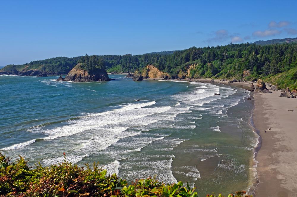
Location: Trinidad, California
College Cove Beach (Humboldt County) is located in a cove north of Trinidad State Beach in the quaint town of Trinidad. The beach is quite large and splits into two sections when the tide comes in. It is recommended that visitors only travel between the two sections during low tide.
- Tide-Dependent Access – Beach divides at high tide; cross only during low tide
- Surf & Swim Spot – Popular year-round for surfing and cold-water swimming
- Marine Life Viewing – Sea lions, seals, and the occasional migrating whale
- Tide Pool Discoveries – Look for starfish, sea urchins, clams, and mussels in the rocks
- Scenic Seclusion – Nestled in a beautiful cove just north of Trinidad State Beach
Address: College Cove Beach, 585 Stagecoach Road, Trinidad, CA
Map: View on Google Maps
For a private atmosphere: Shell Beach
Paddle out for small waves and explore tide pools along rocky shores.
Location: Jenner, California
Shell Beach is a slender and rocky beach south of the Russian River located in the small town of Jenner. To get to the beach, visitors make a quick hike down the bluffs along the trail until they hit the sand.
- Short Bluff Trail – Quick descent to the beach; can be slippery when wet
- Secluded Setting – Steep surrounding bluffs create a quiet, private atmosphere
- Rocky Beauty – Striking rock formations and tide pools revealed at low tide
- Fisherman’s Favorite – Mussel-covered rocks make it a hotspot for anglers
- Beachcomber’s Delight – Great for exploring and collecting shells and sea life
Address: Shell Beach, Highway 1 and Shell Beach Road, Jenner, CA
Map: View on Google Maps
For striking cliffs: Fort Funston Beach
Surf wind-swept waves and watch hang gliders soar above the cliffs.
Location: San Francisco, California
Fort Funston Beach is situated 200 feet below striking cliffs at the southernmost edge of San Francisco, and it is revered as one of the most magnificent and unspoiled beaches in the city.
- Cliffside Views – Steep path offers stunning views of the Pacific and coastal bluffs
- Wildlife Watching – Spot dolphins, whales, and seals from the shoreline
- Leisurely Walks – Enjoy a scenic 20-minute walk along the cliffs at low tide
- No Swimming – Rough waters make this beach unsafe for swimming
- Hang Glider Haven – A top destination for hang gliding enthusiasts in the Bay Area
Address: Fort Funston Beach, Fort Funston Road, San Francisco, CA
Map: View on Google Maps
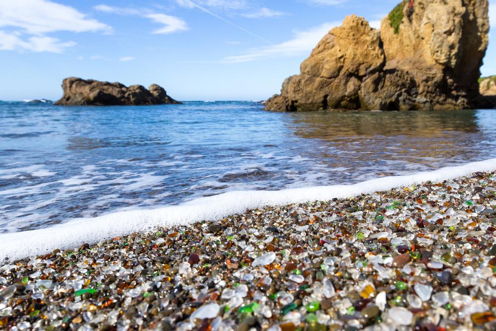
For ocean-polished glass pebbles: Glass Beach
Explore colorful glass pebbles and surf nearby reef breaks carefully.
Location: Fort Bragg, California
Glass Beach is an iconic southern beach in the MacKerricher State Park of Fort Bragg. It was previously the location of a trash dump and many pieces of old broken bottles covered the beach, which is how it received the name Glass Beach. The remnants of these bottles have been smoothed by the ocean and turned into treasured, colorful sea glass, which is the beach's main draw.
- Sea Glass Spectacle – Famous for its vibrant, ocean-polished glass pebbles
- Historic Origins – Former dump site transformed by nature into a coastal gem
- Rare Colors – Find ruby red taillight glass and deep sapphire apothecary pieces
- Photography Paradise – Collect photos, not glass – removing sea glass is prohibited
- State Park Setting – Part of scenic MacKerricher State Park’s southern shoreline
Address: Glass Beach, W Elm Street and Glass Beach Drive, Fort Bragg, CA
Map: View on Google Maps
For gray whale spotting: Gray Whale Cove (San Mateo County)
Surf peaceful swells and hike scenic bluffs above the cove.
Location: San Mateo County, California
Gray Whale Cove (San Mateo County), also known as Devil's Slide, is a protected cove encircled by cliffs that abruptly drop into the Pacific Ocean. As its name states, the beach is known for gray whales traveling close to the shore, making it an ideal locale to whale watch during their migration period mid-April to mid-May.
- Scenic Cove – Surrounded by cliffs and dramatic coastal views
- Whale Watching – Best viewed mid-April to mid-May during gray whale migration
- Moderate Trail – Beach access via a marked but slightly steep path
- Sunbather-Friendly – Popular with both clothed and clothing-optional visitors
- Local Etiquette – Swimsuits to the left, nudists to the right upon entering
Address: Gray Whale Cove, 1416 9th Street, Sacramento, CA
Map: View on Google Maps
For kayakers: Greenwood State Beach
Paddle into crisp ocean waves and explore historic remnants along the beach.
Location: Elk, California
Greenwood State Beach is situated in the small town of Elk where Greenwood Creek spills into the Pacific Ocean. There is a parking lot off Highway 1 across from the Elk store that gives visitors access to the beach with a graded trail leading from the parking area to the beach.
- Easy Access – Graded trail connects the Highway 1 parking lot to the beach
- Coastal Charm – Located where Greenwood Creek meets the Pacific Ocean
- Offshore Beauty – Gunderson Rock adds to the beach’s dramatic shoreline
- Kayaking Paradise – Calm days allow paddlers to explore sea stacks and rock arches
- Hidden Gem – Paddle to nearby Elk Creek Beach, accessible only by water
Address: Greenwood State Beach, 6101 Highway 1, Elk, CA
Map: View on Google Maps
Best Time to Visit Beaches in Northern California
- June to September – Best weather for beach walks, tide pooling, and coastal picnics.
- July & August – Peak season with cool breezes and lively coastal towns like Santa Cruz.
- May & October – Mild temps and fewer visitors, ideal for scenic drives and quiet beach time.
- November to April – Cooler and foggy, perfect for storm watching and dramatic ocean views.
- Late September – A hidden gem of warmth and sunshine along the NorCal coast.
Map:
Plan Your Trip
Table of Contents:
- 1. For families: Baker Beach
- 2. For hikers: Black Sands Beach
- 3. For beautiful coastal views: Caspar Headlands State Beach
- 4. For photographers: Centerville Beach
- 5. For surfers: College Cove Beach (Humboldt County)
- 6. For a private atmosphere: Shell Beach
- 7. For striking cliffs: Fort Funston Beach
- 8. For ocean-polished glass pebbles: Glass Beach
- 9. For gray whale spotting: Gray Whale Cove (San Mateo County)
- 10. For kayakers: Greenwood State Beach